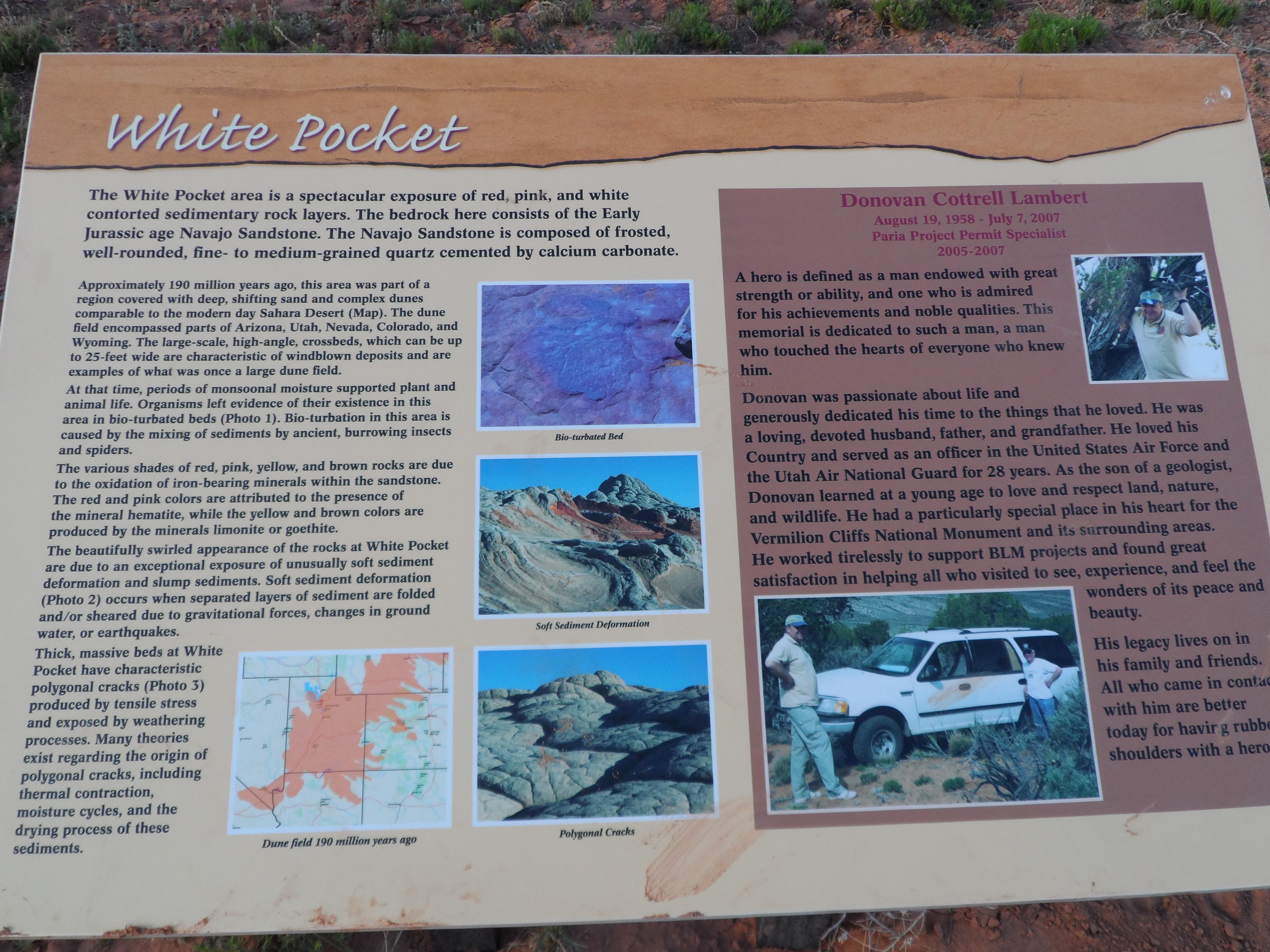
White Pockets - Paria Plateau (Vermillion Cliffs)
THE PLAN:
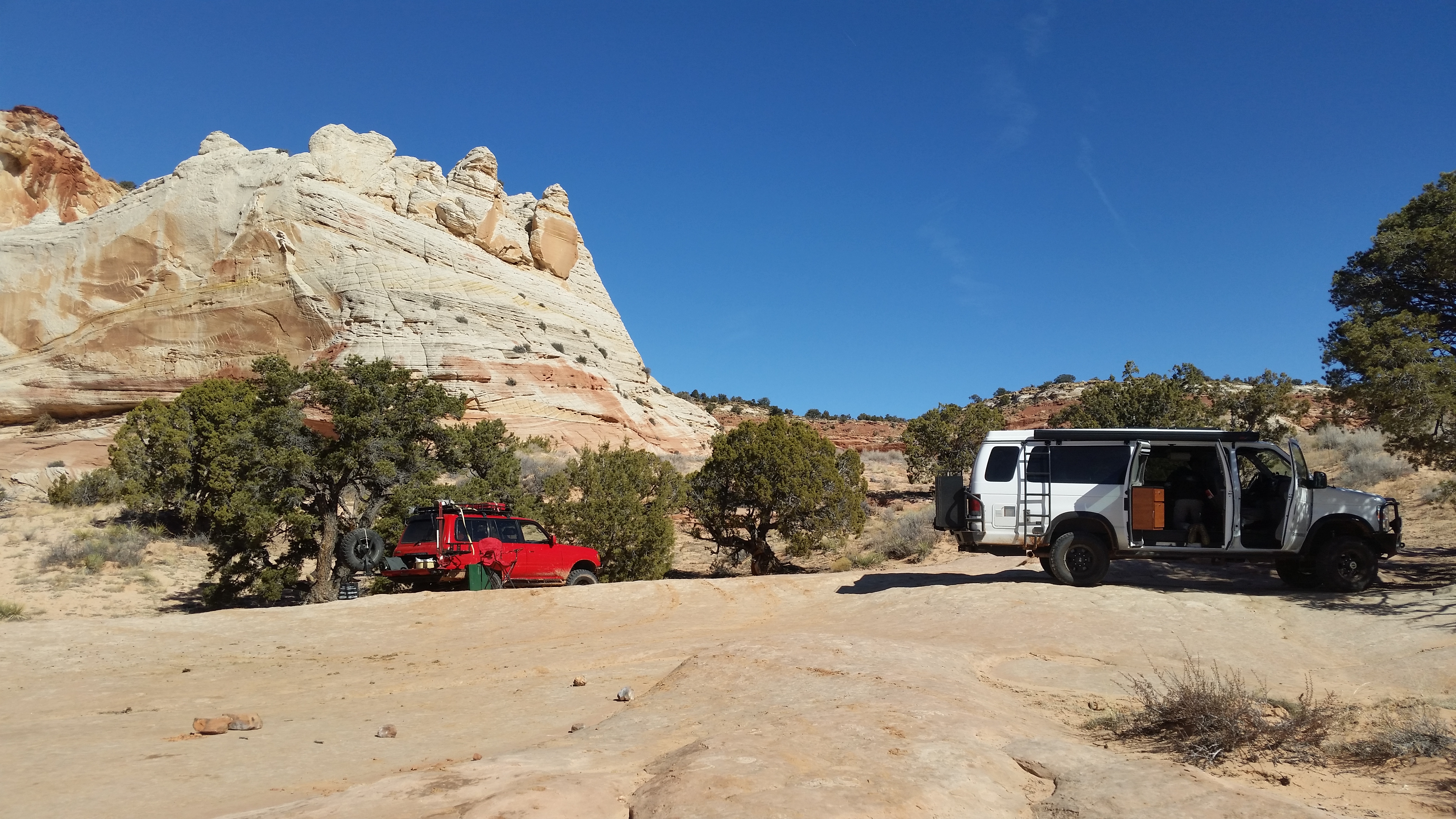
We will meet in Kanab and travel to the Paria Plateau (Vermillion Cliffs). We will camp near White pockets. We plan to arrive in time for photos of White Pocket at sunset and stick around a while in morning so if you want to get up and take picture at sunrise you can do that.
TIME ZONE:
From March through November, Utah observes Mountain Daylight Savings Time.
Arizona stays on Mountain Standard Time year round.
Kanab UT is on Mountain Time. Once we are in Kanab we will use local time.
MAPS & BOOKS: You certainly don’t need all these maps but for those of you who like to know where you are:
• AAA Map - Indian Country Guide Map for an overview
• AAA Map - AZ/ NM
• AAA Map - Utah/Nevada
• BLM Arizona Strip Visitor Map (AZ Strip Info Ctr: 435-688-3200 / 3246)
• Natl Geographic Grand Canyon East
• Guide to Backroads & 4-Wheel Drive Trails by Charles Wells
RATING: 2 or 3:
Road conditions can vary from good gravel roads to deep sand & muddy roads to back country roads that require 4WD.
WEATHER:
The average high in Kanab for this period is 50 degrees and the average low is 32 degrees. Precipitation averages .01 inches.
At Kanab:
http://www.wunderground.com/history/air ... .wmo=99999
The NWS gives a 7 day “point” forecast which can give us a general idea of what to expect, but is only useful just before we go.
White Pockets Camp
http://forecast.weather.gov/MapClick.ph ... o1cn8pIj4g
REPEATER LIST & HAM FREQUENCIES:
Simplex Primary frequency: 146.460 MHz
Repeaters
8800 Frequency PL
199 Bryce* 145.350 - 123.0 Bryce Canyon Utah (the Pinks)
201 Kanab 449.850 - no pl
203 Kanab 146.880 - no pl
204 Kanab 147.360 + no pl
Received At White Pockets
212 Blowhard Mt. 146.800 - 100 UVHFS Linked
200 Panguitch * 147.160 + 100 Mt. Dutton
195 Navajo Mtn * 146.960 - 100 Lake Powell Coverage
Navajo Mtn 146.960 - no pl
213 Jacob Lake, AZ 147.300 + 100 North Rim Grand Canyon UVHFS linked
202 SPBNCH 146.720 - 100 Spencer Bench / Glendale linked Irlp 3576
Received Alstoms
205 Page 449.925 - no pl
206 Page 448.750 - no pl
207 Mt Ellen * 147.080 + 136.5 Cannot access from Page anymore
208 Abajo Peak * 146.610 - 88.5 Monticello area
209 Abajo Peak 447.100 might be 147.200 - 107.2
210 Abajo Peak 447.400 - no pl
211 Abajo Peak 447.100 88.5
Directions to White Pocket
• From Kanab, drive 40 miles east on Highway 89.
• The turn onto House Rock Valley Road is located on the south side of the road (right side driving from Kanab). It is located between mile markers 25 and 26, before a sweeping left hand curve in the road, prior to a guard rail protecting the curve. Slow down and turn right just before the guard rail. This north-south running road is House Rock Valley Road. The road soon becomes dirt and may be impassible if wet.
• Continue past the Wirepass Trailhead (8.4 miles from Highway 89) to the Utah - Arizona state line. This is the border of the Grand Staircase-Escalante National Monument in Utah and the Vermillion Cliffs National Monument in Arizona.
• Keep driving south for another 8.1 miles past the Wire Pass Trailhead and look for the dirt road that turns left and to Lone Tree Reservoir.
• At this point there are two options to arrive at Poverty Flat. Poverty Flat is the junction to the east which is necessary to locate to continue further to either Cottonwood Spring (South Coyote Buttes) or White Pocket even further to the east.
• Turn left at Lone Tree Reservoir and follow the main, sandy 4WD road to the east for 2.5 miles to the Paw Hole trailhead. Beyond Paw Hole the road becomes even deeper sand and may require tire deflation to prevent becoming stuck. The next 3 miles to the Windmill at Poverty Flat Ranch is deep sand and quite rugged in places. The road will pass through two gates. Close the gates after passing through them.
Alternative route to the Poverty Flat Ranch and Windmill Intersection:
At the Lone Tree Reservoir/ House Rock Valley Road Intersection you may opt to continue another 4 miles to the south on House Rock Valley Road to the road intersection 1017.
• Turn left (east) on 1017 and then travel 3 miles east to the junction bearing north-east and another 3 miles to Red Pocket. Traveling north-east for another 2.5 miles puts you at the Ranch and Windmill, and the junction to either Cottonwood Spring or White Pocket. This option of driving is longer, but does not require 4WD until after the Windmill.)
• Once at the Windmill, travel northeast passing the windmill just on your left and a group of buildings on your right. The road now becomes quite sandy as it ascends a hill, toward a large water tank resting on a knoll 100 yards away.
• Be sure to keep up momentum and follow this sandy road to the east and then north for 1.8 miles until it arrives at a corral and fence.
• At this point the road will turn right and follow alongside the fence for a short time and continues east for 2.8 miles and then steers northeast for another 1.5 miles and ends in a very sandy area by a lone juniper tree. This is the parking area and trailhead. "White Pocket" monolith will have been visible during the drive at various times, and at the trailhead/parking area it is just a half mile to the west. There is no formal trail established, but it will soon be evident that wandering and exploring is the main fare.
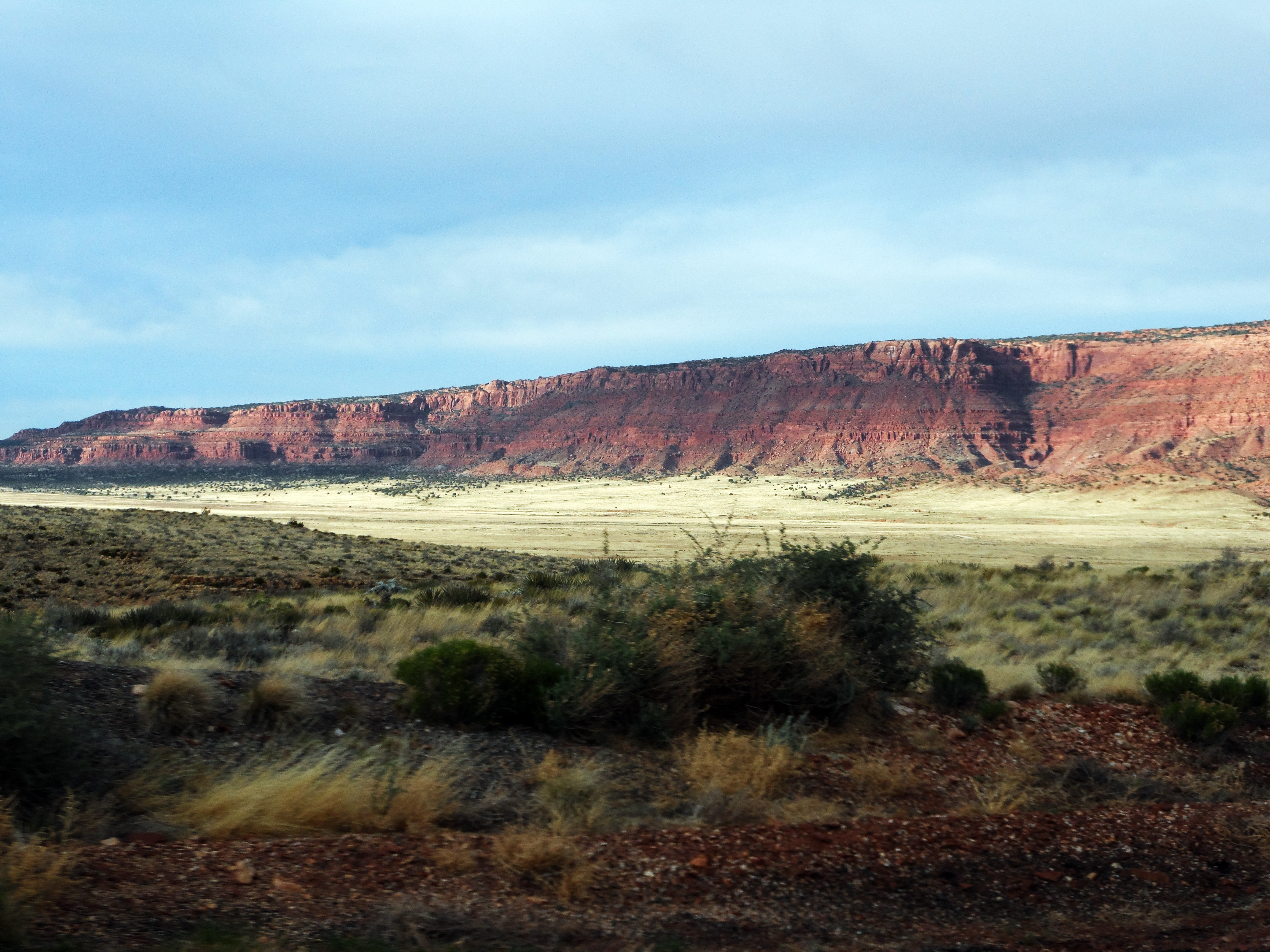
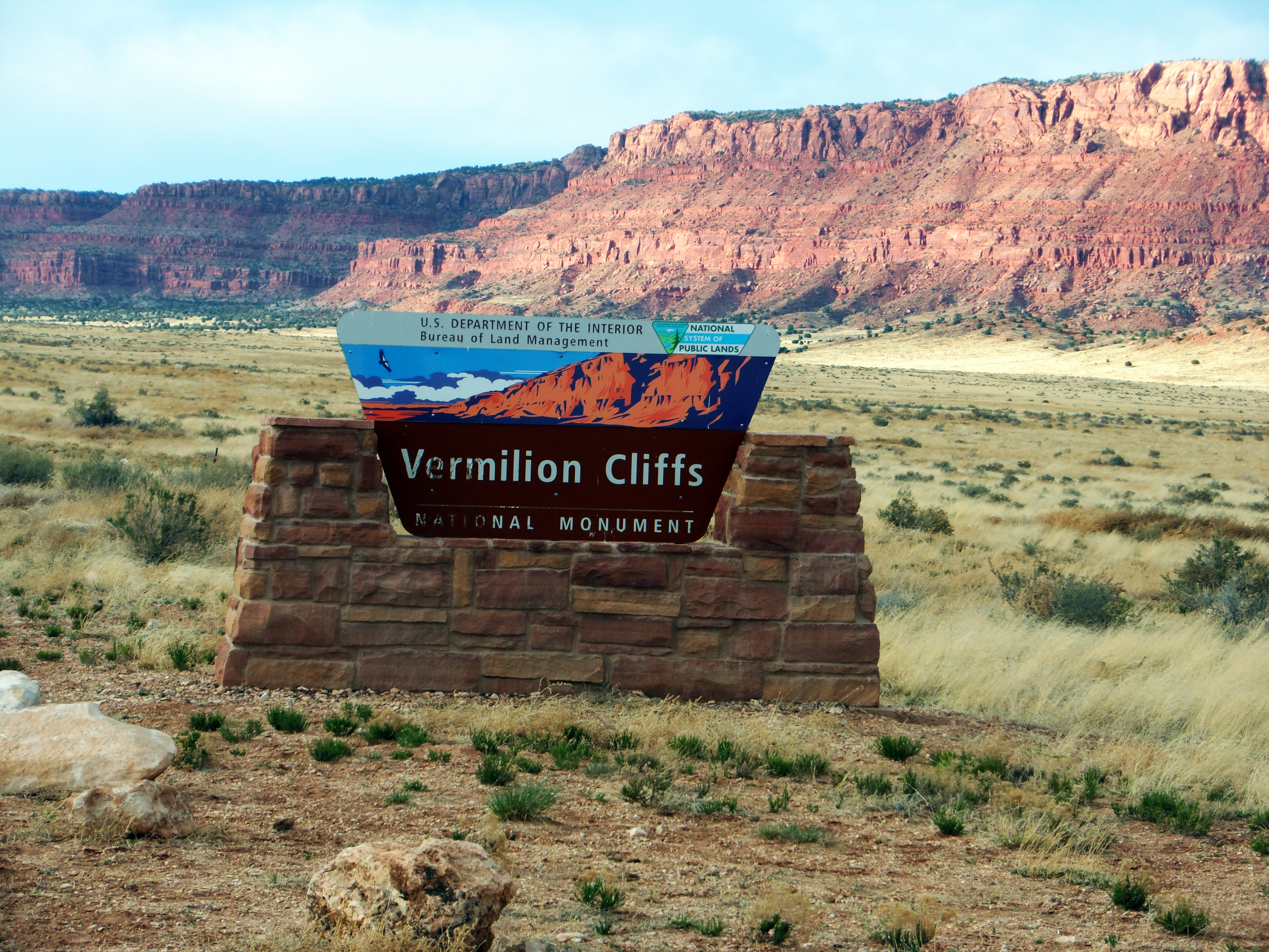
- Vermillion Cliffs
- SAM_0342L.jpg (7.63 MiB) Viewed 562 times
- SAM_0344L.jpg (9.65 MiB) Viewed 562 times
- SAM_0352L.jpg (6.46 MiB) Viewed 562 times
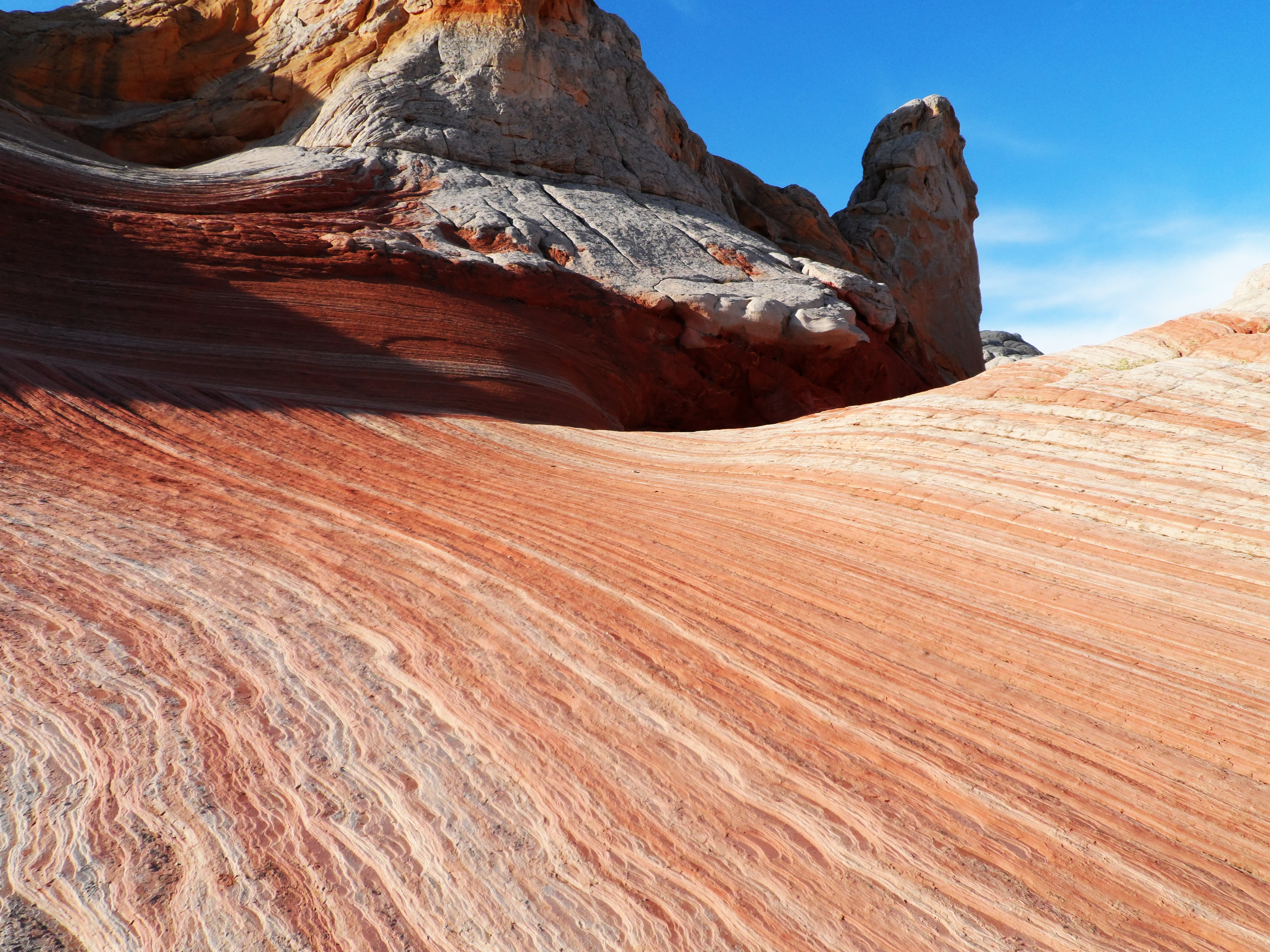
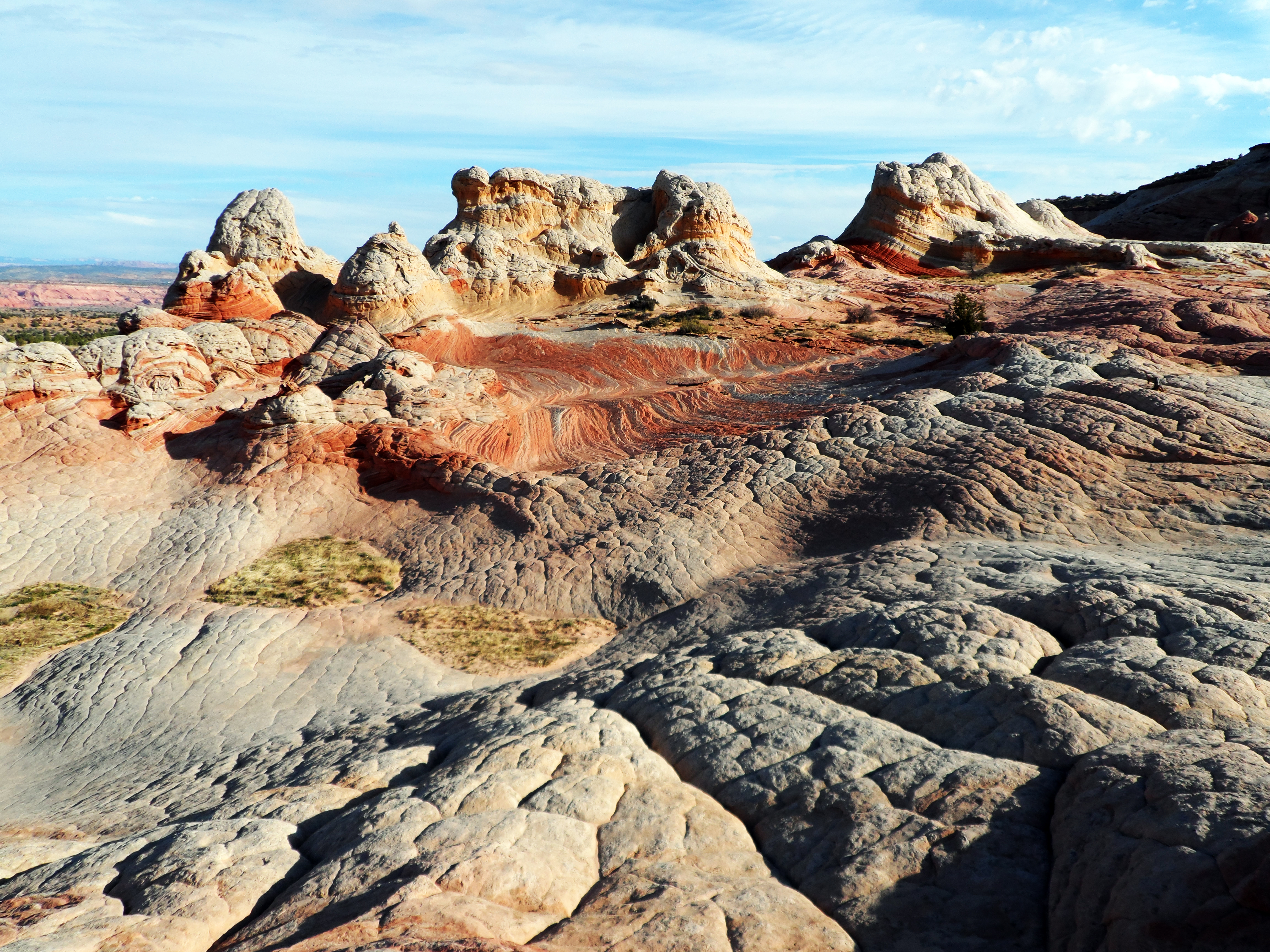
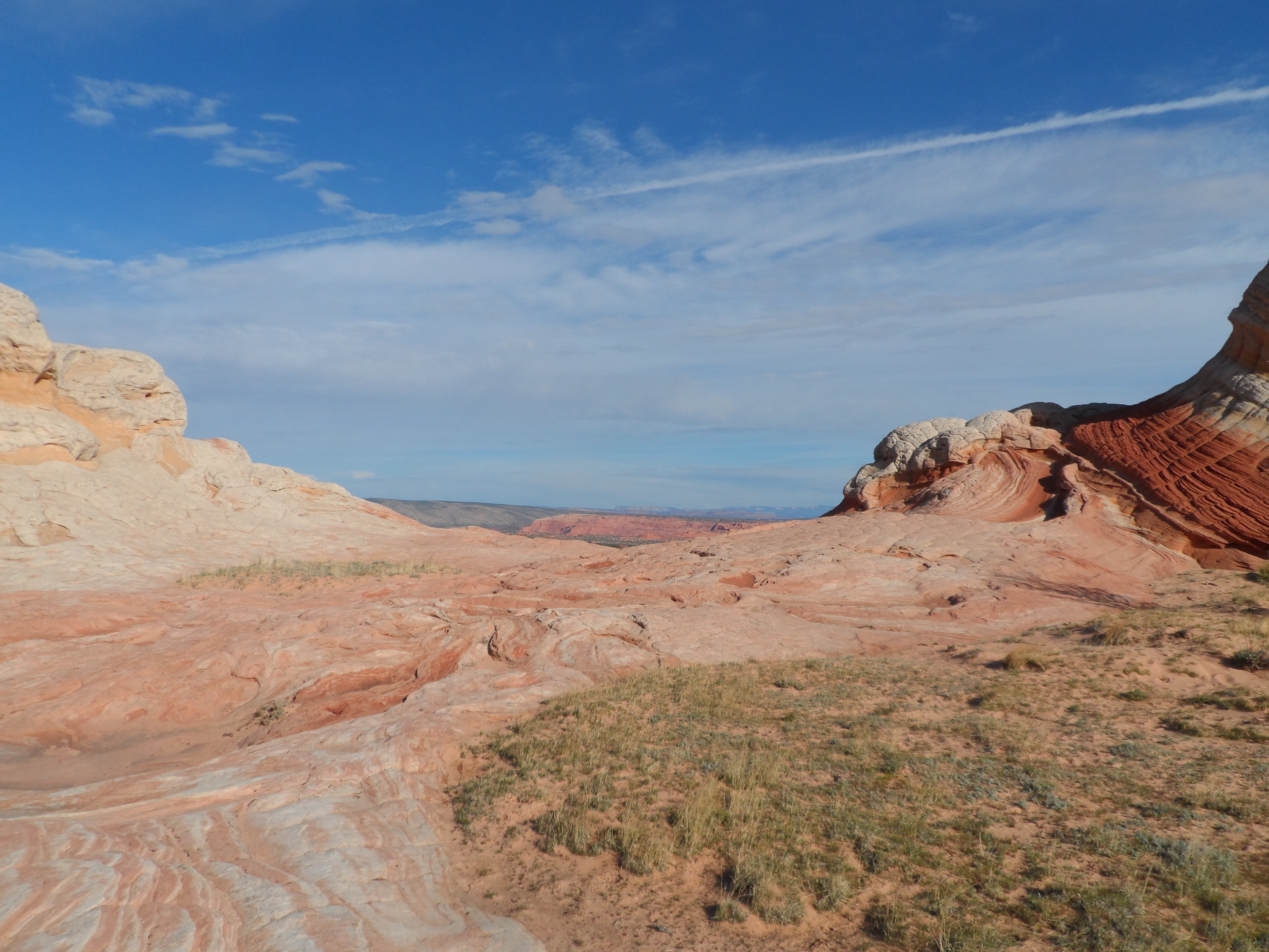
- White Pockets
- SAM_0363.JPG (3.32 MiB) Viewed 562 times
- SAM_0441L.jpg (8.35 MiB) Viewed 562 times
- SAM_0463ps.jpg (8.59 MiB) Viewed 562 times
- SAM_0486.JPG (3.44 MiB) Viewed 562 times
- 20160213_120737.jpg (5.69 MiB) Viewed 562 times


