Page 2 of 7
Re: 52 Hike Challenge 2017- AKA: Not All Who Wander Are Lost
Posted: Thu Oct 12, 2017 8:07 pm
by BorregoWrangler
Re: 52 Hike Challenge 2017- AKA: Not All Who Wander Are Lost
Posted: Sun Oct 15, 2017 7:41 pm
by BorregoWrangler
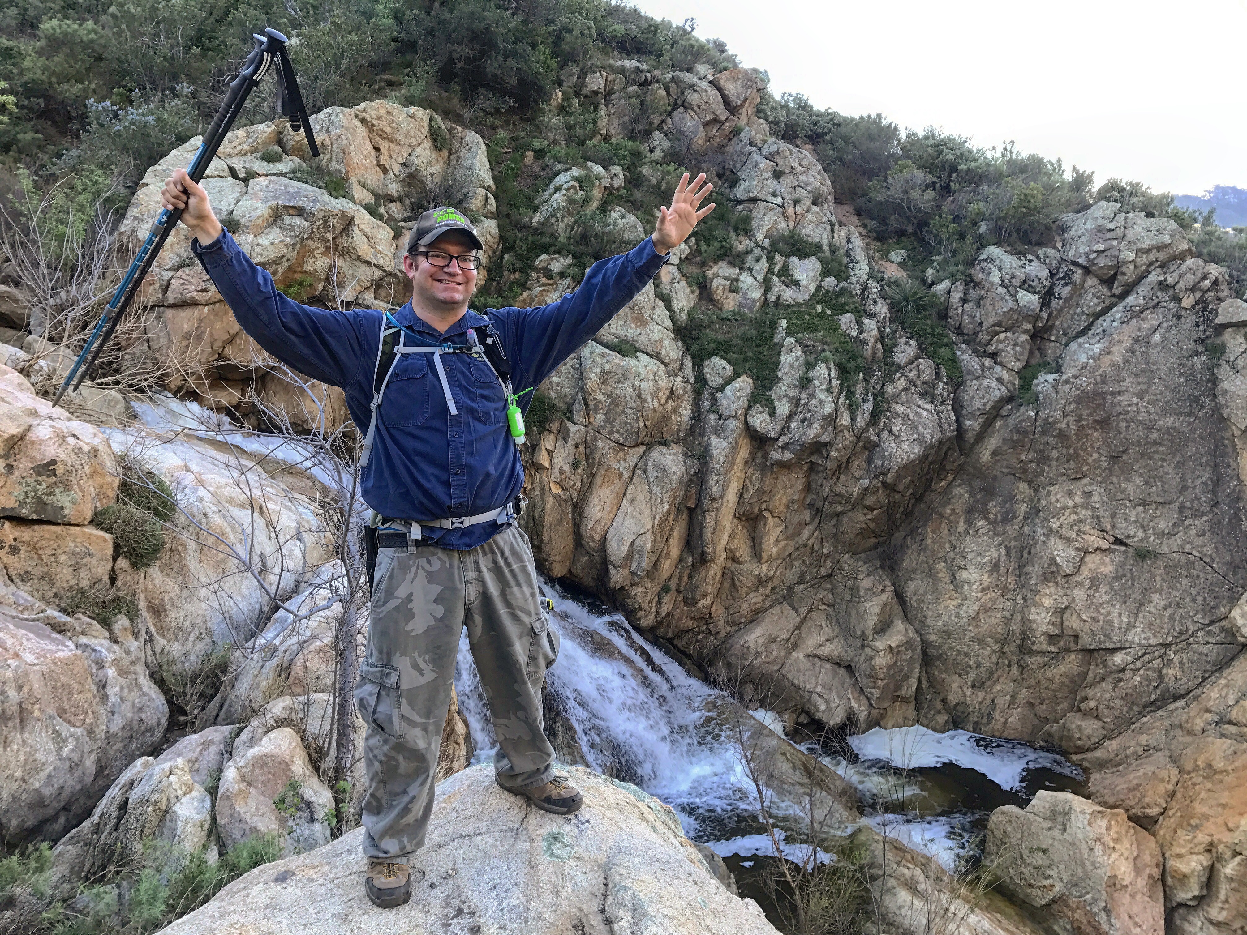
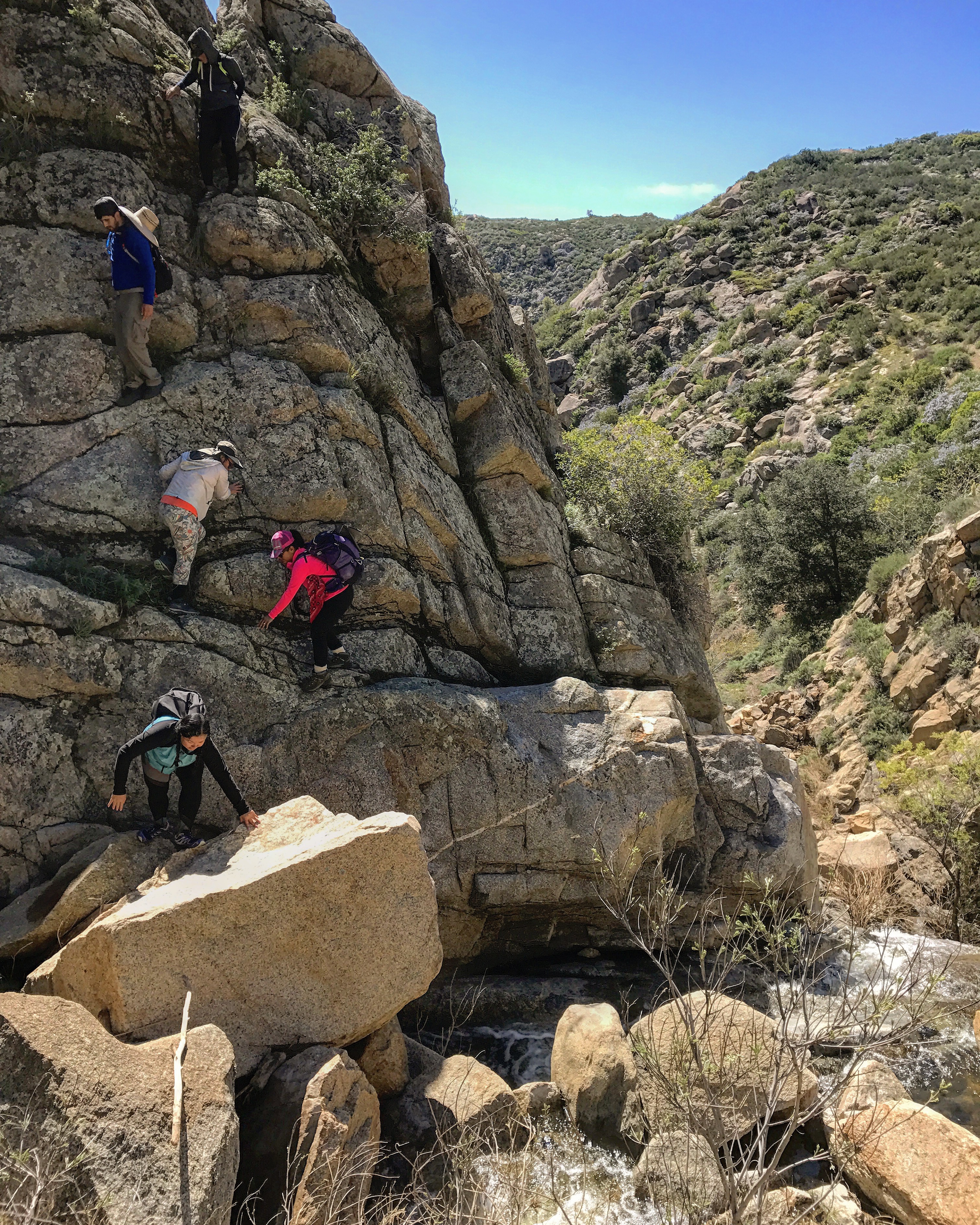
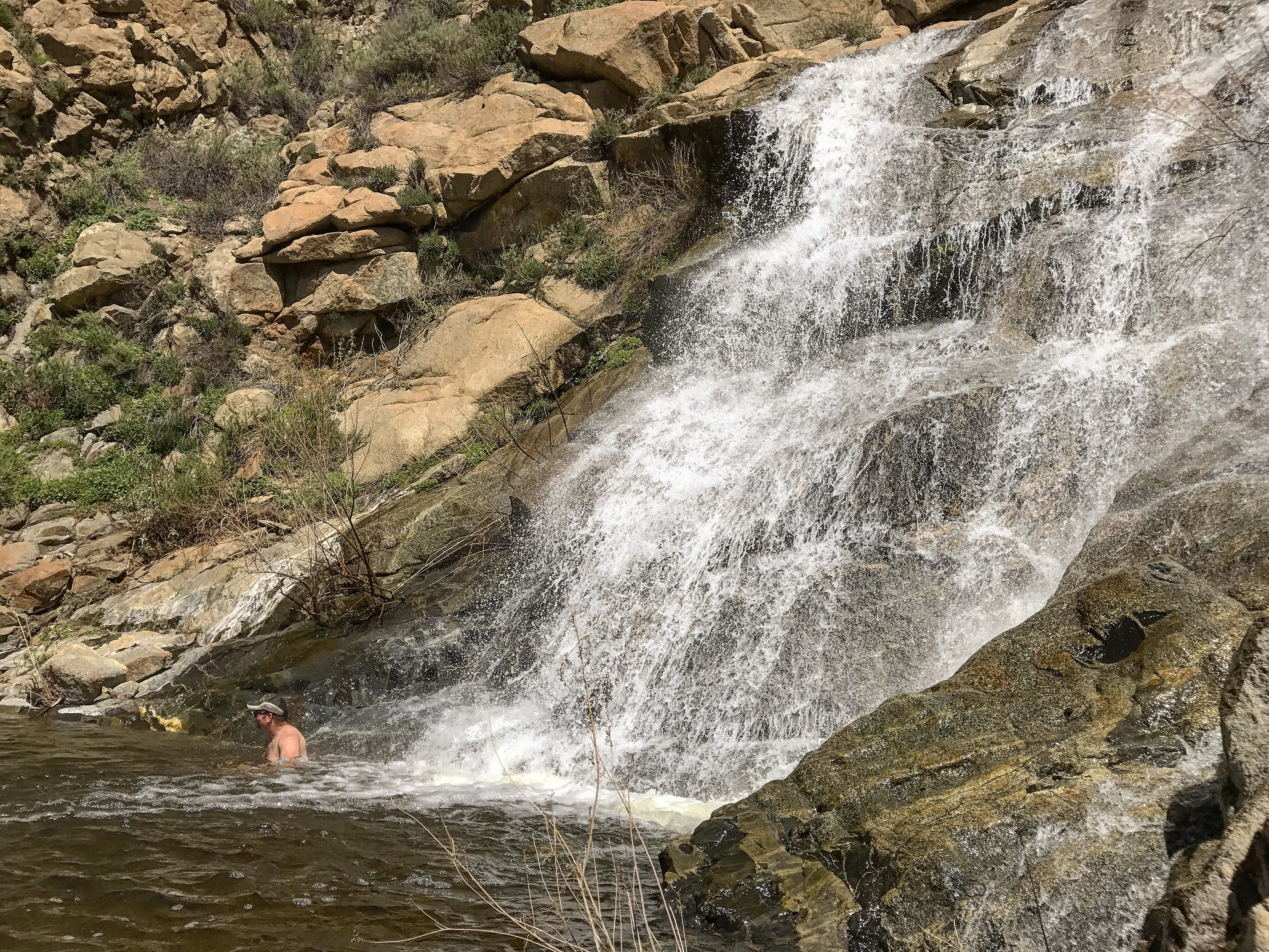
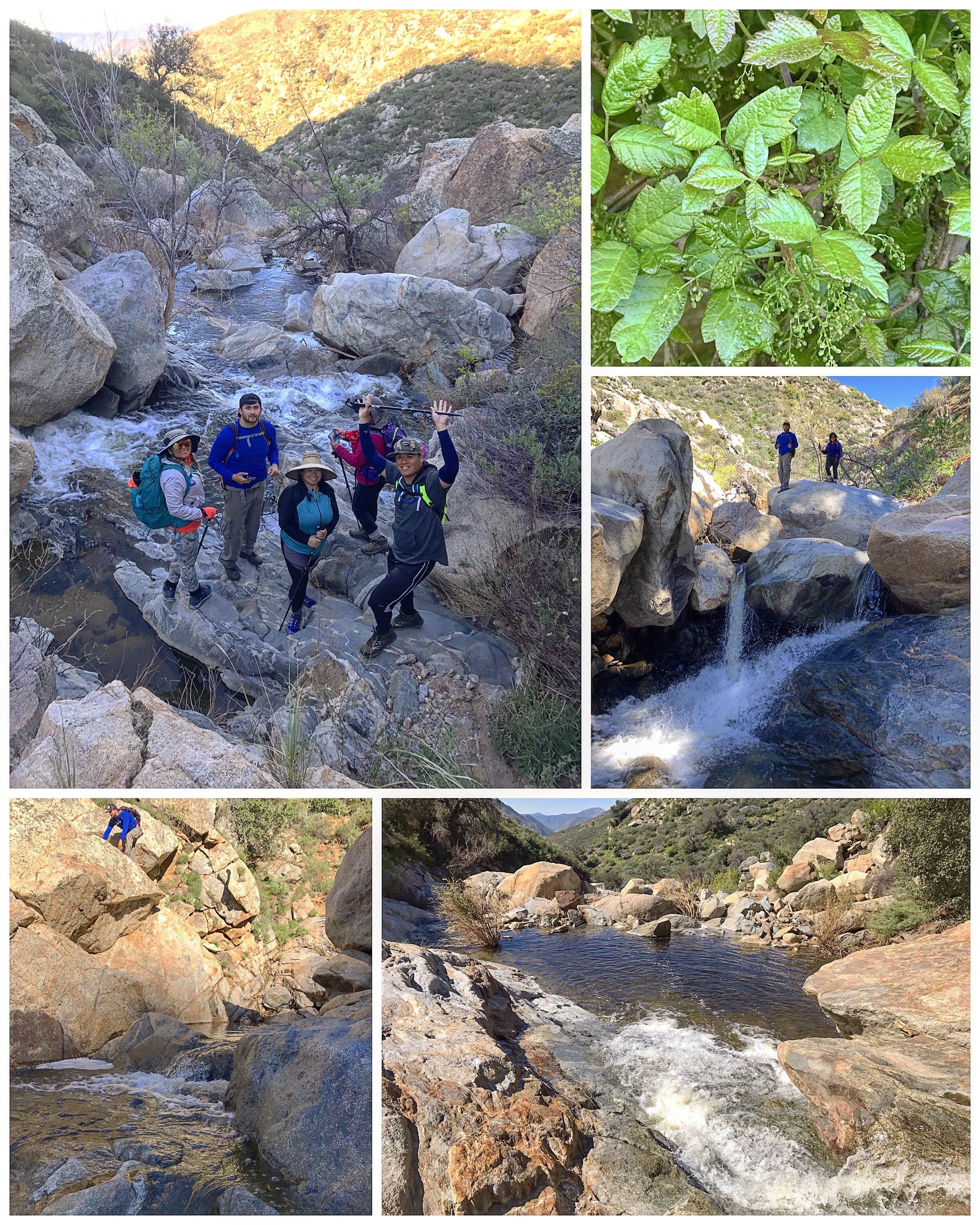
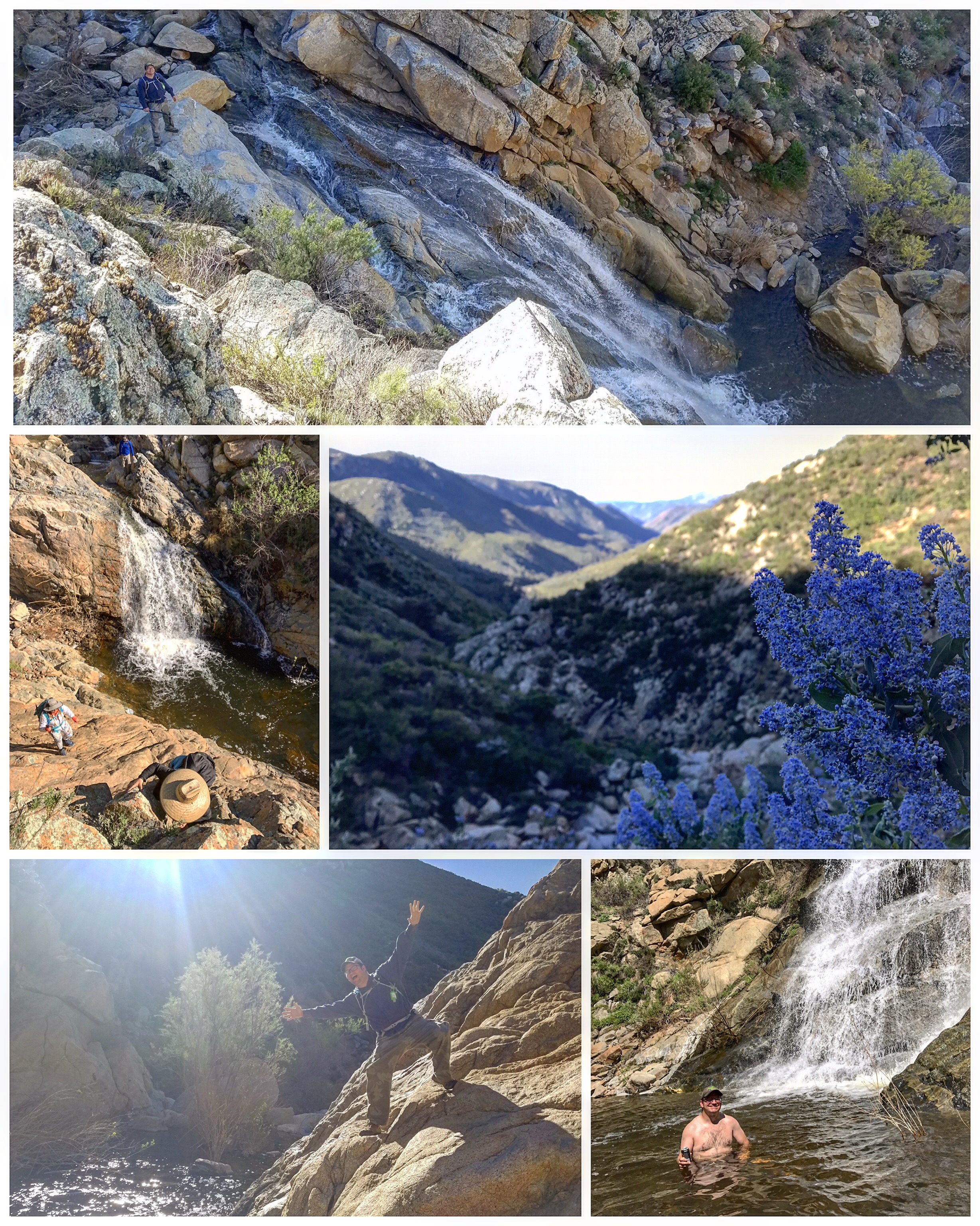
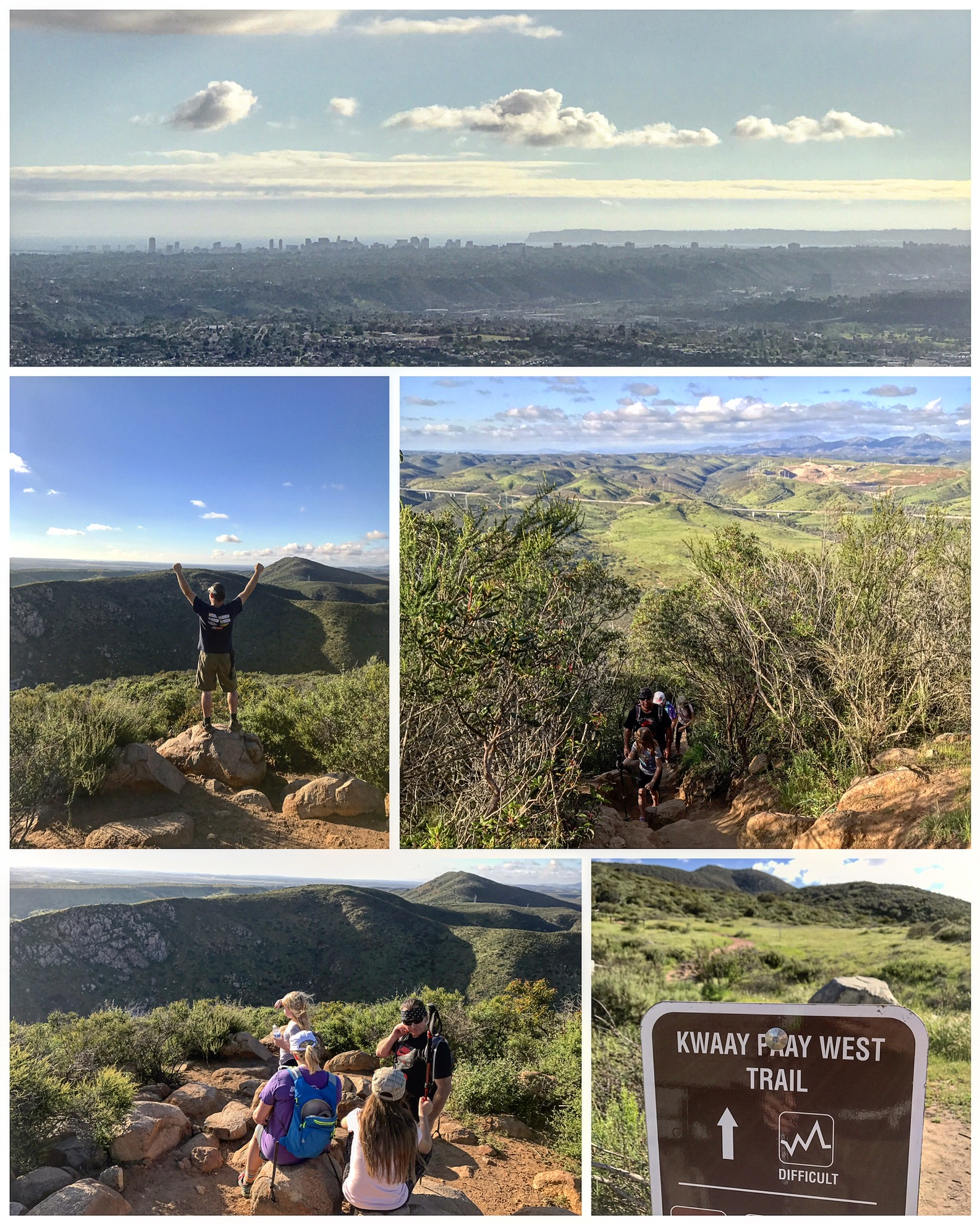
#12 Upper San Diego River Gorge
3 miles | +1080’
- 412AB692-7596-4CF1-A16D-C1D394AE1B38.jpeg (4.42 MiB) Viewed 92329 times
- B17CABB7-9307-464B-BC1F-8E280B936813.jpeg (4.83 MiB) Viewed 92329 times
- B4272B7D-61D0-4202-A1CB-7DBD870B422C.jpeg (6.49 MiB) Viewed 92329 times
- BD4E5210-7FC2-4E4F-88C1-D38277E6D302.jpeg (3.5 MiB) Viewed 92329 times
- BAC6FA57-4D7C-4705-98DA-C42324F801D9.jpeg (2.82 MiB) Viewed 92329 times
Chasing waterfalls along the upper San Diego River. It was slow going with bushwhacking, water crossings, boulder scrambling, and poison oak in abundance. The reward was relaxing in a pool at the base of a 50 foot waterfall.
The San Diego River has always held a special place in my heart. Many think of it as a stagnant and polluted watercourse running through town, but it's upper reaches offer a truly remote wilderness adventure.
"Turn down-canyon, and at 0.5 mile arrive at the first falls, a set of two, each about 50 feet high. To get by, you'll probably need to traverse through brush and over tilted rock slabs on the right (west) side. If you don't like this dicey maneuver, go no further and turn back. You will encounter nothing but long stretches of boulder hopping, and occasional rock climbing ahead." -Jerry Schad
Re: 52 Hike Challenge 2017- AKA: Not All Who Wander Are Lost
Posted: Mon Oct 16, 2017 7:15 am
by BorregoWrangler
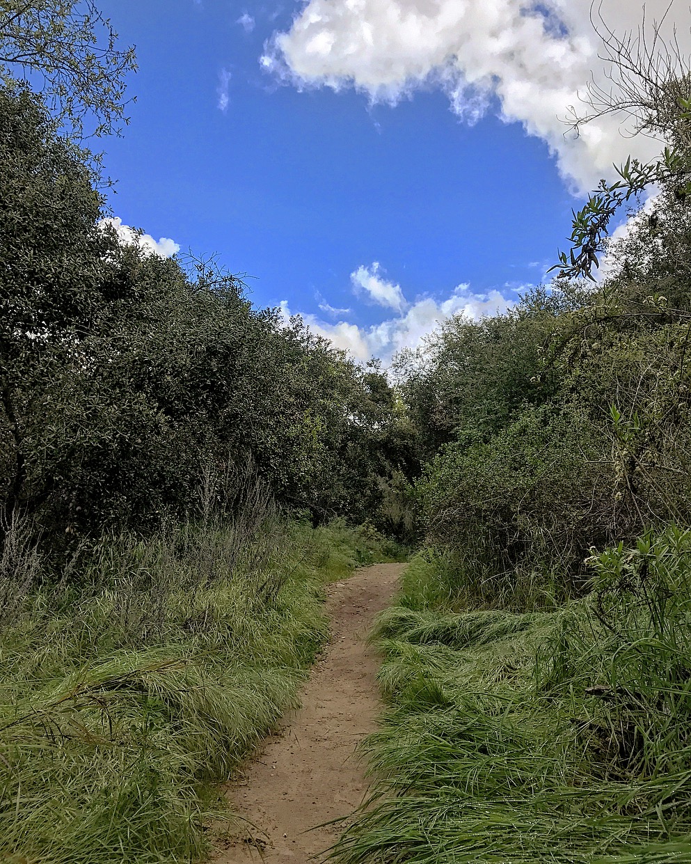
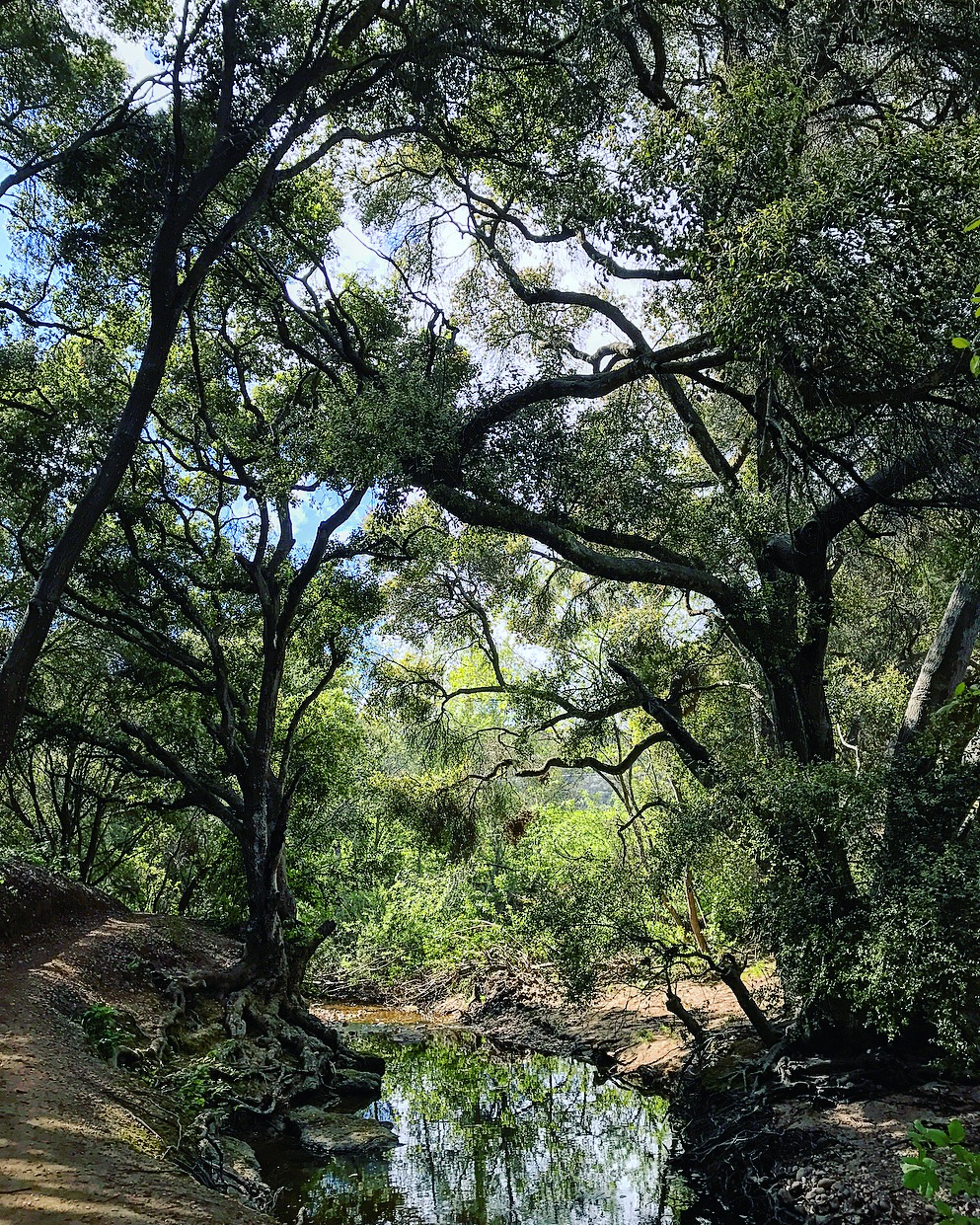
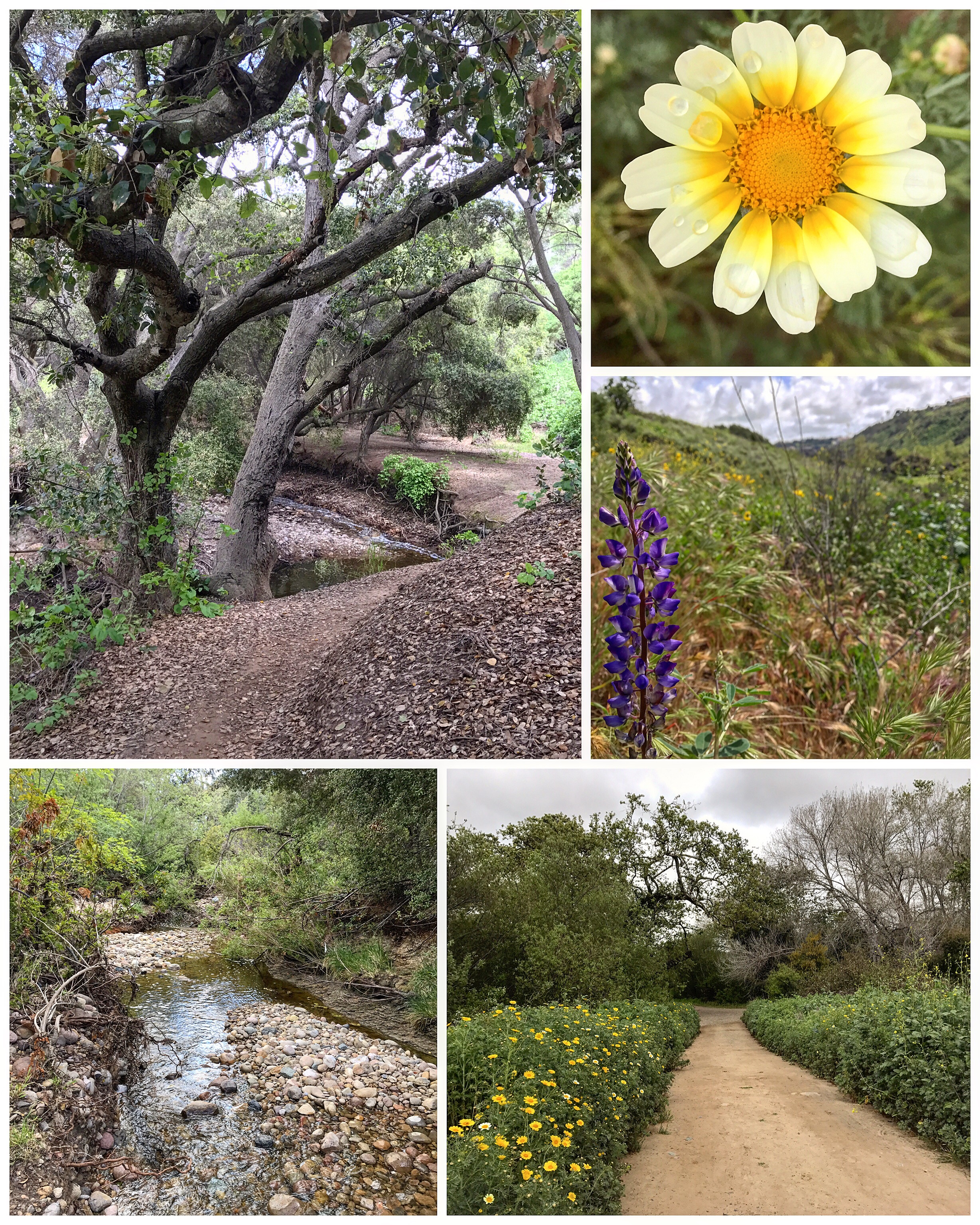
#13 Tecolote Canyon
6.5 miles | +310’
- 4E1811BB-E169-49C7-905B-AF96C1E2A2AE.jpeg (695.67 KiB) Viewed 92326 times
- EE7E6DEA-962E-454A-BF9B-1D91BC7A1739.jpeg (954.2 KiB) Viewed 92326 times
- D27B0F44-7A62-49C4-88CB-A50E818A751E.jpeg (3.49 MiB) Viewed 92326 times
Rustic signs along some of Clairemont's major streets call attention to one of the oldest designated open-space parks in San Diego: the 900-acre Tecolote Canyon Natural Park. Using the park's network of service roads and narrow footpaths, it's possible to follow most of the six-mile length of the main Tecolote Canyon and to poke into several of its tributary "finger canyons." By day you can spot hawks and ravens soaring on the strong coastal breeze blowing up the canyon. By night, you might hear the yapping of a coyote or the plaintive hoot of an owl, the creature for which this canyon was named.
Re: 52 Hike Challenge 2017- AKA: Not All Who Wander Are Lost
Posted: Wed Oct 18, 2017 8:19 pm
by BorregoWrangler
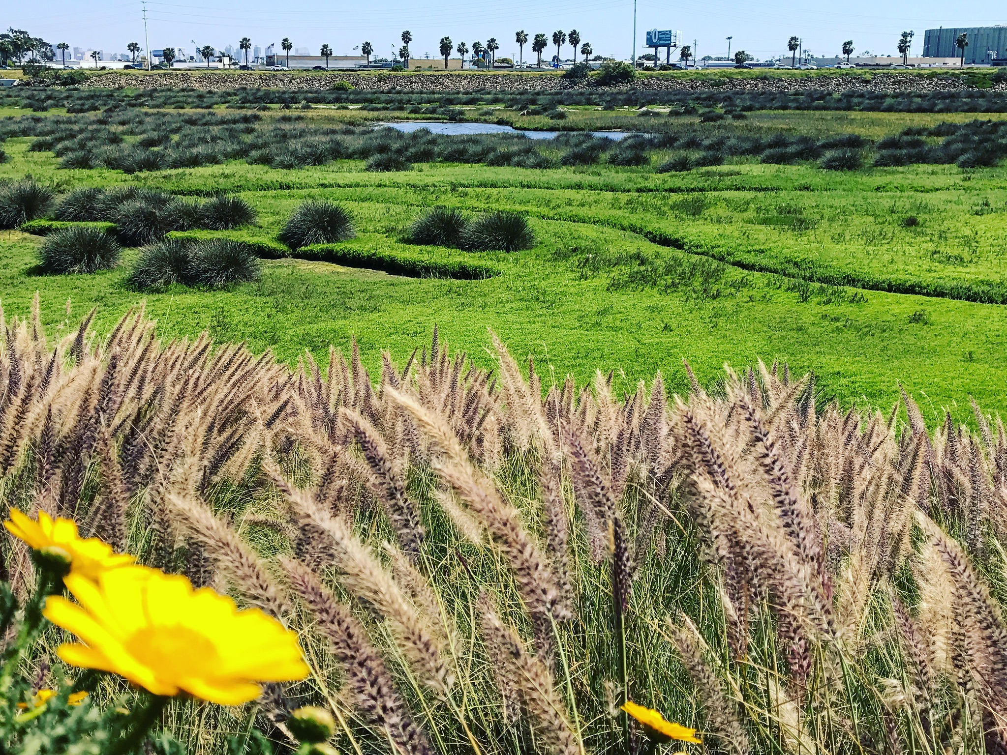
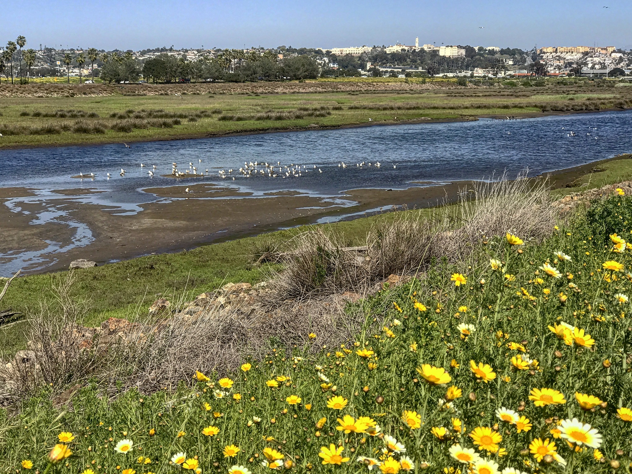
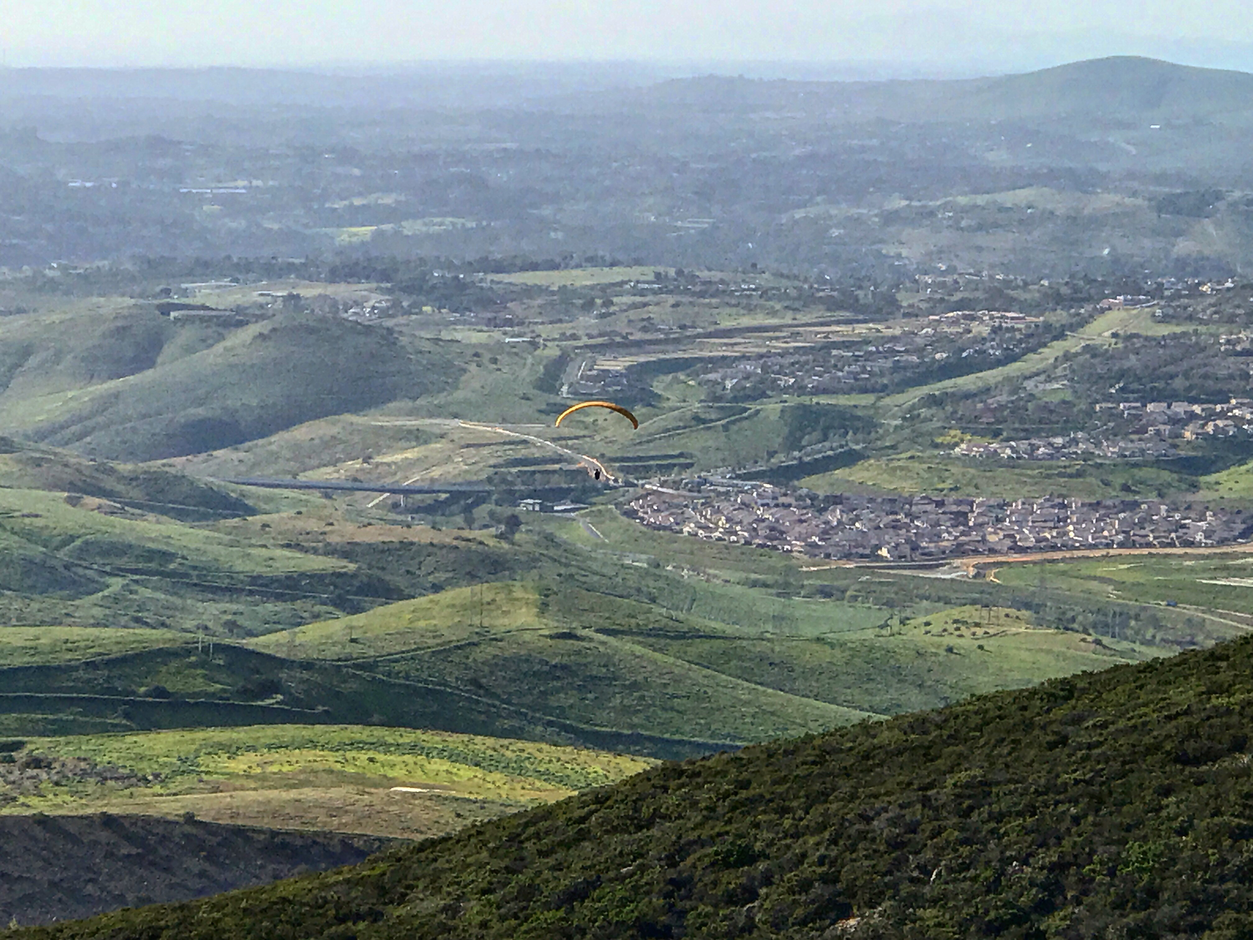
#14 San Diego River Delta/Old Sea World Drive
3 miles | +50’
- E542C1BD-3CC6-4875-9836-D13D41D56BCD.jpeg (1.73 MiB) Viewed 92314 times
- 8E03C933-C047-413D-86FB-BC76B5A0AFE1.jpeg (1.62 MiB) Viewed 92314 times
San Diego River can be seen as a green ribbon winding its way through steep valleys, agricultural lands, industrial areas, residential developments, and dense urban settings as it journeys from the hills and mountains near Julian and Santa Ysabel to the Pacific Ocean.
Rolling sand dunes, wandering trails and thriving wildlife make the San Diego River Delta area a real gem. It is part of a large 300+ acre estuary and also part of Mission Bay Park.
Coastal wetlands like this are incredibly significant for their unique habitats, serving many critical functions for both marine and freshwater aquatic species, birds, mammals, reptiles, and many more.
This walking/bike path on both sides of the river channel parallels Interstate 8. It is a section of the route that will eventually be completed as the 52 mile San Diego River Trail.
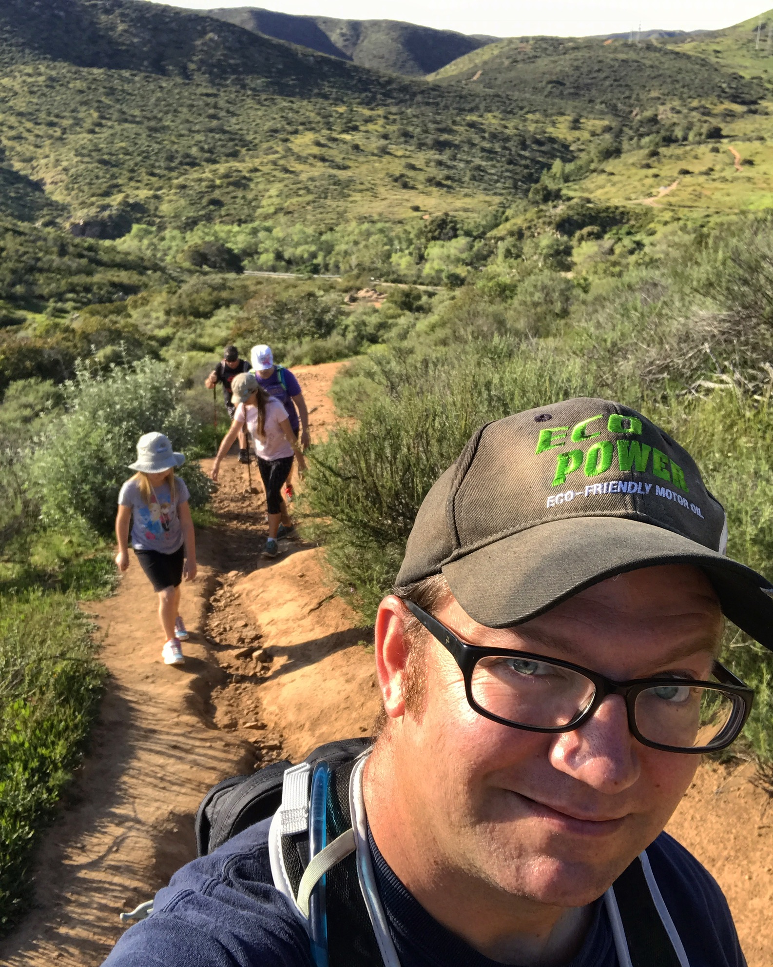
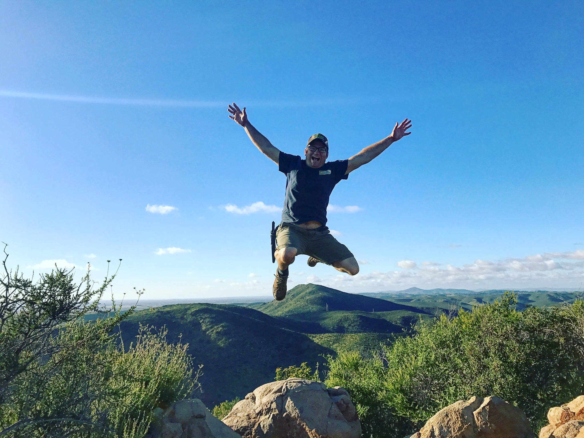
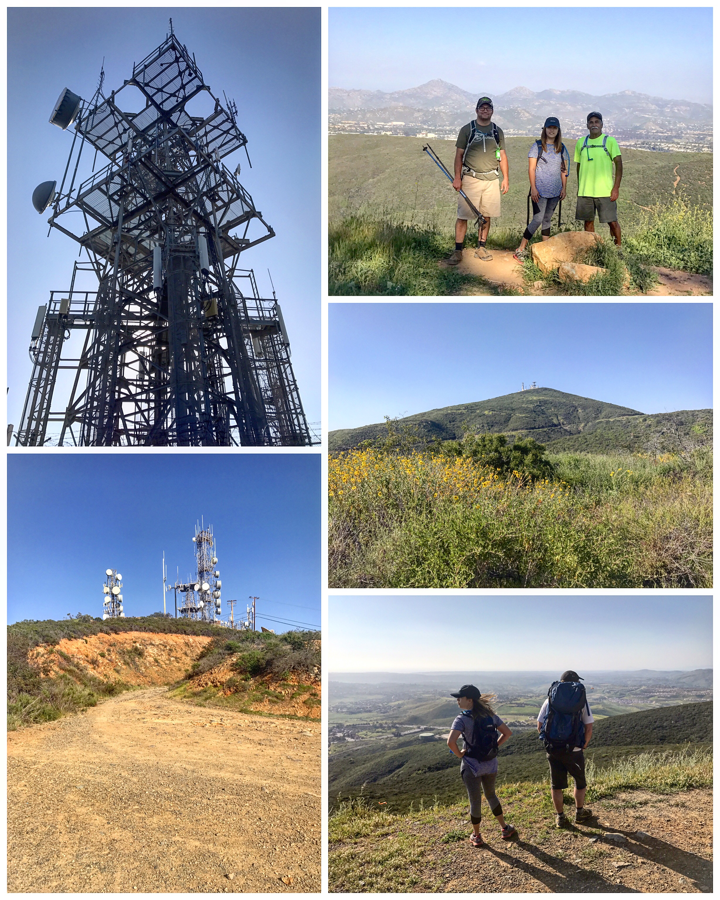
#15 Kwaay Paay Peak
2.25 miles | +900’
- 56275340-AF02-4564-A884-A1EAC1D6FD6B.jpeg (1.01 MiB) Viewed 92314 times
- B133136D-BC85-4A48-9456-7993E159F460.jpeg (916.54 KiB) Viewed 92314 times
- 37F8F55E-C6BC-46A5-B1EC-C9E952C1CA68.jpeg (1.13 MiB) Viewed 92314 times
Lead my sister and her family up Mission Trail's shortest but steepest peak. Now she only has one more mountain to complete for the 5 Peak Challenge. Lesson learned on this hike: when you hide in the brush to scare your niece, the ticks will get you!
Re: 52 Hike Challenge 2017- AKA: Not All Who Wander Are Lost
Posted: Wed Oct 18, 2017 8:27 pm
by BorregoWrangler
Re: 52 Hike Challenge 2017- AKA: Not All Who Wander Are Lost
Posted: Sun Oct 22, 2017 8:31 am
by BorregoWrangler
#17 Black Mountain
4 miles | +800’
- 1F2C3D0F-FD80-4137-B957-87FA8EF0859C.jpeg (1.86 MiB) Viewed 92305 times
- 3E90FD81-AADD-4252-B3AF-742F2B8C27C5.jpeg (2.62 MiB) Viewed 92305 times
Black Mountain is a relatively small yet scenic peak in the Rancho Penasquitos area. It’s antenna clad crest stands out prominently amid its lower lying surroundings, and can be easily seen and identified from other nearby San Diego peaks like Mt. Woodson and Iron Mountain.
There are several possible routes up Black Mountain. For this trip, we began at Hilltop Community Park and climbed the southern slope of the mountain along the Nighthawk trail. While most of the distant views were obscured by the haziness, it was a pleasant climb to the top.
Re: 52 Hike Challenge 2017- AKA: Not All Who Wander Are Lost
Posted: Tue Oct 24, 2017 7:33 pm
by BorregoWrangler
#18 Tecate Peak
7 miles | +1700’
- F75AA055-FEAA-4434-B05B-2D5C41B413DE.jpeg (1.74 MiB) Viewed 92301 times
- 1933CECE-6B6E-41CA-A679-376CAE2FFC85.jpeg (2.53 MiB) Viewed 92301 times
- 232F40A8-678B-46D0-B307-CAE34BF1401C.jpeg (2.24 MiB) Viewed 92301 times
Tecate Peak is a prominent landmark mountaintop overlooking Tecate, Mexico, and even featured on their iconic beer cans. However, the peak lies barely over the border, in the United States. Because of its height and prominence, it is a natural location for summit towers and a perch for the Border Patrol to keep an eye on things. There is a solid hard-pack dirt road all the way to the top, which is open to hikers. Purists may moan about there being a road in the first place, but without the road, climbing this peak would be an awful bushwhack up rocky, brushy slopes. From the top, you get excellent views of Tecate and Tijuana, Mexico, and all sorts of peaks south, the ocean west of San Diego, and the myriad of summits in southern San Diego County.
Re: 52 Hike Challenge 2017- AKA: Not All Who Wander Are Lost
Posted: Thu Mar 22, 2018 7:04 am
by BorregoWrangler
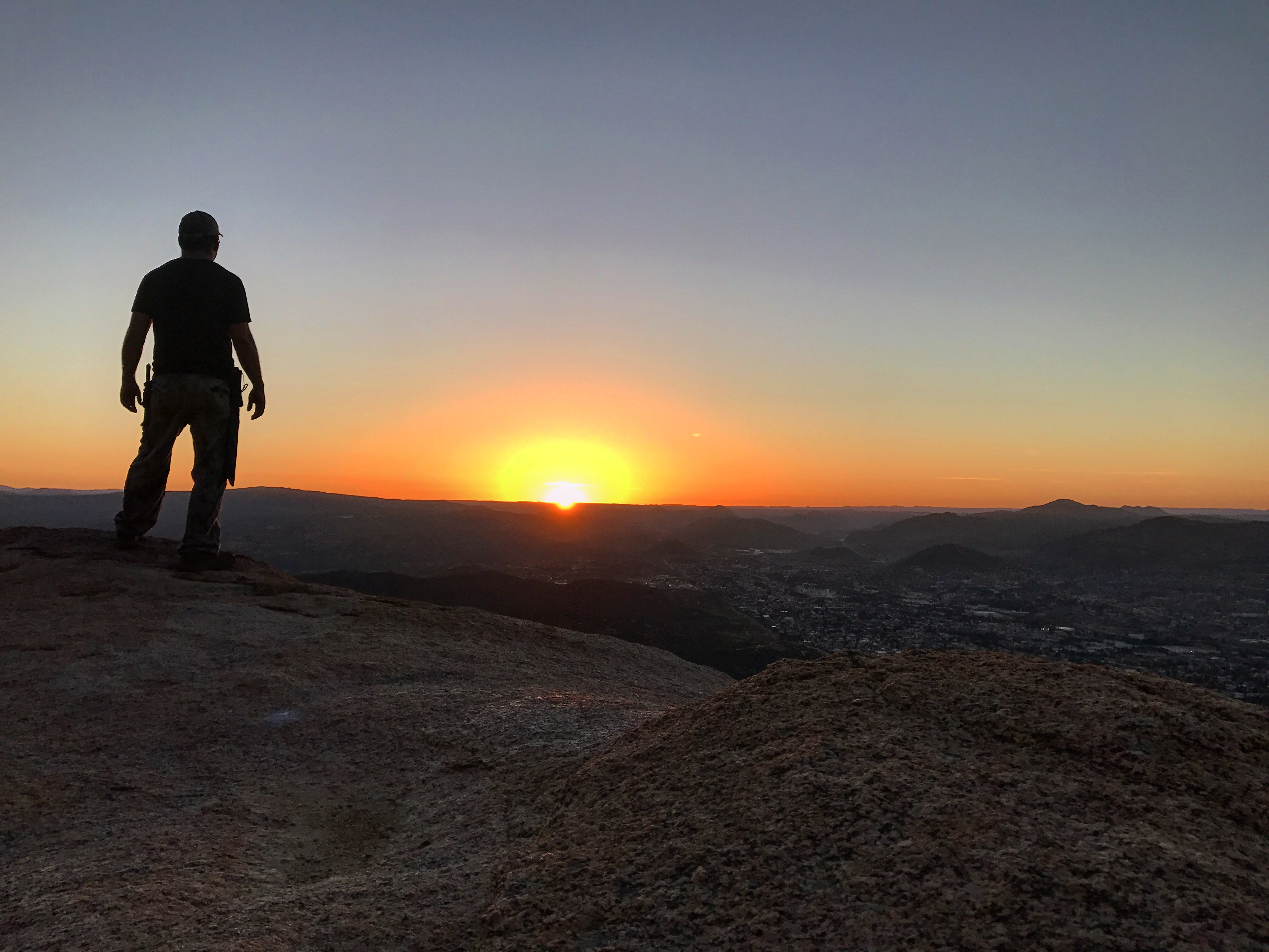
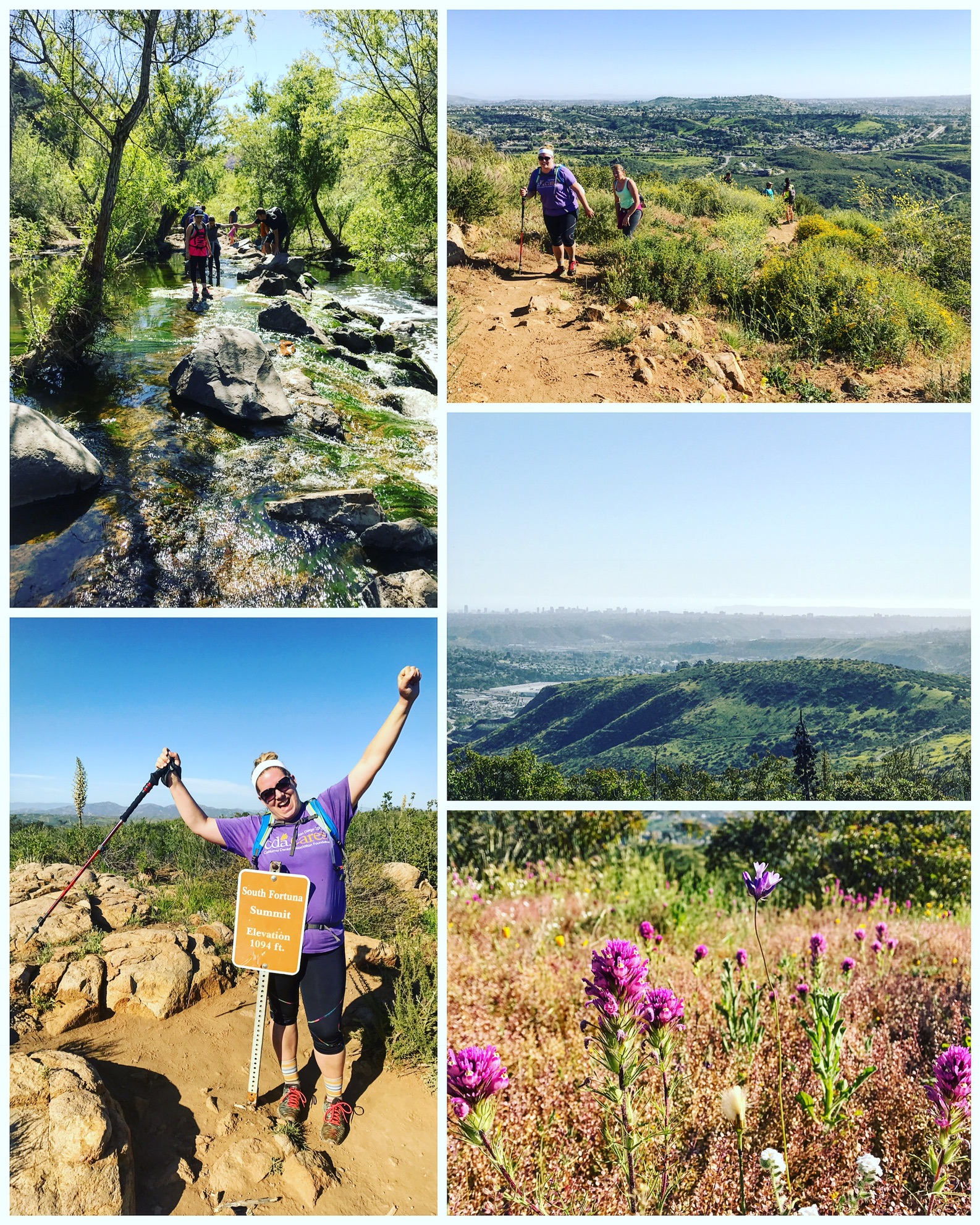
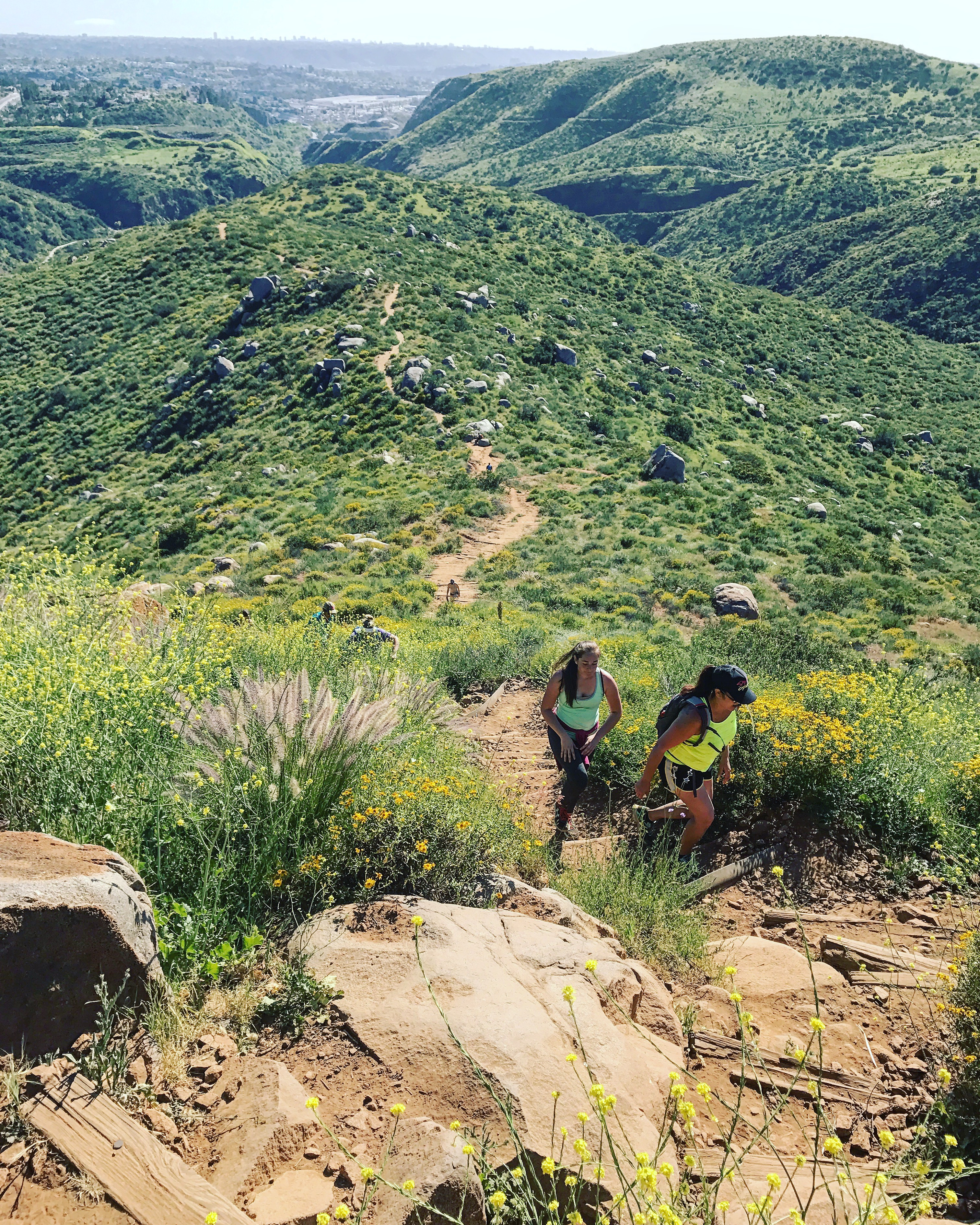
#19 South Fortuna Mountain
5.5 miles | +1400’
- 99642871-A5DB-4B8D-A1FD-2AF72DA12C58.jpeg (1.5 MiB) Viewed 92206 times
- 15753C8B-58A3-4157-BF7A-6A553A0A0A26.jpeg (5.95 MiB) Viewed 92206 times
Tecate in the morning, South Fortuna in the afternoon. My sister has now completed the Mission Trails Five Peak Challenge. So proud of her!
Re: 52 Hike Challenge 2017- AKA: Not All Who Wander Are Lost
Posted: Thu Mar 22, 2018 7:10 am
by BorregoWrangler
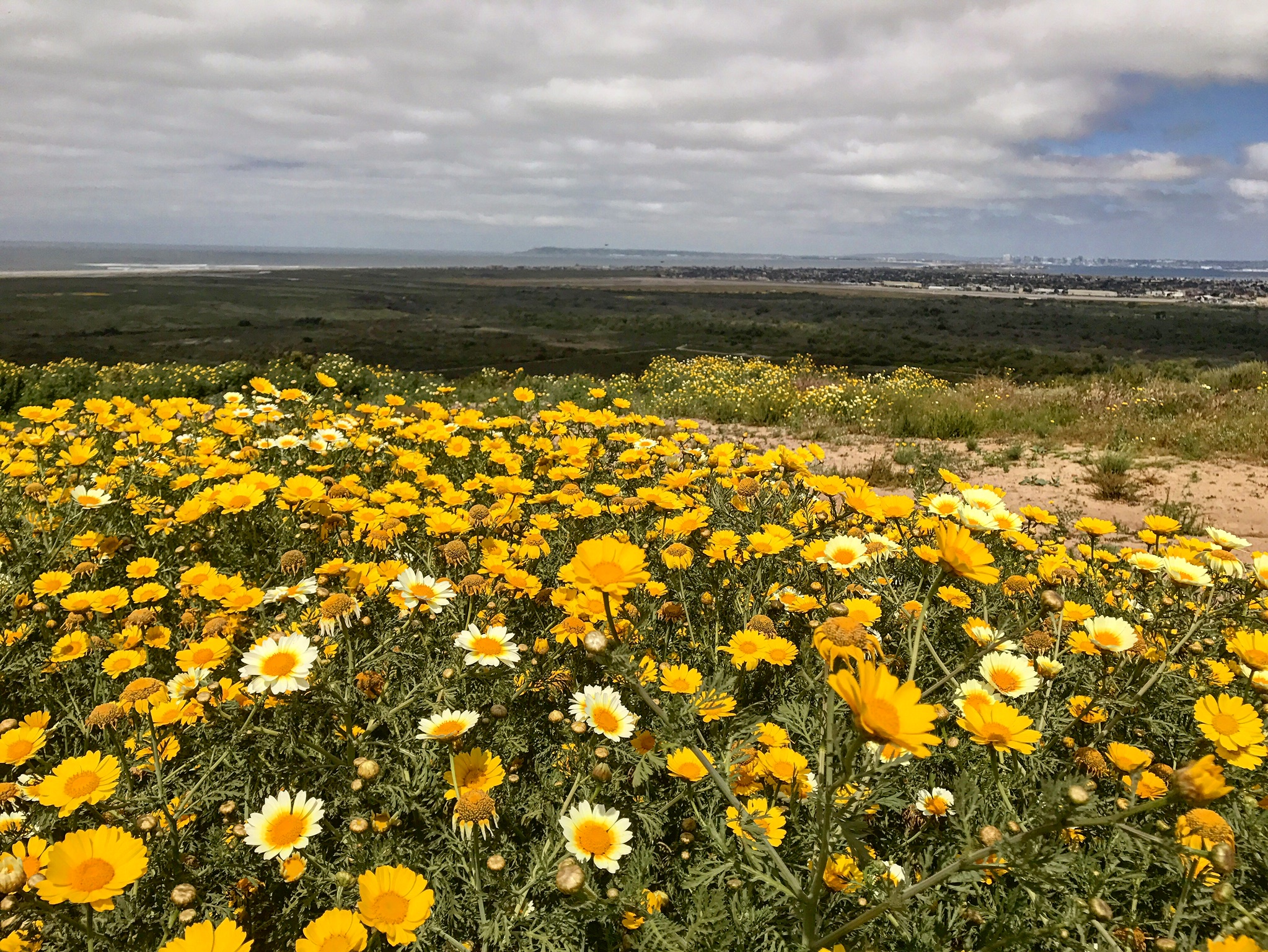
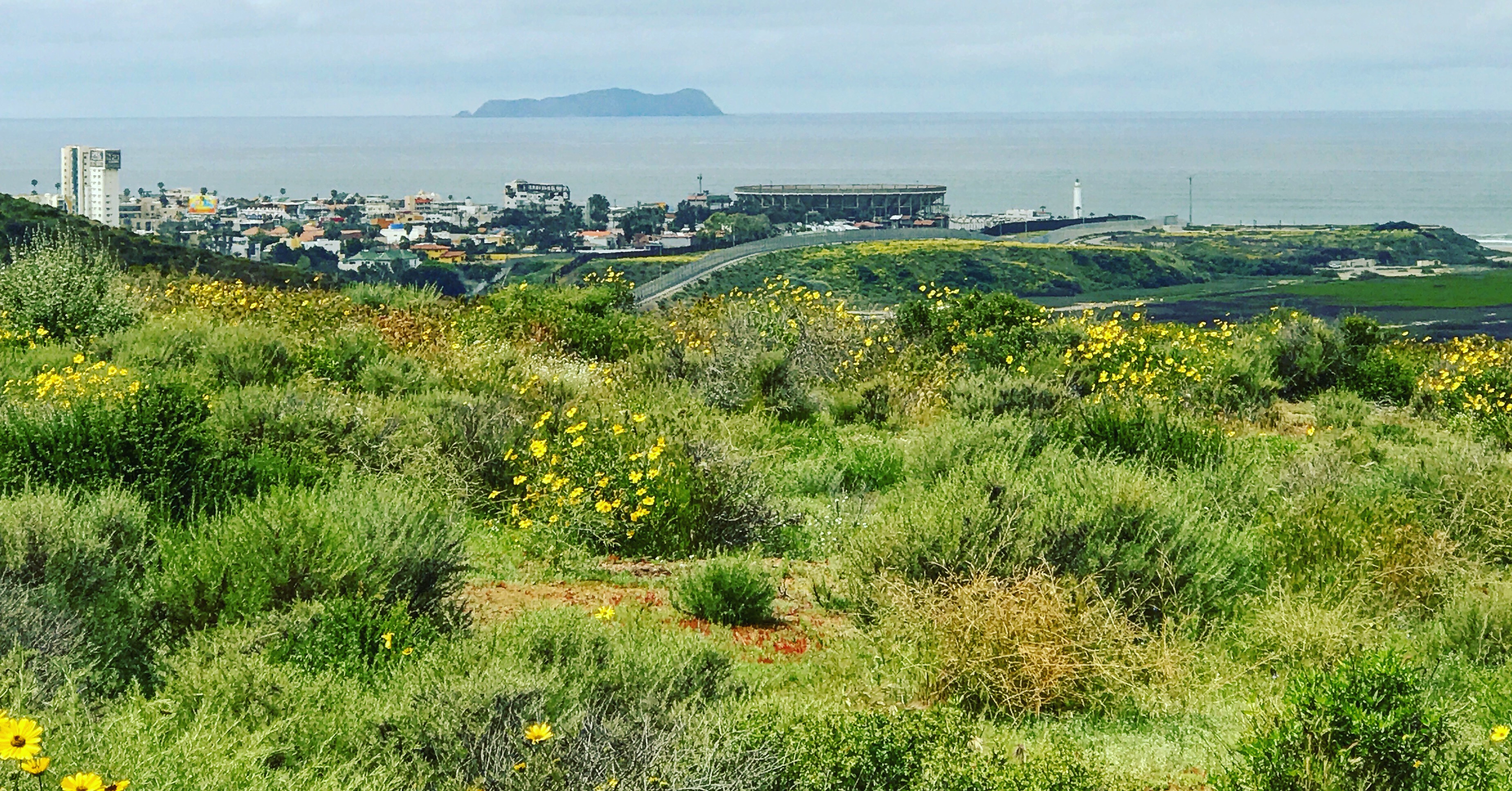
#20 Spooner's Mesa
2 miles | +340'
- 86607BCA-77F8-44FD-9E85-2B2A88A3E923.jpeg (1.44 MiB) Viewed 92206 times
- 756B21A6-4011-4EC4-AD7D-B3D358810D9B.jpeg (2.42 MiB) Viewed 92206 times
A quick lunch break hike to explore part of a new trail.
"While most of the trails in the Tijuana River Valley traverse the valley's broad, flat floor, the trail to top of 400-foot-high Spooner's Mesa rewards visitors with an impressive binational view." -Jerry Schad and Scott Turner, Afoot & Afield San Diego County
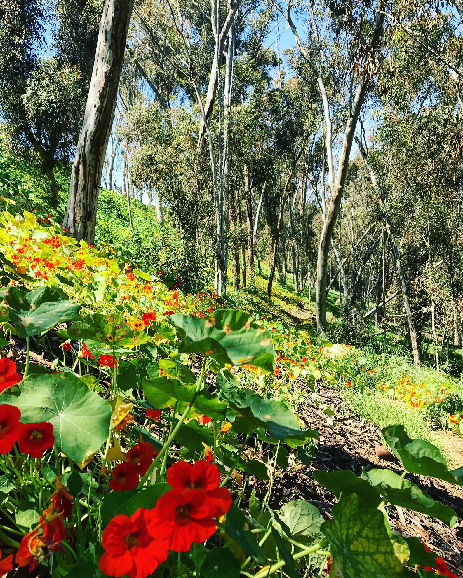
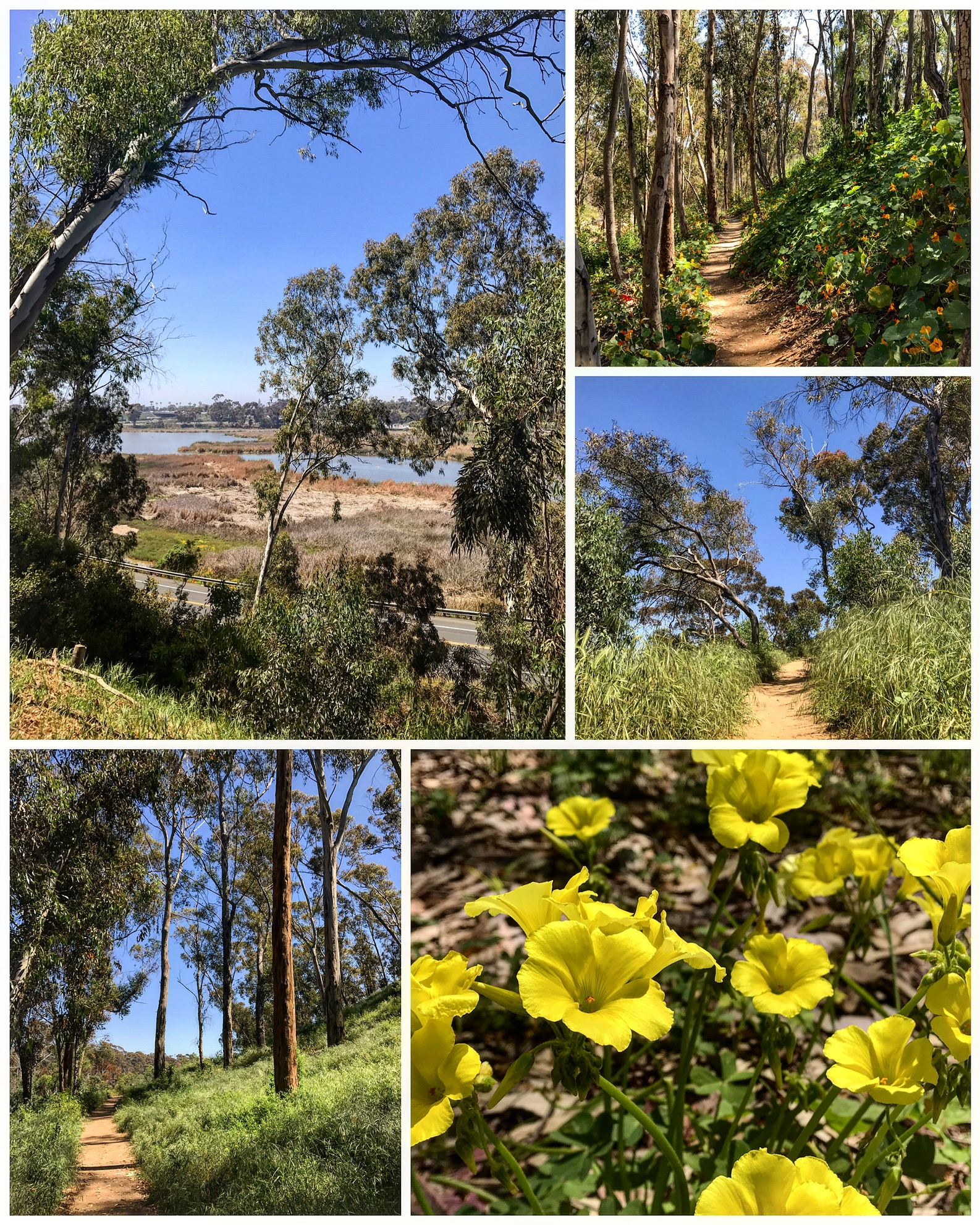
#21 Hosp Grove
1.75 miles | +220'
- 88C00280-07EC-48B1-8E56-2450F974B674.jpeg (1.98 MiB) Viewed 92206 times
- F4F75A3D-ABDB-41EE-B9B4-69C8C609D21A.jpeg (1.68 MiB) Viewed 92206 times
Hosp Grove was founded by a group of investors called The Hosp Eucalyptus Corp in 1908. They planted 219 acres of trees hoping they could be harvested & sold to the Santa Fe Railroad as railroad ties. Unfortunately, eucalyptus is a brittle wood and cracks easily, therefore was unsuitable.
Since the beginning, much of the grove has been sold off, but what remains are fun, forested trails with plenty of inclines and twists & turns. Part of the trail is parallel to the Buena Vista Lagoon and offers great views.
Re: 52 Hike Challenge 2017- AKA: Not All Who Wander Are Lost
Posted: Thu Mar 22, 2018 7:15 am
by BorregoWrangler
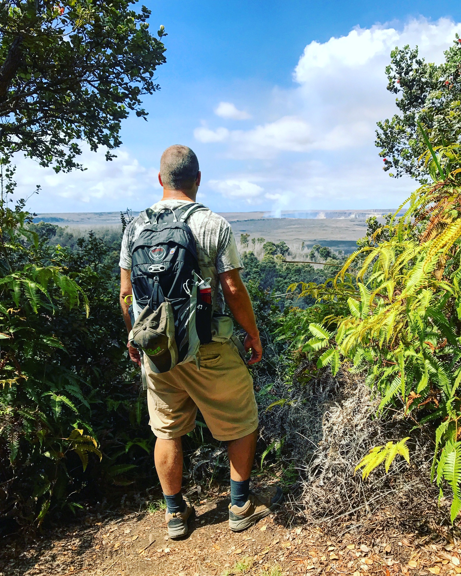
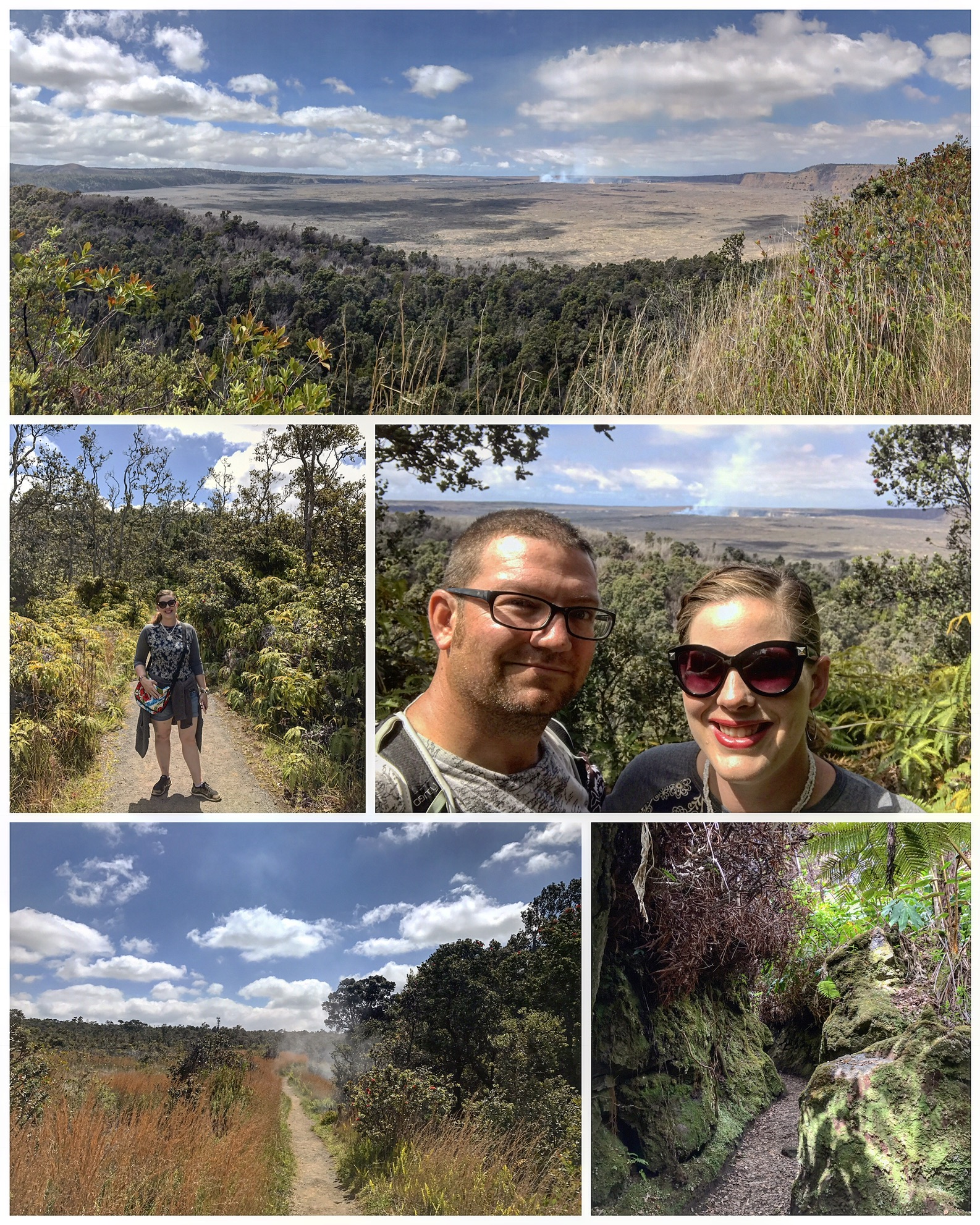
#22 'Iliahi (Sandalwood) Trail
1.25 miles | +200'
- F8A4DE23-7468-469D-8C43-AF8F66A8ADDD.jpeg (1.52 MiB) Viewed 92206 times
- 918CEEE9-8E55-4C57-B696-36940F0CC22C.jpeg (1.39 MiB) Viewed 92206 times
The next few hikes are a bit further west of Southern California. The prized and fragrant sandalwood tree once grew in such abundance in Hawaii that the Chinese knew the islands as Tahn Heung Sahn or the Sandalwood Mountains. By the 1830's much of the sandalwood forests had been decimated. Hawaii’s largest grove of sandalwoods can be found on the Big Island of Hawaii on the slopes of Mauna Loa. This beautiful rainforest trail can be found a short distance away from the Hawaii Volcanoes National Park visitor center. Feel the heat from the active steam vents and peer across the steaming floor of Kīlauea Caldera and the erupting Halema`uma`u Crater while enjoying the comforts of this mostly shady loop trail.