Page 2 of 4
Re: OAUSA Net - 04/02/20 - Destination: The Bradshaw Trail (Gold Road to La Paz)
Posted: Wed Apr 01, 2020 3:40 pm
by toms
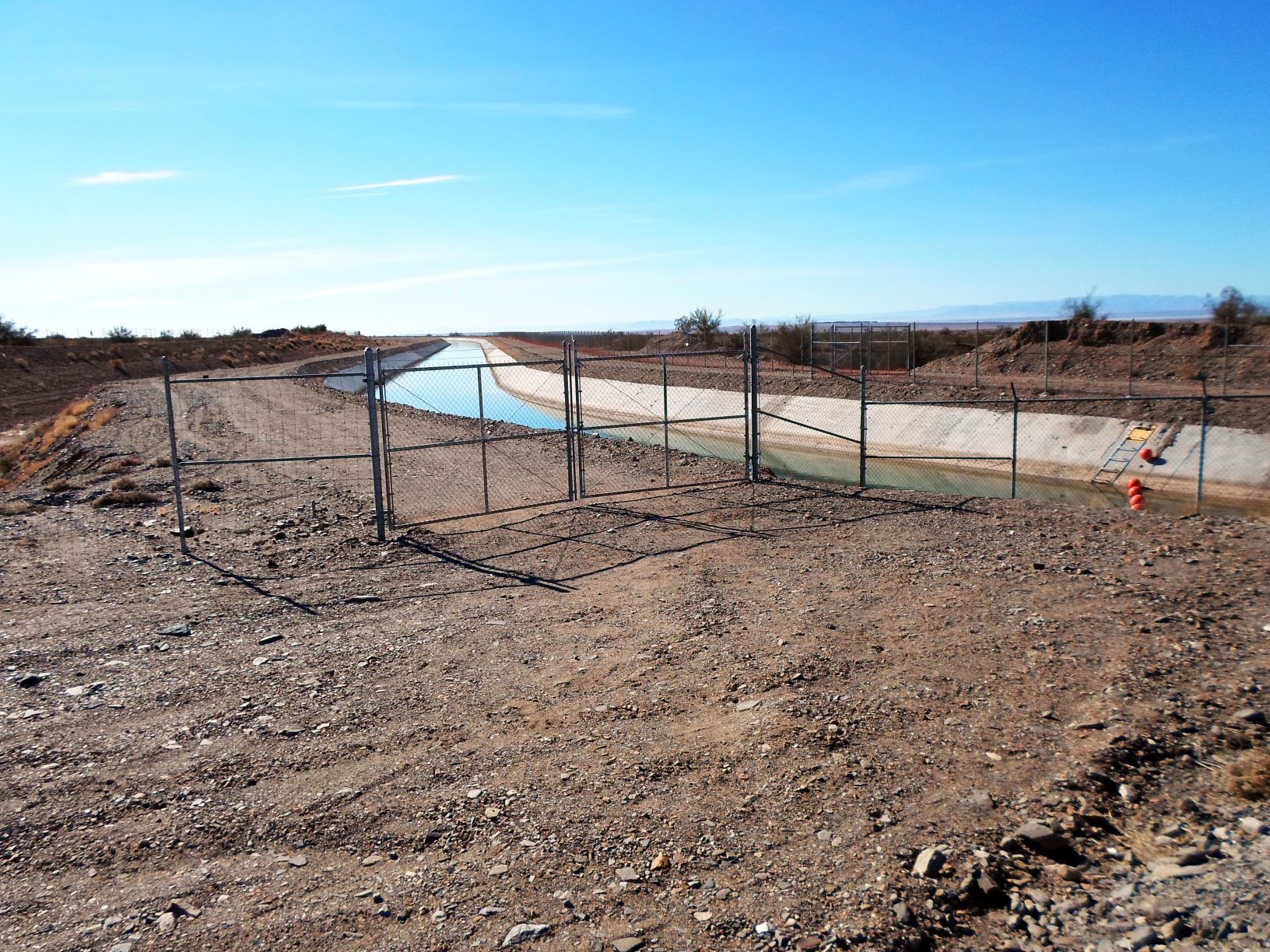
All-American Canal
The All-American Canal is an 80-mile long aqueduct, located in southeastern California. It conveys water from the Colorado River into the Imperial Valley and to nine cities.
It is the Imperial Valley's only water source.
The Imperial Dam, about 30 miles northeast of Yuma, Arizona on the Colorado River, diverts water into the All-American Canal, which runs to just west of Calexico, California before its last branch heads mostly north into the Imperial Valley.
Six smaller canals branching off the All American Canal move water into the Imperial Valley.
These canal systems irrigate up to 630,000 acres of good crop land.
It is the largest irrigation canal in the world,[1] carrying a maximum of 26,155 cubic feet per second.
Agricultural runoff from the All American Canal drains into the Salton Sea.
- Coachella Canal.JPG (515.42 KiB) Viewed 726 times
The All-American Canal feeds, from east to west
The Coachella Canal,
East Highline Canal,
Alamo River,
Central Canal,
New River Canal and the
Westside Main Canal.
Today the road to the Bradshaw trail runs 7 or 8 miles along the Coachella canal. Don't mess around with the canal. It has claimed over 500 lives.
Re: OAUSA Net - 04/02/20 - Destination: The Bradshaw Trail (Gold Road to La Paz)
Posted: Wed Apr 01, 2020 5:56 pm
by Ionyx
Not that much more to add. The road is not very hard, very few people in the trail and is subject to flooding. Some trash left in the trail, there was also a camper left behind that I don't have pictures for it.
PS The F-150 is not part of the trash found in the trail, that's the friend that joined me.
Re: OAUSA Net - 04/02/20 - Destination: The Bradshaw Trail (Gold Road to La Paz)
Posted: Wed Apr 01, 2020 7:41 pm
by NotAMog
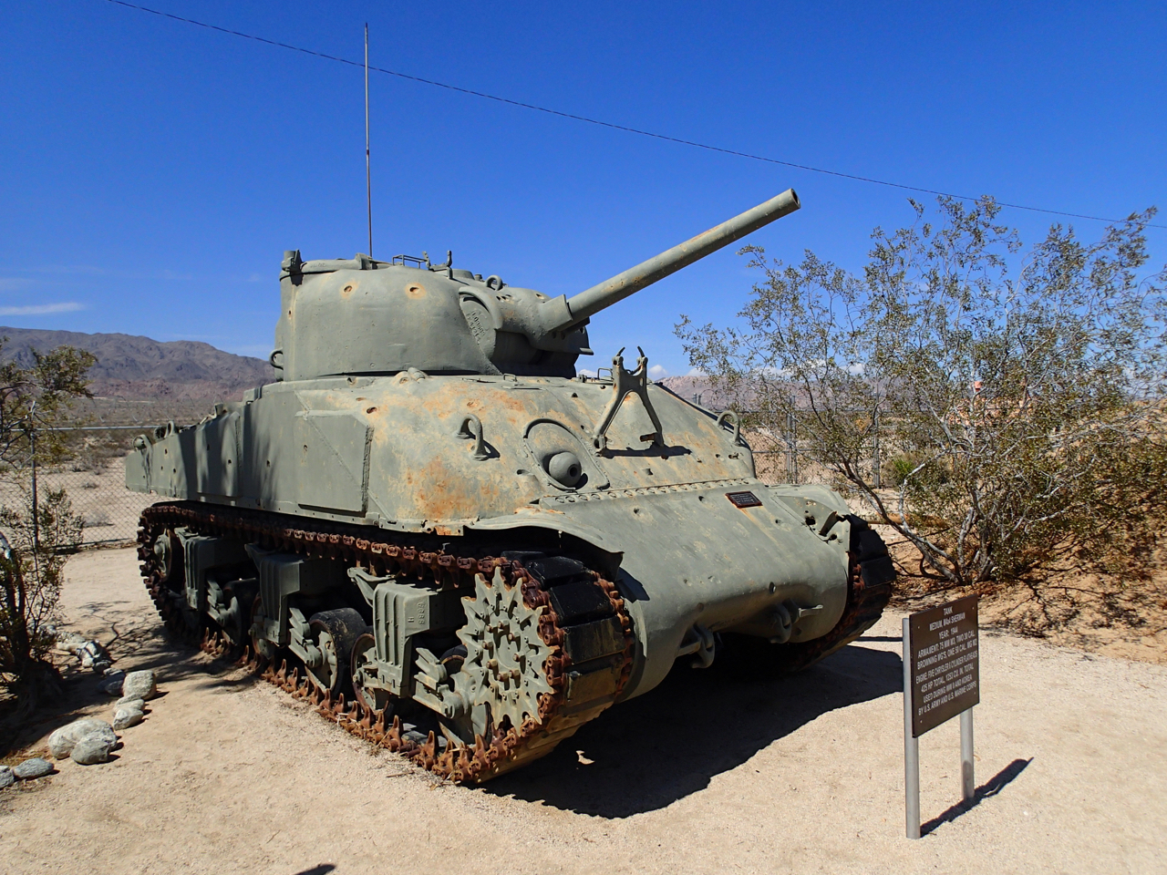
The General Patton Memorial Museum
The General Patton Memorial Museum is located at Chiriaco Summit. It's located here because it's near the location of the Desert Training Center camps where General George Patton trained his tank battalions. It's well worth a stop to see the tanks and other military vehicles on display. Inside the museum are many artifacts relating to General George Patton and the events that took place at the Desert Training Center.
Here is the link to the museum web site -
http://generalpattonmuseum.com/
Link to the Wikipedia page on the Desert Training Center -
https://en.wikipedia.org/wiki/Desert_Training_Center

- P5160890.jpg (1.72 MiB) Viewed 721 times
There are many different tanks on display around the grounds of the museum.
- P5160891.jpg (1.5 MiB) Viewed 721 times
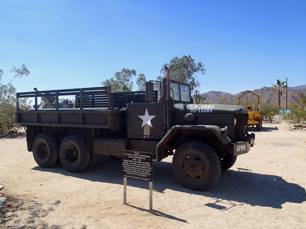
Other types of military vehicles are also on display. Most of them are unrestored. They are generally faded but in good shape being preserved by the desert climate.
- P5160887.jpg (1.58 MiB) Viewed 721 times
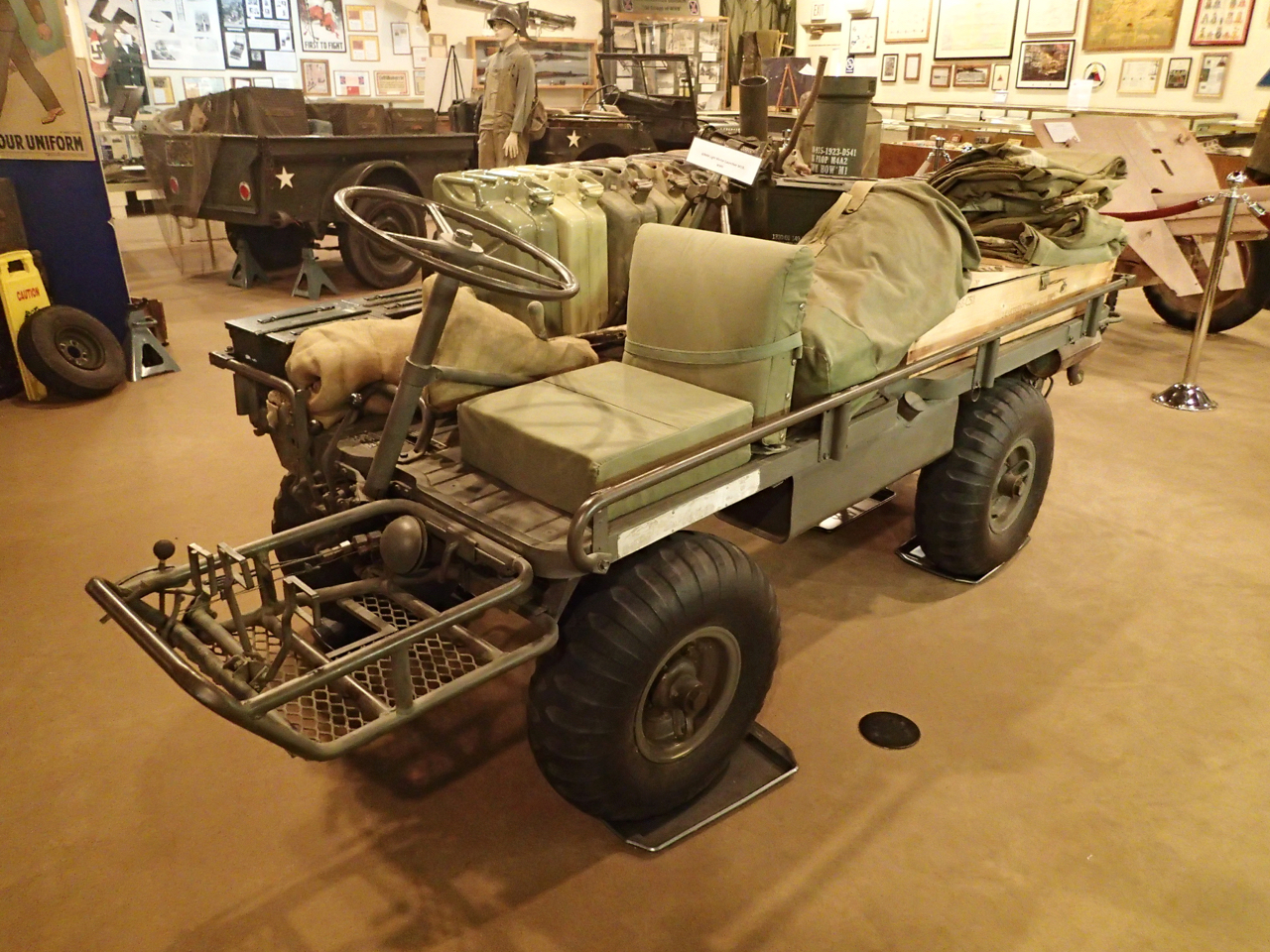
Here is a U.S. Army M274 half ton truck generally known as a "mule". They were produced from 1956 to 1970. I was at an off roading event where someone was actually driving one of these. They didn't go on any of the long runs but did have a great deal of fun driving it on trails near the camp.
- P5160886.jpg (1.47 MiB) Viewed 721 times
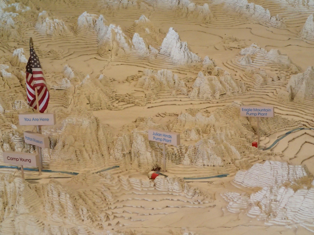
One of the more interesting features inside the museum (at least for me) is the "Big Map". It's a large 3D map of the surrounding area showing the locations of multiple training camps, airfields, infrastructure locations, and trails. I usually spend quite a lot of time studying this map when I'm in for a visit.
Re: OAUSA Net - 04/02/20 - Destination: The Bradshaw Trail (Gold Road to La Paz)
Posted: Wed Apr 01, 2020 8:30 pm
by toms
Side Trip in AZ
Ehrenberg Sandbowl OHV Area
A popular site for use of off road vehicles, with hilly, sandy terrain and a network of roads and trails. Ehrenberg Sandbowl is quite literally a big sand pit with some hills This site provides a starting point for visitors to explore a variety of designated roads and trails. Dispersed camping is available nearby. Use is limited to day use only, 6 am to 10 pm. Current fire restrictions limit fires to charcoal grills or propane stoves. No trash collection on site. Pack it in and pack it out. Please tread lightly.
Use I-10 to Ehrenberg, AZ. Take Ehrenberg exit to South Frontage Road. Go West on frontage road approximately one mile. Turn left on gravel surfaced Ehrenberg/Cibola Road. Go south 3 miles to site entrance.
The fee is $5 daily per vehicle. Visitors must pay daily fees at self-registration fee pipes located at the site or at the BLM Yuma Field Office located at 2555 E. Gila Ridge Road in Yuma.
Re: OAUSA Net - 04/02/20 - Destination: The Bradshaw Trail (Gold Road to La Paz)
Posted: Wed Apr 01, 2020 9:17 pm
by KK6DYO
Some Videos
Video showing typical Bradshaw Trail quality (click right and Open link in new tab).
Bradshaw Trail
Drone video showing driving a side road off the Trail to the Potato Patch (click right and Open link in new tab).
Potato Patch
Re: OAUSA Net - 04/02/20 - Destination: The Bradshaw Trail (Gold Road to La Paz)
Posted: Wed Apr 01, 2020 10:17 pm
by KK6DYO
Lost Ship of the Desert
There are rumors of a
Lost Ship of the Desert somewhere around the Salton Sea, perhaps a Spanish Galleon carrying pearls or gold that sailed up the Gulf of California when it was connected to the inland Salton Sea.
But this oddity found at 33.41423° N 115.11591° W along the Bradshaw Trail probably isn't it.
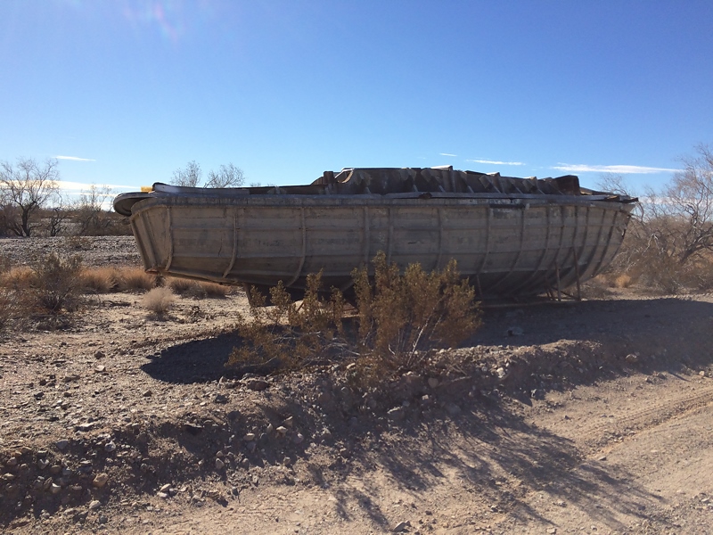
- 20161229 130920 Lost Ship.jpg (296.84 KiB) Viewed 716 times
Re: OAUSA Net - 04/02/20 - Destination: The Bradshaw Trail (Gold Road to La Paz)
Posted: Thu Apr 02, 2020 11:49 am
by KK6DYO
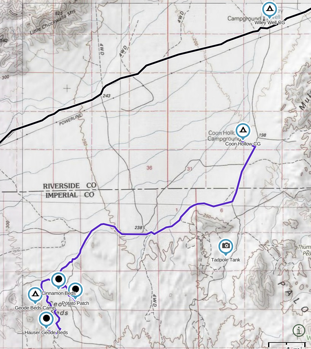
Rockhounding
Rockhounding is a popular activity for many people who stay at the campgrounds in the Mule Mountains LTVA (Wiley’s Well and Coon Hollow). Of particular popularity is the
Hauser Geode Beds which is a 10-mile drive from Coon Hollow.
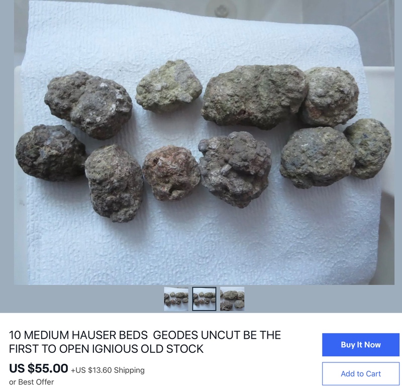
Geode - hollow roughly spherical rock lined or filled with crystals, often clear quartz, sometimes purple amethyst
Must be broken or cut open, breaking can destroy the crystals inside
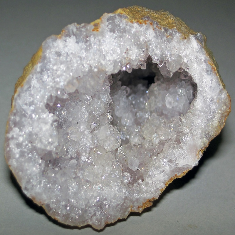
- geode800.jpg (302.86 KiB) Viewed 698 times
Rockhounding around Mule Mountains LTVA
- AAF01DA7-E724-4278-91A7-F9BF6FE249D1.jpeg (986.14 KiB) Viewed 700 times
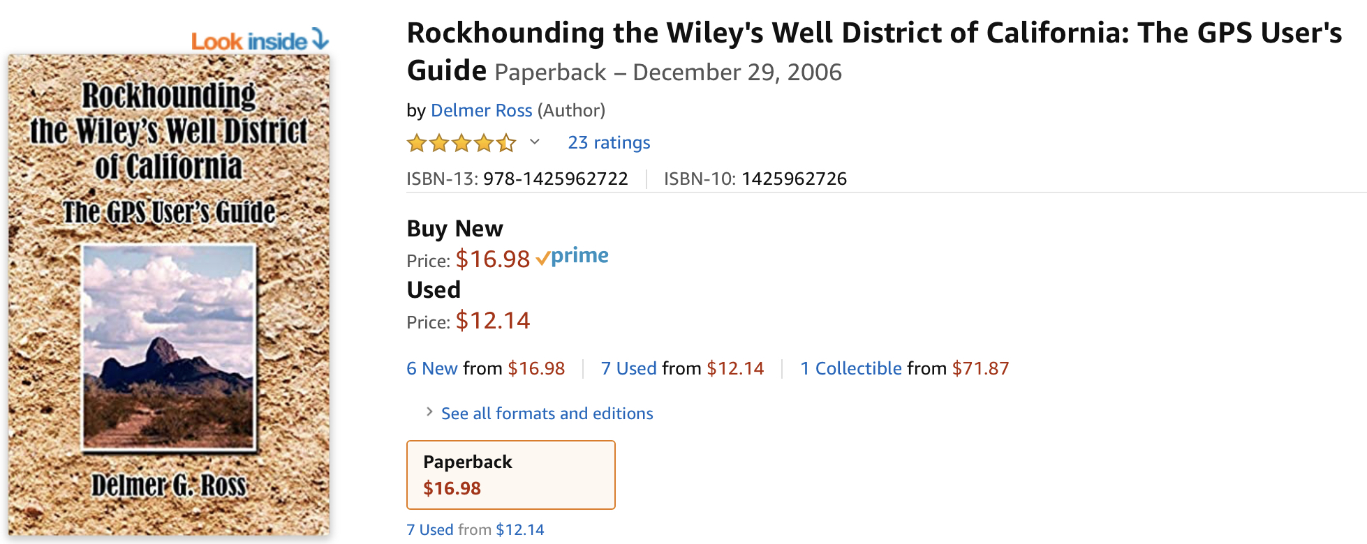
Rockhounding the Wiley's Well District of California: The GPS User's Guide
- A5753540-5B03-4A93-B591-730CBB5F66F8.jpeg (752.96 KiB) Viewed 704 times
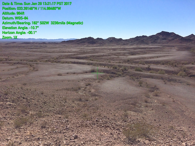
View of the Geode Beds from the Cinnamon Beds
- 20170129 132117 Cinnamon Beds.jpg (365.61 KiB) Viewed 699 times
Found on eBay
- 59E3E1EF-6995-44E5-B435-1CFA57602B3E.jpeg (205.58 KiB) Viewed 704 times
Re: OAUSA Net - 04/02/20 - Destination: The Bradshaw Trail (Gold Road to La Paz)
Posted: Thu Apr 02, 2020 11:50 am
by KK6DYO
Tadpole Tank
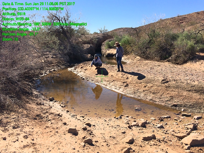
- 20170129 110606 Tadpole Tank.jpg (489.52 KiB) Viewed 699 times
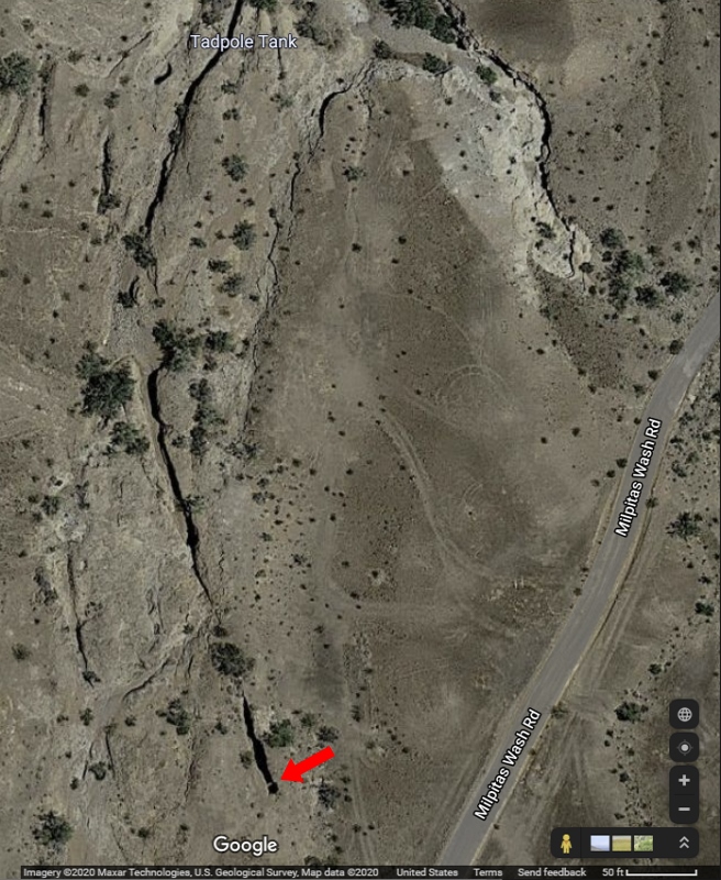
- TP Cut.jpg (310.12 KiB) Viewed 699 times
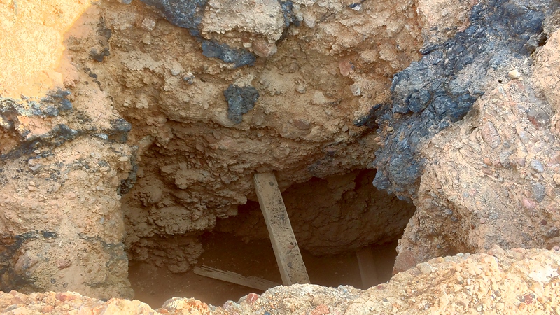
- 20161228 120733a Mine.jpg (323.05 KiB) Viewed 699 times
Re: OAUSA Net - 04/02/20 - Destination: The Bradshaw Trail (Gold Road to La Paz)
Posted: Thu Apr 02, 2020 11:56 am
by toms
Chocolate Mountain Aerial Gunnery Range
Part of the
Yuma Training Range Complex, this 456,000 acre open-Area, approximately 20 miles wide, east to west, and 50 miles long, northwest to southeast, has been used by the Navy and Marines since 1942 for aerial bombing and live fire aerial gunnery practice.
The Bradshaw trail runs along the northern border of the range. On some nights you can see flashes of lights in the range when standing on the western side of the Salton Sea.
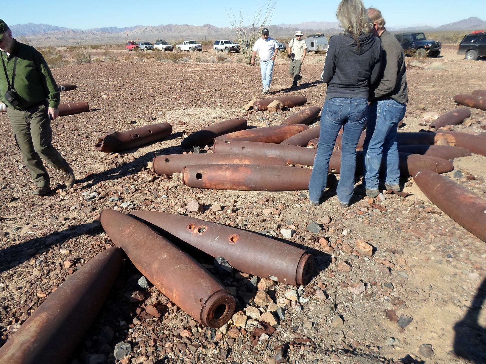
- Bombs.JPG (493.71 KiB) Viewed 708 times
No idea why these are up close to the road.
An interesting report from 2019 describes the environmental hazards faced by Border Patrol agents in this area while trying to apprehend visitors without visas:
Chocolate Mountain Aerial Gunnery Range Report.
Re: OAUSA Net - 04/02/20 - Destination: The Bradshaw Trail (Gold Road to La Paz)
Posted: Thu Apr 02, 2020 12:04 pm
by toms
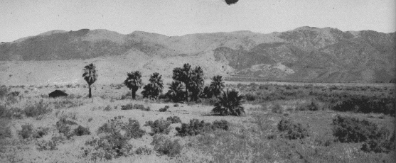
Dos Palmas
Dos Palmas is an artesian spring at the foot of the Orocopia Mountains. It was a know watering hole for centuries.
Bradshaw basically started his trail at Dos Palmas. However today, The Dos Palmas Spring is now part of the Dos Palmas Preserve a 14,000-acre preserve created to protect important biological resources which is why we start the trail now just on the other side of the Coachella Canal.
Dos Palmas was a know watering spot on existing trails in 1862 which trails Bradshaw used until that point.
Originally there were only 2 palm trees, hence the name. In later years, quite a few more grew up.
A stage stop called Dos Palmas was established there for the Bradshaw and Yuma roads. This spring and stage station was the site of the murder of Herman Ehrenberg on October 9, 1866.
There is an article in the Desert Magazine of January 1947 “Waterhole on the
Old Bradshaw Trail” by the publisher Randall Henderson that provides a complete overview up to that time. While the magazine stopped publication the articles can still be found in the public domain.
http://www.sci.sdsu.edu/salton/DosPalmasHistory.html
Pictures from R Henderson's article
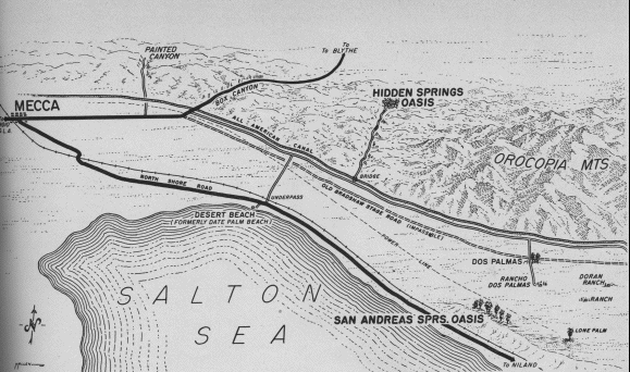
- DosPalmas Map.gif (73.08 KiB) Viewed 706 times
- DosPalmasOasissm.gif (49.46 KiB) Viewed 706 times