2009-11-14&15: Upper Coyote Canyon & Toro Peak Run
Posted: Wed Oct 28, 2009 10:14 am
Upper Coyote Canyon & Toro Peak Run
Well I don't know about anyone else, but I'm sure ready to get back out into the desert. I have a few weekends open in november so I'd like to head on out to Anza Borrego for either the weekend or just a day trip. If I wasn't going quail hunting on saturday I'd go this weekend! What I had in mind is either rolling out to Coyote Canyon friday evening or early saturday morning. There's a few good spots to meet up in Anza or somewhere else along the way. If Bailey's Cabin is available we can set up camp there or in Alder Canyon. Saturday can be spent hiking down through Middle Willows and/or exploring the upper reaches of Coyote and Horse Canyon. On sunday, break camp and head on up Toro Peak. Of course, this is just a rough idea. Any suggestions will be appreciated.
Dates: Nov. Sat./Sun. 14/15
Meeting Time: 9:00am
Departure time: 9:30am
Run Type: Day or Overnight for those wanting to camp.
Difficulty Rating: Easy to Difficult.
Meeting Location: Mobil gas station (Dairy Queen next door)
56245 State Highway 371, Anza, CA
http://maps.google.com/maps?f=q&source= ... 38581&z=15
Trailhead Directions: From San Diego take I-15 north to 79 south (Temecula Pkwy) then left on CA-371 (Cahuilla Rd).
Signed up:
1. BorregoWrangler
2. BlueFJ
3. Chazz Layne ?
4. VCCruzr ?
5.
CB Channel: 34
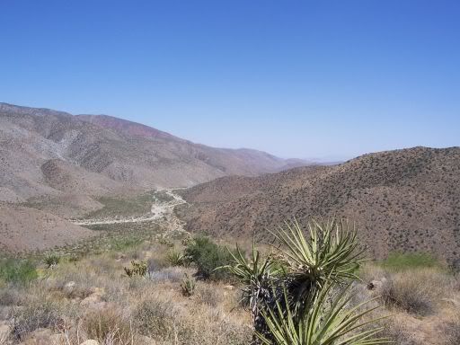
The trailhead for Upper Coyote Canyon is located in Anza, CA off Hwy 371. Upper Coyote Canyon is a special place if you are willing to drive to the town of Anza and enter the park from the north. This area offers challenging jeep and hiking trails to the outdoor explorer. Points of interest are Bailey’s Cabin, First Child Monument, Alder Canyon, Horse Canyon and a section of the Pacific Crest Trail.
Upper Coyote Canyon:
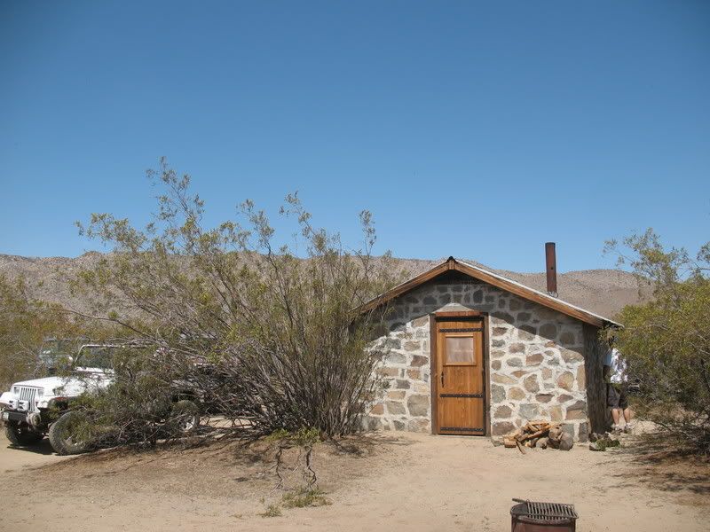
Bailey’s Cabin:
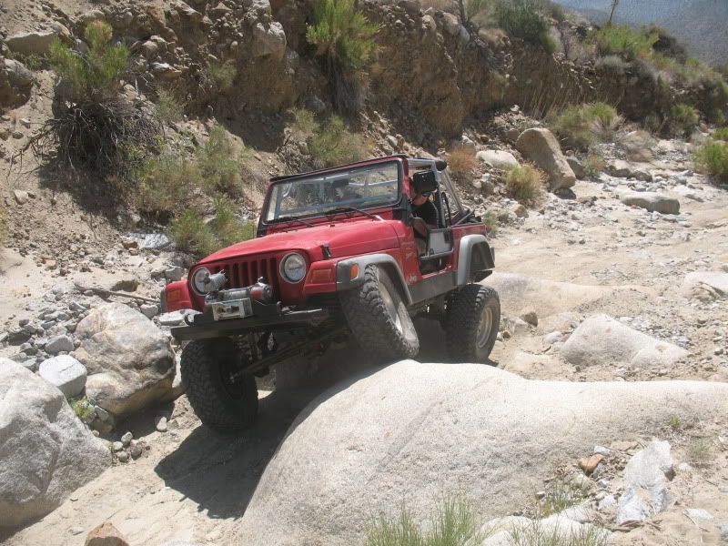
For those wanting a more difficult trail there's Horse Canyon:
Toro Peak
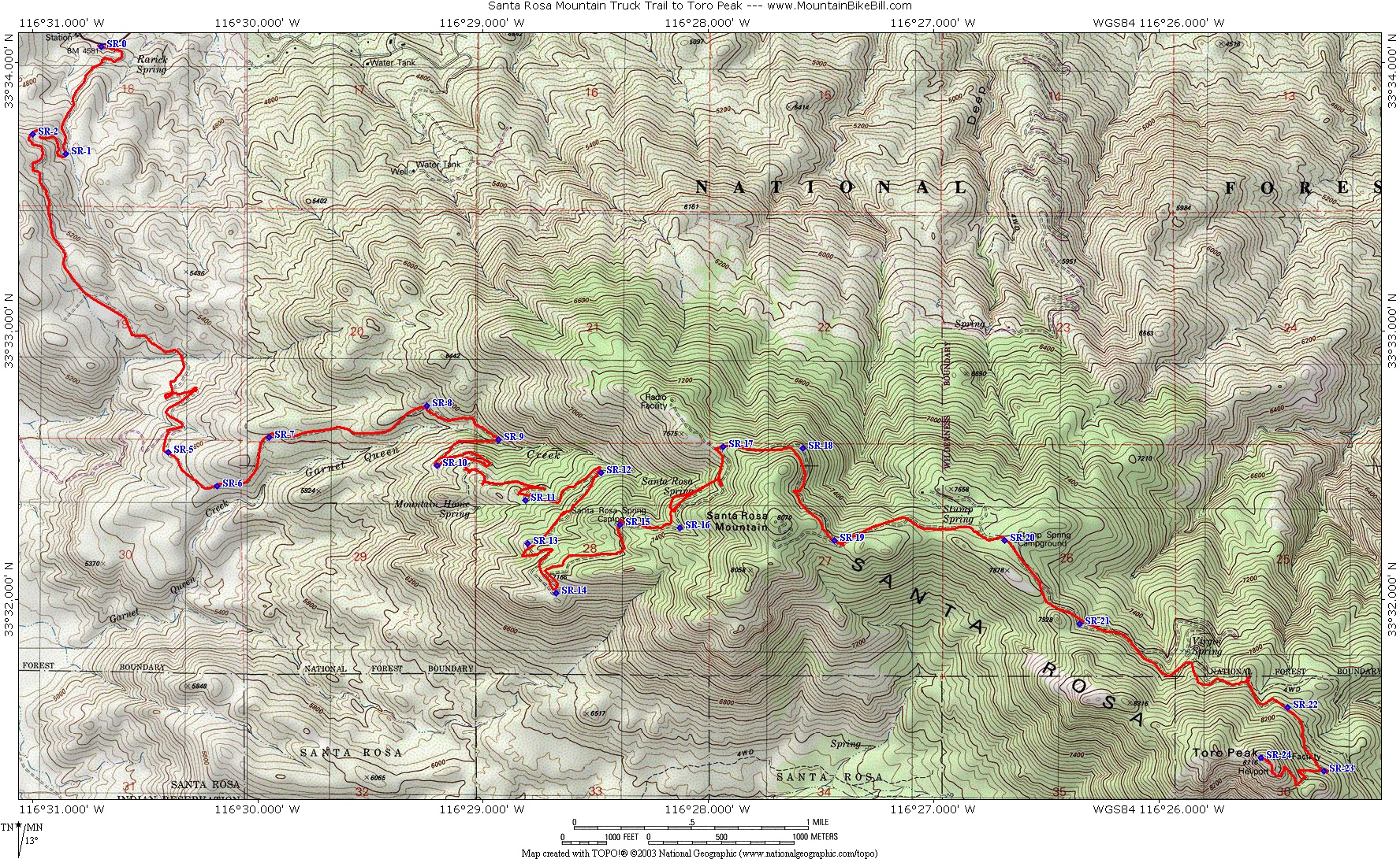
Map: http://www.mountainbikebill.com/images/ ... aMtMap.JPG
Toro Peak is a mountain in Southern California in the Santa Rosa Mountains. South of Palm Springs, west of the Salton Sea, east of Temecula, California.
It is the highest mountain in the Santa Rosa Mountains, part of the mountain is administered under the San Bernardino National Forest the other portions including the 8,716ft summit and the United States Geological Survey marker on the summit registers year 1939 and portions of the mountain are controlled and gated under the Santa Rosa Indian Reservation Another portion of the mountain is under the Santa Rosa and San Jacinto Mountains National Monument.
This mountain is easily visible from California State Route 74 looking south (also known as the Pines to Palms Highway) the turn off is easily seen marked by a large sign along the south side of Route 74 for the Santa Rosa Mountains. From this point onward the road heads southeast toward the mountain this is a rough dirt road that climbs steadily for approximately 13 miles.
A 4x4 or off-road vehicle is highly recommended for this road as it becomes steep, rocky and rough in various spots as it continues to climb the mountain, the road starting elevation is around 4,700' and climbs to a locked gate around 8,200ft At that point you will have to hike or bike the last 500 feet up the summit, its a short walk up a rough maintenance road that passes by former MCI's (now owned by Verizon Communications) primary power generator that provides electricity to the summit as there are no electrical load lines that climb the mountain.
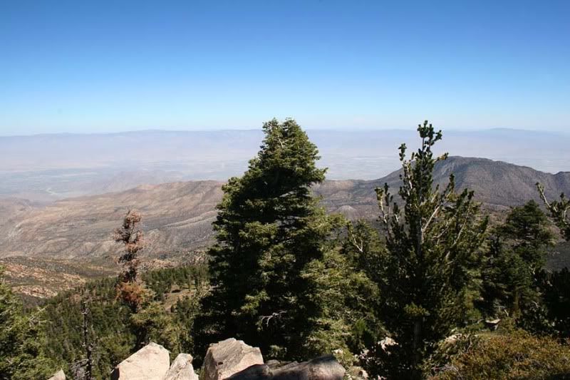
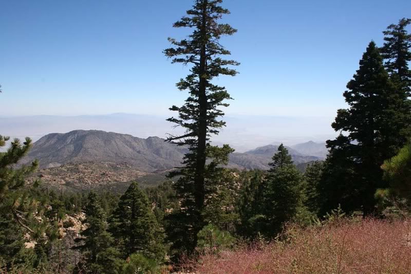
From Toro Peak's summit at an elevation of 8,716' (2,657 M) a commanding view of eastern southern California, including views of the entire Santa Rosa Mountains to Palm Springs, neighboring mountains such as Mount San Jacinto, Mount San Gorgonio, southwest looking to Palomar Mountain and Hot Springs Mountain all just to name a few. To the east / southeast the Salton Sea and Imperial Valley are visible, on very clear days one may be able to see Charleston Peak to the northeast in Nevada.
Views from the top of Toro Peak:
(Photos from here: http://www.mountainbikebill.com/SantaRosaMt.htm )
Well I don't know about anyone else, but I'm sure ready to get back out into the desert. I have a few weekends open in november so I'd like to head on out to Anza Borrego for either the weekend or just a day trip. If I wasn't going quail hunting on saturday I'd go this weekend! What I had in mind is either rolling out to Coyote Canyon friday evening or early saturday morning. There's a few good spots to meet up in Anza or somewhere else along the way. If Bailey's Cabin is available we can set up camp there or in Alder Canyon. Saturday can be spent hiking down through Middle Willows and/or exploring the upper reaches of Coyote and Horse Canyon. On sunday, break camp and head on up Toro Peak. Of course, this is just a rough idea. Any suggestions will be appreciated.
Dates: Nov. Sat./Sun. 14/15
Meeting Time: 9:00am
Departure time: 9:30am
Run Type: Day or Overnight for those wanting to camp.
Difficulty Rating: Easy to Difficult.
Meeting Location: Mobil gas station (Dairy Queen next door)
56245 State Highway 371, Anza, CA
http://maps.google.com/maps?f=q&source= ... 38581&z=15
Trailhead Directions: From San Diego take I-15 north to 79 south (Temecula Pkwy) then left on CA-371 (Cahuilla Rd).
Signed up:
1. BorregoWrangler
2. BlueFJ
3. Chazz Layne ?
4. VCCruzr ?
5.
CB Channel: 34
The trailhead for Upper Coyote Canyon is located in Anza, CA off Hwy 371. Upper Coyote Canyon is a special place if you are willing to drive to the town of Anza and enter the park from the north. This area offers challenging jeep and hiking trails to the outdoor explorer. Points of interest are Bailey’s Cabin, First Child Monument, Alder Canyon, Horse Canyon and a section of the Pacific Crest Trail.
Upper Coyote Canyon:
Bailey’s Cabin:
For those wanting a more difficult trail there's Horse Canyon:
Toro Peak
Map: http://www.mountainbikebill.com/images/ ... aMtMap.JPG
Toro Peak is a mountain in Southern California in the Santa Rosa Mountains. South of Palm Springs, west of the Salton Sea, east of Temecula, California.
It is the highest mountain in the Santa Rosa Mountains, part of the mountain is administered under the San Bernardino National Forest the other portions including the 8,716ft summit and the United States Geological Survey marker on the summit registers year 1939 and portions of the mountain are controlled and gated under the Santa Rosa Indian Reservation Another portion of the mountain is under the Santa Rosa and San Jacinto Mountains National Monument.
This mountain is easily visible from California State Route 74 looking south (also known as the Pines to Palms Highway) the turn off is easily seen marked by a large sign along the south side of Route 74 for the Santa Rosa Mountains. From this point onward the road heads southeast toward the mountain this is a rough dirt road that climbs steadily for approximately 13 miles.
A 4x4 or off-road vehicle is highly recommended for this road as it becomes steep, rocky and rough in various spots as it continues to climb the mountain, the road starting elevation is around 4,700' and climbs to a locked gate around 8,200ft At that point you will have to hike or bike the last 500 feet up the summit, its a short walk up a rough maintenance road that passes by former MCI's (now owned by Verizon Communications) primary power generator that provides electricity to the summit as there are no electrical load lines that climb the mountain.
From Toro Peak's summit at an elevation of 8,716' (2,657 M) a commanding view of eastern southern California, including views of the entire Santa Rosa Mountains to Palm Springs, neighboring mountains such as Mount San Jacinto, Mount San Gorgonio, southwest looking to Palomar Mountain and Hot Springs Mountain all just to name a few. To the east / southeast the Salton Sea and Imperial Valley are visible, on very clear days one may be able to see Charleston Peak to the northeast in Nevada.
Views from the top of Toro Peak:
(Photos from here: http://www.mountainbikebill.com/SantaRosaMt.htm )