Carrizo Mountain & Southern Anza Borrego Tour | Saturday October 11, 2014
- Carrizo Trail.jpg (85.5 KiB) Viewed 9656 times
Lead: BorregoWrangler
Tail Gunner: TBD
Comms Designee: TBD
Difficulty: Moderate
Meeting Time: 8:00 AM
Meeting Place: Butterfield Ranch Resort Group Campsite
Departure Time: 8:30 AM
CB Channel: 36
2M Simplex: 147.510\
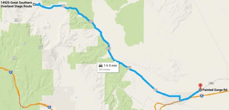
Camp to Trail Head: 39.4 miles
Format for sign up-
OAUSA Screen Name, Vehicle, Name
Signed Up:
1. BorregoWrangler - 2000 Jeep Wrangler - John
2. monark192 - Nissan Xterra - Simon
3. gzeleniak - Bronco II - Greg
4. brentbba - Toyota Landcruiser - Brent
5. Azmiik - F150 - Mike
6. Borrego60 - Toyota Tacoma - Richard
7. mtngote - Toyota 4runner - Steve & Shellie
8. bgray - FJ Cruiser - Brian
9. nickshammas - FJ Cruiser - Nick
10.
11.
12.
Nearest gas station:
Chevron Ocotillo
1071 Imperial Hwy
Ocotillo, CA 92259
Route Description:
- CarrizoMtn.jpg (82.84 KiB) Viewed 9588 times
This trail travels through Painted Gorge, which gets its name from the colored sections of sandstone blocks within the canyon. Metallic oxides and sulfides have introduced red, blue, and green staining to parts of the narrow gorge. Fossilized remains of marine life can also be found in this area.
At the end of the trail, Carrizo Mountain sits high above the colorful shapes of the Carrizo Badlands at the edge of the Coyote Mountains and offers rewarding views over Carrizo Wash. The wash is closed to the public, having been once used as a military target-practice zone. In the late 1850's, Butterfield Overland stagecoaches traveled along the wash far below, carrying mail and passengers on a difficult route from St. Louis to San Francisco.
Carrizo is a Spanish word meaning "reed grass." This reed was found to give a sweet taste to the water found in its vicinity. Native Americans used the reed as a sweetener.
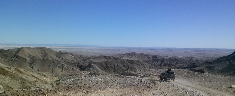
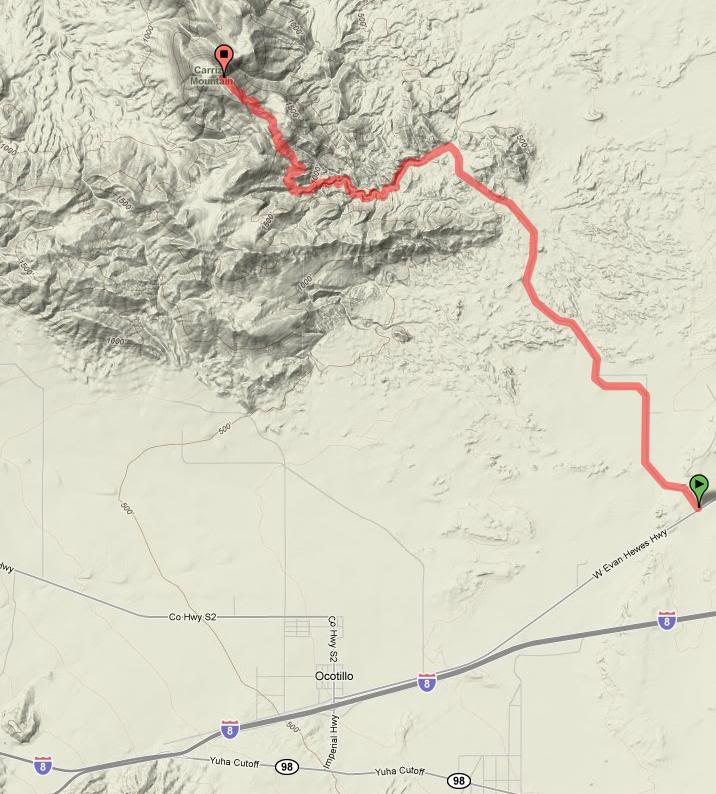
The trail leaves S80 between Plaster City and Ocotillo, just west of the sign for the Plaster City West OHV Staging Area. Initially, it is a well-used graded road that serves as access for Painted Gorge. Entering public lands, the graded road becomes a formed trail that passes through a wide open area and then swings west, dropping into the sandy wash of Painted Gorge. The trail through the canyon is sandy and twisty as it winds its way into the Coyote Mountains. Embedded rocks litter the wash, but the difficulty of the trail comes not from this section but further up as the trail climbs high atop Carrizo Mountain.
The trail climbs steeply as it swings out of the wash along a well-used shelf road. The surface is loose in places and the road is narrow, limited to single vehicle width for most of its length. Passing places are limited. As you climb, Painted Gorge unfolds beneath you. Beyond the gorge to the south are the Yuha Basin and Mexico.
The trails on Carrizo Mountain were put through for mining, and there are many to explore. There are some good back country campsites, most of which have excellent views. Our route will lead through a network of trails to a viewpoint near the summit of Carrizo Mountain. From there, its only a short hike to the summit to take in the impressive views of the surrounding areas. The final section of trail to the top is the most challenging, with embedded rocks, loose surfaces, and a very narrow shelf road to negotiate.
This trail is also subject to a seasonal closure for the lambing of bighorn sheep from January to June each year. So by the time BorregoFest rolls around this area will only be accessible for another two months until June of 2015. Once off the mountain we'll follow the remains of the old 1915 CA Highway past the town of Ocotillo and into lower Devil's Canyon, past the old Doz Cabezas railroad siding and into Piepkorn Slot. After descending a short drop-off, and traversing Jojoba Wash our route will end at Highway S2, south of the campground. If time permits, we will see about exploring some areas north of the S2 before heading back to camp at a decent hour.
Camp to Trail Head: 39.4 miles