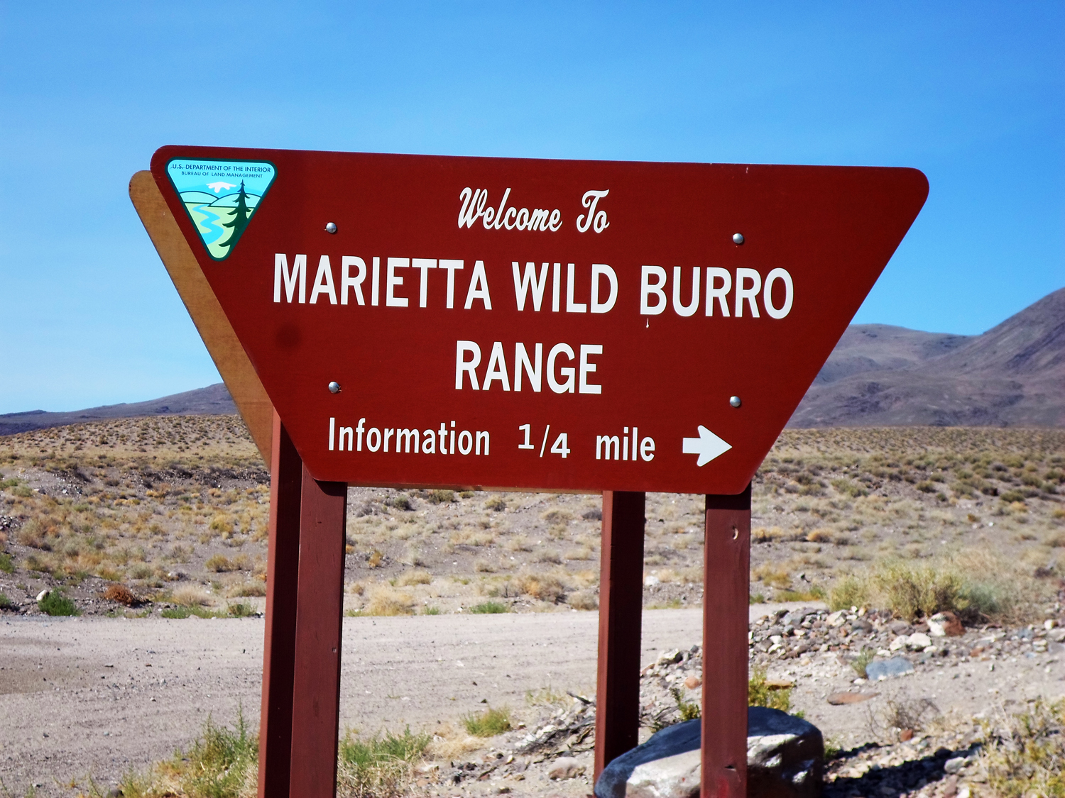
Marietta Wild Burro Range
Located in Mineral County, Nevada, Marietta is the Nation's first formally recognized Wild Burro Range.
The 68,000-acre range is managed for between 78-104 wild burros (Equus asinus asinus). The burros roam freely near the ruins of the historic Nevada mining town of Marietta and the seasonally changing Teels Marsh.
The Marietta Wild Burro Range was publicly dedicated in 1991-- the 20th anniversary of passage of the Wild Free-Roaming Horses and Burros Act.
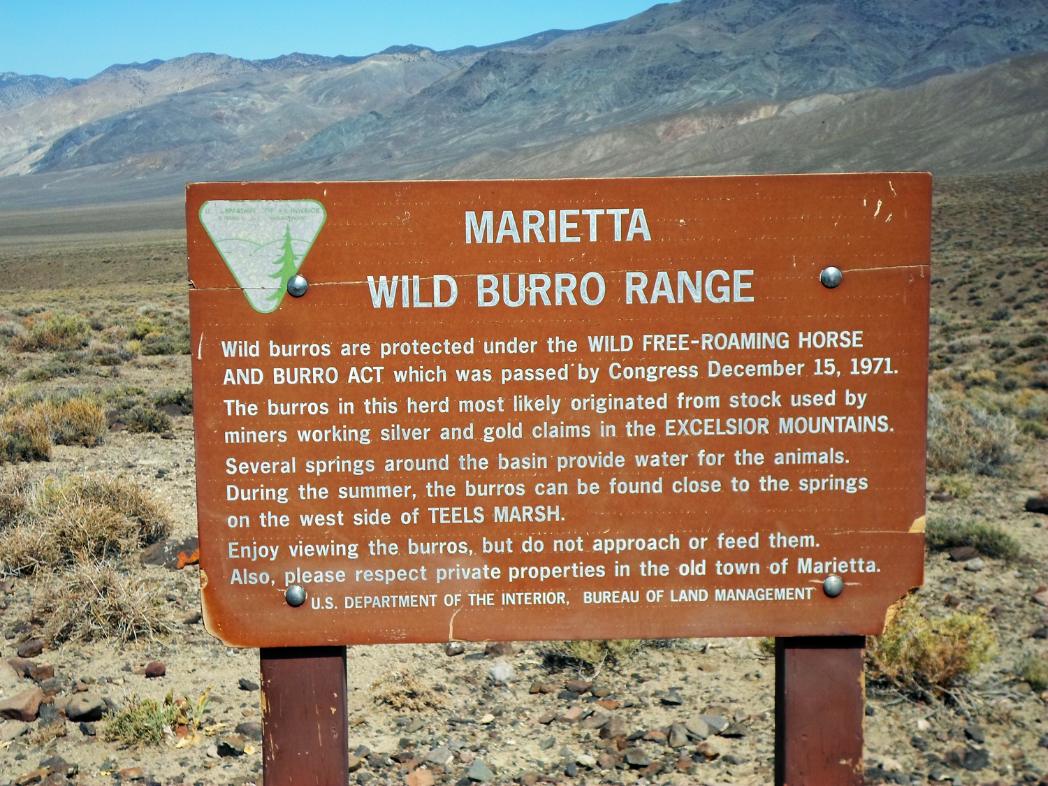
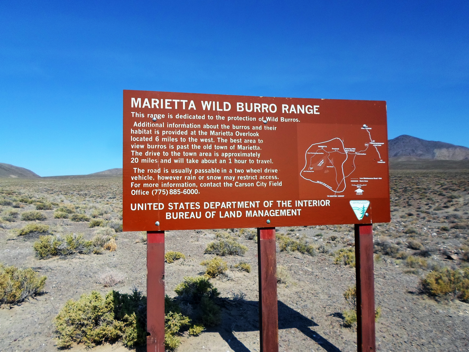
The range is located south east of Hawthorne, Nevada. The area includes nearly 66,500 acres of public land. Patented mining claims around Teels Marsh and the Marietta mining district account for 1,500 acres of private lands within the area.
This is an old mining district. Open mine shafts, shaky buildings, unstable rock ruins and rattlesnakes are common. LOOK before you STEP, TOUCH or CAMP.
- Sign 1.jpg (1.13 MiB) Viewed 2478 times
- Sign 2.jpg (1.47 MiB) Viewed 2478 times
- Sign3.jpg (1.32 MiB) Viewed 2478 times
A BURRO HAVEN
Designation as a Wild Burro Range means the area may be managed "principally", but not necessarily exclusively, for wild burros. This is a national designation conferred by the Director of the Bureau of Land Management (BLM). One reason for this area's designation as a range is the unique opportunity available for public viewing of the herd and its habitat.
LIVING SYMBOLS OF THE WEST
Congress said "...wild free-roaming horses and burros are living symbols of the historic and pioneer spirit of the West...they contribute to the diversity of life forms within the Nation and enrich the lives of the American people." The Marietta Wild Burro Range is one of about 15 areas where burros can be found in Nevada. As of August 2011, there were approximately 38,500 wild horses (Equus caballas) and burros on BLM-managed lands. A majority of these animals reside in Nevada and are managed by the BLM.
The Wild Free-Roaming Horses and Burros Act of 1971
The Wild Free-Roaming Horses and Burros Act was passed, unanimously, through Congress and signed by former President Nixon on December 15, 1971. It became Public Law 92-195, which protects wild horses and burros within designated territories on both Forest Service and Bureau of Land Management lands. This law mandates that these horses and burros are managed in a thriving ecological balance with the land and as part of the natural landscape.
Wild horses and burros have few natural predators, except for humans and mountain lions.
Wild horses and burros have an average recruitment rate of 18% per year, so their populations double about every 5 years.
During the 1950s in Nevada, Velma B. Johnston, later known as Wild Horse Annie, became aware of the ruthless and indiscriminate manner in which wild horses were being rounded up from the rangelands. Ranchers, hunters and "mustangers" played a major role in harvesting wild horses for commercial purposes.
Wild Horse Annie lead a grassroots campaign, involving mostly school children, that outraged the public and ultimately got them fully engaged in the issue.
Newspapers published articles about the exploitation of wild horses and burros and as noted in a July 15, 1959, Associated Press article, "Seldom has an issue touched such a responsive chord."
In January 1959, Nevada Congressman Walter Baring introduced a bill prohibiting the use of motorized vehicles to hunt wild horses and burros on all public lands.
The House of Representatives unanimously passed the bill which became known as the "Wild Horse Annie Act." The bill became Public Law 86-234 on Sept. 8, 1959; however, it did not include Annie's recommendation that Congress initiate a program to protect, manage and control wild horses and burros.
Public interest and concern continued to mount, and with it came the realization that federal management, protection, and control of wild horses and burros was essential.
This would result in enactment of the 1971 Wild Free-Roaming Horse and Burro Act.
Wild Horse Annie Act -
The Marietta Wild Burro Range is the first and only of it's kind of Herd Management Area in the United States.
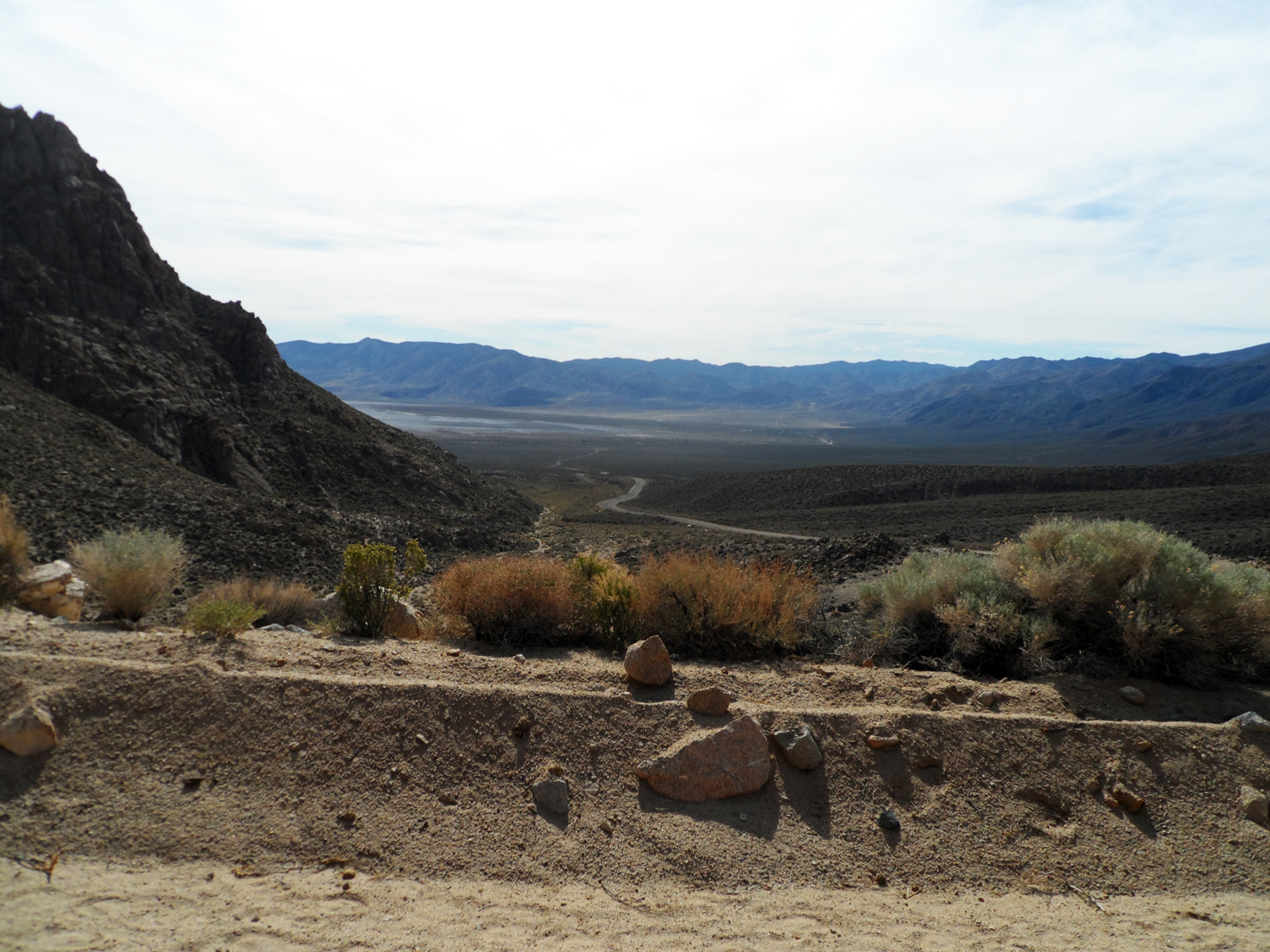
- View going in 4.jpg (1.08 MiB) Viewed 2476 times
Getting There
a. US395 to Bishop CA – about 265 from LA area. Then take US 6 out of the north end of Bishop towards NV
b. US95 to Tonopah. Then west on US6
c. US95 (or US95Alt to US95) south to Hawthorne. Then stay on south US95 to State 360
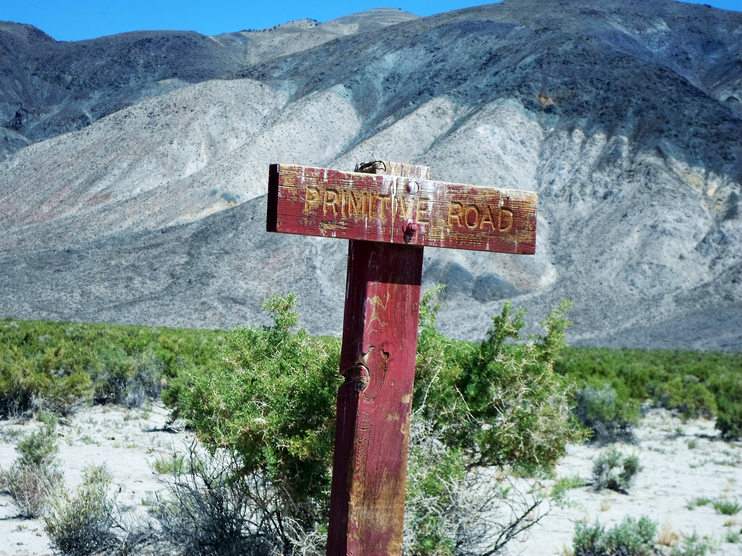
Trail Difficulty
Mostly class I , II and III - possibility of a bit of class IV. See Mitchel book for his definition.
Dirt roads, dusty, wash board, desert, mountains, steep grades, canyons, areas of soft sand, shelve roads, dry lake beds
How long is it, how much time?
This can be done in a day on a long weekend 0r 2 days if you camp. If you have more time there are several other trails worth exploring that are nearby. – eg Bodie , Arora and Masonic.
Seasons
Spring, and fall. This is desert: at the lower elevations (3500 -4500) so it can be hot in the summer. In the winter, the higher elevations (7000+) may be snowed in.
Elevation
4500 to 9700 feet
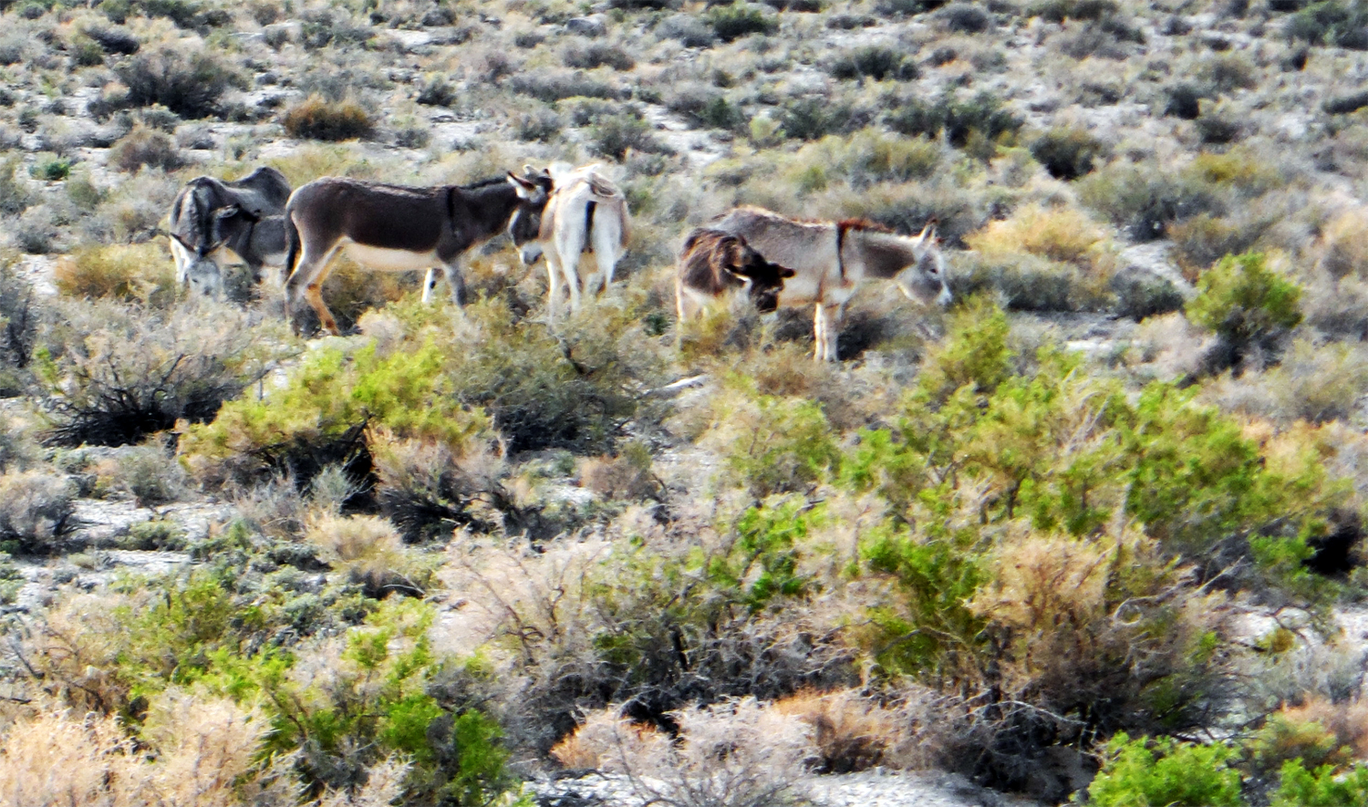
- Burros 7.JPG (1.23 MiB) Viewed 2479 times
Cell phone signal
Intermittent – but always places where it is available.
Ham radio repeaters
The Bishop Repeater club operates a repeater on Mazourka peak [146.760 (-) 100 ] that is linked to the Bishop repeater [ 146.940 (-) 103.5 ] on Silver peak to the north.
They hold a nightly net at 8:00pm. They really like guests.
Tonopah repeater on Mt. Oddie is 146.460 (-) Pl 123. It has an IRLP node.
In the Hawthorne area try Corey Peak 146.790 (-) open
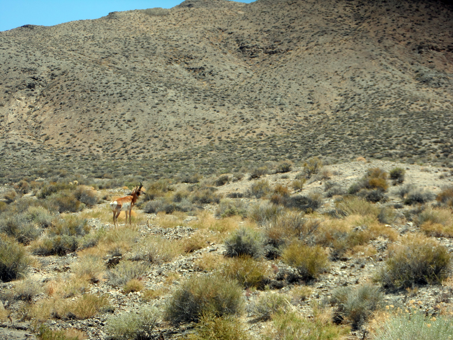
- Prong 8.jpg (1.61 MiB) Viewed 2473 times
Access to Stores, Gas Stations, Medical facilities (distance)
Gas and supplies are available Bishop, Benton, Dyer, Hawthorne, & Tonopah
Dyer will have only one grade of gasoline. Mina no longer has gas.
The closest medical facilities are
Northern Inyo Hospital in Bishop 760-873-5811 150 Pioneer Lane Bishop
Nye Regional Medical Center 775-482-6233 825 Main St. Tonopah
Trail travel density
Very low.
Any special precautions, extra gas
Normal for remote travel in mountains and deserts
2 or more vehicles
Extra supplies, water, and gas
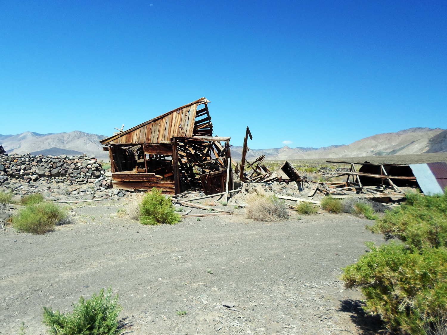
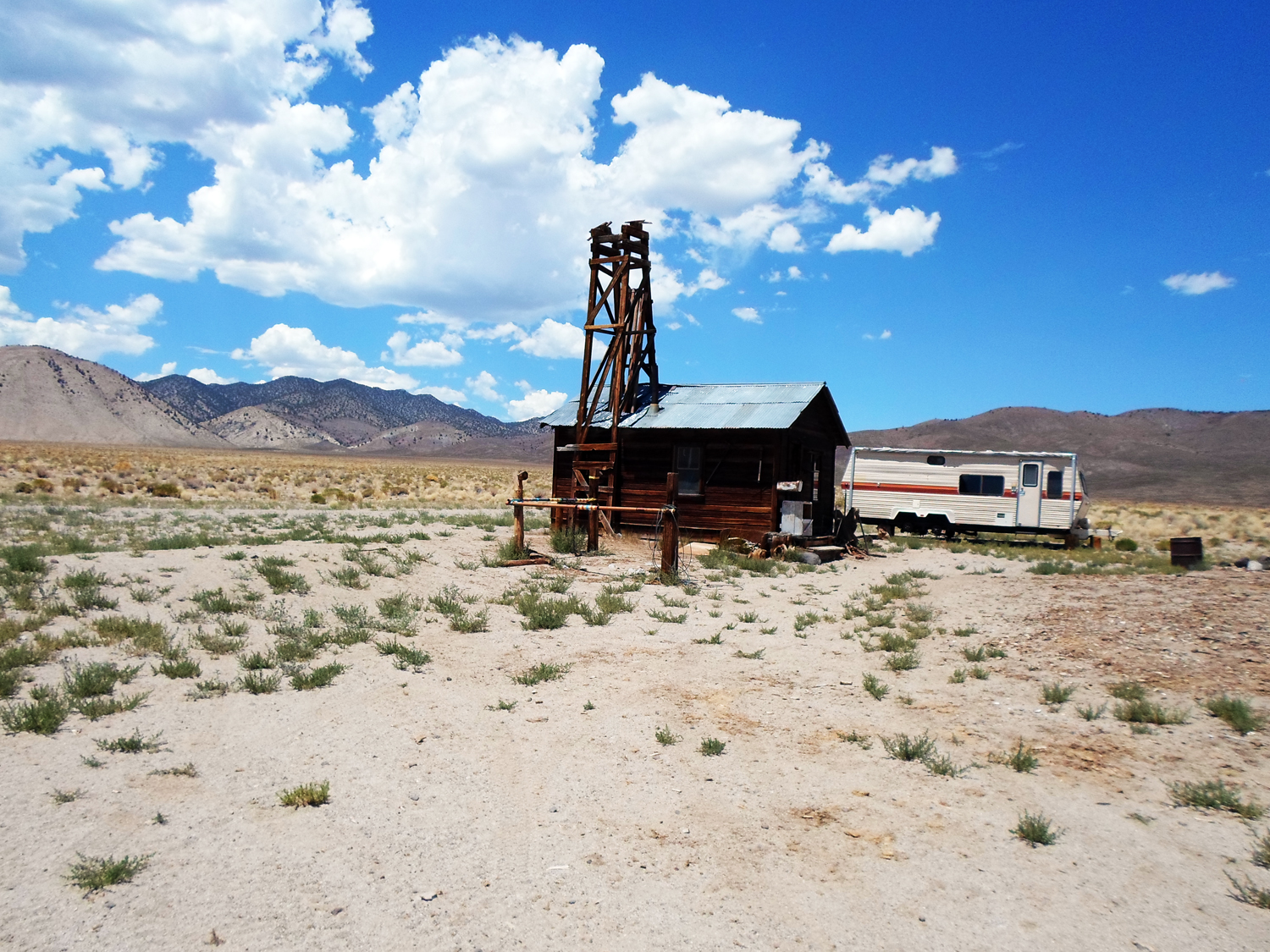
- Marietta 5.jpg (1.31 MiB) Viewed 2476 times
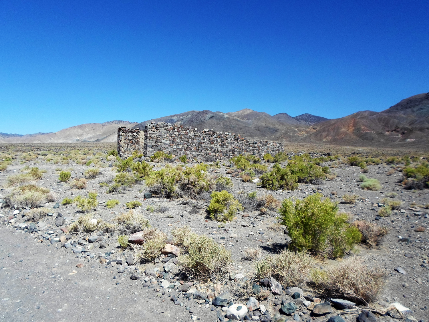
- Marietta Store 6.jpg (1.41 MiB) Viewed 2476 times
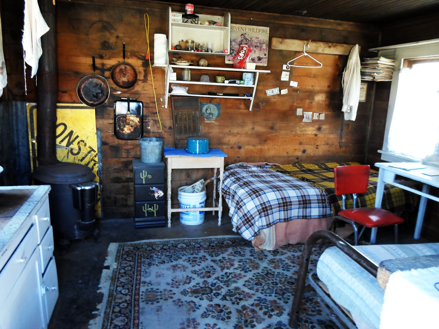
Camping options
Disbursed camping is allow
No formal camp grounds
It is possible to stay in a motel & do day runs from Tonopah, NV, Bishop, CA and Hawthorne, NV (plan to spend an extra hour & a half each way).
- Cow Camp 12.jpg (1.17 MiB) Viewed 2479 times
- Cow Camp 11.jpg (1.23 MiB) Viewed 2479 times
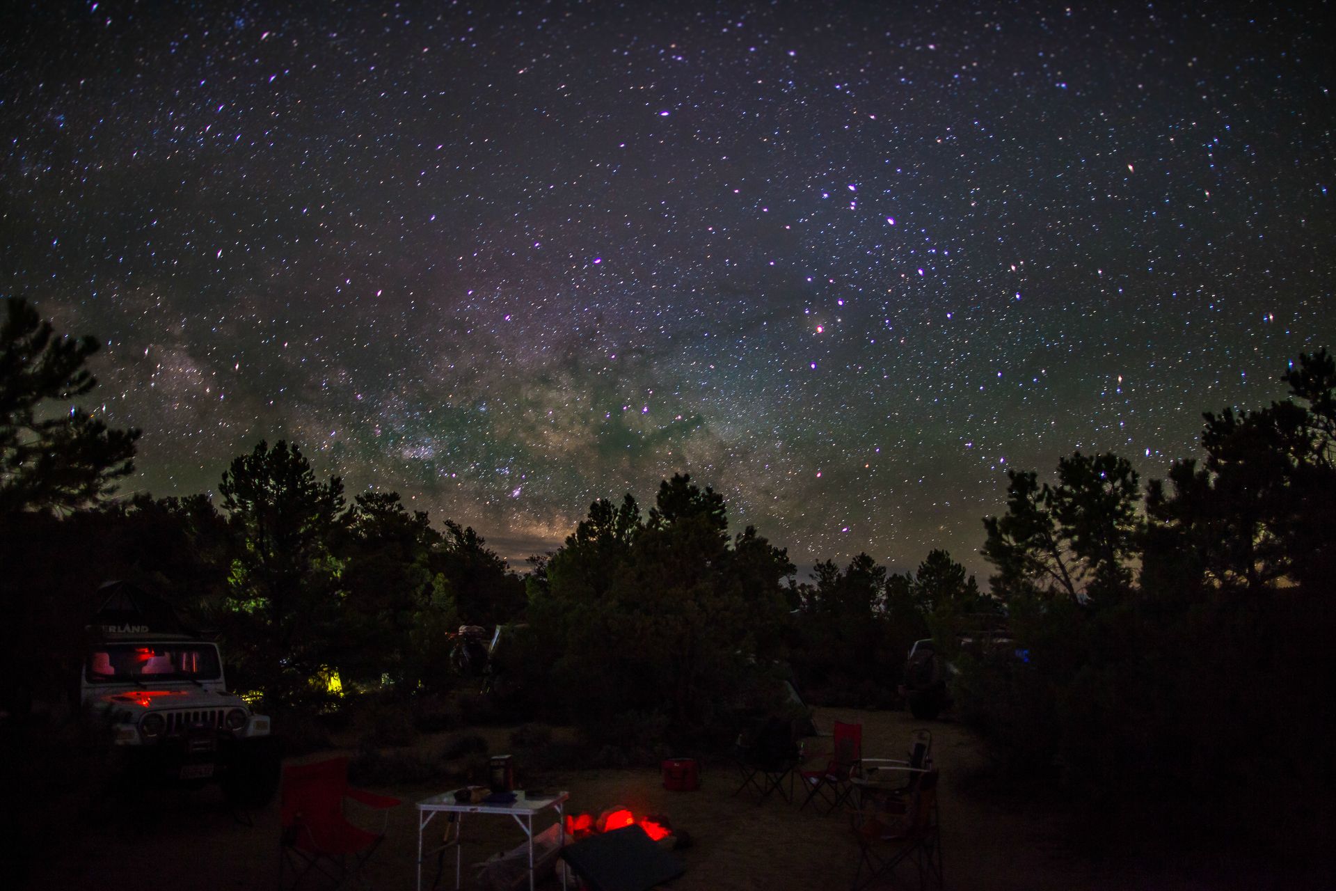
- High Camp 13.jpg (299.25 KiB) Viewed 2479 times
Terrain
Very remote
High view
What kind of vehicle do you need?
Recommend 4WD with low range. SUV ok
Driving Skills required: Normal
- Road to Huntoon Valley 9.jpg (1.48 MiB) Viewed 2476 times
Emergency Numbers
• Inyo County Sheriff 760-878-0323 Central dispatch
• Mono County CA Sheriff 760-932-7549 (Dispatch)
• Nye County Sheriff 775-771-7000 (non-emergency south area)
• Esmeralda County Sheriff 775-485-6373 Goldfield, NV
• Inyo National Forest HQ - Bishop 760-873-24000
Weather
Some spot forecasts in areas you might be near. They are only good for 7 day into the future, so check them just before you depart.
Teel’s Marsh
http://forecast.weather.gov/MapClick.ph ... zi4zJ_n_mQ
Excelsior Mountains
http://forecast.weather.gov/MapClick.ph ... zi5C5_n_mQ