KINGS CANYON AND SURROUNDING AREAS
Places to Visit / Things to Do
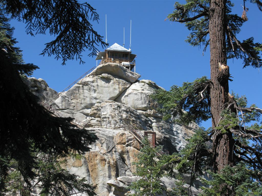
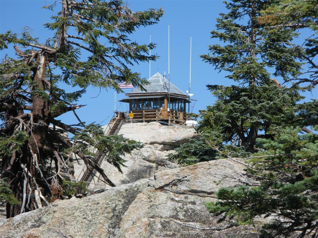
1. Buck Rock Fire Lookout Station
The Buck Rock Fire Lookout is located in the Sequoia National Forest. It is accessible by dirt roads, is open to the public, and is a must-see when you visit the area. Fire Look out stations are in many respects, a thing of the past, although the Buck Rock station still functions. It's history is well preserved, and is available here:
http://www.buckrock.org/aboutbrl.html. Here is a small excerpt from this website, and a visit there, to get the full story, is highly recommended.
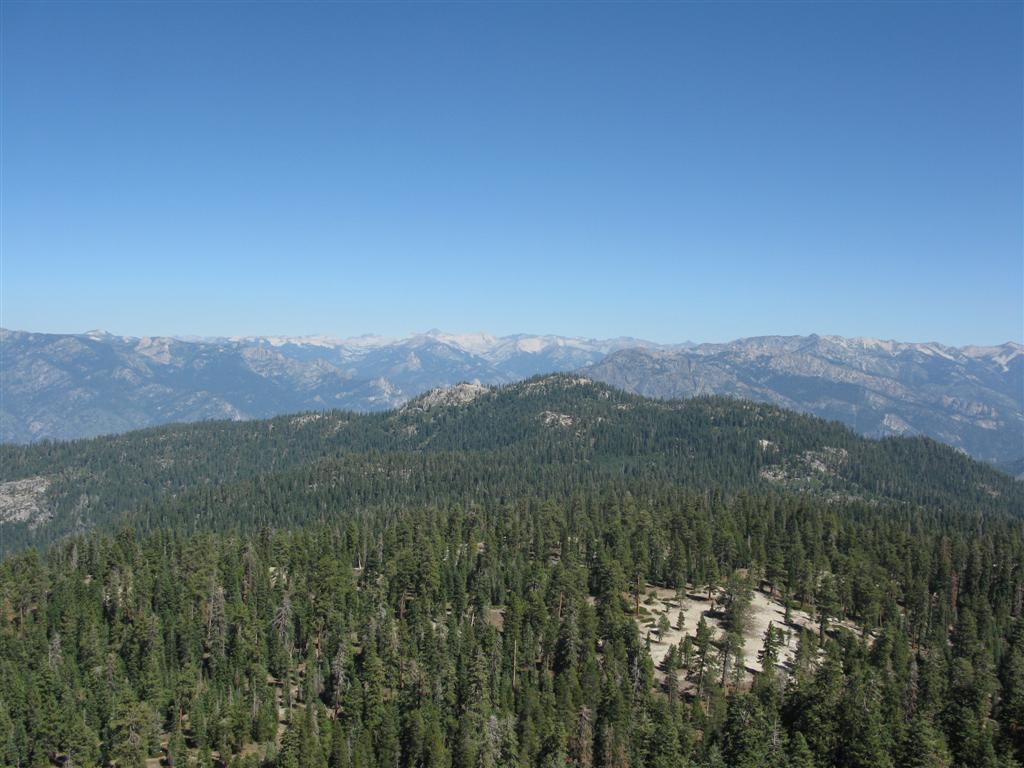
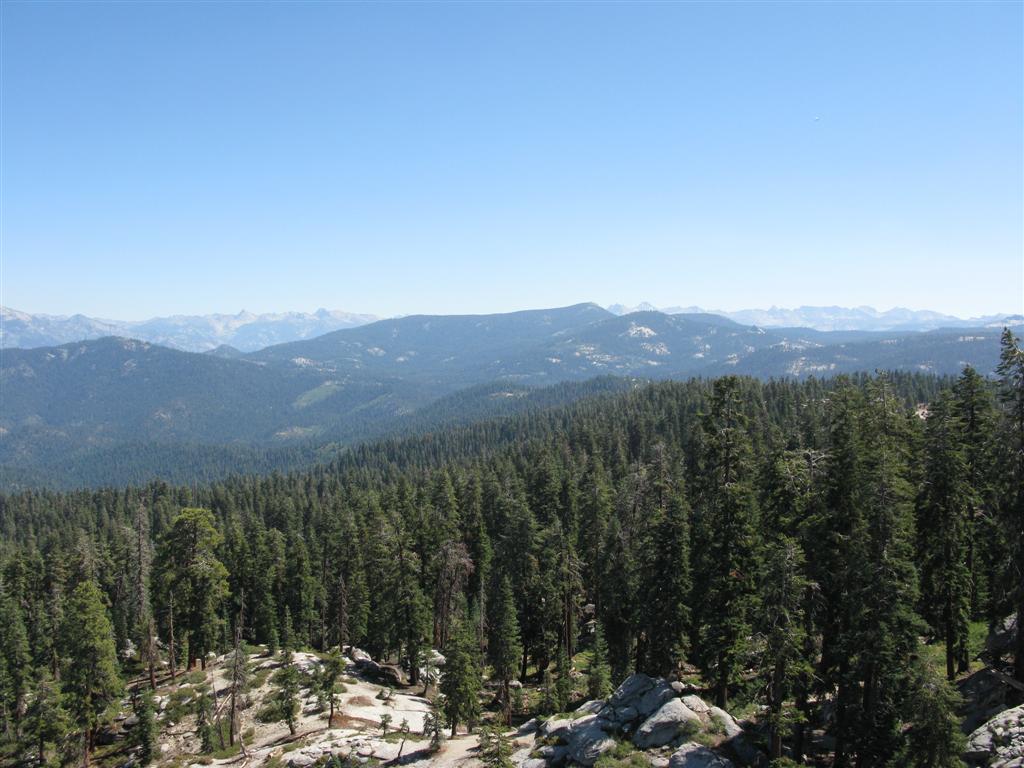
In the land of the giant sequoias, perched on a granite dome at 8,502’ Buck Rock Lookout offers a spectacular 360-degree view stretching from the Coastal Ranges across the San Joaquin Valley to the highest peaks of the Sierra Nevada. An icon of a by-gone era, Buck Rock captures the spirit of the forest, our conservation heritage and all that nature has to offer.
Fire lookouts were originally developed to help protect our nation’s forests from devastating wildfires. Established as early as 1912, Buck Rock was one of the first permanent fire detection locations in the Sierra Nevada. The current building was constructed in 1921-22 and is historically significant as one of the earliest live-in style cabs. Prior to this building a ranger, using a series of ladders, would climb the rock to scan for smokes using only binoculars, a compass and a map. Spotting a smoke, he would quickly descend hop on his horse, and chase down the fire. Today, the lookout is fully equipped with modern radios and a telephone used to report fires and other emergency incidents. Except for some minor modifications, the lookout remains true to its original design – a visit to Buck Rock is like stepping into the past.
For several years in the 1980’s and 1990’s Buck Rock was closed, used only for emergencies during fire season. Unwilling to see this historic treasure lost for future generations, a local grass-roots organization was formed to save it. Working with the Forest Service, the Buck Rock Foundation obtained grants, recruited volunteers and continues to renovate the lookout. It was finally re-opened in 2000 and today Buck Rock is staffed seven days a week during a fire season that can stretch for 6 months.
Buck Rock is open to the public from 10:30 to 5:00 daily during fire season, usually June to October, but may be closed due to fire activity or adverse weather conditions.
Here is what it looks like:
THE LOOKOUT
- BRFL-5.JPG (186.33 KiB) Viewed 1409 times
- BRFL-4.JPG (217.81 KiB) Viewed 1409 times
THE VIEWS
- BRFL-7.JPG (107.4 KiB) Viewed 1409 times
- BRFL-8.JPG (114.06 KiB) Viewed 1409 times

- BRFL-3.JPG (107.28 KiB) Viewed 1409 times
THE OAUSA CREW (at the top, on the lookout)
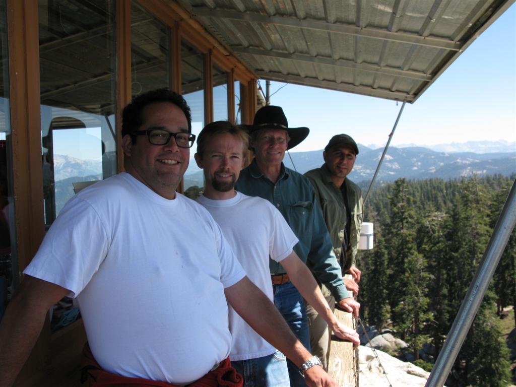
- BRFL-1.JPG (99.62 KiB) Viewed 1409 times
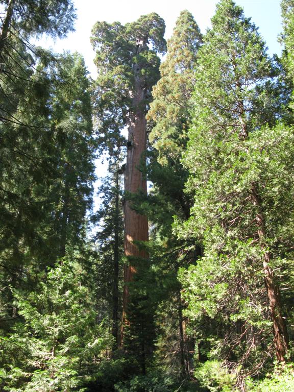
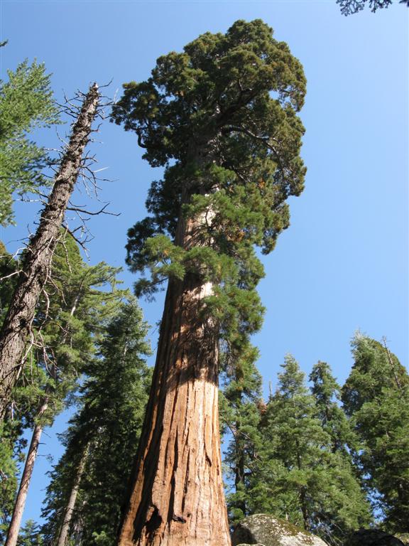
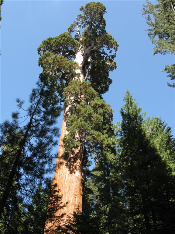
2. General Grant Grove
The Grant Grove is a spectacular showcase of some of the largest and most majestic trees in the world. Contained within the grove and nearby are several trails that explore different aspects of this area. Visiting them all is not realistically possible in a day. Another reason why longer duration trips are advisable. More information is available from the Park Service at,
https://www.nps.gov/seki/planyourvisit/ggdayhikesum.htm. Here are some excerpts from the website:
General Grant Tree Trail
One of the world's largest living trees. President Coolidge proclaimed it the Nation's Christmas tree in 1926. Visit the historic Gamlin Cabin and the Fallen Monarch along this 1/3 mile (.5 km) paved trail. Start at the General Grant Tree Parking area, 1 mile (1.6 km) northwest of the Kings Canyon Visitor Center.
North Grove Loop
This lightly traveled, 1.5 mile trail provides an opportunity for a close look at the big trees. Enjoy a quiet walk past meadows and creeks, through mixed conifer and sequoia forest. The trailhead is at the Grant Tree parking area, 1 mile northwest of the visitor center.
Buena Vista Peak
The 2 mile round-trip hike up this granite peak begins just south of the Kings Canyon Overlook on the Generals Highway. Drive 6 miles southeast of Grant Grove Village, and park at the indicated area near the trailhead. From the top of Buena Vista Peak, a 360-degree view looks out over the majestic sequoias in Redwood Canyon, Buck Rock Fire Tower, and beyond to a splendid panorama of the high Sierra.
Redwood Canyon
The trailhead for this area is 2 miles down a rough dirt road 6 miles south of Grant Grove Village. This road is closed to vehicle traffic in the winter. Redwood Canyon is one of the largest of all sequoia groves. Sixteen miles of trail are available for short walks, day hikes and overnight backpacking trips. As you hike through sequoia/mixed conifer forest, meadow and shrubland, you will see sign of many fires, some recent, some ancient. The result of 30 years of prescribed fires, showing the positive relationship between fire and sequoias.
A few pictures, but as always, full appreciation is only possible by actually being there.
- GGG-1.JPG (147.92 KiB) Viewed 1403 times
- GGG-2.JPG (105.28 KiB) Viewed 1403 times
- GGG-3.JPG (103.94 KiB) Viewed 1403 times
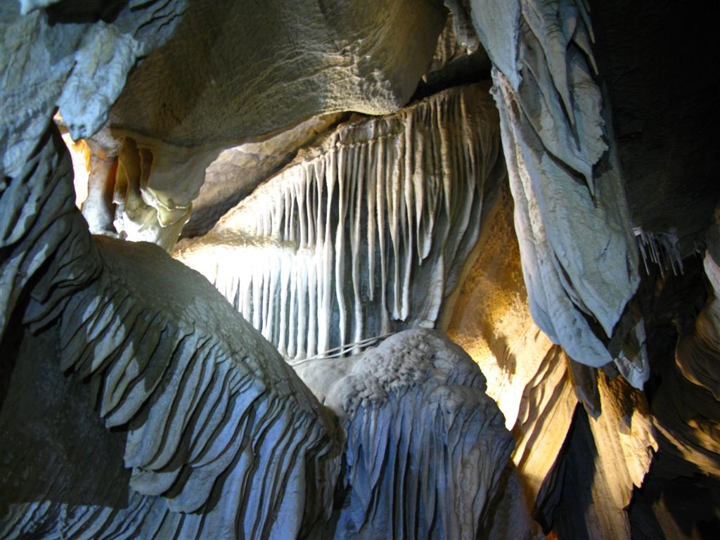
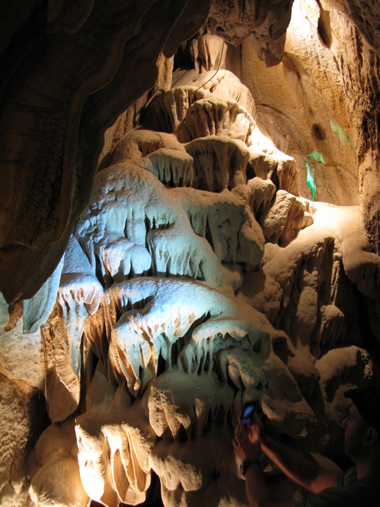
3. Natural Caverns
There are said to be over 300 natural caverns or caves in the Kings Canyon and Sequoia National Parks. A few are open to the public, and well worth the visit. The Park Service says this about the cave systems,
https://www.nps.gov/seki/learn/nature/cave.htm:
By some accounts Sequoia and Kings Canyon National Parks could have been set aside solely to protect the amazing caves found in this area of the Southern Sierra Nevada. The two parks protect half of the caves more than a mile long in California, the longest cave in the state, numerous karst streams, and some of the best alpine karst topography in the United States. The caves contain Pleistocene era fossils, rare minerals, and unique animals. They are the sites of numerous scientific research projects and provide recreational opportunities to thousands of park visitors each year.
These parks contain at least 275 caves. This number continues to rise as more caves are discovered. Caves are found primarily in the western one-third of the parks in narrow bands of marble. Caves form where streams on the surface are diverted underground, and the mildly acidic waters can dissolve soluble rocks like limestone, eventually forming caverns.
Park caves occur at a variety of elevations, from 1,640 feet to more than 9,800 feet. As a result, cave temperatures range from just above freezing to over 60F. Cave conditions vary across this elevation range. The parks' lowest cave is amidst oaks and grasses, and its passages are warm, dry, and dusty. In contrast, some alpine caves have floors or walls of transparent ice.
Some links for the caverns in the Kings Canyon area:
1.
http://www.nps.gov/seki/naturescience/cave.htm
2.
http://www.nps.gov/seki/naturescience/c ... UMP_114878
3.
http://www.caves.org/pub/journal/PDF/V6 ... espain.pdf
4. Great book on the caves of Sequoia and Kings Canyon: Hidden Beneath the Mountains, Caves of Sequoia and Kings Canyon Parks by Joel Despain. See:
http://www.amazon.com/Hidden-Beneath-Mo ... 0939748568

- Hidden Beneath the Mountains.jpg (322.47 KiB) Viewed 1403 times
Here are a few pictures of caves we have visited in the Parks:

- Caverns-3.JPG (105.98 KiB) Viewed 1403 times
- caverns-1.JPG (124.35 KiB) Viewed 1403 times
- Caverns-4.JPG (126.2 KiB) Viewed 1403 times
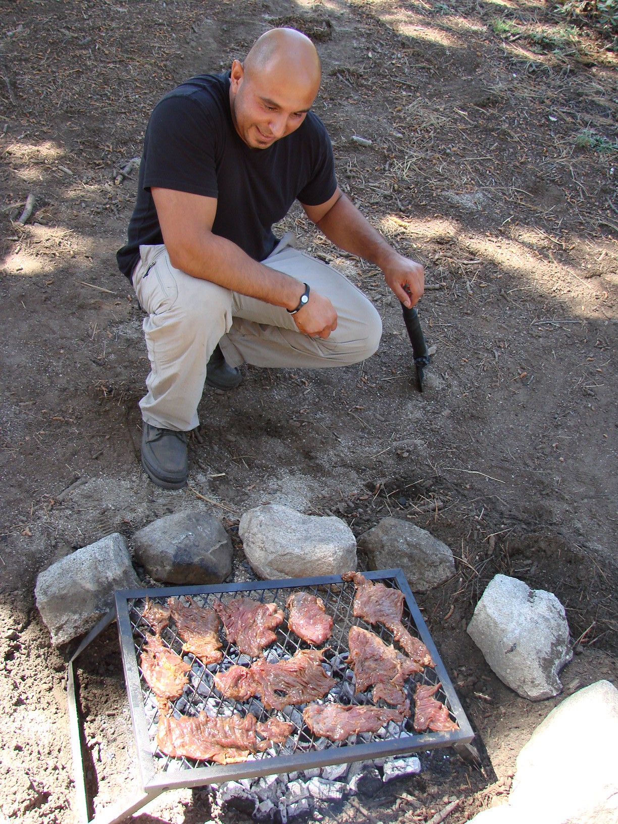
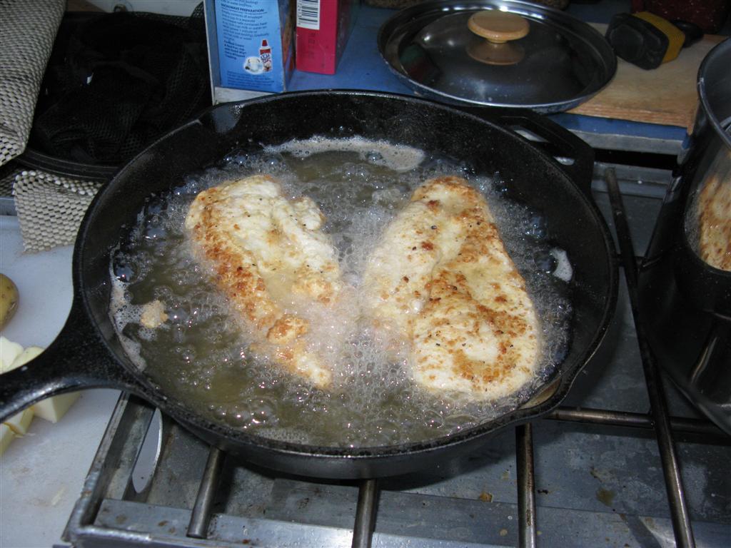
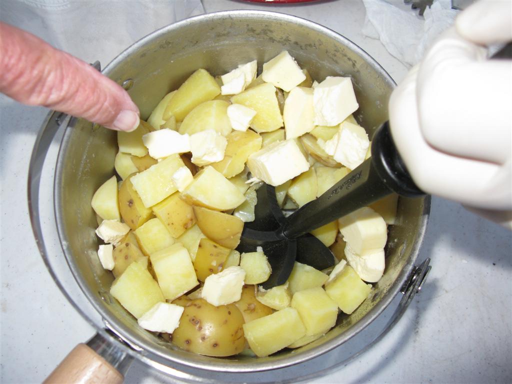
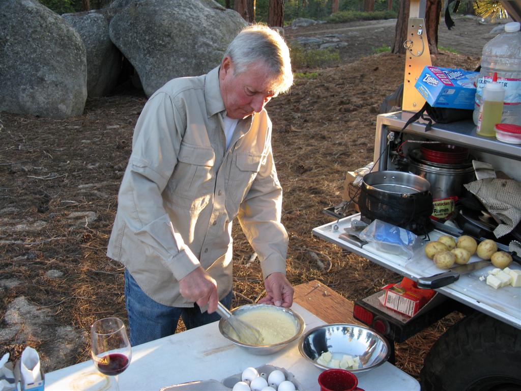
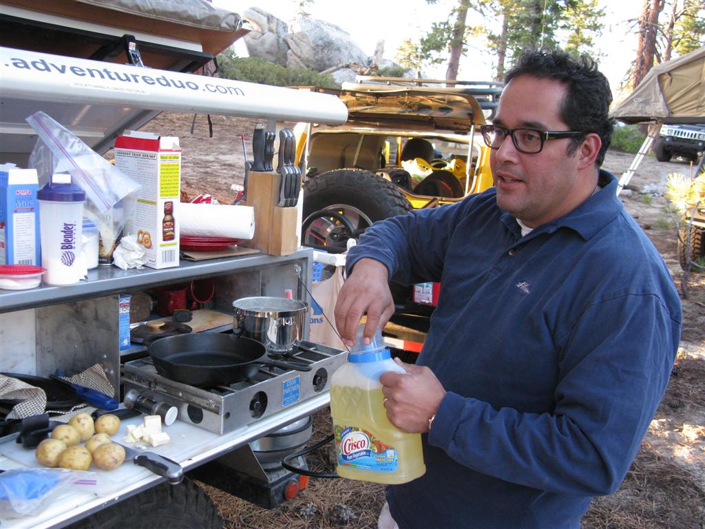
4. Enjoy Great Cuisine and Beverage
Remote wilderness camping is really where great meals and beverages are most appreciated. There is just no getting around it - great chow, with great beverages, great family/friends, and great scenery, is mighty tough to beat. I'll even go one step further - it is the best!!!!!
From steaks being barbecued over an open fire to fried chicken, it was top cuisine all the way.
- Food-1.JPG (791.06 KiB) Viewed 1408 times
- Food-2.JPG (117.5 KiB) Viewed 1408 times
- Food-3.JPG (92.55 KiB) Viewed 1408 times
- Food-4.JPG (147.69 KiB) Viewed 1408 times
- Food-5.JPG (143.44 KiB) Viewed 1408 times
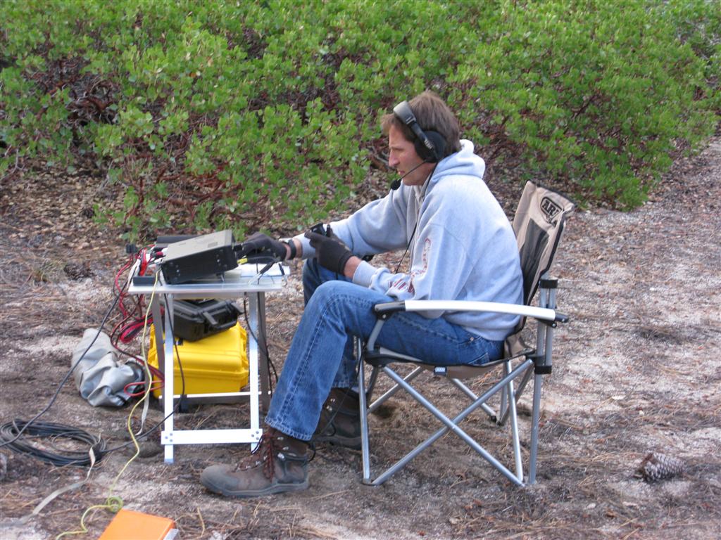
5. Ham Radio Operating
We confirmed one of the most important axioms in Ham radio - there is so substitute for a 8,100 foot antenna. At camp, we had the opportunity to really get out, both on HF and VHF. Much more on the Net.
- Ham Radio Operating (Large).JPG (180.07 KiB) Viewed 1400 times