1.
Charles Wells
His publishing company is Fun Treks (
https://www.funtreks.com/ ). Originally there were 2 books for California. The latest revision combined them into one book and made it a spiral spine for ease of use. (the right most book is the new one). They also publish books for Colorado. You can buy an SD card with the track and waypoints for each book and they have an app with all 600 trails.
California
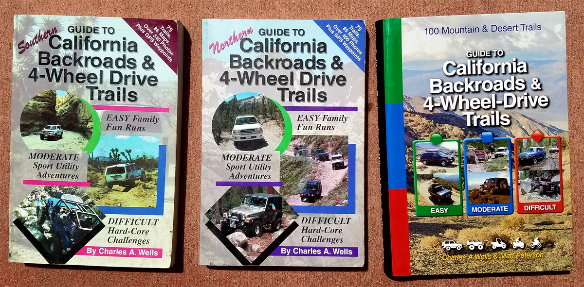
- Charles Wells CA L1200.jpg (866 KiB) Viewed 1495 times
Moab and Arizona
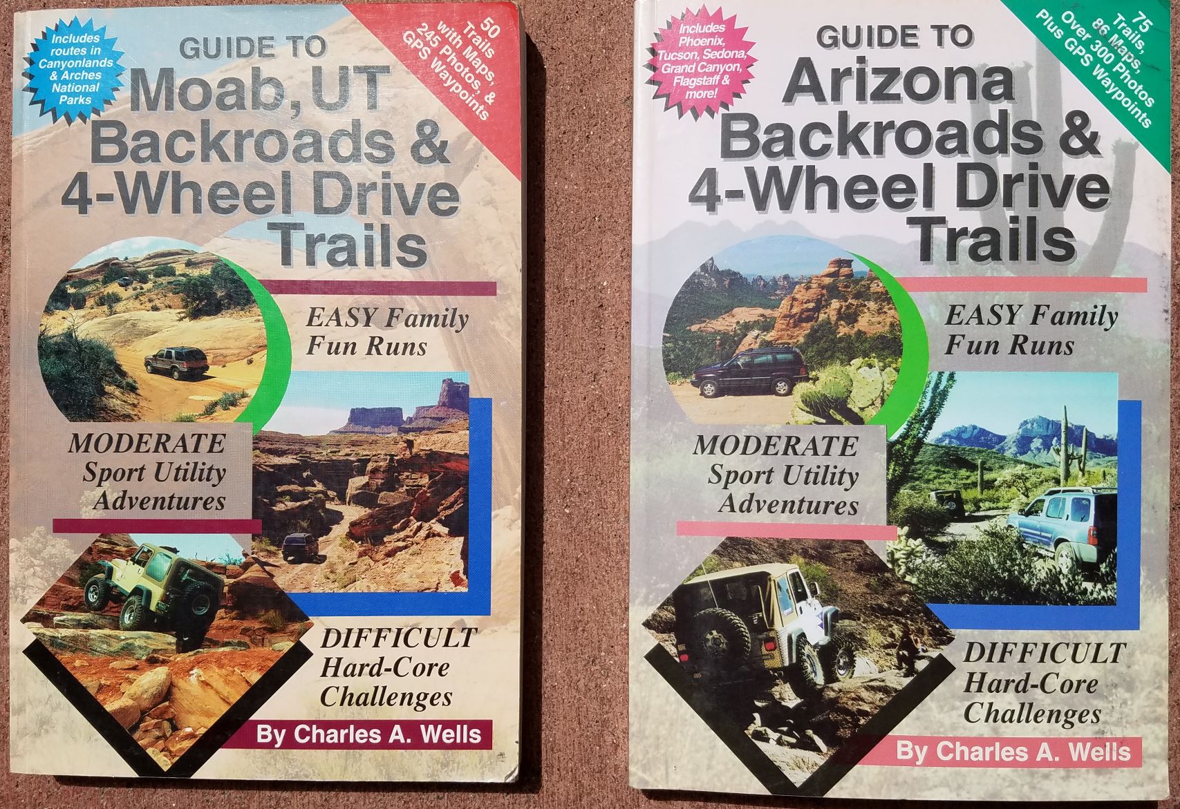
- Charles Wells AZ & Moab.jpg (506.83 KiB) Viewed 1495 times
______________________________________________________________________________________________________________________________
2.
Massey & Wilson
I have posted pictures of the CA and NV books but they also cover Colorado and Utah. The books run about $25 on Amazon. At one time they had one large book in an 81/2 x 11 format to cover each state. These were phased out in favor of 2 or 3 small format books to cover regions of each state. I believe they had feedback that the big book was too difficult to use in the field. Some people think the big format is a collector’s item and you might find the books quite pricey.
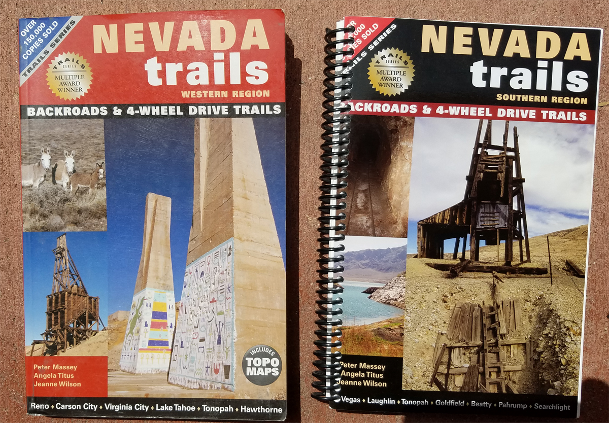
- Massey NV L1200.jpg (956.73 KiB) Viewed 1492 times
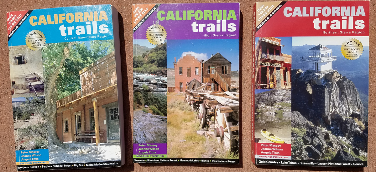
- Massey California L1200.jpg (742.59 KiB) Viewed 1492 times
_____________________________________________________________________________________________________________________________
3.
Roger Mitchell
HIs company is Track and trails.
www.trackandtrailpublications.com Or call 559-683-6984
About $17 per book.
While his books do overlap some of the same trails as Wells and Massey/Wilson, he has many trails that neither of the first two authors document. His books are long on history and geology and can be light on directions. He has very few GPS waypoints and his books are not organized to quickly identify directions from historical narrative.
I almost gave up on Mitchell after using the first book. I reached a junction and had to read two full pages before I found out which way to turn. Since then, I highlight the directions before I go.
Never-the-less, these are good books to have and I recommend them. They focus on SUV trails (easier) and lesser known trails.
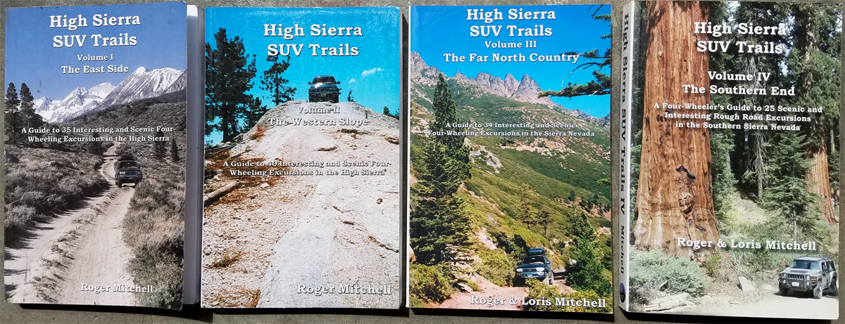
- Mitchell High Sierra L1200.jpg (655.38 KiB) Viewed 1492 times
- Mitchell CA L1200.jpg (742.28 KiB) Viewed 1492 times
- Mitchel Great Basin NV L1200.jpg (5.23 MiB) Viewed 1492 times
Table of Contents (page 1 only) of High Sierra SUV Trails Vol 1 the East side
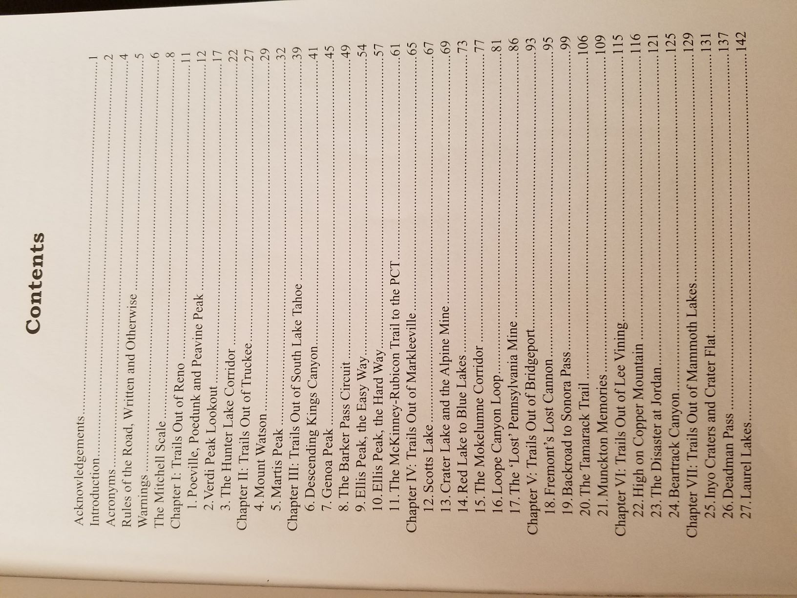
- The East Side I Table of Contents.jpg (292.09 KiB) Viewed 1488 times
Mitchell Trail Rating
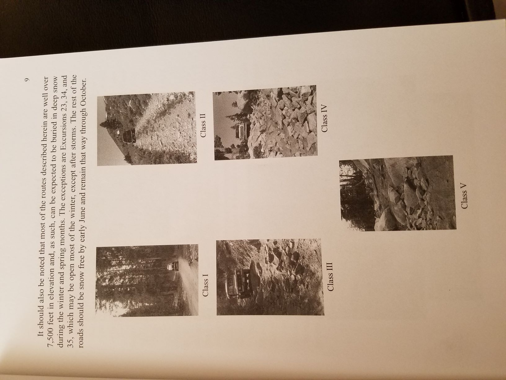
- Mitchell Trail Rating.jpg (228.67 KiB) Viewed 1488 times
_____________________________________________________________________________________________________________________________
4.
Jeanne and Willie Worthy
Grizzly Gulch Publications
The size is 8 1/2 by 11, laminated color covers, heavy duty paper printed with waterproof ink, spiral bound. All the trails lead to a historic or scenic overlook, a lake, or to historical mining features.
The latest book is 4×4 Routes of Southcentral Montana, by Willie and Jeanne Worthy. This all new book covers the areas around Cooke City, Emigrant, McAllister, Sheridan, and Twin Bridges with extensive histories of the notable towns and long-forgotten mining sites. They even suggest camping spots for larger RVs and trailers.
The format: describing 4×4 routes using mile-to-mile, turn-to-turn points with landmarks, odometer readings, and GPS coordinates to keep on track.
Book One, 4×4 Routes of Western Montana, used Missoula as a hub to visit most areas within a day’s trip.
The second book, 4×4 Routes of Southwestern Montana, used Dillon, Jackson and Melrose as central locations to visit the selected areas within a day’s trip.
Books are available by phone at 406 825 4126, from our web site
www.montana4x4trails.com
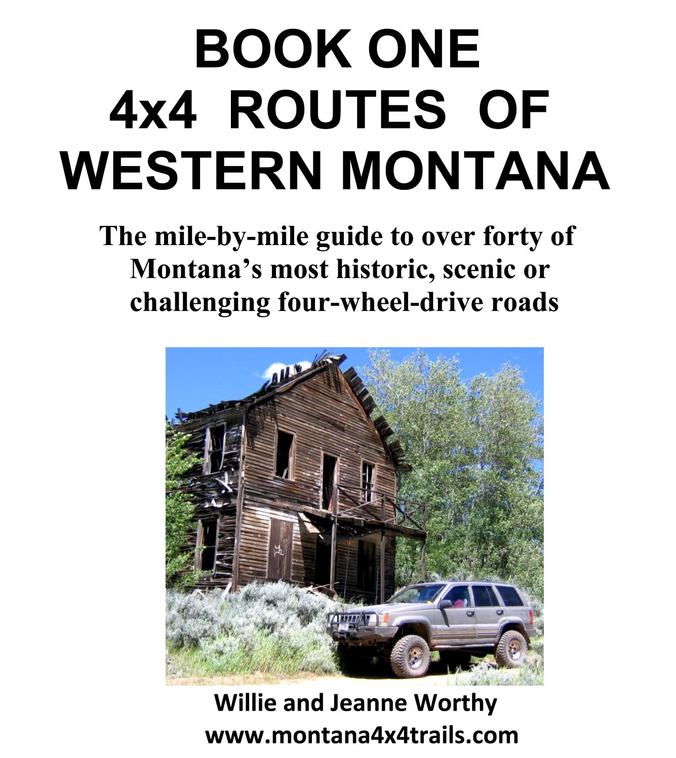
- Book One Western MT.jpg (257.12 KiB) Viewed 1472 times
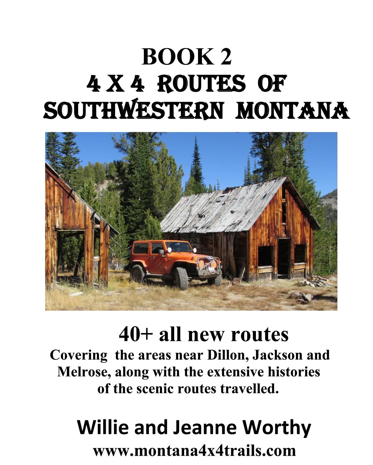
- Book Two Southwestern MT.jpg (261.13 KiB) Viewed 1472 times
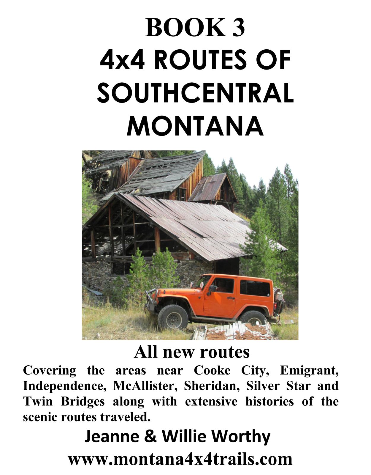
- Book Three Southcentral MT.jpg (234.76 KiB) Viewed 1472 times
SAMPLE TRAIL
FROGPOND BASIN ROUTE
This is about a half day trip from the camp grounds depending on how much hiking and other exploring you do. The route is mostly class 1 with just a bit of class 2 to 2.5 sections. We did not find any frogs.
NEW MILEAGE
Mile 0.0 (46 04 04/113 32 15) JUNCTION A of FSR 1506 and 80 near Copper Creek Campgrounds. Follow FSR 80 towards Frogpond Basin, which starts out as a good graded gravel road.
Mile 0.3 Continue on the main road FSR 80 as it passes through willow filled flood plain with Copper Creek meandering through it on your left.
Optional Route. Just past the campground, FSR 1511 goes to the left (S) and then splits in a short distance. Where FSR 1511 splits, the left fork which is FSR 8672 goes straight ahead (S) to a locked gate in about one mile. The right fork road (SW) FSR 1511 parallels FSR 80 for another mile to where it intersects with FSR 8672. This road, FSR 8672, heads south and ends at an unnamed mine on the east slope of a high ridge in about four miles. If you continue on FSR 1511, it will join back with FSR 80 in less than two miles. This can make for an interesting area to explore in the future.
Mile 2.3 There is a spacious camping area on the left next to Copper Creek. The road to the right is kelly-humped to restrict access.
Mile 2.7 FSR 5107 joins from the right, and then a few hundred yards past the intersection on FSR 80 is a sign that says “Green Canyon Creek.” This side road leads to a clear cut logging area, and it is within hiking distance to the wilderness Whetstone Lake. This small 15 acre lake is unusually deep at 52 feet. It contains no fish to speak of.
Thirteen lined Ground squirrel (Spermophilies tridecemlineatus)
NEW MILEAGE
Mile 0.0 Intersection of FSR 80 and FSR 5107. Continue on FSR 80 (SW). The road becomes narrow and rougher.
Mile 0.2 The road to the left goes to a creek.
Mile 0.8 The road to the left also goes to a creek.
Mile 1.0 Intersection with FSR 78388, which follows Copper Creek to FS Trail 26 in about 1 ½ miles. Stay on the main road, FSR 80.
Mile 2.5 (46 02 02/113 37 21) The road heads up hill steeply and back down the hill with a switchback.
Mile 4.0 (46 01 27/113 38 35) JUNCTION 1, Intersection with FSR 5110, which heads to the right (NE) and FSR 80.
NEW MILEAGE (Optional side trip)
Mile 0.0 (46 01 27/113 38 35) From JUNCTION 1, Turn right (NE) on FSR 5110. The road follows along the hillside, and becomes narrower and rougher as it gains elevation.
Mile 0.8 There is a faint road to the right - stay on the main road.
Mile 1.5 Road is still class 1, but it is rough with little usage and approaches class 2 in spots. The forest begins to have some white and sub-alpine fir, and it was logged many years ago.
Mile 2.6 (46 02 10/113 38 54) This is a good place to stop and turn around to enjoy the view. The road splits, but both left and right forks dead end in ¼ mile. The elevation is 7830 feet at the highest point. There are a few stunted trees, alpine plant life, and three small ponds about 500 feet to the west.
Backtrack to JUNCTION 1, The intersection of FSR 80 and FSR 5110 at
46 01 29/113 38 35 where we had turned right at mile 4.0 just above.
NEW MILEAGE
Mile 0.0 (46 01 27/113 38 35) JUNCTION 1, Intersection of FSR 80 and FSR 5110. Turn to the northwest and continue on FSR 80.
Mile 1.0 You will cross a cattle guard. Just past it on the right side heading down hill where snow markers mark the edge, look down in the canyon (SE) at the remains of an old road.
Mile 1.3 A big meadow.
Mile 1.4 (46 01 30/113 39 51) The road splits with FSR 8671 to your right (NW) and FSR 80 continues to left (SW) about a mile to a locked gate at the Montana Prince mine. Turn to your right and follow FSR 8671. You’re in Frogpond Basin, with a short section of cool looking granite boulders, some round and some angular.
Mile 2.1 A small road to the right leads past an old closed gate across a small road to left, and continues about ½ mile to a campsite with a cement culvert two feet in diameter, five feet long. Why is it there? It’s a fairly decent road to the campsite, more like a quad road as it twists and turns through trees. Past the campsite the road enters a meadow and disappears, so we turned around. Purple lupine in heavy bloom in places along with blooming corn lily, blue harebells and white yarrow. Backtrack to the main route and continue mileage.
Mile 2.2 Gate. A road goes to the left for a very short distance. There are some private property signs posted. There is still quite a bit of mining remains in the area if one is willing to hike some and explore as it is hard to tell exactly where the property boundaries in this are.
Gear driven cable/drum winch
Keeping to your right on FSR 8671, the road continues on for less than a mile until reaching some “gate keeper” rocks and going up a steep hill with a sign “Bitterroot Divide trail # 313” and “Junction Chain of Lakes Trail # 396.” Stop at the gate keeper rock just before you get to the trail sign as it’s hard to turn around beyond it. USFS maps and USGS maps show this as a trail that leads to Shadow Lake in about five miles and joins with other trails. However, Google Earth shows it distinctly as a road. From the mile or so of it that we walked it appears to be a class 3.5 route and it appears that quads have driven it. It would be interesting to follow up with the USFS as to the legal vehicle usage of this trail.
Return route follows the main roads back to where you came in.
______________________________________________________________________________________________________________________________
5.
Bill Mann aka short fuse.
Bill spent 50 year working and guiding in the Mojave Desert. He sold and delivered explosives to small mining companies throughout the desert. As a result, he discovered many sites of interest. He has documented many in a series of 6 books.
His format is a big picture of the site (with him and his pole in the picture), sometime another one or 2 pictures, driving directions and sometimes one GPS waypoint (not all were printed correctly) and a short paragraph of background. Using the book is much like geocaching.
Bill lived in Barstow CA and died Aug 12, 2006 at age 79.
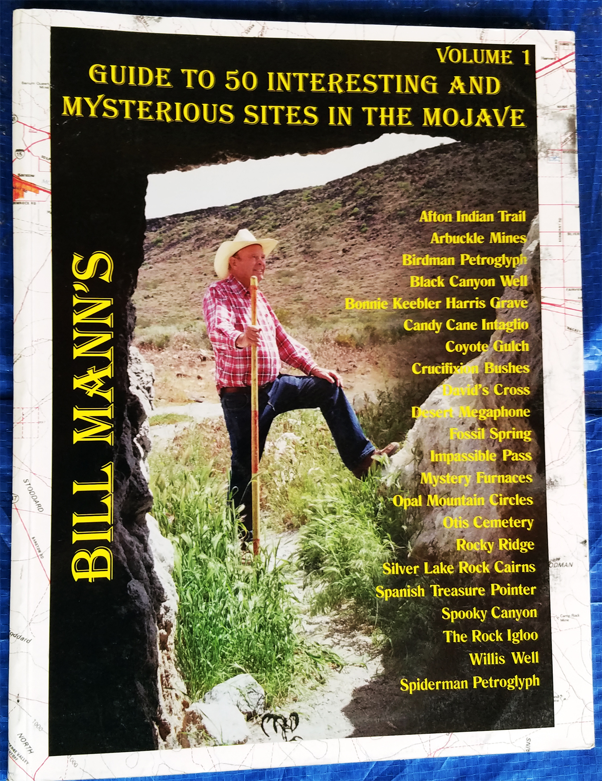
- Bill Mann Vol 1 L1200.jpg (1.6 MiB) Viewed 1492 times
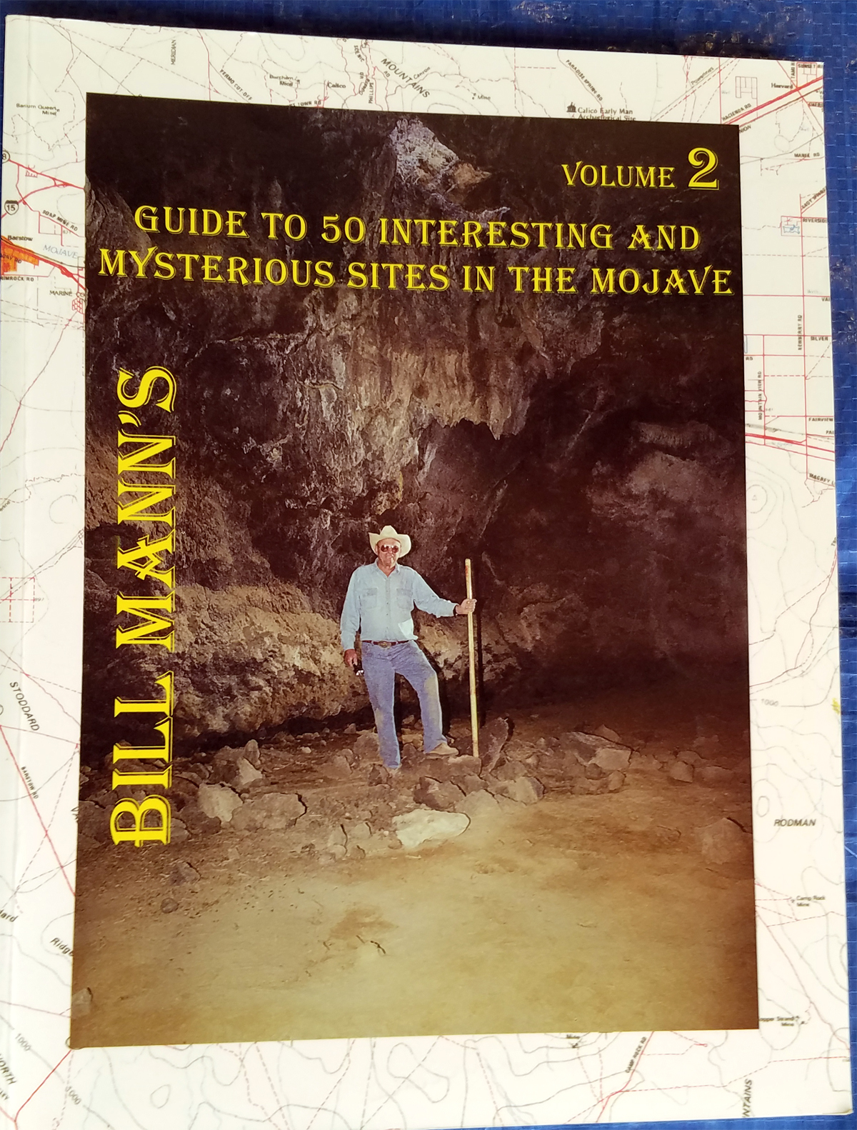
- Bill Mann Vol 2 L1200.jpg (1.27 MiB) Viewed 1492 times
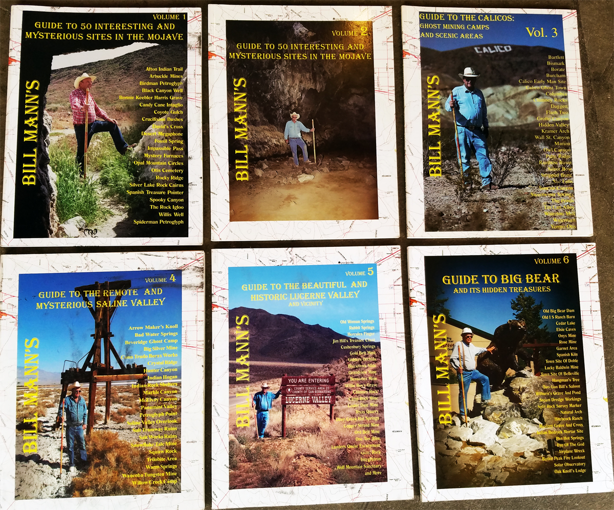
- Bill Mann All Vol L1200.jpg (1.35 MiB) Viewed 1492 times