Wildflower Locations
The terms "desert" and "wildflower" are often found together, but that is by no means the only climates or zones where they are to be found. Mountains and Plains are places where wildflower blooms are to be found as well.
The deserts however, offer multiple opportunities to enjoy this spring event, and are, by far, one of the most popular. For the American South West, there are vast areas that are considered deserts, included in the states of Arizona, Utah, Idaho, Nevada, New Mexico, and California. In particular, one of the largest deserts in the USA is the Mojave, covering some 54,000 square miles, the Sonoran, covering some 100,000 square miles, and the Great Basin, covering some 190,000 square miles.
In the images below, you can see the general boundaries of the Mojave, the Sonoran, and the Great Basin Deserts, and it is easy to see that there are many areas where wildflowers can be found. This is clearly not a "California" only phenomenon, as these deserts cover vast areas of the USA, including parts of Utah, Nevada, Arizona, New Mexico, Idaho, Utah, and yes, California.
The popularity of Wildflower viewing has increased so much in recent times, that hotlines, park information, and internet adventure sites are great sources of information that you can consult to see where the best areas are to be found, near where you live.
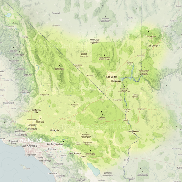
- Mojave Desert Boundaries.jpg (453.22 KiB) Viewed 8793 times
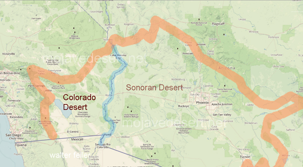
- Sonoran Desert Map.jpg (202.86 KiB) Viewed 8793 times
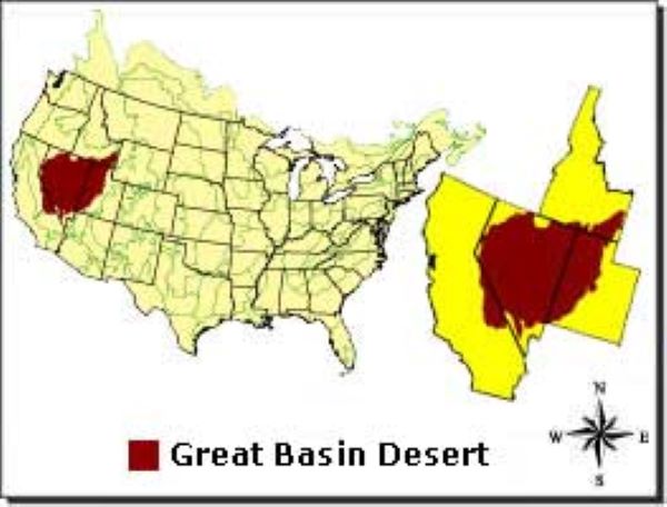
- Great Basin-1.jpg (39.59 KiB) Viewed 8793 times
SUGGESTED WILDFLOWER LOCATIONS
- 1. Carrizo Plain National Monument
Carrizo Plain National Monument is a fascinating and relatively unknown Monument, with an intriguing history and equally compelling reasons to put it on your list of places to visit. The monument is quite large, as the map below shows. The monument is some quarter of a million acres and measures about 50 miles long and up to 15 miles wide.
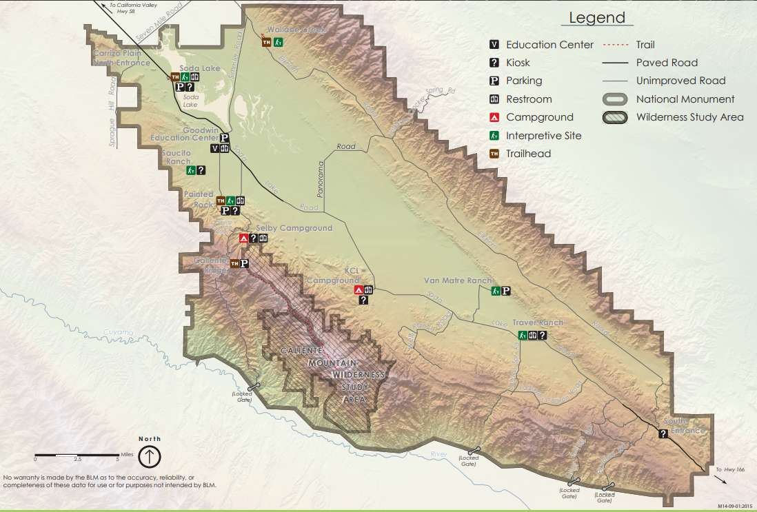
- CP Map-1.png (1.28 MiB) Viewed 7603 times
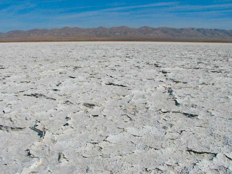
The Plain is situated in a basin with Soda Lake being the lowest point and it's centerpiece. The interesting and unique aspect of Soda Lake is that when it rains, the water all drains into Soda Lake, but being situated in a basin, there is no outlet for the water to drain out. The result is that in wet years, Soda Lake is full (so to speak.) and looks like this:
- Soda Lake - full.jpg (37.72 KiB) Viewed 7603 times
Source: Discover Central California (
https://www.discover-central-california ... -monument/)
- Soda Lake full-1.png (831.43 KiB) Viewed 7549 times
When the rain stops and the weather turns warm, the lake dries up leaving behind all the salts, and giving the appearance of baking soda. And, looks like this:
- Soda Lake - dry.png (883.33 KiB) Viewed 7603 times
Source: Discover Central California (
https://www.discover-central-california ... -monument/)
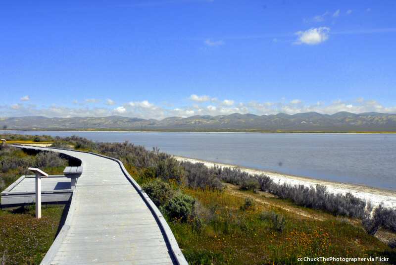
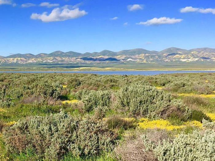
The topography of the CPNM is unique in that it it is largely a flat treeless grassland, surrounded by large mountains. Long before the Central Valley was dominated by agricultural and residential interests, the area was a vast grassland, the only remnants of which today is the Carrizo Plain National Monument. Many roads traverse the Monument (which is open year round), and camping in designated areas is allowed.
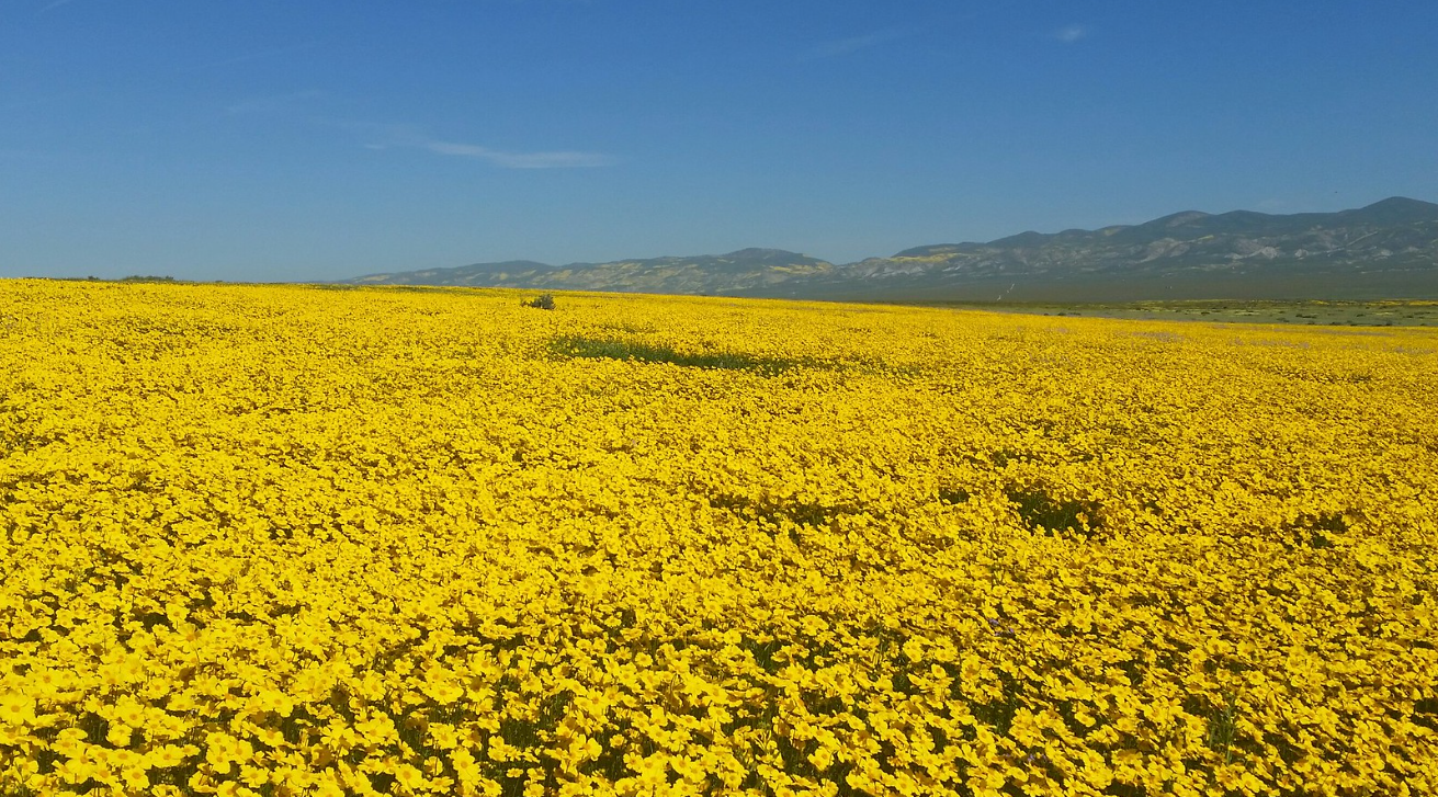
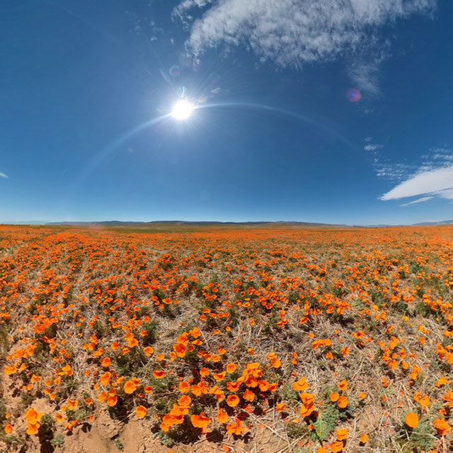
For this net, the main focus on the Monument will be the spring wildflower blooms. When that happens, it is the best of the best. In the last several years, when spectacular pictures of wildflower booms are reported, they are often from the Carrizo Plain National Monument.
The following are pictures that showcase the amazing display that appears in the Carrizo Plain when the bloom is in full swing:
- CNM-2.png (1.99 MiB) Viewed 7549 times
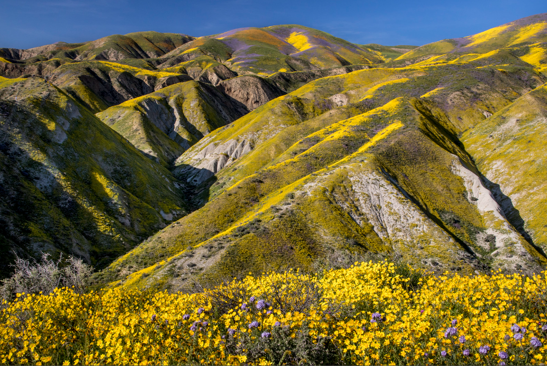
- CNM-3.png (1.99 MiB) Viewed 7549 times
Now, this is a "SUPER BLOOM"!!! (At Carrizo NM.)
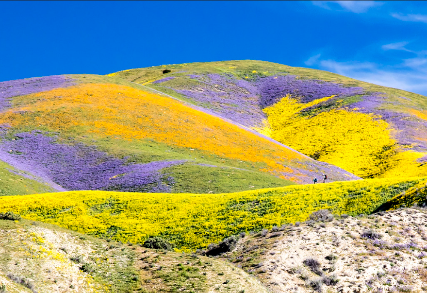
- CNM-1.png (1.13 MiB) Viewed 8153 times
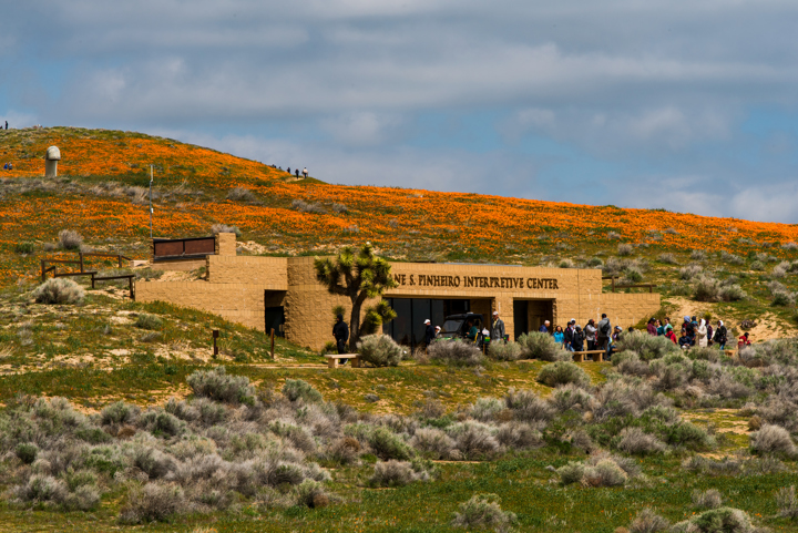
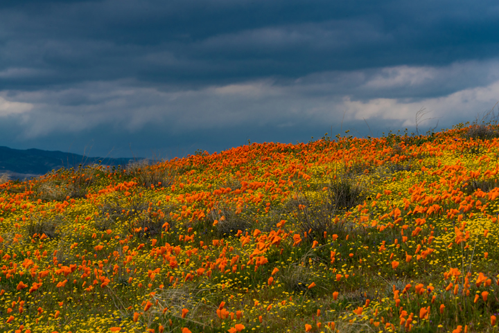
The Antelope Valley is located in the western Mojave Desert at an elevation ranging from 2600--3000 feet, making it a high desert environment. No special vehicle is required to visit the Reserve and no hiking for long distances or in rough terrain is necessary. It is easy to reach on paved roads and there are eight miles of trails through the gentle rolling hills.
- $10 admission per vehicle
- open year around from dawn to dusk
- benches along the trails for those who need a rest or to just soak up the sights and quiet
- eight miles of trails through the gentle rolling hills
Some pics of the Reserve.
- Poppy Reserve-1.png (750.66 KiB) Viewed 8190 times
- Poppy Reserve-2.png (709.5 KiB) Viewed 8190 times
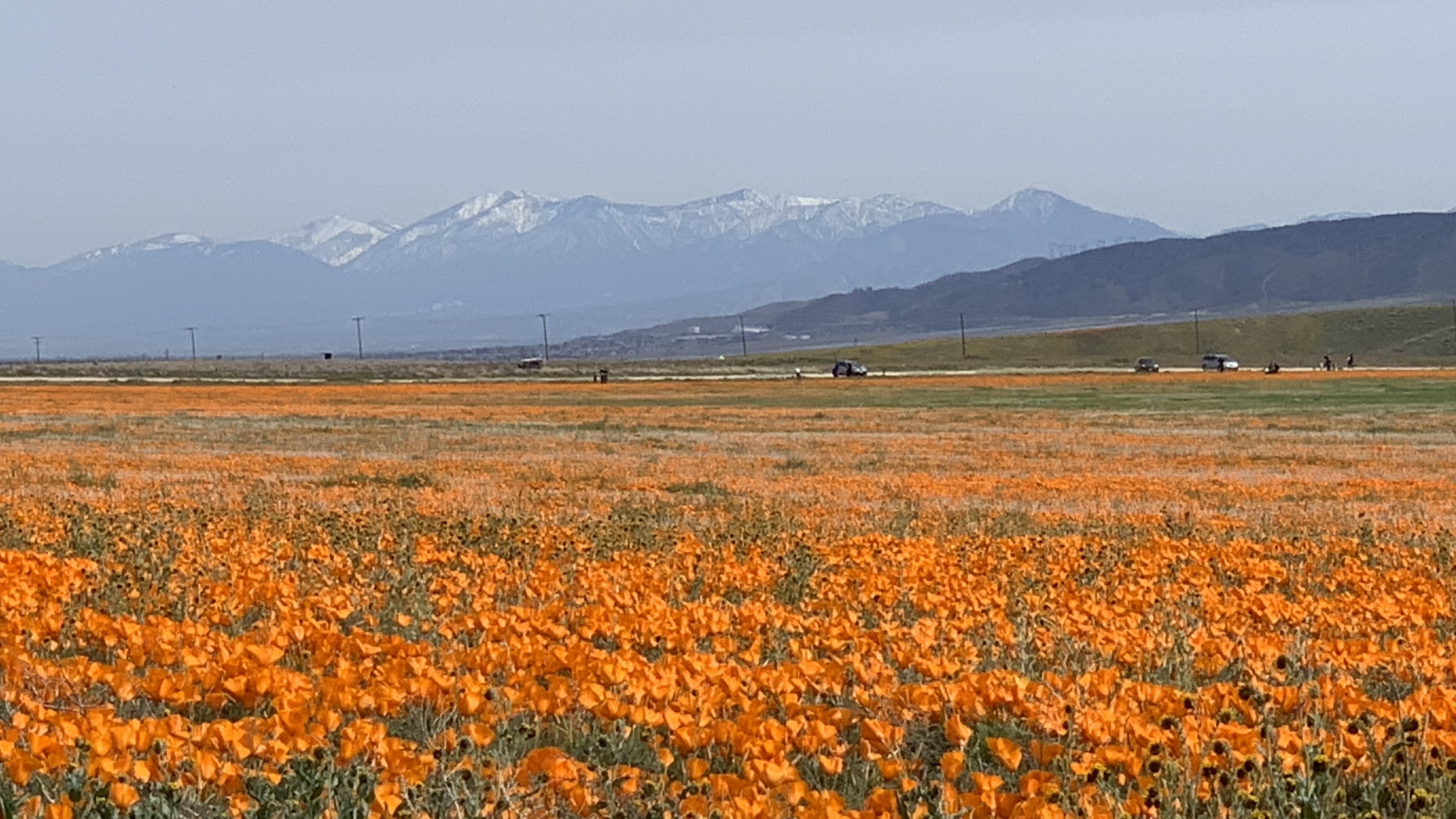
- Poppy Reserve-3.jpg (1.9 MiB) Viewed 8190 times
- Poppy Reserve-4.jpg (205.37 KiB) Viewed 8190 times
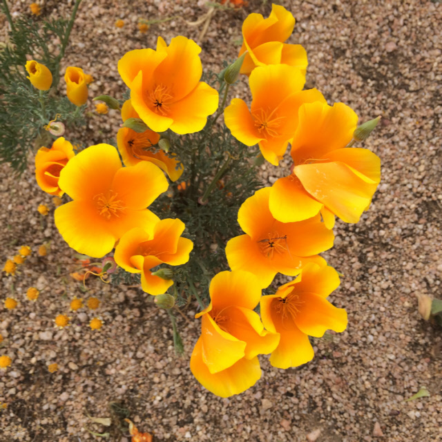
- Poppies-5.jpg (188.25 KiB) Viewed 8190 times
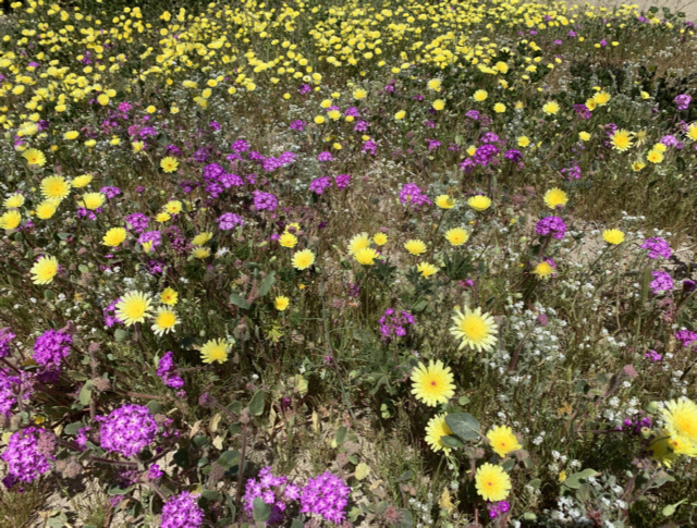
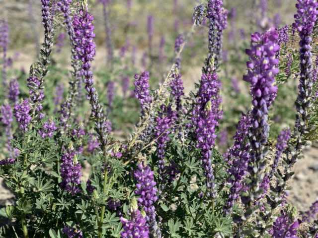
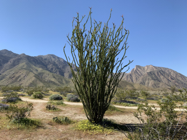
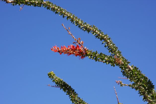
- 3. Anza Borrego Desert State Park
Anza Borrego is a favorite wildflower destination for SoCal, due mostly to the huge size of the park, the ability to traverse almost 600 miles of off road trails, an amazing diversity of very scenic and unique terrain, and untold numbers of wildflower locations. The park is also right on the way to Julian with great lodging and dining. For those so inclined, the wine region of Temecula is also nearby. The park staff and the Anza Borrego Foundation actively locate and report wildflower conditions throughout the season. While the park often gets a little crowded during the bloom season, one can get the solitude of an uncrowded flower field if you can take your 4WD off road.
A good example is Coyote Canyon. While the trail into the Canyon can be difficult for 2WD vehicles, especially in the sandy stretches, the tougher trail begins right after what was called the "third stream crossing." This is the point where most vehicles stop. With a 4WD vehicle, the trip to the top, in the Collins Valley, is rewarding and much, much less crowded. Lots of wildflowers, too.
Some pics of Anza Borrego.
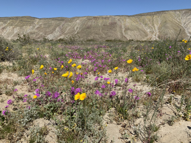
- AB-1.jpg (183.31 KiB) Viewed 8178 times
- AB-2.jpg (239.66 KiB) Viewed 8178 times
- AB-3.jpg (191.03 KiB) Viewed 8178 times
- AB-4.jpg (139.74 KiB) Viewed 8178 times
- AB-5.JPG (29.39 KiB) Viewed 8178 times