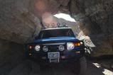
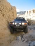
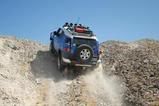
Anza Borrego 33° 1'22.61N 116°29'29.45W
Here is some info I gleaned from the Web and if you'll notice in the close up pic I posted there is a blue shadow next to the plane.
http://googlesightseeing.com/2005/04/13 ... in-flight/
I think the “blue shadow” phenomenon is an artifact of image processing. All the images I looked at with blue shadows appear to have been Color Infrared images. CIR is routinely flown by agencies that need to do vegetation surveys, since it is easier to tell different kinds of vegetation apart in CIR than in “true color” or “natural color.” In CIR images, vegetation shows as red. It looks like the CIR images have been processed to make them more natural, and that probably shifted the shadow into the blue.
This leads me to a common misconception about Google Maps/Google Earth imagery. It is NOT all from satellites. The best imagery (i.e., the really high-resolution stuff, with 1 ft or even 6″ pixels) is shot by relatively low-level aircraft. Notice that the best imagery is typically over cities, out in the middle of nowhere the imagery is low-res. That’s where you’ll find either national 1 meter resloution photos done by high-altitude aircraft for the US Geological Survey, or actual satellite imagery from a variety of sources (e.g., Digitalglobe Quickbird, 0.6 m; Geoeye IKONOS, 1 m). When you use Google Earth to see places outside the US that have no equivalent to the USGS, the best available imagery might be Landsat (15 m) satellite imagery.
 _
_ _
_