Donate

Dec. 2011 SoCal & AZ Overland Adventure

Past or present, share your outdoor adventure reports with us here. We want to read all about them. Share pictures, videos, etc.
User avatar
BorregoWrangler
Posts: 1920
Joined: Wed May 07, 2008 6:53 pm
Location: San Diego, CA (El Cajon)
Contact:

Dec. 2011 SoCal & AZ Overland Adventure

Post by BorregoWrangler » Tue Dec 27, 2011 4:08 pm

SoCal & AZ Overland Adventure: Dec. 23-26, 2011
Image

Day 1: Bradshaw Trail to Cibola Wildlife Refuge Trail

This trip turned out to be quite the adventure. I was able to see and explore areas and trails I had never seen before, as well as scout out new places to go fishing. Friday morning of December 23rd, I awoke early to hit the road on out towards the east side of the Salton Sea to the Bradshaw Trail.

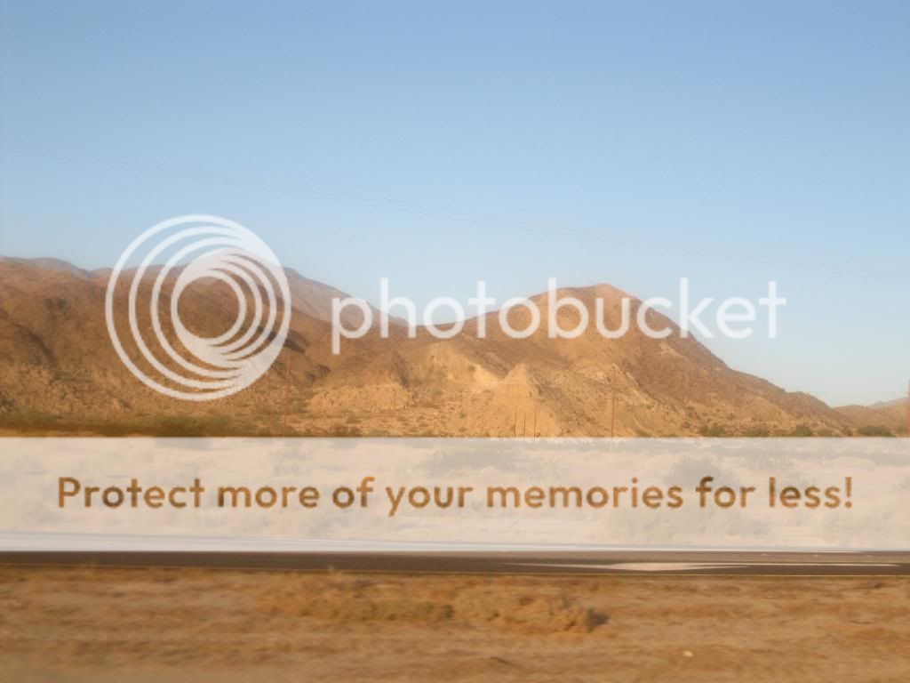
The water line of ancient Lake Cahuilla can be seen on the hills west of the Salton Sea.
Image

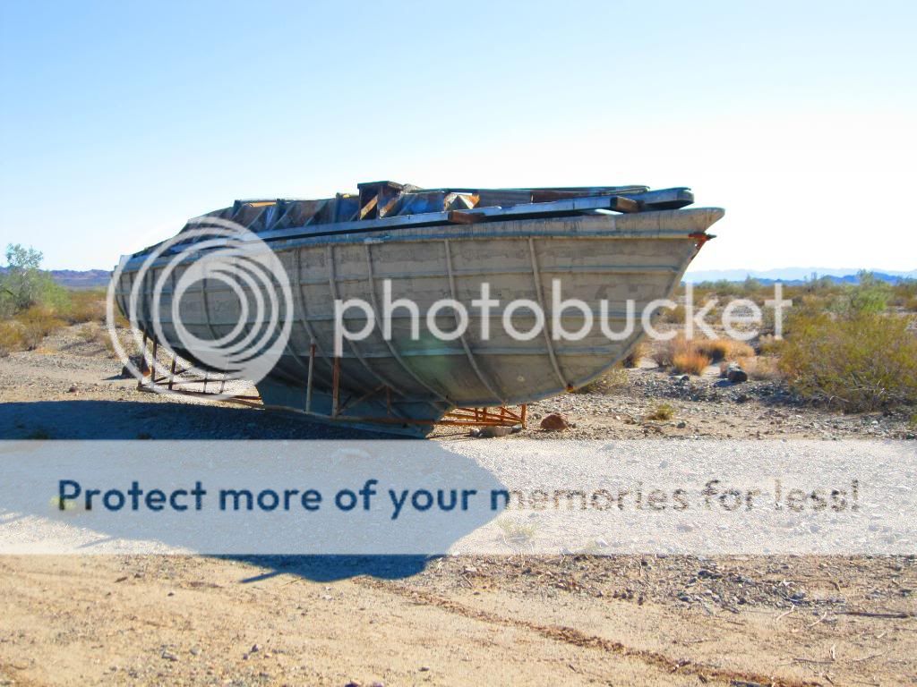
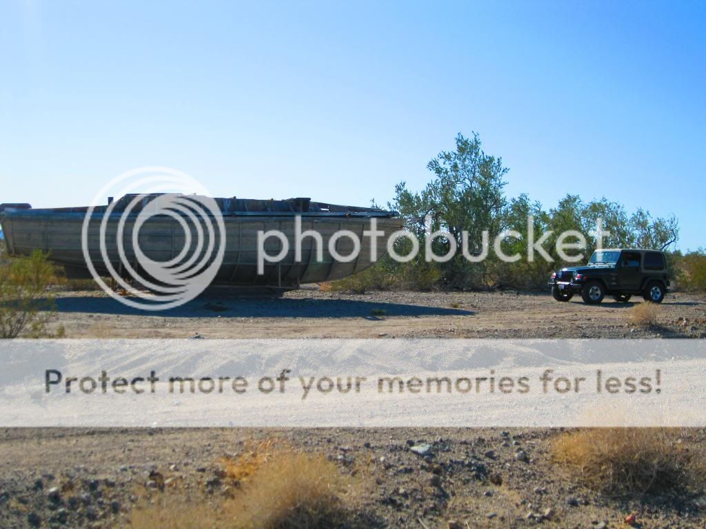
This suggests of the possibility of one or more ships entrapped in the Salton Basin after entry via the Colorado River.
Image

North Shore Beach & Yacht Club
Image

Salton Sea
Image

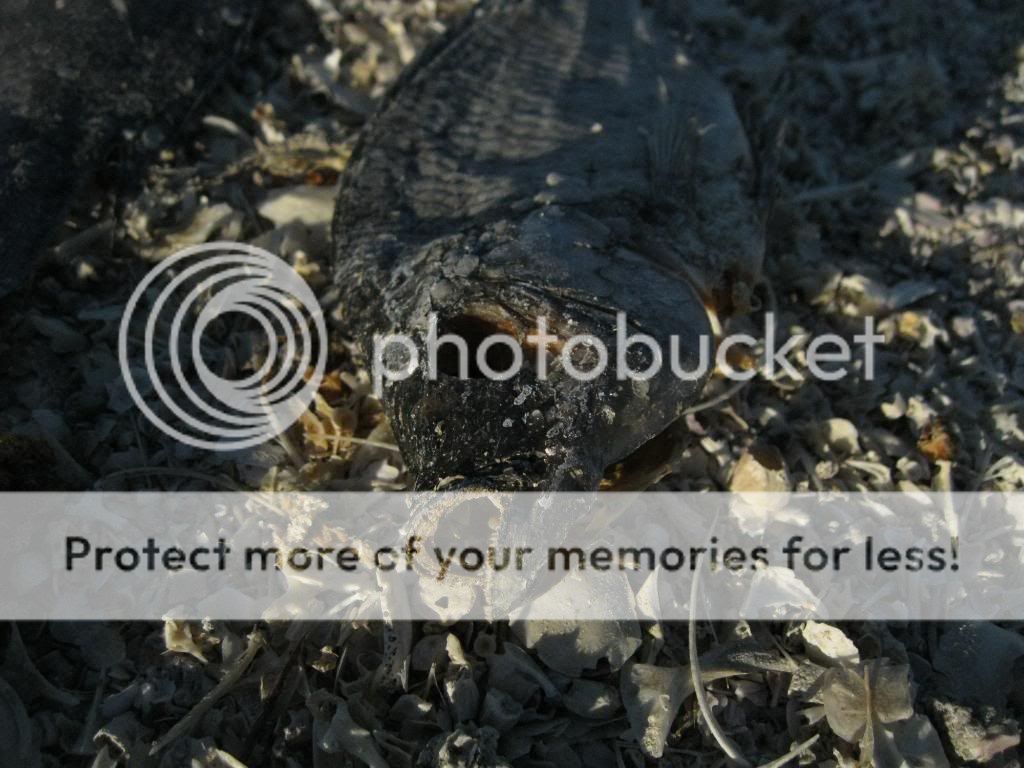
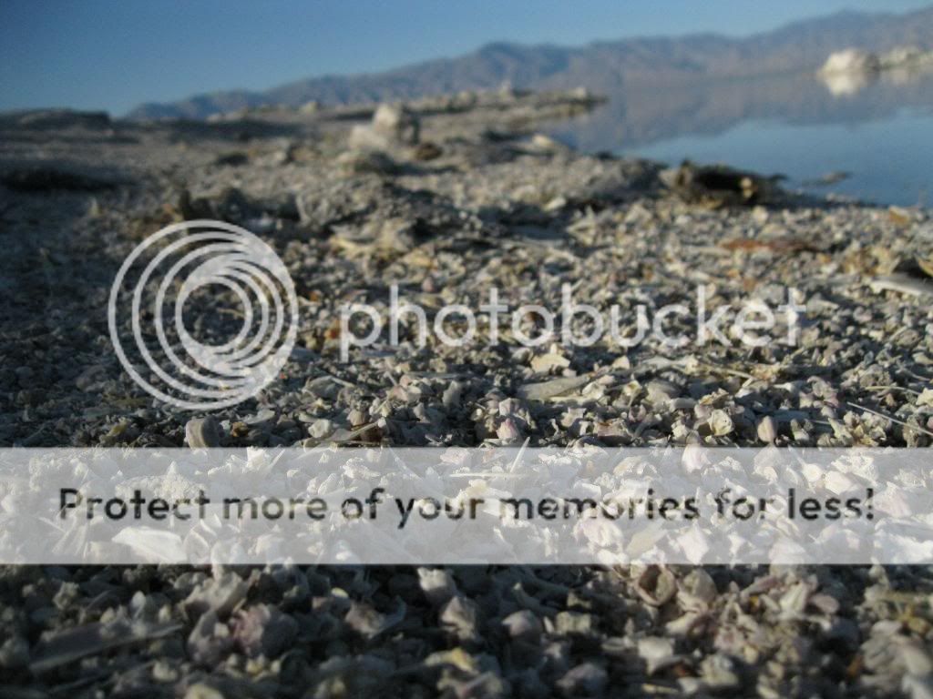
The shore was littered with dead Talapia.
Image

Image

Image

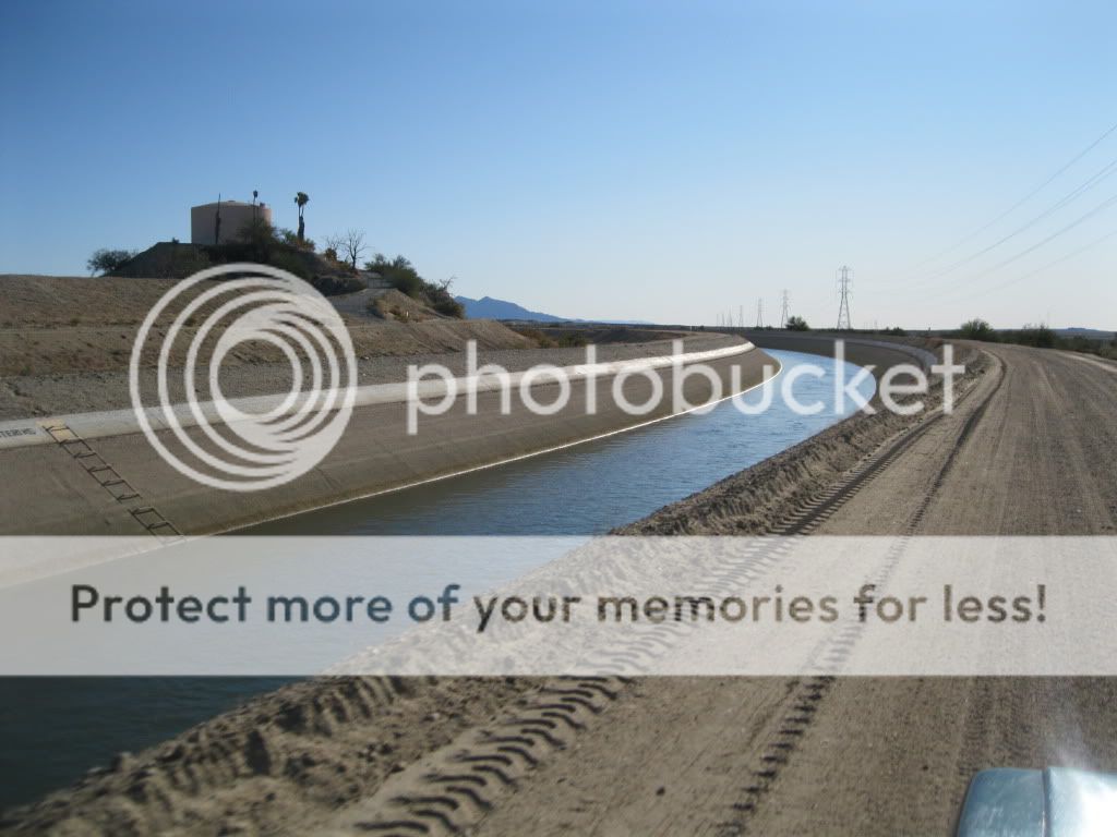
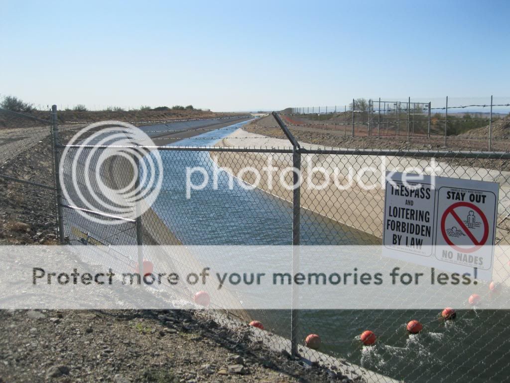
Heading towards the Bradshaw Trail, along the Cochella Canal.
Image

Image

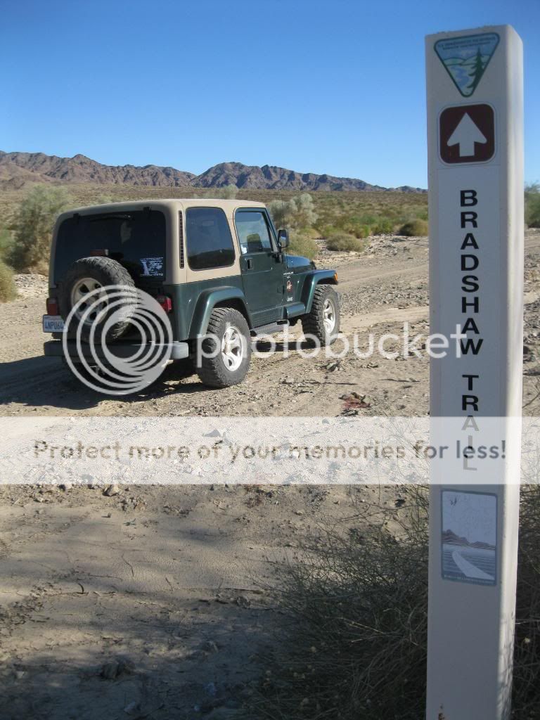
Start of the trail. Nicknamed the Gold Road at one time, this historic overland stage route in Southern California originally connected San Bernardino, California to gold fields in La Paz, Arizona, some miles north of Ehrenberg. It was the first road connecting Riverside County to the Colorado River.

Its remainder, a graded dirt road, traverses southeastern Riverside County and a part of Imperial County, beginning roughly 12 miles east of North Shore and terminating about 14 miles southwest of Blythe for a total of 70 miles.
Image

Here you see the route of the old canal.
Image

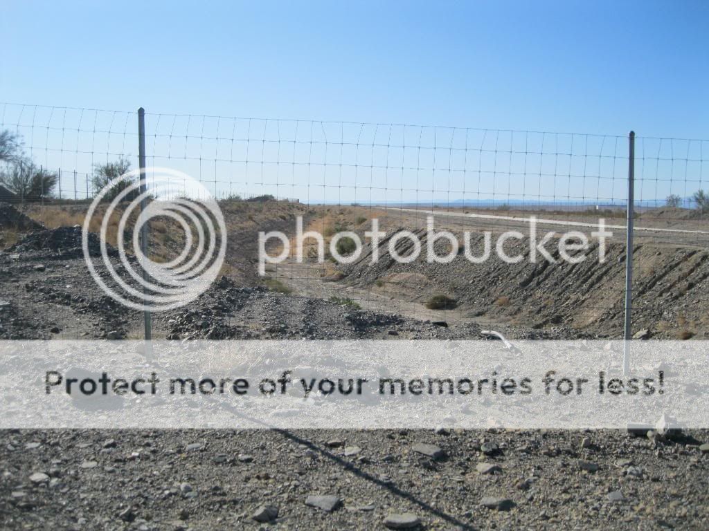
The new one is fenced in. So much for fishing it.
Image

Stay on the trail!
Image

Image

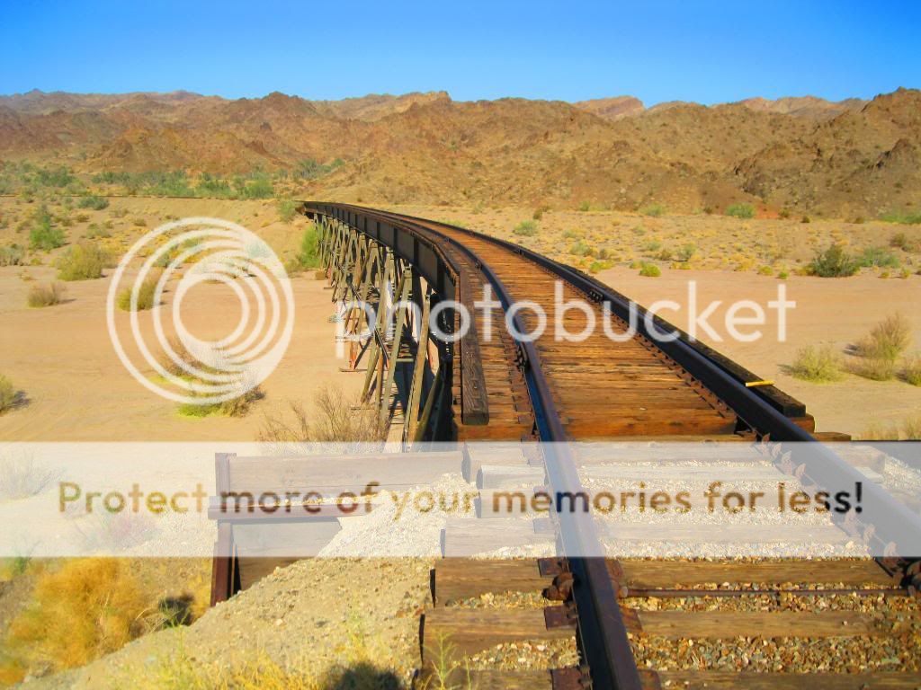
Abandoned railroad tracks.
Image

Image

Image

Image

Image

Image

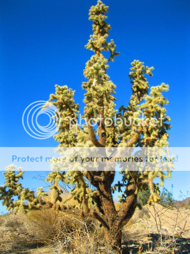
Some of the biggest Cholla I’ve seen.
Image

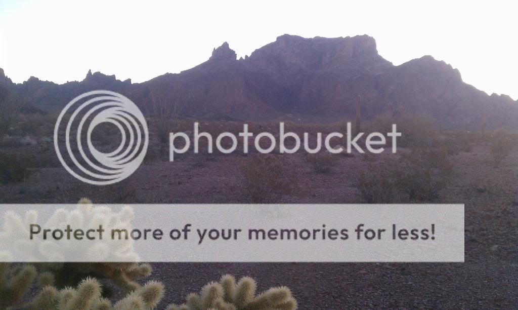
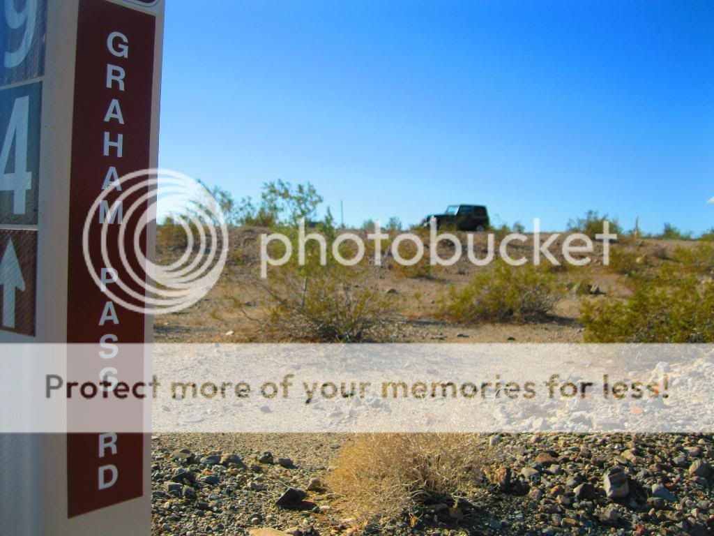
I’ve got a trail named after me!
Image

I found the lost ship of pearls!
Image

Image

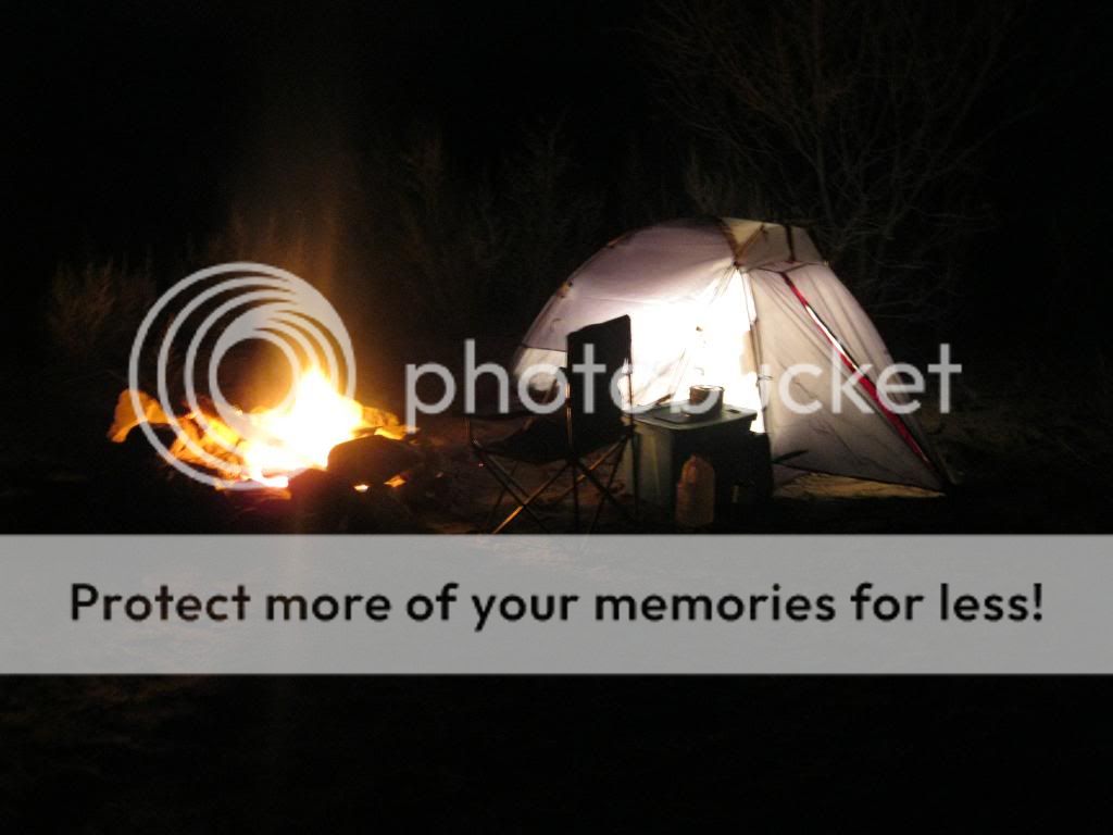
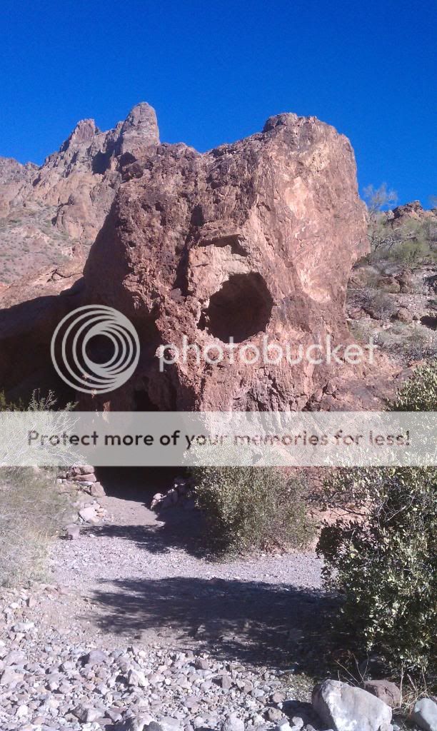
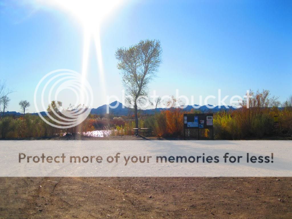
This was a nice campground.
Image

Image

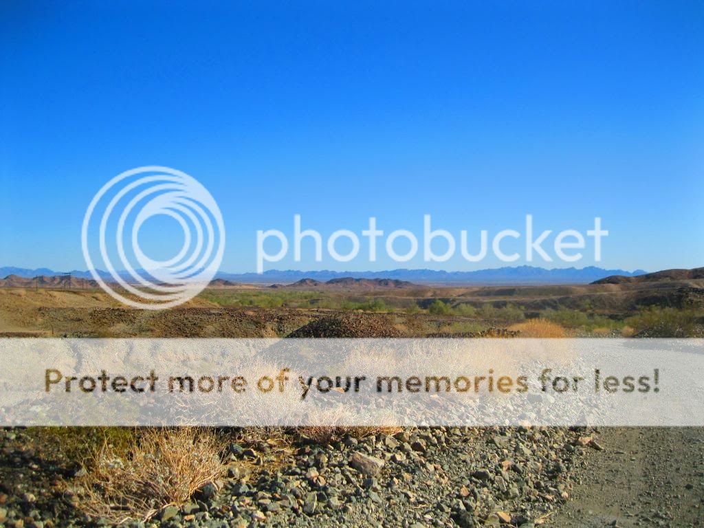
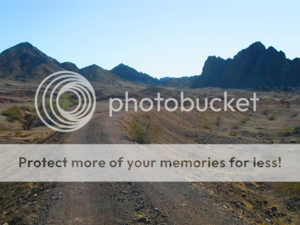
Coming to the end of the trail.
Image

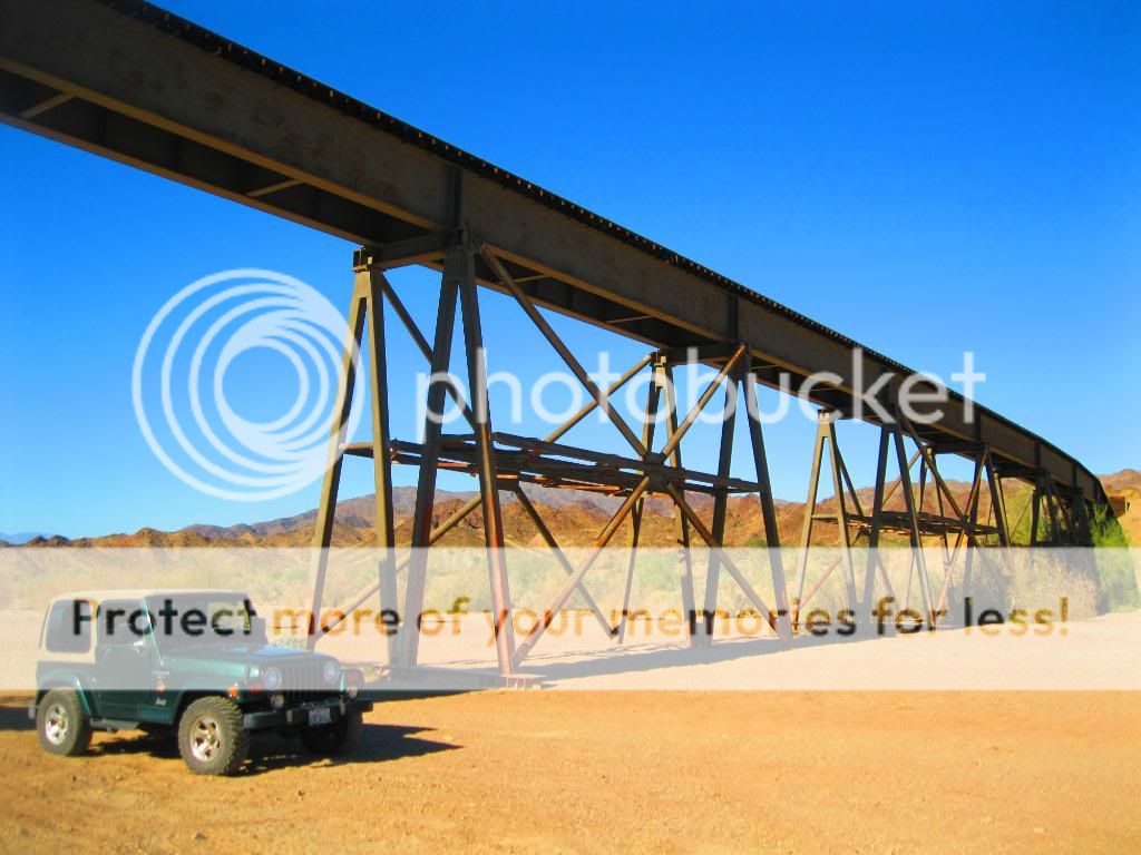
You pass over this canal at the end.
Image

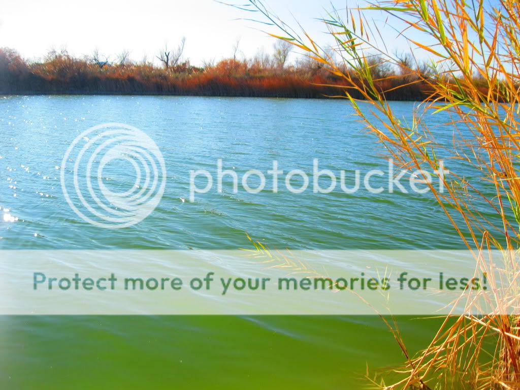
Any good fishing here?
Image

Another canal.
Image

Image

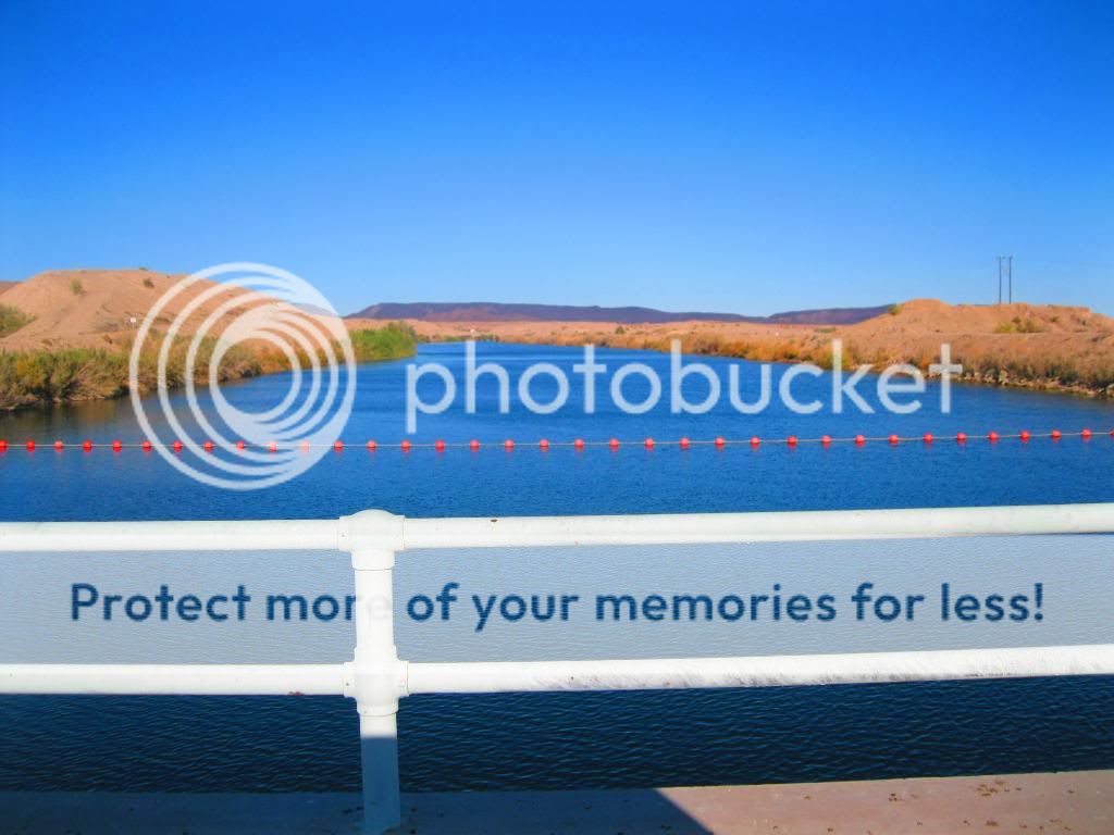
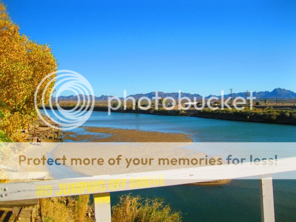
Cibola Bridge over the Colorado River.
Image

Image

Image

The Cibola Wildlife Refuge Trail is located in the floodplain of the lower Colorado River and surrounded by a fringe of desert ridges and washes. The refuge encompasses both the historic Colorado River channel as well as a channelized portion constructed in the late 1960's. Along with these main waterbodies, several important backwaters are home to many wildlife species that reside in this portion of the Sonoran Desert. Because of the river’s life sustaining water, wildlife here survive in an environment that reaches 120 degrees in the summer and receives an average of only 2 inches of rain per year.

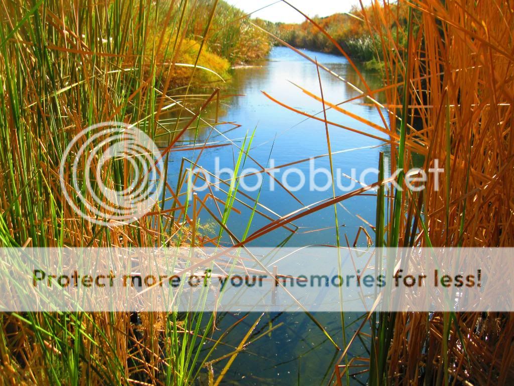
The trail starts at Cibola Bridge and travels parallel to the Colorado river. This is mainly a dirt road and is bordered with arrow weeds at many places.
Image

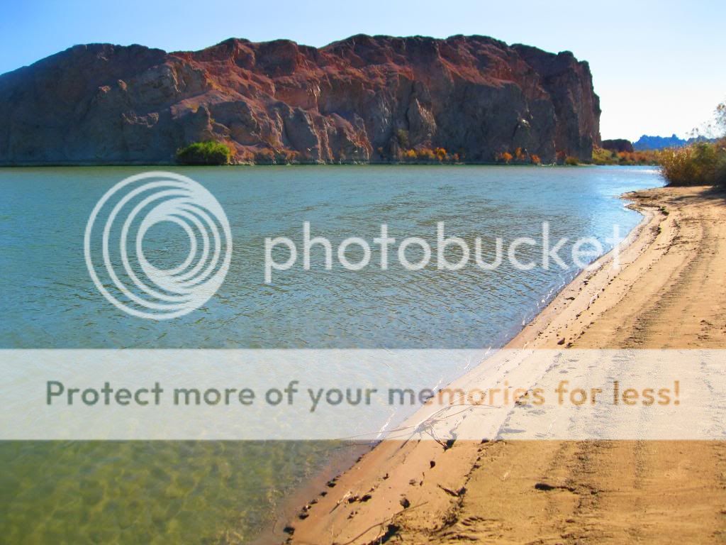
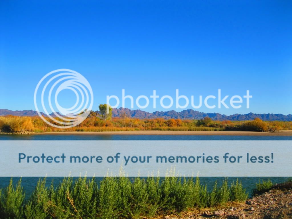
Campsite along the river with a nice spot to fish from.
Image

Image

Campsite along oxbow lagoon.
Image

Image

Image

End of the route, across from Walters Camp.
Image

Image

Image

The old river channel. The original Colorado River in the Cibola National Wildlife Refuge, bypassed and abandoned by government agencies. Neglect has caused a major migratory corridor for numerous bird species to become polluted and overgrown. Invasive plants have replaced quality native habitat mesquite, cottonwood and willows that once existed along the river. The levee was supposed to let water flow through to the old channel but has become filled with silt.
Image

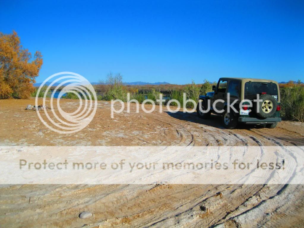
First campsite of the trip.
Image

Image

Image

Image
-John Graham
1989 YJ & 2000 TJ

View all my trip reports here at my blog: GrahamCrackers

User avatar
BorregoWrangler
Posts: 1920
Joined: Wed May 07, 2008 6:53 pm
Location: San Diego, CA (El Cajon)
Contact:

Re: Dec. 2011 SoCal & AZ Overland Adventure

Post by BorregoWrangler » Tue Dec 27, 2011 4:41 pm

Day 2: Cibola WRT to Ferguson Lake

Sunrise over the Colorado River.
Image

I ended up running over a nail in the road...
Image

Another campsite along a lagoon.
Image

Palo Verde Lagoon.
Image

One of many camp sites along the old river channel.
Image

I'll have to come fishing here over the spring.
Image

Next stop, Black Mountain.
Image

A partially difficult trail, Black Mountain Road starts at California 78 and ends near Ogilby and Indian Pass Road.
Image

Although the road up is paved, it is quite deteriorated.
Image

Image

The trail at first takes you on a graded road along the base of Black Mountain. This soon changes to a single-lane paved road as you start ascending the northern section of the mountain. The terrain is largely made up of black volcanic boulders and a mix of vegetation like ocotillos, chollas and creosore bushes.
Image

Image

Image

At the top of the Black Mountain you see communication towers. The view also includes Chocolate Mountains, parts of Colorado river, Arizona, Cargo Muchacho Mountains and Picacho Peak.
Image

Looking west over the Imperial Sand Dunes, Salton Sea, and Laguna Mountains.
Image

Views east over the Colorado River.
Image

When you descend the Black Mountain the trail again turns into a dirt road and it gets quite steep. As the ground is made up of loose soil which gets worse when it rains. At the bottom, the trail moves across a bajada and small washes.
Image

Image

Getting steeper...
Image

Image

Made it!
Image

Driving the pole line road to Indian Pass.
Image

Picacho Peak in the distance.
Image

Indian Pass.
Image

Image


One hundred years ago Picacho was a gold mining town with about 100 citizens. Today the site is a State Park, popular with boaters, hikers, anglers and campers. The park offers diverse scenery, including beavertail cactus, wild burros, bighorn sheep and thousands of migratory waterfowl. Eight miles of the lower Colorado River are the recreation area's eastern border.

Image

$5.00
Image

One of my favorite places to camp.
Image

This is not the typical Colorado River party zone, campers are mostly kayakers, fishermen, birders and hikers. The area has two boat launch ramps as well as fish cleaning stations where you can clean your channel and flathead catfish, blue gill, and bass. The area has some nice hikes and great picture taking opportunities. What was left of the old gold mining town of Picacho was inundated when Imperial Dam was built and the old cemetery was moved near the camping area.
Image

Image

Continuing through the park.
Image

Image

Taylor Lake
Image

This trail takes you to an overlook of the river at the south end.
Image

Image

Mule Deer
Image

On the way out I ran into Dave of Adventure Duo and his CalZona Expedition.
Image

Crossing the All American Canal.
Image

Meeting up with Steve and Shellie (mtngote), we set off for camp along Ferguson Lake.
Image

Ferguson Lake is a backwater connected to the lower Colorado River that provides camping, fishing, boating, hiking, and hunting opportunities. A number of undeveloped shoreline campsites provide recreational boating access and stunning views of the Colorado River. Trails leading into the adjacent Little Picacho Wilderness Area provide ideal day-hiking opportunities from your campsite.
Image

Home for the evening.
Image

To be continued...
-John Graham
1989 YJ & 2000 TJ

View all my trip reports here at my blog: GrahamCrackers

User avatar
Crismateski
Posts: 383
Joined: Thu Dec 10, 2009 8:32 pm
Call Sign: KJ6DZZ
Location: San Antonio Heights Ca
Contact:

Re: Dec. 2011 SoCal & AZ Overland Adventure

Post by Crismateski » Tue Dec 27, 2011 7:49 pm

looks like an awesome trip, wish i could have gone along, Maybe next time


C
2006 Dodge Power Wagon @BlkWgn
Family Off The Map http://www.familyoffthemap.com
Kilo Juliet Six Delta Zulu Zulu

EMR (Emergency Medical Responder) Certified via San Bernardino County Fire
San Antonio Heights C.E.R.T Founding Member
San Bernardino National Forest OHV Volunteer

User avatar
BorregoWrangler
Posts: 1920
Joined: Wed May 07, 2008 6:53 pm
Location: San Diego, CA (El Cajon)
Contact:

Re: Dec. 2011 SoCal & AZ Overland Adventure

Post by BorregoWrangler » Tue Dec 27, 2011 8:51 pm

Day 3: Ferguson Lake to Imperial and Kofa National Wildlife Refuge

View point on Ferguson Lake Road.
Image

Crossing over the Colorado River and into Arizona.
Image

We made a short stop at Camp Laguna Desert Training Center.
Image

Image

Past Martinez Lake we enter Imperial National Wildlife Refuge along Red Cloud Mine Road. The Imperial National Wildlife Refuge protects wildlife habitat along 30 miles (50 km) of the lower Colorado River in Arizona and California, including the last un-channeled section before the river enters Mexico. The Imperial Refuge Wilderness, a federally designated, 15,056-acre (60.93 km2), wilderness area is protected within the refuge.
Image

There a several overlooks of the river and its backwaters along the way. The river and its associated backwater lakes and wetlands are a green oasis, contrasting with the surrounding desert mountains. It is a refuge and breeding area for migratory birds and local desert wildlife. The Red Cloud Mine Road is the only scenic drive on the property, and if you want to go further than to the Painted Desert Trail, you'll want a good, high-clearance 4WD under your seat. There are lookout points at the Mesquite, Ironwood and Smoke Tree pullouts. Meers Point offers a boat launch with tables and toilets on the shore. The Painted Desert Trail is a 1.3-mile self-guided trail though an area of 30,000-year-old volcanic activity that also offers some great views over the Colorado River valley.
Image

Image

Image

Image

Image

Image

Image

A spot to launch a boat.
Image

Image

Back on the main trail.
Image

Image

Gettin' rough...
Image

Image

Wild burros.
Image

Image

Clip Wash has a few rocky steps to traverse.
Image

Image

Image

Image

We finally make our way back to the river, opposite of where I camped on the first day.
Image

Image

North of Cibola NWT we make our way east along Cibola-Ehrenberg Road to Highway 95, then north to Quartzite to refuel.
Image

Kofa Range in the distance.
Image

We finally arrive to the Kofa NWR and make camp along Palm Canyon Road.
Image

As we stop at the monument sign some guy in a truck pulls up alongside Steve and Shellie. He smiles and ominously says, "It's gettin' dark out..." then slowly drives away... :shock:
-John Graham
1989 YJ & 2000 TJ

View all my trip reports here at my blog: GrahamCrackers

User avatar
BorregoWrangler
Posts: 1920
Joined: Wed May 07, 2008 6:53 pm
Location: San Diego, CA (El Cajon)
Contact:

Re: Dec. 2011 SoCal & AZ Overland Adventure

Post by BorregoWrangler » Tue Dec 27, 2011 8:57 pm

Crismateski wrote:looks like an awesome trip, wish i could have gone along, Maybe next time.
Thanks. I'm sure I'll be doing this again sometime.
-John Graham
1989 YJ & 2000 TJ

View all my trip reports here at my blog: GrahamCrackers

sdnative

Re: Dec. 2011 SoCal & AZ Overland Adventure

Post by sdnative » Tue Dec 27, 2011 9:14 pm

Awesome trip. Thanks for the picture story, I enjoyed it.

User avatar
BorregoWrangler
Posts: 1920
Joined: Wed May 07, 2008 6:53 pm
Location: San Diego, CA (El Cajon)
Contact:

Re: Dec. 2011 SoCal & AZ Overland Adventure

Post by BorregoWrangler » Thu Dec 29, 2011 9:23 am

Day 4: Kofa National Wildlife Refuge

For 57 miles, US 95 cuts through the desert of Southwest Arizona - quite flat, perfectly straight and aligned exactly north-south, and interrupted only by the small town of Quartzsite. In the mild seasons of winter and early spring, much traffic uses the road, bringing sun seekers from all over the US to Yuma and on into Mexico, but few travel to this region in summer, when temperatures of over 120°F are not uncommon. Rain falls on only a few occasions each year - the summer thunderstorms that affect the higher areas of Arizona rarely extend this far. South of Interstate 10, US 95 is bordered by the Yuma Proving Ground to the west and the Kofa National Wildlife Refuge to the east - a protected area 25 x 40 miles in extent with no paved roads or facilities of any kind. The refuge is an excellent place for viewing desert plants and wildlife, rock climbing, exploring old mines, or just camping in remote wilderness.

Morning along Palm Canyon Road.
Image

It was cold!
Image

Signal Peak in the distance.
Image

Image

Image

Image

This graded dirt road provides access to Palm Canyon, from where a short hike leads to views over what is possibly the only community of native palms in Arizona. The trail itself is suitable for passenger vehicles. This area has sweeping views west over the La Posa Plain to the Trigo Mountains and Chocolate Mountains and is especially lovely at sunset. The California palm fans, from which the canyon derives its name, are thought to be remnants from an era when Arizona was a lot cooler and wetter than it currently is. The cooler air within the canyon, lack of direct sunlight, and slightly moister conditions have allowed the trees to survive. The hiking trail to view the palms is a rough but well defined path that climbs up into the canyon for half a mile to a viewing point.

Start of the hiking trail.
Image

California palm fans.
Image

Looking back down the canyon.
Image

Now on our way to Kofa Queen Canyon.
Image

Image

This spur trail is one of the few within the Kofa NWR that travels up one of the high walled red canyons that penetrate into the rugged Kofa Range. After leading off from Palm Canyon Road, the trail is smooth and easy going for the first 4 miles. At 4.3 miles is a large flat area good for camping. At the mouth of the canyon the trail drops into a gravelly wash and remains in it until the end of the route. Big horn sheep like the habitat within the canyon and can often be seen in the early morning and evening high up on the canyon walls. The wash is generally loose and gravelly, with only a few rough boulders to contend with. The last mile, however, is quite brushy, and most vehicles will collect a few scratches.

Image

Skull Rock.
Image

Image

End of the trail.
Image

Image

On our way back out.
Image

Image

Image

By the time we had finished up here it was already 11AM. I had to work that night so we had to skip the trail through the Castle Dome Mountains. I'll save that for another day. After airing up and parting ways with Steve and Shellie, I hit the road and made it home around 3:30PM. It was a great trip and I look forward to doing it again.
-John Graham
1989 YJ & 2000 TJ

View all my trip reports here at my blog: GrahamCrackers

User avatar
ssc
Posts: 718
Joined: Fri May 09, 2008 11:24 am
Location: Riverside, Lake Havasu

Re: Dec. 2011 SoCal & AZ Overland Adventure

Post by ssc » Thu Dec 29, 2011 3:04 pm

Great write-up. I enjoyed your pics and info. Thanks John. I like the picture of the deer.

Cheers, Steve
FJ Mamba. Icon 2.5 front CO XT, Icon rear 2.5 with res, Icon UCA, AP sliders, Demello front bumper, AP Rear Bumper and skids. BFG KM-2 285-70-17. Warn winch. Don't forget the Puddy Cat!

2012 Tundra Crewmax 4x4 with BFG's, 05 4-Runner 4X4, BFG's, http://www.sscphoto.zenfolio.com
The other off road rig, the "License To Chill"

User avatar
BorregoWrangler
Posts: 1920
Joined: Wed May 07, 2008 6:53 pm
Location: San Diego, CA (El Cajon)
Contact:

Re: Dec. 2011 SoCal & AZ Overland Adventure

Post by BorregoWrangler » Mon Jan 02, 2012 2:37 pm

ssc wrote:Great write-up. I enjoyed your pics and info. Thanks John. I like the picture of the deer.

Cheers, Steve
Thanks, Steve. This trip was a blast. Of course, there's no way i could have done this with the wife and child, so increasing the Jeep's cargo capacity is first on my list.
-John Graham
1989 YJ & 2000 TJ

View all my trip reports here at my blog: GrahamCrackers

sdnative

Re: Dec. 2011 SoCal & AZ Overland Adventure

Post by sdnative » Mon Jan 02, 2012 6:14 pm

BorregoWrangler wrote:Of course, there's no way i could have done this with the wife and child, so getting a roomy Toyota with their rock-solid reliability is first on my list.
Fixed it for you, again... ;)

Post Reply

Return to “TRAIL RUN REPORTS”

Who is online

Users browsing this forum: No registered users and 1 guest