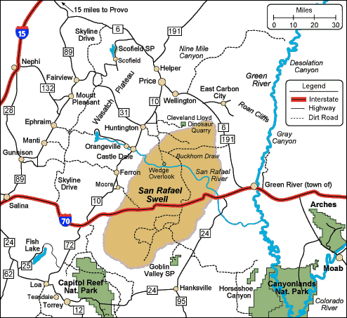
San Rafael Swell
This is an area little know to many people as they zoom by on I-70.
"The San Rafael Swell is a very large anticline located in the very center of Utah.
I-70 cuts right through the center of the Swell and climbs up and over it.
The town of Green River in Utah sits along the east side and the tiny town of Emery on the west.
In between the swell extends 70 miles north to south and 40 miles east to west and forms a large kidney shaped fold in the Earth."
A.
- Untitled-1.jpg (251.82 KiB) Viewed 1147 times
A-1.
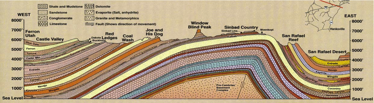
- GeologySanRafael.jpg (634.92 KiB) Viewed 1083 times
More quotes --
"The Swell is 2,000 square miles of public land, known for its scenic sandstone formations, deep canyons, desert streams, and expansive panoramas. The Swell is a massive maze of winding canyons, broken fins and buttes in the heart of Utah."
"Managed by the Bureau of Land Management, the Swell offers visitors many of the same sights that can be seen in several of Utah's national parks but allows these visitors to enjoy these sights in leisurely solitude. The San Rafael Swell also provides sights that cannot be found anywhere else, such as Goblin Valley and the San Rafael Reef. Hiking possibilities here range from easy to strenuous- technical canyoneering.
A part of the Colorado Plateau, the San Rafael Swell is high desert country, vastly different from the Sonoran desert of the Southwest. In some sections, it is a sweeping country with towering mesas, buttes, and pinnacles rising from flat desert floors. In other areas, it boasts rolling pasturelands populated with antelope and wild horses. And just around the bend it can become an incredibly wild, broken land with streams cutting through slot canyons that open up to panoramic vistas."
"There are numerous roads that only four-wheel drive vehicles can negotiate. Spring and fall are ideal seasons to explore this country because temperatures are usually moderate. Summer days can be uncomfortably hot. Winter nights get very cold but winter days are often mild - very pleasant for hiking, biking and jeeping. Make sure your car is filled with gas and bring plenty of drinking water."
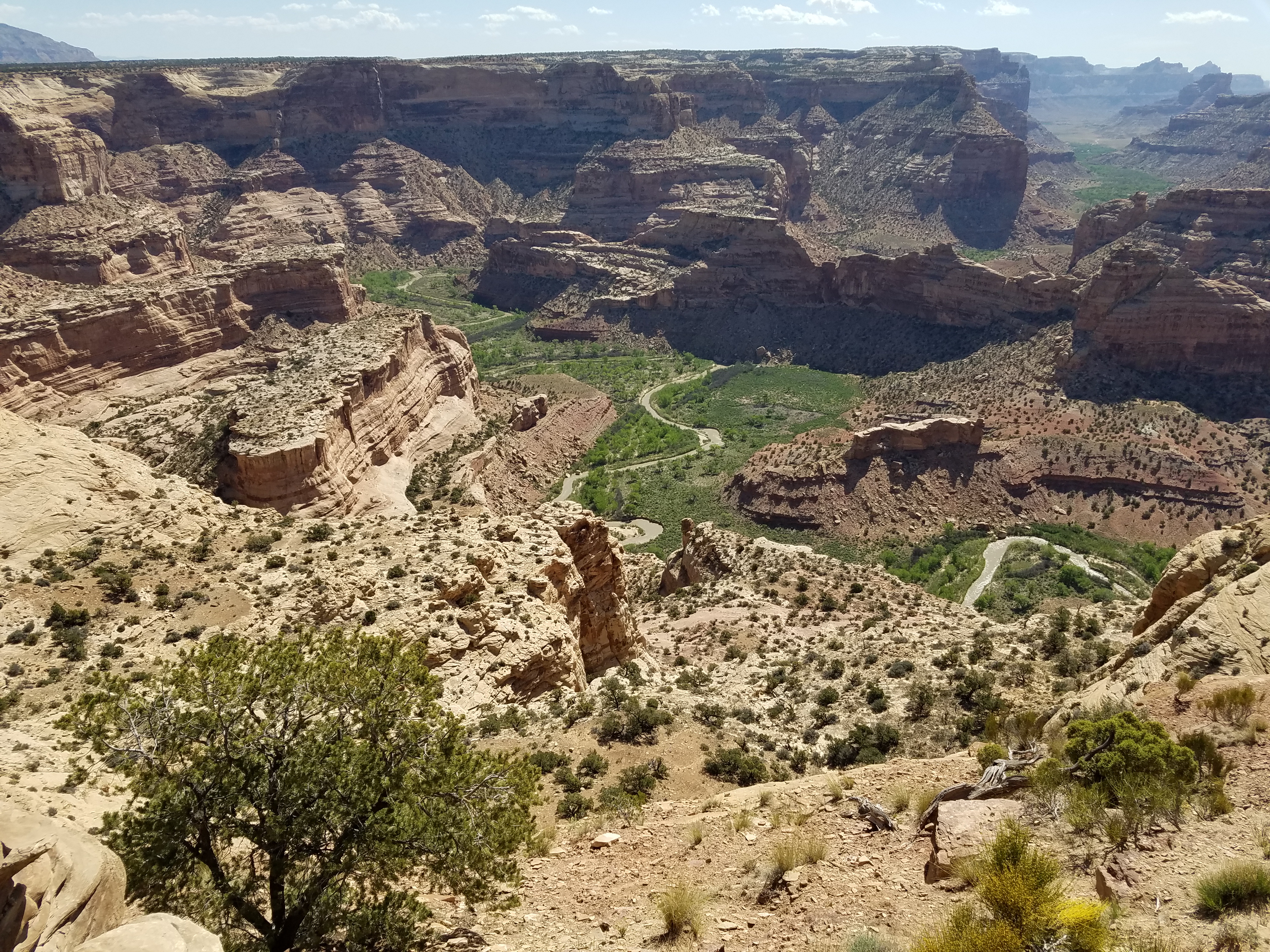
I think one of the top items on a must see list is the Little Grand Canyon at the Wedge Overlook.
B.
- SanRafaelSwell03m.jpg (7.22 MiB) Viewed 1142 times
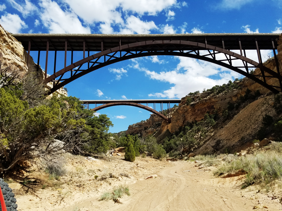
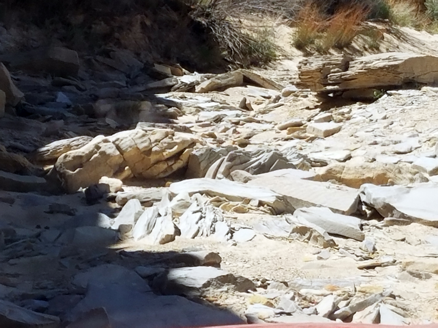
Another fun site is the view ( from below) of the 2 I-70 bridges that span Eagle Canyon. The trail there will take you pass Swasey's 1930's cabin and it becomes a level 3 trail down into the wash.
There are miles of flat, sandy, easy level 1 or 2 roads in the Swell. There are also areas with a bit more 4WD challenge.
Like this one at the bottom of Eagle Canyon on the North side of I-70.
C.
- SanRafaelSwell01m.jpg (1.18 MiB) Viewed 1142 times
There are miles of flat, sandy, easy level 1 or 2 roads in the Swell. There are also areas with a bit more 4WD challenge.
Like this one at the bottom of Eagle Canyon on the North side of I-70.
D.
- North Eagle CynLm.jpg (924.71 KiB) Viewed 1123 times
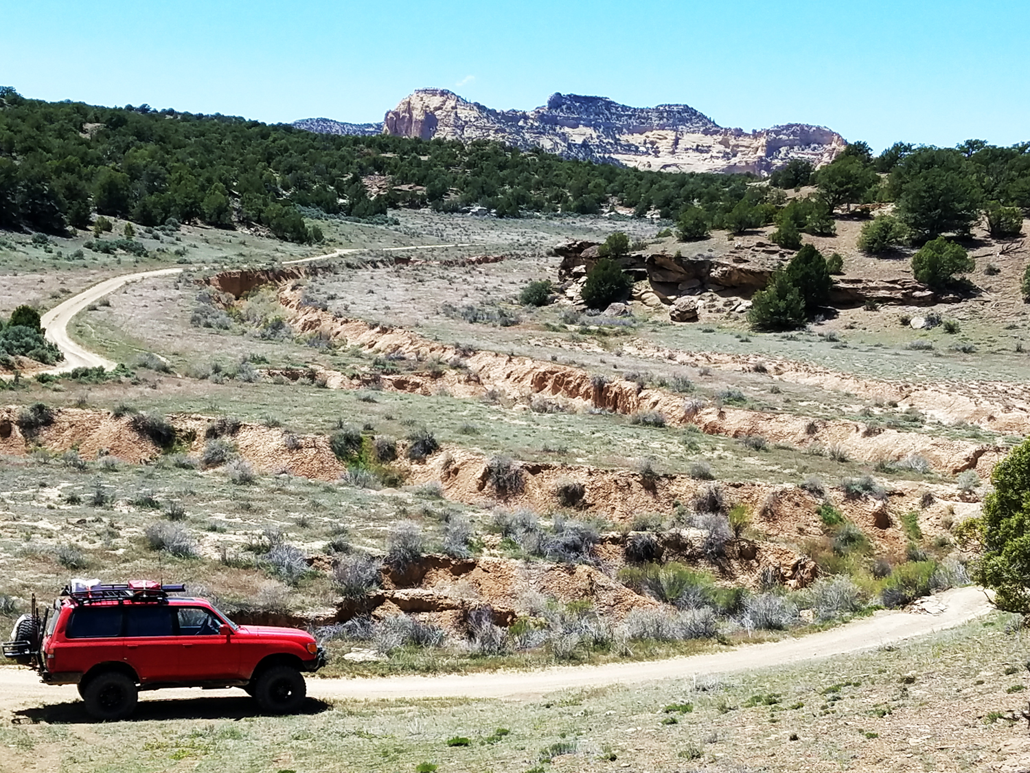
Most of the road are like this and very scenic.
E.
- 20170514_140143Lm.jpg (1.6 MiB) Viewed 1123 times
Since I-70 cut right across the Swell East and West you sometimes find yourself using tunnels under the freeway. Most tunnels are big enough. My vehicle will just make it with an 8x8 foot but I prefer the 9x12 foot ones. There are a few that are too small for an SUV. Just hope you don't find your trail dead ends into one of the these small ones.
F.
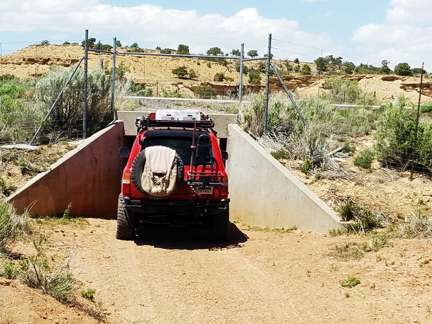
- Good size Tunnel I-70Lm.jpg (1.36 MiB) Viewed 1120 times
G. Partway through the west side tunnel.
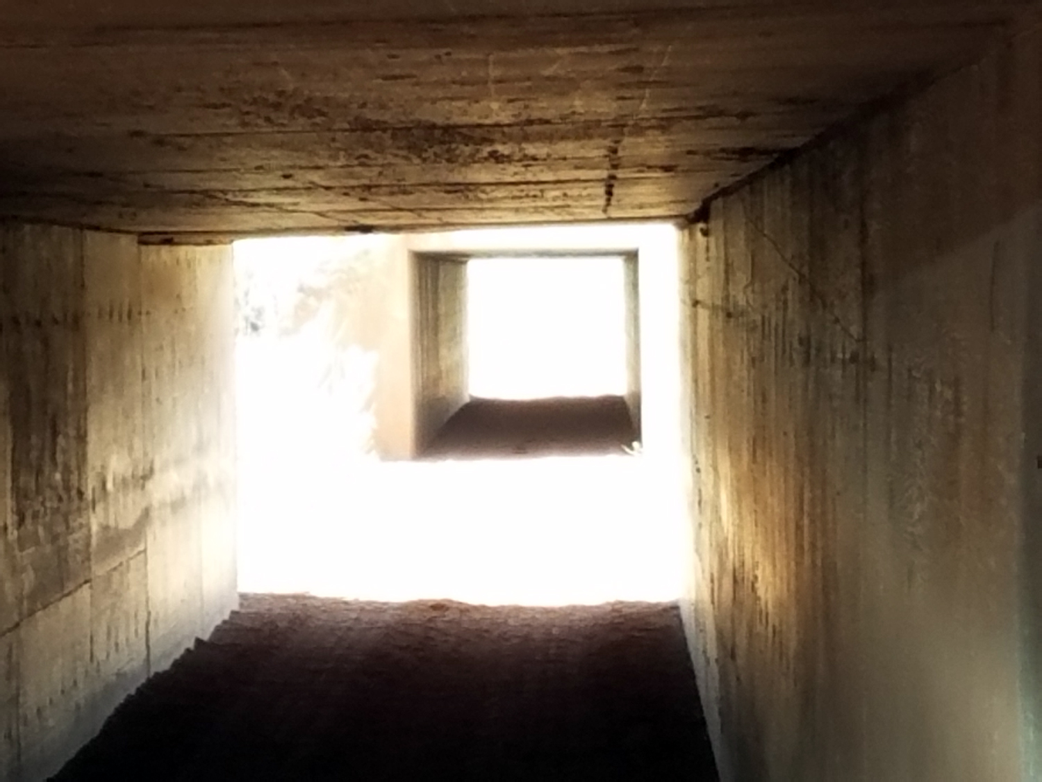
- In the I70 TunnelLm.jpg (569.8 KiB) Viewed 1120 times
You can camp almost anywhere in the San Rafael Swell. There are some great remote areas.
H.
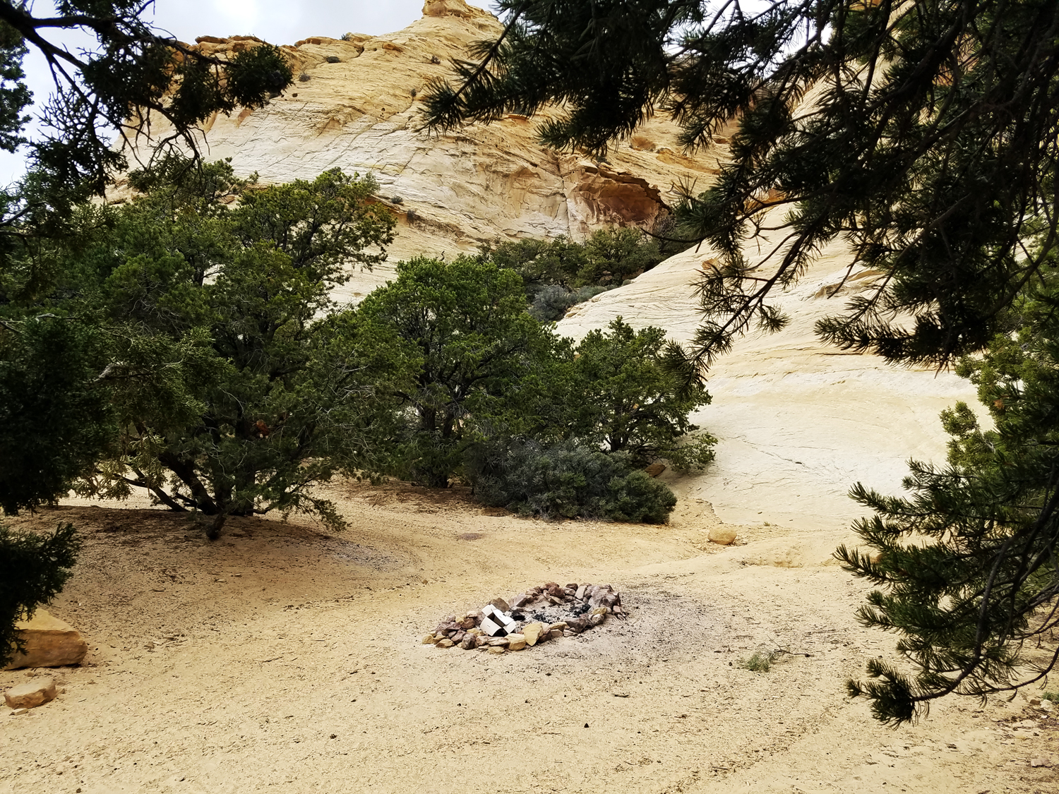
- One of many campsitesLm.jpg (1.96 MiB) Viewed 1120 times
There is only one bridge across the San Rafael River. It is also where a primitive camp ground exsists with pit toilets. Fuller Bottom is a place to ford the river. But not the day of this picture!
I.
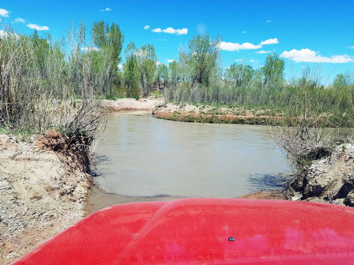
- Fuller BottomLm.jpg (1.61 MiB) Viewed 1120 times
Goblin State Park is just off the Southwest corner of the Swell. They have a camp grounds with pads.
J.
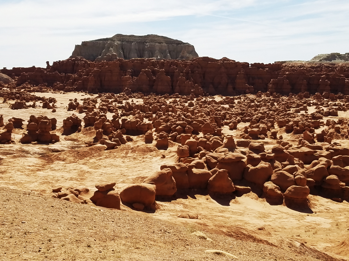
- SanRafaelSwell02m.jpg (1.09 MiB) Viewed 1120 times
A must have for the trip is the National Geographic San Rafael Swell Map #712. This map has a full UTM grid lines in both directions at 1000 meter intervals. It makes it easy to tell where you are or in conjunction with a GPS where you want to go.
K.
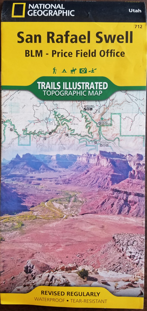
- Nat Geo Map s300 - Copy.jpg (222.44 KiB) Viewed 1142 times
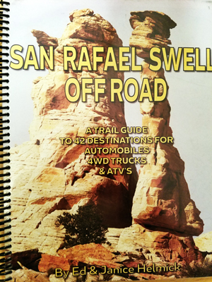
A very useful book is the San Rafael Swell Off Road by Ed & Janice Helmick
Sub title: A trail Guide to 42 Destinations for Automobiles 4WD Trucks & ATV's
L.
- SwellOffRoadEdHelmicks.jpg (197.93 KiB) Viewed 1142 times
Both the book and map can be ordered as a package deal at
https://www.4x4training.com/w/product/s ... uide-book/


