#72 Torrey Pines
4 miles | +385’
- 96FBB215-8708-417C-990F-BBF8400DB0F6.jpeg (311.75 KiB) Viewed 153215 times
- 292D3991-94F7-4161-B443-4E688C57B2A2.jpeg (380.45 KiB) Viewed 153215 times
- 1A4CCA80-8932-498E-9915-3DD270573B2E.jpeg (547.58 KiB) Viewed 153215 times
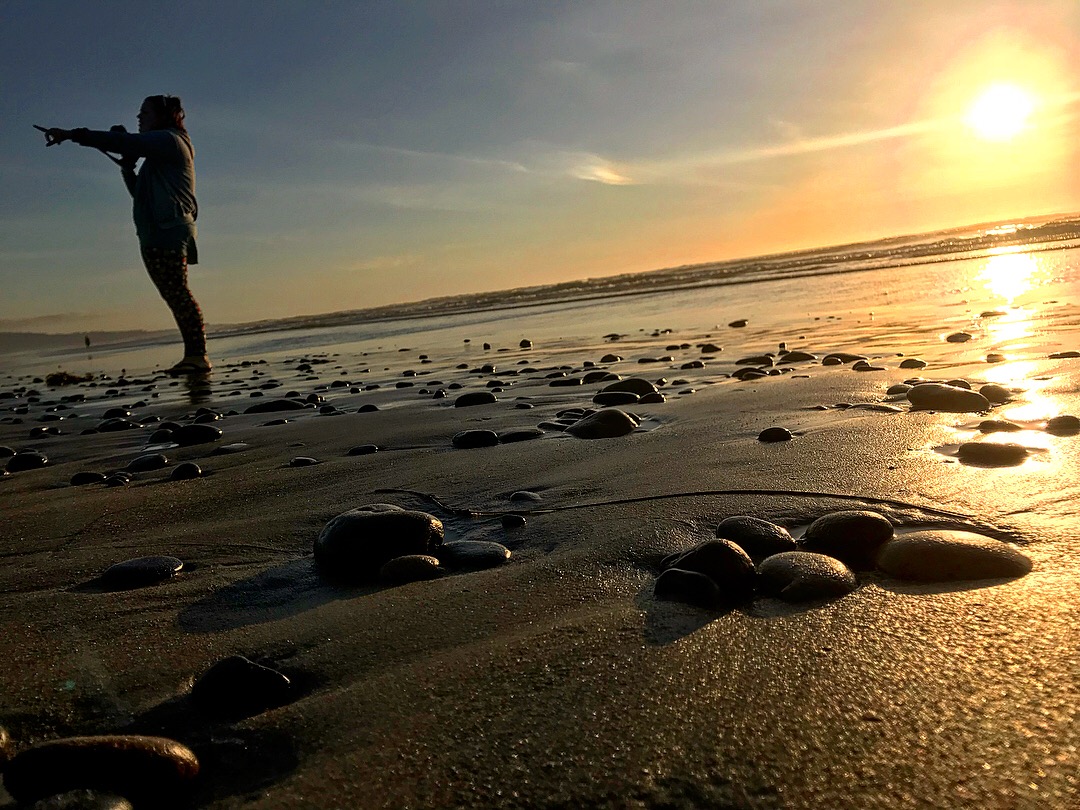
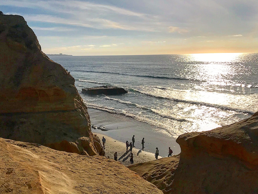
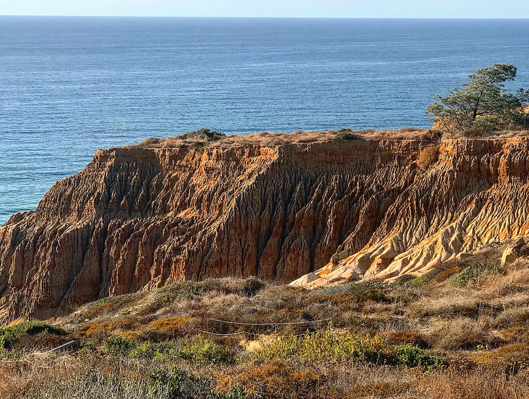
Exploring some of the coastal bluffs while the family relaxes on the beach.
#73 Hot Springs Mountain
10.5 miles | +2500’
- 91401B0A-963C-4840-9E45-E388C4CD2B7E.jpeg (3.66 MiB) Viewed 153215 times
- 3D2760FD-7A40-44A2-8DB9-DA907C43EC79.jpeg (2.89 MiB) Viewed 153215 times
- 2449BA63-CE47-4ABE-938C-8C0EDA6CB807.jpeg (3.16 MiB) Viewed 153215 times
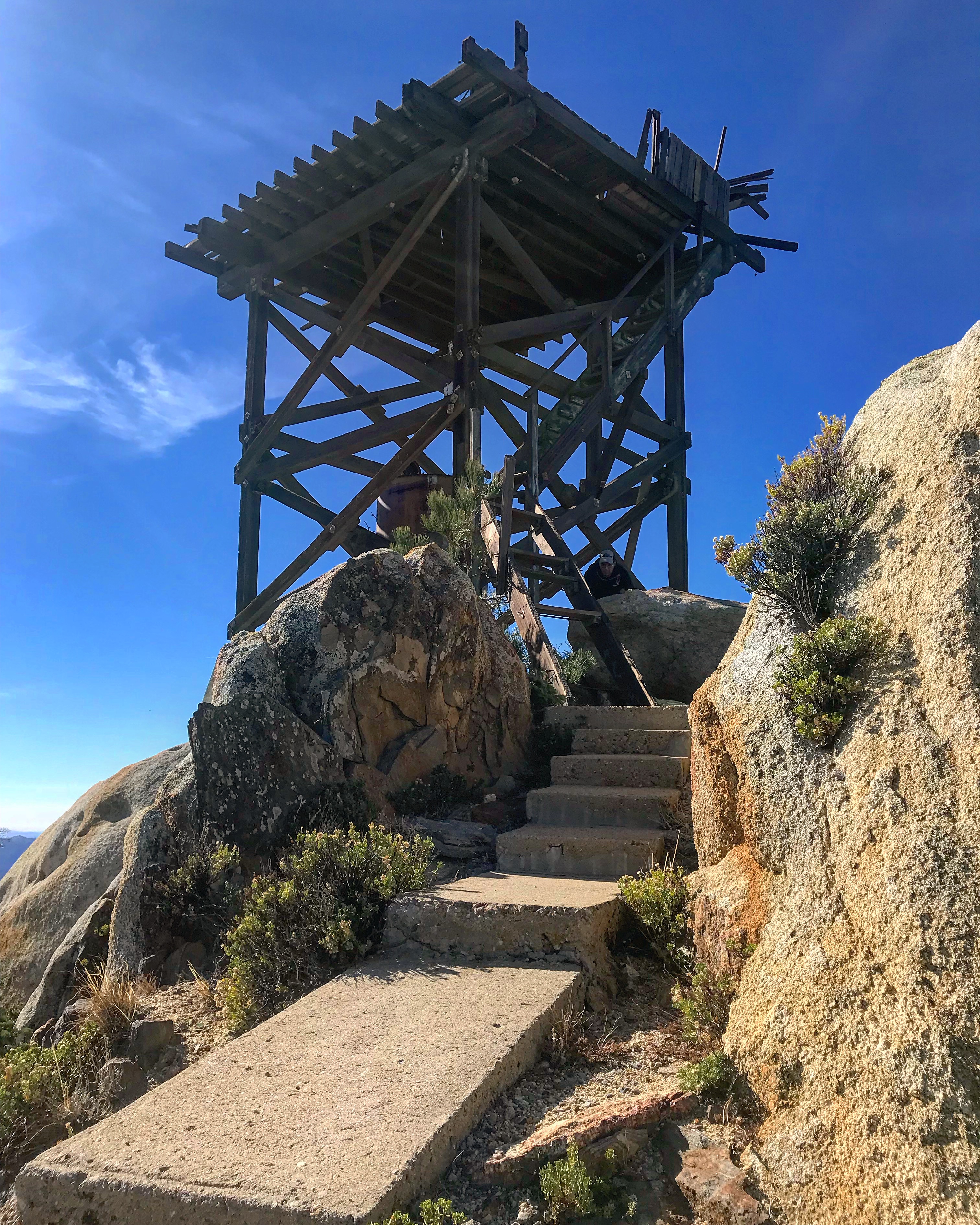
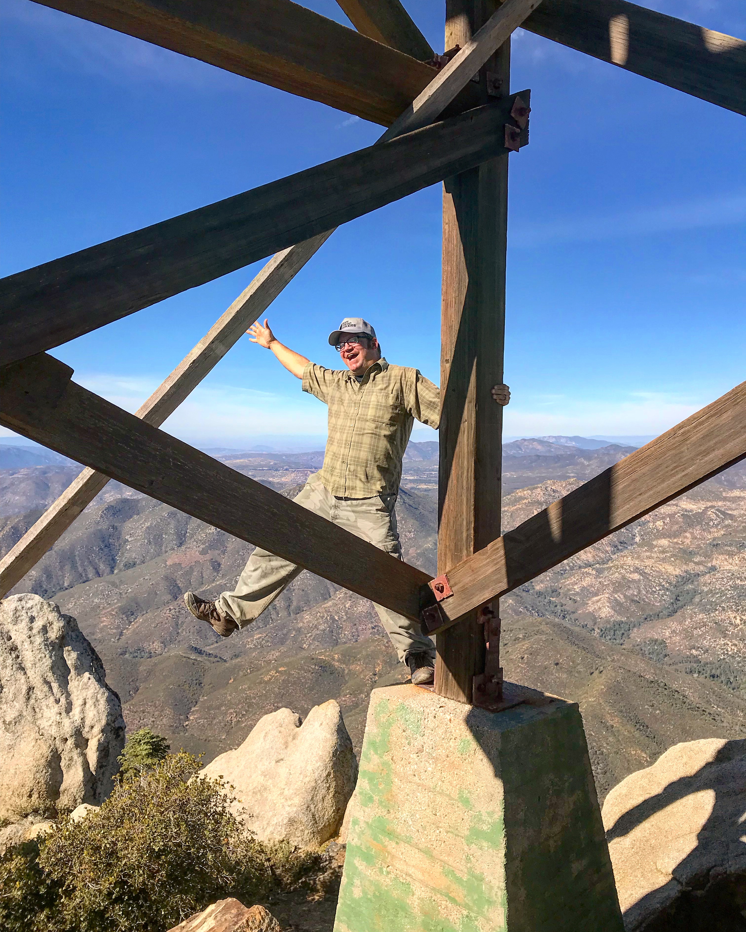
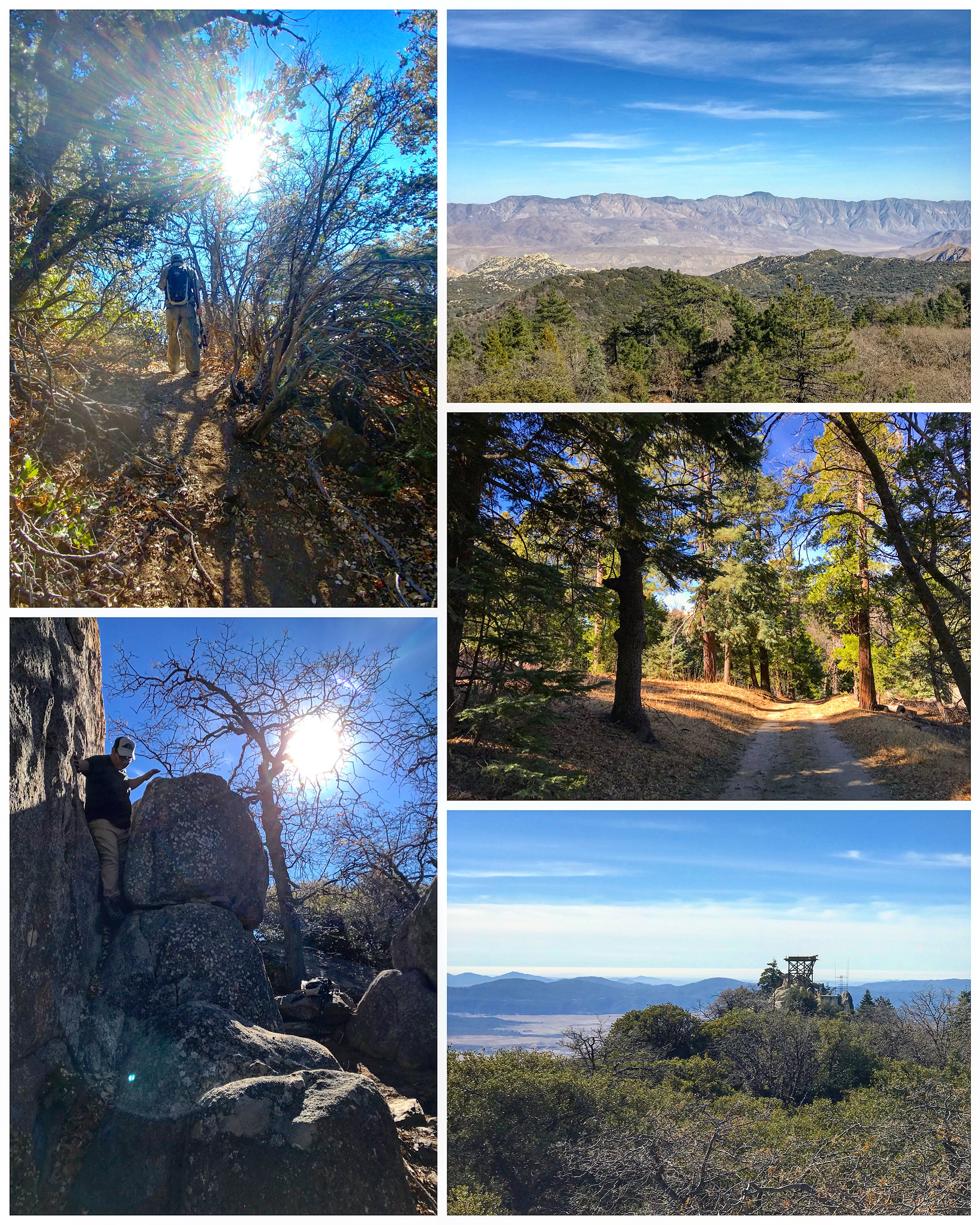
Finishing up the 2017 hiking season with a trek up to the highest point in San Diego County. Located within the Los Coyotes Indian Reservation at an elevation 6533 feet, Hot Springs Mountain beats the better-known 6512 foot Cuyamaca Peak by a whisker.
Clear skies gave us phenomenal views all around. Dawn, Rabbit, and Villager Peaks to the east; Mt. San Jacinto and San Gorgonio Mountain to the north; Woodson and Iron Mountain, as well as all five Mission Trails peaks to the west; and Middle, Cuyamaca, and Stonewall Peaks to the south. Whenever we get some snow out here, I’d like to return to this summit.
The original tower atop Hot Springs Mountain went into service in 1912. A second structure replaced the original in 1928. The current cab and tower were built in 1942. The elements have not been kind to it and what remains is a dilapidated structure. East of the old lookout tower, you can climb a little higher through chaparral and oaks to reach the county’s true high point; a flat concrete platform on top of a large boulder.
2017 was quite an adventurous year! I hiked a total of 385.5 miles. All it took was putting one foot in front of the other.

