Checking out the Carson & Colorado RR Tunnel
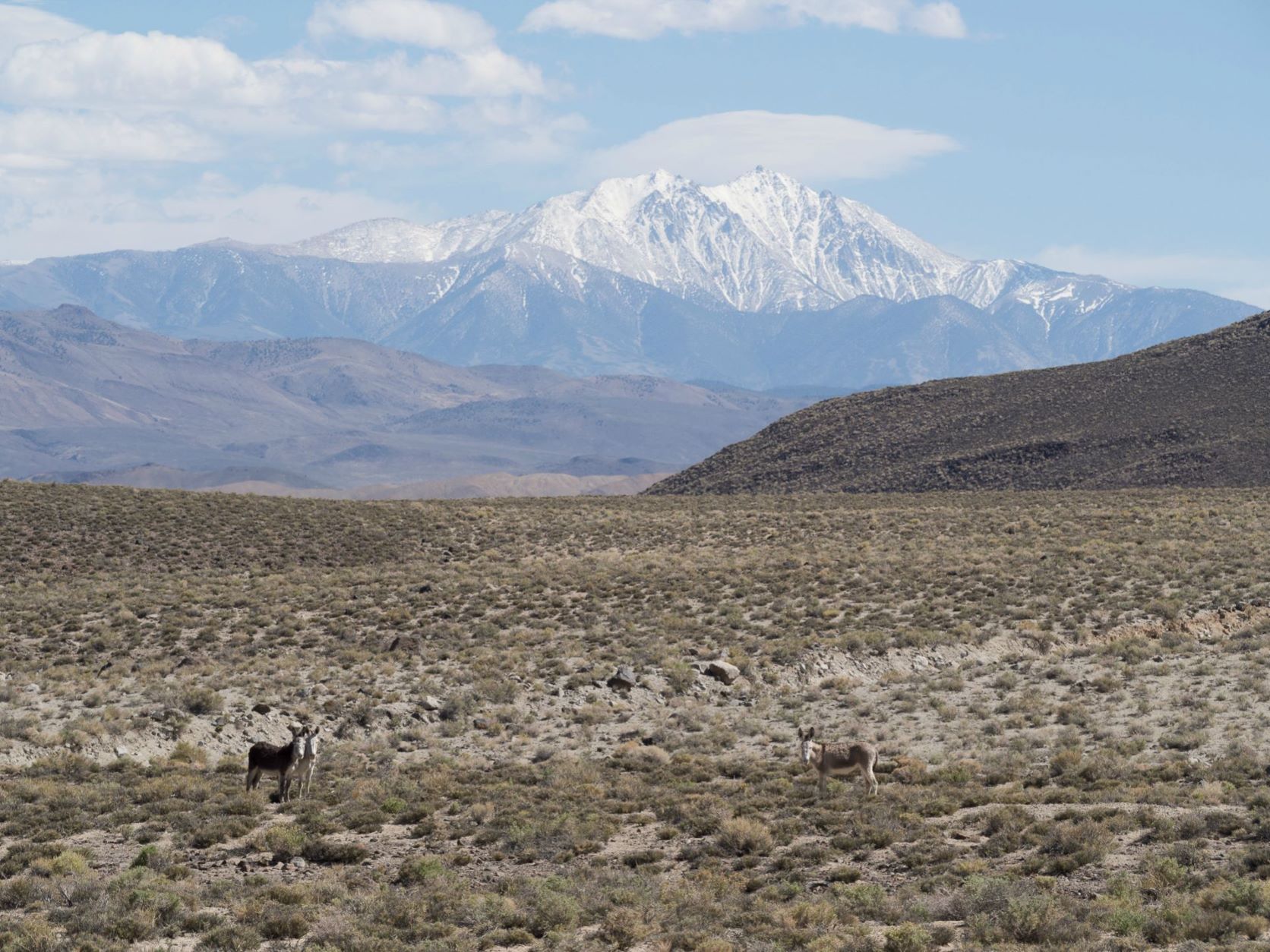
- Boundry Peak & Montgomery in back ground from Teals Marsh.jpg (347.74 KiB) Viewed 686 times
Overview
• Good one day trip or combine with others for an overnight
• Only one tunnel in 300 miles of RR
• In the Montgomery Mountains on the CA & NV border
• Turn off is 50 miles from Bishop CA on US 6
• Turn right at N37 58.338 W118 19.785 and look for trail (aka Rail Road bed)
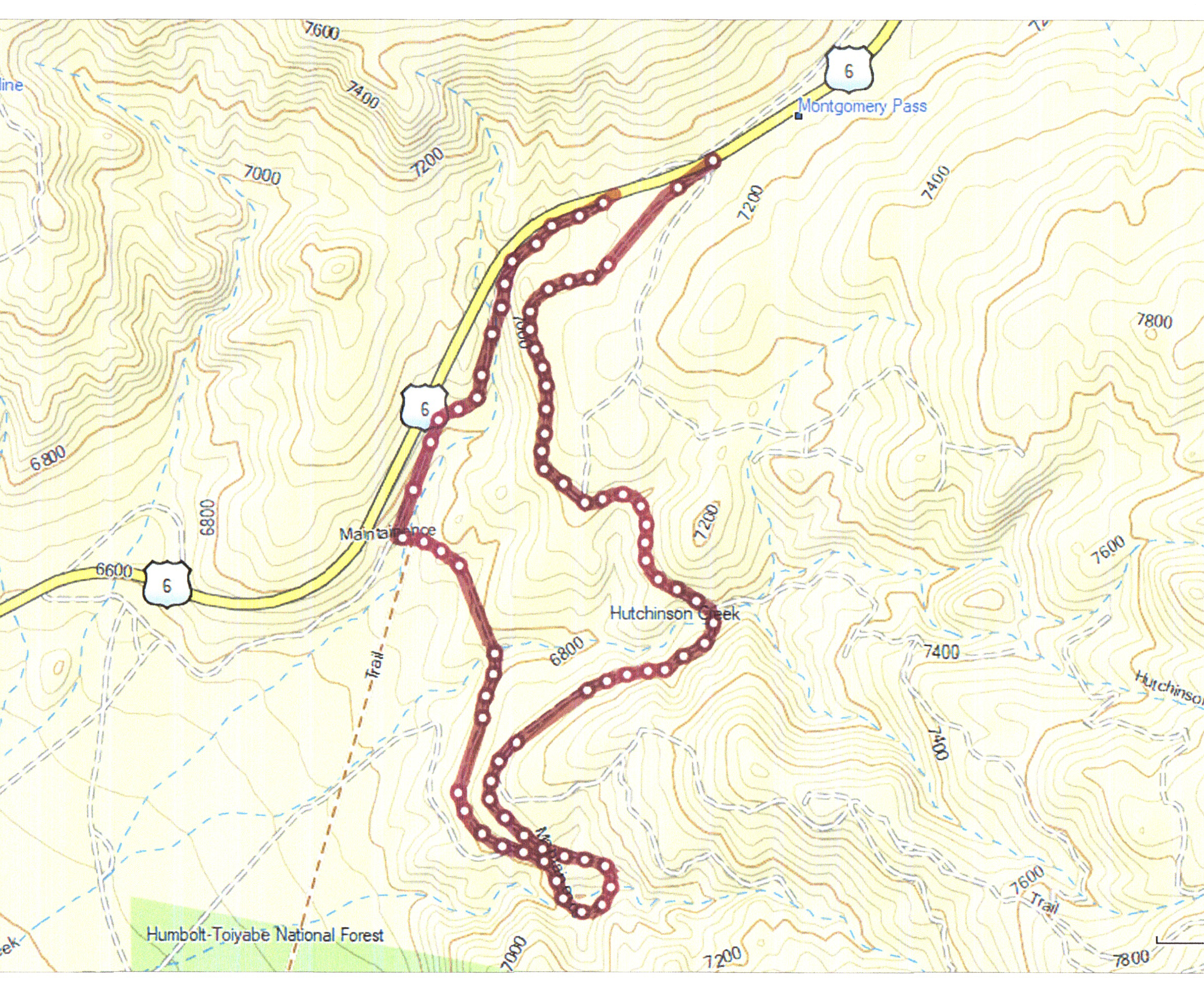
- C&C Tunnel Route .jpg (4.24 MiB) Viewed 686 times
History of the Carson & Colorado railroad
The C & C began operation in August 1883. Interestingly it was owned by the Virginia and Truckee RR (V&T) – a short line serving the Comstock mining district in the Carson City and Virginia City NV area.
To save money, it was designed as a narrow gauge (3 ft. wide) railroad. Covering about 300 miles, the railroad ran from Mound House, Nev. to Keeler, Calif. Its primary function was to haul the vast minerals, mainly gold and silver, from the mines in Nevada. It also served the Ranchers and farmers hauling agriculture products to markets in the east.
The rail line climbed to more than 7,100 feet as it worked its way through Montgomery Pass. It is there that engineers cut the only tunnel to maintain about a 2% grade needed for the route. (It is that tunnel that is the focus of a recent expedition.)
The name C&C came from the original plan to build the railroad from the Carson River to the Colorado River.
Southern Pacific purchased the C & C railroad in 1900, and in 1905 converted 140 miles of track in Nevada to standard gauge. Most of that track was abandoned in the 1930s and ’40s. The final run on the narrow-gauge track occurred on April 29, 1960.
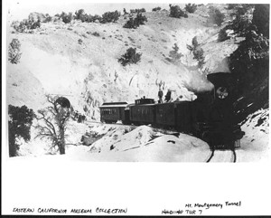
- Train near tunnel (Courtesy of Eastern California Museum) .jpg (24.82 KiB) Viewed 686 times
Route to the C & C railroad tunnel
Thanks to Roger Mitchell’s guide book Great Basin SUV Trails Vol. II, I mapped out a route from Bishop, Calif., to the tunnel. [Note: you can reach the start of the trail head from Tonopah, NV also.]
It proved to be just as interesting as I imagined. It’s a relatively short drive (as four wheeling goes), and the trail is in good shape.
The drive from Bishop to the trail head took about an hour. We drove US6 for about 50 miles to a point near [N37 58.338 W118 19.785] where the old railroad bed crosses the highway almost at the top of Montgomery Pass.
Although the trail is in pretty good shape, you definitely need a 4WD vehicle. Driving was smooth overall, though you need to use compression braking while changing grade in the mountain passes
I was continually amazed at the condition of the trail, especially over old washes. Engineers many years ago filled in and leveled those sections. The fill, 10-15 deep in places, was just as solid and stable as the day it was built. It’s a testament to their engineering and construction ability.
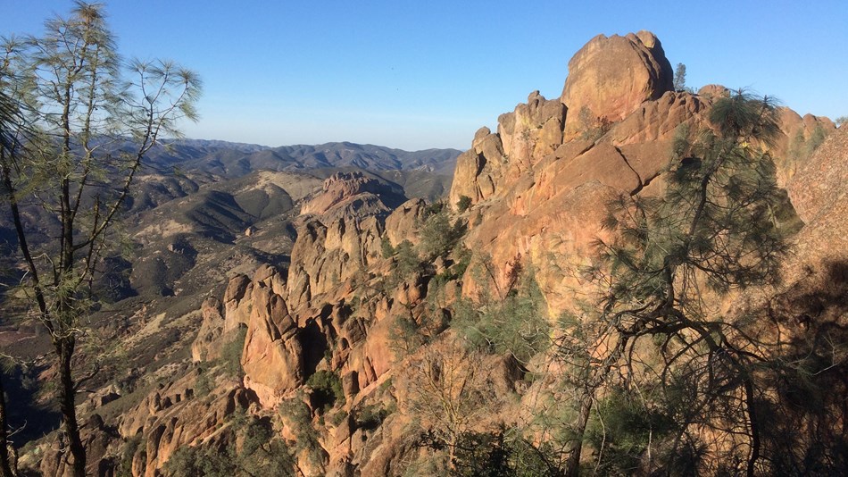
The north end of the tunnel is about 2.2 miles in. We were there in 45 minutes. There were some truly awesome views of the White Mountains and Sierra Nevada Mountains on the way in. The tunnel can no longer be safely entered.
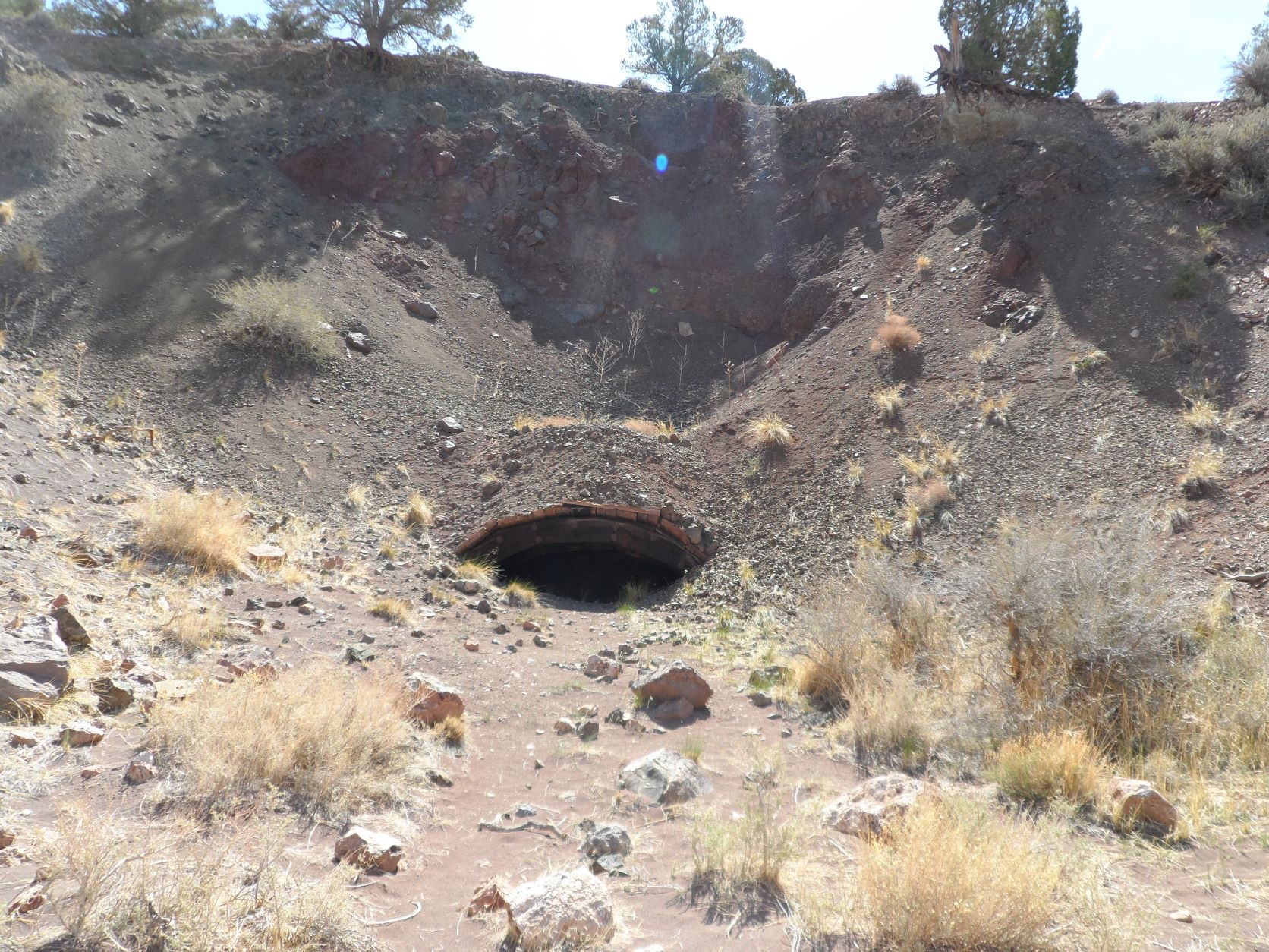
- Other end of the tunnel.jpg (590.93 KiB) Viewed 686 times
By traversing down a steep bypass, we dropped to the lower RR bed as it winds out of the south entrance on the mountain contours. A very short drive put us at the south entrance.
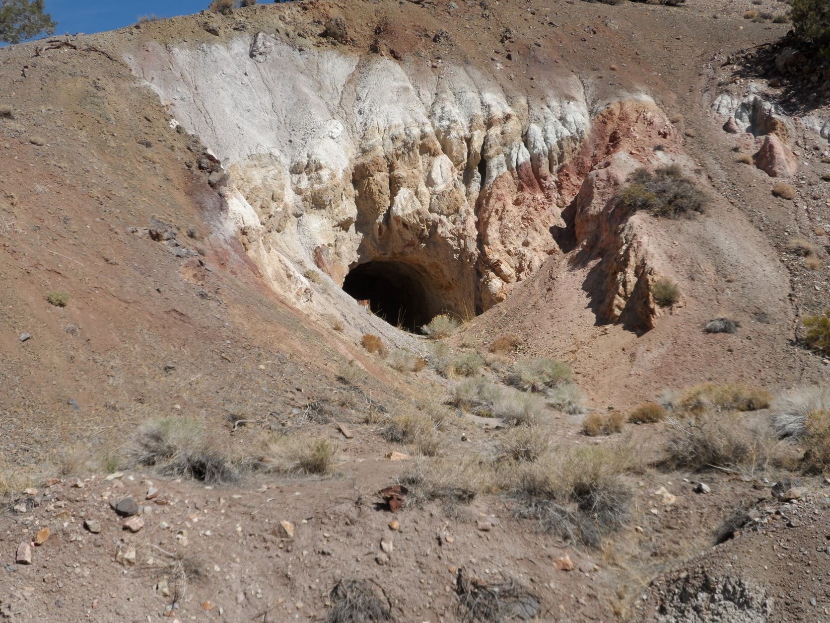
- Open end.JPG (503.98 KiB) Viewed 686 times
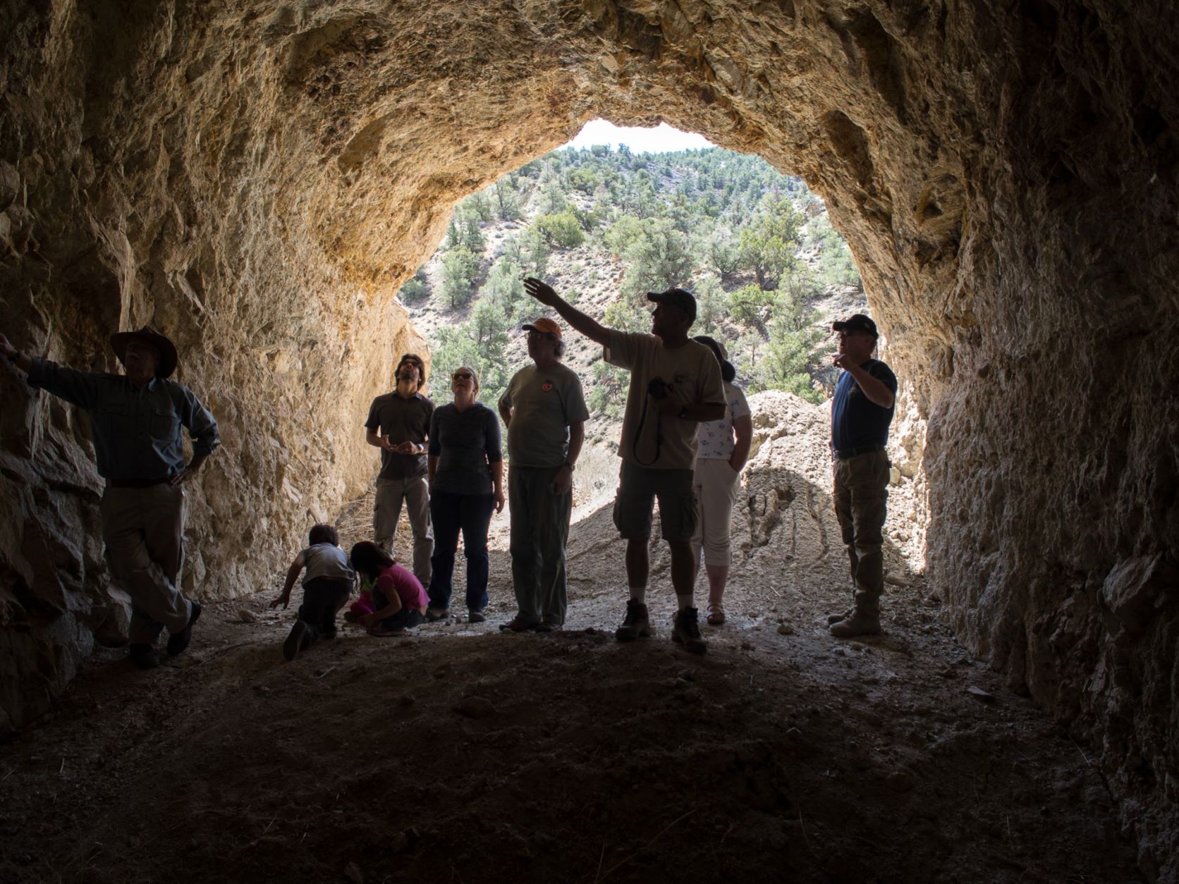
- In the Tunnel.jpg (374.96 KiB) Viewed 686 times
We chose not to retrace out path but follow the south bound RR bed until in came out again on the highway.
Total distance to and from the highway was about 4.5 miles. We averaged around 3 mph, so the railroad part of the trip took about 90 minutes. But that includes stops for picture taking and walking around. After returning to the highway, we headed back to Bishop.