Unique and Unusual Destinations
NOTE: Our first session did not allow us to cover all of the unique locations listed in this net preview. So we have opend up a second session for the September 7, 2023 net in order to cover them all.
With the almost unlimited number of great places to visit in America, it is no surprise that there are a lot of unique and unusual destinations that are mostly unknown, but standout for their one-of-a-kind attractions. And, it is also no surprise that these places are what draw you back for another visit, and the ones that stand out the most in your memories. We all have 'em, and with some luck, we hope to highlight as many as time will allow during this net. If you have one, or more, let us know. A description is good, but pictures really help make the discussion better.
OAUSA Net - 8/24/23 & 9/7/23 - Unique and Unusual Destinations I &II
-
DaveK

- Site Admin
- Posts: 3849
- Joined: Tue Mar 11, 2008 10:33 am
- Call Sign: K6DTK
- Location: American Southwest
OAUSA Net - 8/24/23 & 9/7/23 - Unique and Unusual Destinations I &II
DaveK
K6DTK
Extremism in the defense of liberty is no vice.
Moderation in the pursuit of justice is no virtue.
K6DTK
Extremism in the defense of liberty is no vice.
Moderation in the pursuit of justice is no virtue.
-
DaveK
- Site Admin
- Posts: 3849
- Joined: Tue Mar 11, 2008 10:33 am
- Call Sign: K6DTK
- Location: American Southwest
Re: OAUSA Net - 8/24/23 - Unique and Unusual Destinations
DTK's Picks for Unique and Unusual Destinations.
1. Yuma Territorial Prison
The Yuma Territorial Prison has become a western legend, and for many good reasons. Yuma is famous for many things, and one of them is the FACT that it is one of the hottest places in the country. During the summer time, the temps are regularly above 115 degrees, and when the prison was in operation, Yuma was a remote and desolate location, making escapes rare and very dangerous. In a dramatic departure from today's prisons, the prisoners at the YTP were forced to actually build the prison and live in the extreme conditions of the Yuma Desert.
The Yuma Territorial Prison website (http://www.yumaprison.org) recounted the reasons why the Prison was nicknamed "the Hell Hole":
Among it's many unique features, the YTP had a library of over 2000 books, electricity from an house boiler room generator, forced air ventilation, blacksmith and carpenter shops, shoe and tailor shop, and even a band.
Here are some current pictures of the actual Prison. These are the original buildings and cells.
Entrance
Cell Row
Cells
Dark Cell
Guard Tower
ONE OF THE MOST FAMOUS PRISONERS
“Buckskin” Frank Leslie
Worked for Wyatt Earp at the Oriental Bar - Tombstone, Arizona.
Killed Billy Clairborne of the Clanton Gang.
Killed his girlfriend in a drunken rage.
Wyatt Earp was reputed to have said: " Leslie was the only man who could compare to Doc Holiday's blinding speed and accuracy with a six gun."
2. Camp Cajon
For most travelers on Highway 15, for those who live in the communities of Victorville and Barstow, and for the residents of the counties of San Bernardino and Riverside, you are familiar with the Cajon Pass. While today the Pass is known as a steep hill that often is closed down in inclement weather, it was not always so. Many years ago, the pass did not have the 4 lane freeway of today, nor was it as easy to traverse as it is today. Over 100 years ago the road was known as the National Old Trails Road (later to become Route 66), and the Cajon Pass was the final obstacle that southbound travelers had to negotiate before arriving at their Southland destinations. Back then, in order to finally arrive at what is now known as the Cajon Pass, travelers had to endure the long trip through the Mojave Desert over roads that were nothing like the freeways we enjoy today.
So, in 1919, William Bristol, a local citrus grower, decided to create a rest stop for weary travelers who had just completed the difficult trip through the Mojave Desert and were preparing to descend down the hill to Southern California. Eventually, the area where the rest stop was built, included a Post Office, gas station, picnic grounds, homes, and rental cabins, all of which earned it a national reputation and the official name of, "Camp Cajon." In its heyday, Camp Cajon became known as "The Gateway to Southern California." The interest in Camp Cajon exploded as businesses sprang up, and as fraternal organizations built clubhouses nearby, including the Knights of Pythias , whose castle looking structure is depicted above. Unfortunately, the Knights of Pythias castle was badly damaged in the great flood of 1938, as were most structures. And, since Route 66 was under construction, the Castle, or what remained of it, was torn down in 1939.
Camp Cajon was a product of the time, and as the Country grew and as the the need to widen Route 66 was unavoidable, Camp cajon became the victim. So, in the aftermath of the 1938 flood, which severely damaged Camp Cajon facilities, homes, businesses, and infrastructure throughout the region, County and Road officials decided to close and abandon Camp Cajon.
Few traces of the original Camp Cajon exists today, but in 2019, 100 years after its founding, the Camp Cajon Project dedicated a monument to the once famous camp. Information, including some excellent pictures of the original camp, along with information on the Monument and its location: can be found here:
3. The Plank Road of Imperial Valley
The story of the Plank Road began with the era of automobile transportation and the growing rivalry of two Southern California cities, San Diego and Los Angeles. Just as railroad towns owed their financial well-being to rail commerce, so would communities linked by good roads benefit from the automobile. Civic and business leaders quickly perceived the benefits of bringing routes and roads to their communities. Having lost a bid to become a terminus for the transcontinental railroad, San Diego was determined to beat Los Angeles to become the hub of the Southern California road network.
Plank Road upkeep proved difficult, and a permanent maintenance force was stationed near Gray's Well. From 1916 to 1926, crews of workmen struggled incessantly against nature to keep the road passable. Hard winds blew drifting sand across the road an average of two or three days a week, rendering the road nearly impassable about one-third of the time. The crew routinely worked the road with Fresno scrapers hitched to a team of draft animals, and travelers huddled in their vehicles while the sand swirled around them.
The days of the Plank Road were numbered. The twin headaches of maintenance and traffic flow required a better solution. Suggestions ranged from digging a tunnel under the sand to elevating a structure above it. The State Highway Commission received unsolicited advice, while Highway Engineers studied the problem of attaching a traversable surface to an unstable roadbed. In 1924 the Commission tested a new, improved Plank Road which would permit two-way traffic to cross the dunes.
From 1923 to 1925, engineers monitored the movement of sand dunes adjacent to the Plank Road and tested various surfaces. After concluding that hills of sand over 100 feet high moved very slowly and only the lower dunes moved rapidly, it was determined that a permanent pavement road was indeed possible providing the grade was sufficiently raised.
With an engineering solution at hand, the Highway Commission decided on an asphaltic concrete surface constructed on top of a built-up sand embankment. The new road, 20 feet wide, officially opened on August 12, 1926. Praise for the highway was mixed with a certain nostalgia for the primitive wooden contraption it replaced. After all, the Plank Road had added a bit of spice to life in the Imperial Valley.
Despite pleas from local residents for preservation, the Plank Road began to disappear: a section to the Ford Motor Company for display purposes, another section to the Automobile Club of Southern California for installation at its Los Angeles headquarters, and another section ripped up to make way for the All-American Canal, and so on. Countless cross ties literally went up in smoke as firewood for campers.
Source: BLM
Source: BLM
Source: BLM
Source: BLM
Source: BLM
Source: City of Yuma
4. Table Top Mountain - East Mojave Desert
Table Top Mountain is one of the higher peaks along the Mojave Road (6100 ft.), and it gets it name from the flat surface of the top of the mountain. There are no trails to the top and no guide books where information can be obtained. The hike to the top is a steep and rough 700 foot ascent, but the views from the top are as spectacular as it gets. Interestingly, while there is no cell service at the bottom of the Mountain, it does exist at the top. Like most peaks, it has a bottle at the top where you can record your trip. For the adventurous camper, there are great rewards to backpacking to the top for an overnight stay for a day or two. Surprisingly, the area contains some dense forests of Juniper trees, making for an ideal location to call home for a brief camping trip.
Table Top
Views from the top
Can you spot our vehicles?
Camping Locations at the top
1. Yuma Territorial Prison
The Yuma Territorial Prison has become a western legend, and for many good reasons. Yuma is famous for many things, and one of them is the FACT that it is one of the hottest places in the country. During the summer time, the temps are regularly above 115 degrees, and when the prison was in operation, Yuma was a remote and desolate location, making escapes rare and very dangerous. In a dramatic departure from today's prisons, the prisoners at the YTP were forced to actually build the prison and live in the extreme conditions of the Yuma Desert.
The Yuma Territorial Prison website (http://www.yumaprison.org) recounted the reasons why the Prison was nicknamed "the Hell Hole":
For all its negatives, the YTP had a remarkably enlightened approach, which we will discuss during the net. The YTP only lasted 33 years, from 1876 to 1909 and during its life, it housed a total of 3,069 prisoners, including 29 women. Over crowding eventually took its toll and the prisoner population was moved elsewhere and again, forced to build another prison.Prisoners feared and loathed the Territorial Prison
"Insufferable heat... that made the place an inferno."
Surrounded by rivers, quick sand and desert in all directions.
An inhuman "Snake Den" and Ball and Chain as standard punishment.
Tuberculosis is #1 Killer
"Impossible to endure, more impossible to escape."
Among it's many unique features, the YTP had a library of over 2000 books, electricity from an house boiler room generator, forced air ventilation, blacksmith and carpenter shops, shoe and tailor shop, and even a band.
- YumaPrisonBand.jpg (88.16 KiB) Viewed 9120 times
Here are some current pictures of the actual Prison. These are the original buildings and cells.
Entrance
- YUMA TP Entrance.JPG (158.03 KiB) Viewed 9182 times
Cell Row
- YUMA TP Cell Row.JPG (136.73 KiB) Viewed 9182 times
Cells
- YUMA TP Cell.JPG (108.22 KiB) Viewed 9182 times
- YUMA TP Cell-2.JPG (132.86 KiB) Viewed 9182 times
Dark Cell
- YUMA TP Dark Cell.JPG (98.13 KiB) Viewed 9182 times
- YUMA TP Dark Cell-2.JPG (125.6 KiB) Viewed 9182 times
Guard Tower
- YUMA TP Guard Tower.JPG (101.73 KiB) Viewed 9182 times
ONE OF THE MOST FAMOUS PRISONERS
- Leslie-photo.jpg (17.83 KiB) Viewed 9182 times
“Buckskin” Frank Leslie
Worked for Wyatt Earp at the Oriental Bar - Tombstone, Arizona.
Killed Billy Clairborne of the Clanton Gang.
Killed his girlfriend in a drunken rage.
Wyatt Earp was reputed to have said: " Leslie was the only man who could compare to Doc Holiday's blinding speed and accuracy with a six gun."
2. Camp Cajon
- Camp Cajon Entrance.jpg (37.23 KiB) Viewed 9165 times
- Cajon Camelot.JPG (416.24 KiB) Viewed 9169 times
- Camp Cajon Picnic Grounds.jpg (123.73 KiB) Viewed 9169 times
For most travelers on Highway 15, for those who live in the communities of Victorville and Barstow, and for the residents of the counties of San Bernardino and Riverside, you are familiar with the Cajon Pass. While today the Pass is known as a steep hill that often is closed down in inclement weather, it was not always so. Many years ago, the pass did not have the 4 lane freeway of today, nor was it as easy to traverse as it is today. Over 100 years ago the road was known as the National Old Trails Road (later to become Route 66), and the Cajon Pass was the final obstacle that southbound travelers had to negotiate before arriving at their Southland destinations. Back then, in order to finally arrive at what is now known as the Cajon Pass, travelers had to endure the long trip through the Mojave Desert over roads that were nothing like the freeways we enjoy today.
So, in 1919, William Bristol, a local citrus grower, decided to create a rest stop for weary travelers who had just completed the difficult trip through the Mojave Desert and were preparing to descend down the hill to Southern California. Eventually, the area where the rest stop was built, included a Post Office, gas station, picnic grounds, homes, and rental cabins, all of which earned it a national reputation and the official name of, "Camp Cajon." In its heyday, Camp Cajon became known as "The Gateway to Southern California." The interest in Camp Cajon exploded as businesses sprang up, and as fraternal organizations built clubhouses nearby, including the Knights of Pythias , whose castle looking structure is depicted above. Unfortunately, the Knights of Pythias castle was badly damaged in the great flood of 1938, as were most structures. And, since Route 66 was under construction, the Castle, or what remained of it, was torn down in 1939.
Camp Cajon was a product of the time, and as the Country grew and as the the need to widen Route 66 was unavoidable, Camp cajon became the victim. So, in the aftermath of the 1938 flood, which severely damaged Camp Cajon facilities, homes, businesses, and infrastructure throughout the region, County and Road officials decided to close and abandon Camp Cajon.
Few traces of the original Camp Cajon exists today, but in 2019, 100 years after its founding, the Camp Cajon Project dedicated a monument to the once famous camp. Information, including some excellent pictures of the original camp, along with information on the Monument and its location: can be found here:
- Forest History Society - https://fhsarchives.wordpress.com/2013/ ... e-station/
- Digital Desert - https://digital-desert.com/camp-cajon/
- Historical Marker Database - https://www.hmdb.org/m.asp?m=208068
3. The Plank Road of Imperial Valley
The story of the Plank Road began with the era of automobile transportation and the growing rivalry of two Southern California cities, San Diego and Los Angeles. Just as railroad towns owed their financial well-being to rail commerce, so would communities linked by good roads benefit from the automobile. Civic and business leaders quickly perceived the benefits of bringing routes and roads to their communities. Having lost a bid to become a terminus for the transcontinental railroad, San Diego was determined to beat Los Angeles to become the hub of the Southern California road network.
Plank Road upkeep proved difficult, and a permanent maintenance force was stationed near Gray's Well. From 1916 to 1926, crews of workmen struggled incessantly against nature to keep the road passable. Hard winds blew drifting sand across the road an average of two or three days a week, rendering the road nearly impassable about one-third of the time. The crew routinely worked the road with Fresno scrapers hitched to a team of draft animals, and travelers huddled in their vehicles while the sand swirled around them.
The days of the Plank Road were numbered. The twin headaches of maintenance and traffic flow required a better solution. Suggestions ranged from digging a tunnel under the sand to elevating a structure above it. The State Highway Commission received unsolicited advice, while Highway Engineers studied the problem of attaching a traversable surface to an unstable roadbed. In 1924 the Commission tested a new, improved Plank Road which would permit two-way traffic to cross the dunes.
From 1923 to 1925, engineers monitored the movement of sand dunes adjacent to the Plank Road and tested various surfaces. After concluding that hills of sand over 100 feet high moved very slowly and only the lower dunes moved rapidly, it was determined that a permanent pavement road was indeed possible providing the grade was sufficiently raised.
With an engineering solution at hand, the Highway Commission decided on an asphaltic concrete surface constructed on top of a built-up sand embankment. The new road, 20 feet wide, officially opened on August 12, 1926. Praise for the highway was mixed with a certain nostalgia for the primitive wooden contraption it replaced. After all, the Plank Road had added a bit of spice to life in the Imperial Valley.
Despite pleas from local residents for preservation, the Plank Road began to disappear: a section to the Ford Motor Company for display purposes, another section to the Automobile Club of Southern California for installation at its Los Angeles headquarters, and another section ripped up to make way for the All-American Canal, and so on. Countless cross ties literally went up in smoke as firewood for campers.
Source: BLM
- Plank Road-2 BLM.jpg (28.28 KiB) Viewed 9169 times
- Plank Road-3 BLM.jpg (61.82 KiB) Viewed 9169 times
- Plank Road-4 BLM.jpg (63.56 KiB) Viewed 9169 times
- Plank Road-1A.jpg (154.6 KiB) Viewed 9169 times
- Plank Road-A.png (179.83 KiB) Viewed 8787 times
4. Table Top Mountain - East Mojave Desert
Table Top Mountain is one of the higher peaks along the Mojave Road (6100 ft.), and it gets it name from the flat surface of the top of the mountain. There are no trails to the top and no guide books where information can be obtained. The hike to the top is a steep and rough 700 foot ascent, but the views from the top are as spectacular as it gets. Interestingly, while there is no cell service at the bottom of the Mountain, it does exist at the top. Like most peaks, it has a bottle at the top where you can record your trip. For the adventurous camper, there are great rewards to backpacking to the top for an overnight stay for a day or two. Surprisingly, the area contains some dense forests of Juniper trees, making for an ideal location to call home for a brief camping trip.
Table Top
- Table Top Mtn..JPG (116.56 KiB) Viewed 9169 times
Views from the top
- IMG_0493 Re-Framed.jpg (71.73 KiB) Viewed 9169 times
- IMG_0508 (Large).JPG (101.78 KiB) Viewed 9169 times
- IMG_0516 (Large).JPG (94.97 KiB) Viewed 9169 times
- IMG_0524 (Large).JPG (73.63 KiB) Viewed 9169 times
Can you spot our vehicles?
- IMG_0519 (Large).JPG (220.52 KiB) Viewed 9169 times
Camping Locations at the top
- IMG_0503 (Large).JPG (176.47 KiB) Viewed 8842 times
- IMG_0491 (Large).JPG (131.43 KiB) Viewed 8842 times
DaveK
K6DTK
Extremism in the defense of liberty is no vice.
Moderation in the pursuit of justice is no virtue.
K6DTK
Extremism in the defense of liberty is no vice.
Moderation in the pursuit of justice is no virtue.
-
DaveK
- Site Admin
- Posts: 3849
- Joined: Tue Mar 11, 2008 10:33 am
- Call Sign: K6DTK
- Location: American Southwest
Re: OAUSA Net - 8/24/23 - Unique and Unusual Destinations
5. Cow Cove - Eastern Mojave Desert
The Eastern Mojave desert is a vast area with features and history that are not on any maps or park brochures. For the diligent adventurer, they can be found, but often requiring much research and effort, usually in the form of hiking. Unlike parks such as Yosemite, where just about everything is catalogued and placed in books or park handouts, such is not the case with the Mojave Desert. Finding unusual or unique things sometimes boils down to just exploring, sometimes by foot, sometimes by 4WD, or sometimes by finding residents who are willing to share their knowledge. Some of my most interesting finds have been with the help of "old timers" whose trust I have gained.
The Mojave desert has been inhabited and traveled by many groups, including Indians, cowboys, miners, bandits, ranchers, settlers, religious groups, and explorers. In many cases, the Mojave was just a place to be endured in traveling to a more hospitable place to call home, or where more game was abundant. The East Mojave is just such a place. The remnants or evidence of previous inhabitants is to be found, but usually, when you know where to look.
Cow Cove is such a place. In centuries past, certain Indian tribes inhabited this area, leaving behind a form of expression and perhaps a language, known today as petroglyphs. Cow Cove is no longer accessible by vehicle, but the 4WD trail that passes nearby gets you within a couple of miles of the site. Hiking required.
The Hike to Cow Cove
The Petroglyphs
6. Old Wooden Railroad Tunnels
The days of wooden railroad tunnels or trestles have clearly passed. Some of the most fascinating places to explore are old railroad trestles and tunnels that were constructed from wood. To the extent that they are still standing, it is quite a testament to the ingenuity and engineering techniques that were used over 100 years ago. A perfect example of this is the San Diego and Arizona Railroad which was constructed between 1907 and 1917. The most difficult part of the RR was that portion which traveled though the Carrizo Gorge, in the California Desert. In order for the RR to continue its intended route from San Diego to El Centro, the engineers had to excavate and support over 15 tunnels in the Carrizo Gorge, all of which were supported by a wooden structures.
The history of the SD&A RR is one of disasters, catastrophes, and misfortunes, with the result being intermittent operations. Even until rather recently, there were plans to rehabilitate the railroad for commercial purposes. Despite high hopes, the SD&A RR still is not fully operational and depending on the efforts to rebuild, there are times when walking the tracks to explore the tunnels may or may not be allowed. When it is allowed, it is a fascinating look back in history. The mere fact that these trunnels are still standing says quite a lot about the quality of the engineering.
Several Of The Tunnels Supported By A Wooden Structure.
Collapsed Tunnel (due to a landslide, not a failure of the wooden structure)
7. Water holes Canyon
Water Holes Canyon is located in the Glen Canyon National Recreation area and specifically, on Navajo Nation land. See: http://www.summitpost.org/waterholes-canyon/716826 . Waterholes is very similar to Antelope Canyon but without the crowds. There are essentially, 2 different levels of difficulty, the easiest being the most spectacular. The other level requires some form of canyoneering (rapelling) skills and the equipment to go along with the skills.
The Navajo have established a great tour, which is about 2 miles in length, and requiring about 2+ hours to complete. Our tour had about 10 people and we were allowed to spend as much time as it took to soak it all up and take pictures. By comparison, as we passed the Antelope Canyon area, there were literally hundreds and hundreds of people, and parking lots filled with cars. Bottom line: Water Holes = a good choice.
The Slot Canyons in Water Holes.
10. Town of Oatman, Arizona
Gold mining ghost towns are a significant part of our history. In so many ways they are an insight into America, from the incredible fascination with the glittering valuable mineral to the extreme lengths miners would go to find their strike. Many areas, and many states, owe a great deal to the discovery of gold for it's ability to populate the west. The prospect of great wealth was enough of an incentive for thousands to pack up and leave home. Every gold mining town has it's own unique story, but they all shared one thing - the prospect of "the big strike"!!! And, it brought them in by the tens of thousands.
Arizona had it's share of gold strikes, but the most famous, and the one that produced more than any other, in the State of Arizona, was from the City of Oatman. It is often referred to as a ghost town, but it doesn't really seem to fit that definition. At its peak, Oatman had a population of around 10,000, but today, and for quite a few years, it has had a population of a hundred or so residents. It exists today mostly as a tourist attraction, but there is still active mining going on.
The first gold was discovered in 1863 (in the middle of the Civil War) by a prospector named Johnny Moss. Two of the claims that he staked were the Moss mine (named after himself) and the Oatman Mine (named after Olive Oatman, whose name was eventually used as the permanent name for the town.) An official town, although comprised mainly of tents, began to form in the very early 1900s, and was then known as Vivian, (after the Vi-vian Mining Company.) In 1909 Vi-vian changed it's name to Oatman, in honor of Olive Oatman.
The origin of the Oatman name is interesting, and, as mentioned above, in honor of Olive Oatman. Oatman was a young Illinois girl who had been captured by Indians during their pioneering trip west 1851. During this captivity she was forced into slavery by her Indian captors. She was later traded to Mojave Indians who adopted her as a daughter, but later released her in 1856 at Fort Yuma. This is a picture of her as an adult (date unknown). Note the chin tattoo, a custom amongst the Mojave Indians.
Gold mining in and around the Black Mountains, where Moss made his original claims, had it's ups and downs until the early 1900s, when things really heated up. The real gold boom began around 1904 and continued until around 1930. During this period, estimates put Oatman's gold production at about $36 million, at the then government controlled price of $20.00 an ounce. Every new strike drew more and more people to the city.
This is a picture of Oatman taken around 1921, before the big fire, which destroyed most of the town. Given its gold production, the town was later rebuilt:
Oatman, today, serves mainly as a tourist destination, with one of its main attractions (in addition to its impressive history) being the wandering, tame burros, which populate the town. Vendors sell burro food (whatever that is) and tourists can be seen hand feeding the critters, who have come to expect it. The burros are "wild" (or as wild as you can get under these circumstances) and nobody rounds them up at night. One word of caution if you visit Oatman - watch where you step!!!
Here are some pictures of the town as it exists today:
On the "dirt road" to Oatman
The Town Today
The Oatman Hotel
The Oatman Hotel was built in 1902 and is the largest two story adobe building in Mojave County. It's greatest claim to fame, other than it was one of the very few buildings that escaped the fire of 1921, is the legend that it was the Honeymoon location for Clark Gable and Carol Lombard in 1939. Today it is no longer used as a Hotel, but rather as a museum on the top floor and a restaurant and bar on the ground floor.
Oatman is located about a 45 minute drive from Laughlin, Nevada / Bullhead City Arizona. To do justice to the town, you should give it a day, as there is a lot to see and do. There are two roads that lead to the town from the Bullhead City area - one dirt and one paved. Both are 2WD roads, but the dirt road will jar you a bit. Well worth the trip.
11. Mojave Lava Tube
The California Mojave Desert, and in particular the Eastern Mojave Desert have large areas of past volcanic activity. In the area now known as the Mojave Preserve lies huge portions of basalt fields, the result of volcanic eruptions that occurred thousands of years ago. These eruptions left volcanic cinder cones, still visible today, and in the Cima area, there are about a dozen of such cones. Calderas exist in many of the cones, and the hike down into those where they exist, presents an eerie lunar surface appearance.
Incidentally, these formerly active areas are not limited to the Cima area. As you travel east on Highway 40, beginning around the Ludlow exit, there are large basalt covered portions of the desert, visible on each side of the road.
Once Active Volcanic Area in Mojave Desert
One of the features of past active volcanic eruptions are underground passages known as lava tubes, formed when the upper surface of the lava flow forms a hard crust, but the hot magma below still flows underneath. The passage through which this lava is still flowing often forms a tunnel, or a tube, and when the eruption ceases and the lava exits the passage, it leaves a hollow tube. There are a few such lava tubes in the Mojave that are known, and probably many others that have yet to be discovered. This is one of them.
Lava Tube Entrance
Descending into Lava Tube
Inside
The Eastern Mojave desert is a vast area with features and history that are not on any maps or park brochures. For the diligent adventurer, they can be found, but often requiring much research and effort, usually in the form of hiking. Unlike parks such as Yosemite, where just about everything is catalogued and placed in books or park handouts, such is not the case with the Mojave Desert. Finding unusual or unique things sometimes boils down to just exploring, sometimes by foot, sometimes by 4WD, or sometimes by finding residents who are willing to share their knowledge. Some of my most interesting finds have been with the help of "old timers" whose trust I have gained.
The Mojave desert has been inhabited and traveled by many groups, including Indians, cowboys, miners, bandits, ranchers, settlers, religious groups, and explorers. In many cases, the Mojave was just a place to be endured in traveling to a more hospitable place to call home, or where more game was abundant. The East Mojave is just such a place. The remnants or evidence of previous inhabitants is to be found, but usually, when you know where to look.
Cow Cove is such a place. In centuries past, certain Indian tribes inhabited this area, leaving behind a form of expression and perhaps a language, known today as petroglyphs. Cow Cove is no longer accessible by vehicle, but the 4WD trail that passes nearby gets you within a couple of miles of the site. Hiking required.
The Hike to Cow Cove
- Cow Cove-6.JPG (40.7 KiB) Viewed 9167 times
The Petroglyphs
- Cow Cove-1A.jpg (56.36 KiB) Viewed 9167 times
- Cow Cove-2.JPG (56.9 KiB) Viewed 9167 times
- Cow Cove-3.JPG (68.66 KiB) Viewed 9167 times
- Cow Cove-4.JPG (57.69 KiB) Viewed 9167 times
- Cow Cove-5.JPG (106.64 KiB) Viewed 9167 times
6. Old Wooden Railroad Tunnels
The days of wooden railroad tunnels or trestles have clearly passed. Some of the most fascinating places to explore are old railroad trestles and tunnels that were constructed from wood. To the extent that they are still standing, it is quite a testament to the ingenuity and engineering techniques that were used over 100 years ago. A perfect example of this is the San Diego and Arizona Railroad which was constructed between 1907 and 1917. The most difficult part of the RR was that portion which traveled though the Carrizo Gorge, in the California Desert. In order for the RR to continue its intended route from San Diego to El Centro, the engineers had to excavate and support over 15 tunnels in the Carrizo Gorge, all of which were supported by a wooden structures.
The history of the SD&A RR is one of disasters, catastrophes, and misfortunes, with the result being intermittent operations. Even until rather recently, there were plans to rehabilitate the railroad for commercial purposes. Despite high hopes, the SD&A RR still is not fully operational and depending on the efforts to rebuild, there are times when walking the tracks to explore the tunnels may or may not be allowed. When it is allowed, it is a fascinating look back in history. The mere fact that these trunnels are still standing says quite a lot about the quality of the engineering.
Several Of The Tunnels Supported By A Wooden Structure.
- IMG_0402.JPG (79.82 KiB) Viewed 9165 times
- IMG_0429.JPG (82.05 KiB) Viewed 9165 times
- IMG_0397.JPG (66.05 KiB) Viewed 9165 times
- IMG_0392.JPG (128.36 KiB) Viewed 9165 times
- IMG_0415.JPG (81.08 KiB) Viewed 9165 times
Collapsed Tunnel (due to a landslide, not a failure of the wooden structure)
- IMG_0405.JPG (28.68 KiB) Viewed 9165 times
- IMG_0406.JPG (34.62 KiB) Viewed 9165 times
7. Water holes Canyon
Water Holes Canyon is located in the Glen Canyon National Recreation area and specifically, on Navajo Nation land. See: http://www.summitpost.org/waterholes-canyon/716826 . Waterholes is very similar to Antelope Canyon but without the crowds. There are essentially, 2 different levels of difficulty, the easiest being the most spectacular. The other level requires some form of canyoneering (rapelling) skills and the equipment to go along with the skills.
The Navajo have established a great tour, which is about 2 miles in length, and requiring about 2+ hours to complete. Our tour had about 10 people and we were allowed to spend as much time as it took to soak it all up and take pictures. By comparison, as we passed the Antelope Canyon area, there were literally hundreds and hundreds of people, and parking lots filled with cars. Bottom line: Water Holes = a good choice.
The Slot Canyons in Water Holes.
- Water Holes Canyon-6.JPG (61.78 KiB) Viewed 9165 times
- Water Holes Canyon-5.JPG (50.32 KiB) Viewed 9165 times
- Water Holes Canyon-4.JPG (57.05 KiB) Viewed 9165 times
- Water Holes Canyon-2.JPG (48.16 KiB) Viewed 9165 times
- Water Holes Canyon-1.JPG (54.89 KiB) Viewed 9165 times
- Water Holes Canyon-3.JPG (50.75 KiB) Viewed 9165 times
10. Town of Oatman, Arizona
Gold mining ghost towns are a significant part of our history. In so many ways they are an insight into America, from the incredible fascination with the glittering valuable mineral to the extreme lengths miners would go to find their strike. Many areas, and many states, owe a great deal to the discovery of gold for it's ability to populate the west. The prospect of great wealth was enough of an incentive for thousands to pack up and leave home. Every gold mining town has it's own unique story, but they all shared one thing - the prospect of "the big strike"!!! And, it brought them in by the tens of thousands.
Arizona had it's share of gold strikes, but the most famous, and the one that produced more than any other, in the State of Arizona, was from the City of Oatman. It is often referred to as a ghost town, but it doesn't really seem to fit that definition. At its peak, Oatman had a population of around 10,000, but today, and for quite a few years, it has had a population of a hundred or so residents. It exists today mostly as a tourist attraction, but there is still active mining going on.
The first gold was discovered in 1863 (in the middle of the Civil War) by a prospector named Johnny Moss. Two of the claims that he staked were the Moss mine (named after himself) and the Oatman Mine (named after Olive Oatman, whose name was eventually used as the permanent name for the town.) An official town, although comprised mainly of tents, began to form in the very early 1900s, and was then known as Vivian, (after the Vi-vian Mining Company.) In 1909 Vi-vian changed it's name to Oatman, in honor of Olive Oatman.
The origin of the Oatman name is interesting, and, as mentioned above, in honor of Olive Oatman. Oatman was a young Illinois girl who had been captured by Indians during their pioneering trip west 1851. During this captivity she was forced into slavery by her Indian captors. She was later traded to Mojave Indians who adopted her as a daughter, but later released her in 1856 at Fort Yuma. This is a picture of her as an adult (date unknown). Note the chin tattoo, a custom amongst the Mojave Indians.
- Olive_Oatman.jpg (20.67 KiB) Viewed 9140 times
Gold mining in and around the Black Mountains, where Moss made his original claims, had it's ups and downs until the early 1900s, when things really heated up. The real gold boom began around 1904 and continued until around 1930. During this period, estimates put Oatman's gold production at about $36 million, at the then government controlled price of $20.00 an ounce. Every new strike drew more and more people to the city.
This is a picture of Oatman taken around 1921, before the big fire, which destroyed most of the town. Given its gold production, the town was later rebuilt:
- Oatman 1921.jpg (407.59 KiB) Viewed 9140 times
Oatman, today, serves mainly as a tourist destination, with one of its main attractions (in addition to its impressive history) being the wandering, tame burros, which populate the town. Vendors sell burro food (whatever that is) and tourists can be seen hand feeding the critters, who have come to expect it. The burros are "wild" (or as wild as you can get under these circumstances) and nobody rounds them up at night. One word of caution if you visit Oatman - watch where you step!!!
Here are some pictures of the town as it exists today:
On the "dirt road" to Oatman
- Oatman6.jpg (163.88 KiB) Viewed 9140 times
- Oatman5.jpg (189.03 KiB) Viewed 9140 times
The Town Today
- Oatman7.jpg (107.19 KiB) Viewed 9140 times
- Oatman9.jpg (125.52 KiB) Viewed 9140 times
- Oatman4.jpg (134.88 KiB) Viewed 9140 times
- Oatman1.jpg (118.21 KiB) Viewed 9140 times
- Oatman3.jpg (125.01 KiB) Viewed 9140 times
The Oatman Hotel
The Oatman Hotel was built in 1902 and is the largest two story adobe building in Mojave County. It's greatest claim to fame, other than it was one of the very few buildings that escaped the fire of 1921, is the legend that it was the Honeymoon location for Clark Gable and Carol Lombard in 1939. Today it is no longer used as a Hotel, but rather as a museum on the top floor and a restaurant and bar on the ground floor.
- Oatman8.jpg (128.32 KiB) Viewed 9140 times
Oatman is located about a 45 minute drive from Laughlin, Nevada / Bullhead City Arizona. To do justice to the town, you should give it a day, as there is a lot to see and do. There are two roads that lead to the town from the Bullhead City area - one dirt and one paved. Both are 2WD roads, but the dirt road will jar you a bit. Well worth the trip.
11. Mojave Lava Tube
The California Mojave Desert, and in particular the Eastern Mojave Desert have large areas of past volcanic activity. In the area now known as the Mojave Preserve lies huge portions of basalt fields, the result of volcanic eruptions that occurred thousands of years ago. These eruptions left volcanic cinder cones, still visible today, and in the Cima area, there are about a dozen of such cones. Calderas exist in many of the cones, and the hike down into those where they exist, presents an eerie lunar surface appearance.
Incidentally, these formerly active areas are not limited to the Cima area. As you travel east on Highway 40, beginning around the Ludlow exit, there are large basalt covered portions of the desert, visible on each side of the road.
Once Active Volcanic Area in Mojave Desert
- Cinder Cones.JPG (115.8 KiB) Viewed 8824 times
- Cinder Cone.gif (108.9 KiB) Viewed 8824 times
One of the features of past active volcanic eruptions are underground passages known as lava tubes, formed when the upper surface of the lava flow forms a hard crust, but the hot magma below still flows underneath. The passage through which this lava is still flowing often forms a tunnel, or a tube, and when the eruption ceases and the lava exits the passage, it leaves a hollow tube. There are a few such lava tubes in the Mojave that are known, and probably many others that have yet to be discovered. This is one of them.
Lava Tube Entrance
- Lava Tube Entrance.jpg (86.72 KiB) Viewed 8825 times
Descending into Lava Tube
- Descending Intyo Lava.JPG (171.22 KiB) Viewed 8825 times
- IMG_0532 (Large).JPG (141.81 KiB) Viewed 8825 times
Inside
- Inside Lava Tube.jpg (45.94 KiB) Viewed 8825 times
DaveK
K6DTK
Extremism in the defense of liberty is no vice.
Moderation in the pursuit of justice is no virtue.
K6DTK
Extremism in the defense of liberty is no vice.
Moderation in the pursuit of justice is no virtue.
-
Jeff-OAUSA

- Posts: 405
- Joined: Thu Jul 21, 2016 7:57 pm
- Call Sign: WD6USA
- Location: California
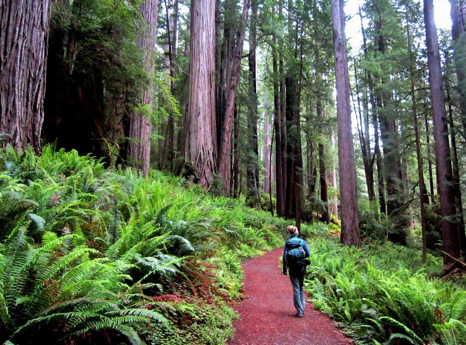
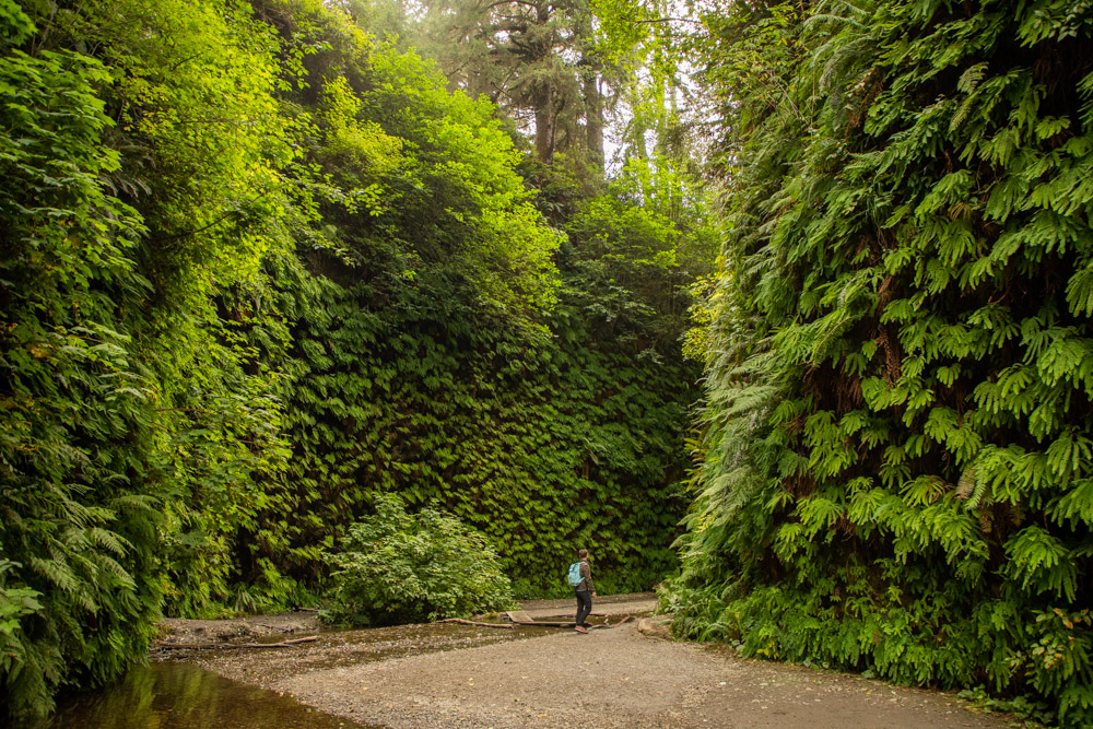
Fern Canyon - OAUSA Net - 8/24/23 - Unique and Unusual Destinations
A Quote to set the stage
“I have seen almost more beauty than I can bear.”
― Everett Ruess
Description
Fern Canyon is a remarkable place. A level trail of about one mile follows Home Creek as it courses through the forest. This modest stream has over the eons carved a 50 to 80 foot deep canyon through the rich sedimentary soils. The canyon walls sprout an amazing variety of luxuriant ferns and other moisture-loving plants. On a sunny day, thousands of tiny drops of moisture make the canyon walls sparkle.
Location
Fern Canyon is located at Gold Bluffs Beach, on California's North Coast, just south of Klamath and 45 miles north of Eureka via US 101. The drive into Fern Canyon from US 101 is via an ~8 mile, well-maintained, but narrow, dirt and gravel road. Expect to pull to the side and even backup to accommodate on-coming vehicles.
A.
Warning
The command forces of the California State Parks and National Park Service have started perhaps the most poorly implemented and shameful ever daily quotas to limit California taxpayers from reaching Fern Canyon. If you plan to drive to Fern Canyon from May 15th - Sept 15th, you will need to apply for online - and have been issued - a Gold Bluffs Beach / Fern Canyon parking reservation. To maximize the inconvenience to those wishing to see Fern Canyon, one must establish an account at recreation.gov, a site that requires answering intrusive questions.
The quota system was noted to have been started due to parking challenges near Fern Canyon. Yet if you arrive without a permit on a rainy, light use day, you can't enter AND you can't apply for a same-day permit.
Alternative Access
If you are up for a walk, you can hike into Fern Canyon via an 11-mile round trip trail from the Prairie Creek Visitor Center and you can still do this without any permit (at least so far). The hike is beautiful and easy to moderate, tending towards moderate due to the distance only.
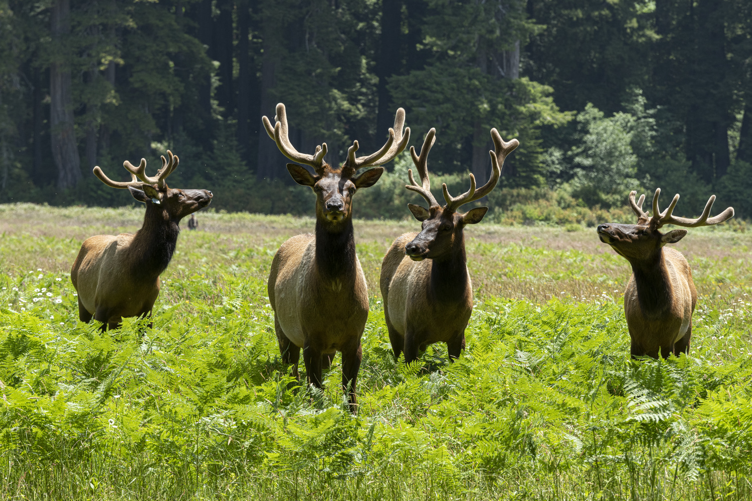
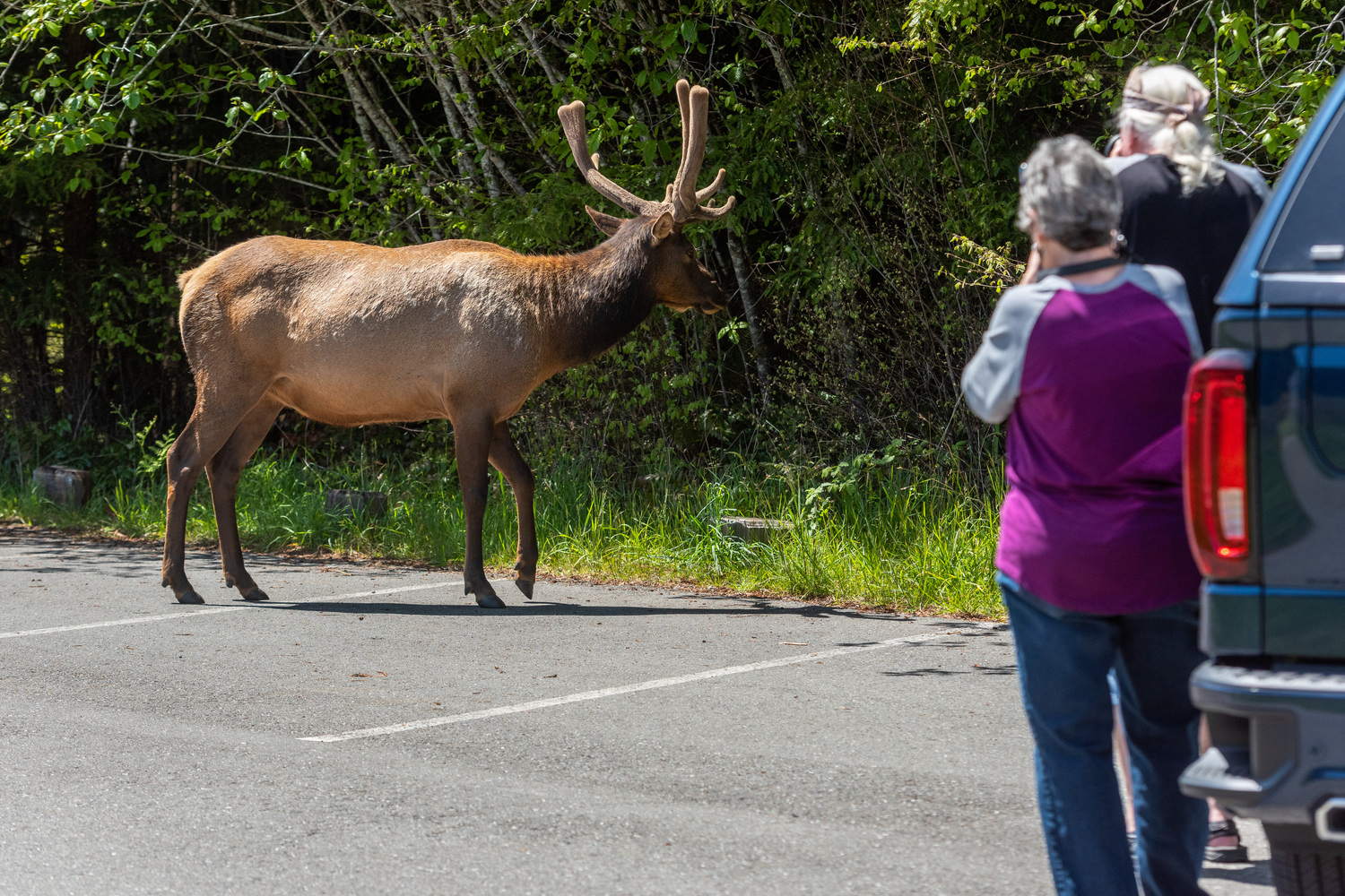
If you are lucky, you might even come across Roosevelt Elk while traversing the trail from the Prairie Creek Visitor Center to Fern Canyon.
Why Go?
The beautiful and quiet forest trail.
B.
C.
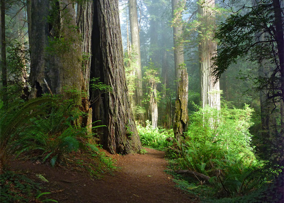
Fern Canyon
D.

E.
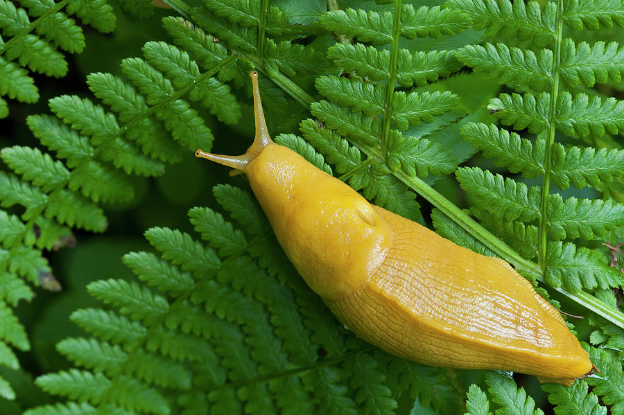
The wildlife.
F.
G.
Don't Come to Fern Canyon to Remove Oneself from the Gene Pool
H.
“I have seen almost more beauty than I can bear.”
― Everett Ruess
Description
Fern Canyon is a remarkable place. A level trail of about one mile follows Home Creek as it courses through the forest. This modest stream has over the eons carved a 50 to 80 foot deep canyon through the rich sedimentary soils. The canyon walls sprout an amazing variety of luxuriant ferns and other moisture-loving plants. On a sunny day, thousands of tiny drops of moisture make the canyon walls sparkle.
Location
Fern Canyon is located at Gold Bluffs Beach, on California's North Coast, just south of Klamath and 45 miles north of Eureka via US 101. The drive into Fern Canyon from US 101 is via an ~8 mile, well-maintained, but narrow, dirt and gravel road. Expect to pull to the side and even backup to accommodate on-coming vehicles.
A.
- Fern Canyon Location Map.jpg (147.06 KiB) Viewed 9144 times
The command forces of the California State Parks and National Park Service have started perhaps the most poorly implemented and shameful ever daily quotas to limit California taxpayers from reaching Fern Canyon. If you plan to drive to Fern Canyon from May 15th - Sept 15th, you will need to apply for online - and have been issued - a Gold Bluffs Beach / Fern Canyon parking reservation. To maximize the inconvenience to those wishing to see Fern Canyon, one must establish an account at recreation.gov, a site that requires answering intrusive questions.
The quota system was noted to have been started due to parking challenges near Fern Canyon. Yet if you arrive without a permit on a rainy, light use day, you can't enter AND you can't apply for a same-day permit.
Alternative Access
If you are up for a walk, you can hike into Fern Canyon via an 11-mile round trip trail from the Prairie Creek Visitor Center and you can still do this without any permit (at least so far). The hike is beautiful and easy to moderate, tending towards moderate due to the distance only.
If you are lucky, you might even come across Roosevelt Elk while traversing the trail from the Prairie Creek Visitor Center to Fern Canyon.
Why Go?
The beautiful and quiet forest trail.
B.
C.
Fern Canyon
D.
E.
The wildlife.
F.
G.
Don't Come to Fern Canyon to Remove Oneself from the Gene Pool
H.
Last edited by Jeff-OAUSA on Thu Aug 24, 2023 7:32 pm, edited 5 times in total.
WD6USA
The middle of nowhere is somewhere I'd prefer to be.
"If future generations are to remember us with gratitude rather than contempt, we must leave them something more than the miracles of technology. We must leave them a glimpse of the world as it was in the beginning, not just after we got through with it."- Lyndon B. Johnson, President of the United States
-
toms

- OAUSA Board Member
- Posts: 951
- Joined: Wed Mar 12, 2008 11:50 am
- Call Sign: KI6FHA
- Location: Redondo Beach CA (5 miles south of LAX)
- Contact:
Re: OAUSA Net - 8/24/23 - Unique and Unusual Destinations
1. Air Beacons
Location: Across USA
GPS:
N35 04.653 W116 23.512 I-15 near Dunn/ Afton Canyon
N35 23.978 W115 49.878 I-15 near Halloran summit past Baker on the top of “ African- American” Head
What: The Transcontinental Airway System was a navigational aid deployed in the United States during the 1920s.
In 1923, the United States Congress funded a sequential lighted airway along the transcontinental airmail route. The lighted airway was proposed by National Advisory Committee for Aeronautics (NACA), and deployed by the Department of Commerce. It was managed by the Bureau of Standards Aeronautical Branch. The first segment built was between Chicago and Cheyenne, Wyoming. It was situated in the middle of the airmail route to enable aircraft to depart from either coast in the daytime, and reach the lighted airway by nightfall. Lighted emergency airfields were also funded along the route every 15–20 miles.
Construction pace was fast, and pilots wishing to become airmail pilots were first exposed to the harsh wintertime work with the crews building the first segments of the lighting system.[1]
By the end of the year, the public anticipated anchored lighted airways across the Atlantic, Pacific, and to China.[2]
The first nighttime airmail flights started on July 1, 1924. By eliminating the transfer of mail to rail cars at night, the coast to coast delivery time for airmail was reduced by two business days. Eventually, there were 284 beacons in service.[3] With a June 1925 deadline, the 2,665 mile lighted airway was completed from New York to San Francisco. In 1927, the lighted airway was complete between New York City and Salt Lake City, Los Angeles to Las Vegas, Los Angeles to San Francisco, New York to Atlanta, and Chicago to Dallas, 4121 miles in total. In 1933, the Transcontinental Airway System totaled 1500 beacons, and 18000 miles[4]
2. C&C Tunnel
Location: Drive from Bishop to the trail head on US6 for about 50 miles to a point near [N37 58.338 W118 19.785] where the old railroad bed crosses the highway almost at the top of Montgomery Pass. Turn off US6 near the top of Montgomery Pass.
GPS: Tunnel is at about N37 58 02.1 W118 19 57.4 Drop down to the track below to see the other end.
What: The only tunnel required to be built for the entire 300 miles of railroad. It is 247 feet long near the summit of Mt. Montgomery. Access able by 4WD. One entrance has collapsed.
https://www.4x4training.com/Articles/Ev ... unnel.html
3. Desert Megaphone
Location: Follow the old rail road bed of the T&T from Ludlow to Crucero (at RR tracks). It is on the left side high on the top of a rock.
GPS: N35 00.355 W116 11.767
What: No one knows for sure what it is.
Historians have thoroughly searched available records, newspaper articles written and now with the internet communication regarding this strange object has increased exponentially, but no one has ever come up with an explanation as to why it is there.
Rumor has it that at one time a group would go out there, climb atop the little mountain, stretch a skin over the end and use it for a drum. If true, and for whatever purpose it served, we may never know.
Some think it is a whistle that sounds a very low pitch sound when the wind gets up to and above about 50 MPH. Its purpose would be to warn people in the area that the wind speed had risen to dangerous levels.
4. Delores Hollands Grave
Location: The grave is just north of a stand of Athel trees on the north side of the tracks at the location of the old King watering stop in the Razor OHV
GPS: N35 02.763 W116 12.742
What:
The story goes that Delores was the child of a railroad worker at King.
She died as an infant in July 1931.
This one is the best maintained graves in the desert. She died as an infant in July 1931.
5. Fossil Falls
Location: Small Road to the west just off US395. Just before a large red cinder cone further up the road.
GPS: N35 58.642 W117 55.381
What: A dry waterfall formed by the Owens River. The river traveled through to Indian Wells Valley, and its course was diverted several times by volcanic activity. The falls were formed when the river was forced to divert its course over a basalt flow, polishing and reshaping the rock into a variety of unique shapes and forms.
Flakes of obsidian can be found in the area, for the Native Americans would camp near Fossil Falls and chip obsidian from the Coso Mountains to form their tools. The Fossil Falls archeological District is on the National Register of Historic Places. Fossil Falls is protected as an area of Critical Environmental Concern by the Bureau of Land Management.
6. Gold Point
Location: Esmeralda County NV – US95 to NV 266 to NV774 (N37 26.260 W117 17.136)
GPS: N37 21.268 W117 21.901 (on 4th street)
What: Ghost town now Gold Point was once quite the happening boomtown that consisted of 125 dwellings, a post office, bakery, hotels, cafes, a store and numerous saloons. The community was known as Hornsilver until 1932 and referred to as Gold Point thereafter; a name that has stuck since.
Gold Point may not exist today if it weren’t for Las Vegas wallpaper hanger Herb Robbins, who with partner Walt Kremin, owns most of the town’s buildings. Herb and his friend Chuck Kremin came across Gold point in the late 1970s, and while only a few hardy residents remained, dozens of deteriorating wooden edifices peppered the original main street. The opportunity to purchase some of these buildings presented itself, and Herb and Chuck sprung into action, each purchasing one. In 1981, Chuck’s brother Walt joined them in purchasing the Post Office, General Store, and the home of Senator Harry Wiley, which was complete with original furnishings.
Location: Across USA
GPS:
N35 04.653 W116 23.512 I-15 near Dunn/ Afton Canyon
N35 23.978 W115 49.878 I-15 near Halloran summit past Baker on the top of “ African- American” Head
What: The Transcontinental Airway System was a navigational aid deployed in the United States during the 1920s.
In 1923, the United States Congress funded a sequential lighted airway along the transcontinental airmail route. The lighted airway was proposed by National Advisory Committee for Aeronautics (NACA), and deployed by the Department of Commerce. It was managed by the Bureau of Standards Aeronautical Branch. The first segment built was between Chicago and Cheyenne, Wyoming. It was situated in the middle of the airmail route to enable aircraft to depart from either coast in the daytime, and reach the lighted airway by nightfall. Lighted emergency airfields were also funded along the route every 15–20 miles.
Construction pace was fast, and pilots wishing to become airmail pilots were first exposed to the harsh wintertime work with the crews building the first segments of the lighting system.[1]
By the end of the year, the public anticipated anchored lighted airways across the Atlantic, Pacific, and to China.[2]
The first nighttime airmail flights started on July 1, 1924. By eliminating the transfer of mail to rail cars at night, the coast to coast delivery time for airmail was reduced by two business days. Eventually, there were 284 beacons in service.[3] With a June 1925 deadline, the 2,665 mile lighted airway was completed from New York to San Francisco. In 1927, the lighted airway was complete between New York City and Salt Lake City, Los Angeles to Las Vegas, Los Angeles to San Francisco, New York to Atlanta, and Chicago to Dallas, 4121 miles in total. In 1933, the Transcontinental Airway System totaled 1500 beacons, and 18000 miles[4]
- AB1
- number.jpg (57.76 KiB) Viewed 9153 times
- AB2
- Arrow.jpg (25.29 KiB) Viewed 9153 times
- AB0
- Map.jpeg (41.71 KiB) Viewed 9107 times
2. C&C Tunnel
Location: Drive from Bishop to the trail head on US6 for about 50 miles to a point near [N37 58.338 W118 19.785] where the old railroad bed crosses the highway almost at the top of Montgomery Pass. Turn off US6 near the top of Montgomery Pass.
GPS: Tunnel is at about N37 58 02.1 W118 19 57.4 Drop down to the track below to see the other end.
What: The only tunnel required to be built for the entire 300 miles of railroad. It is 247 feet long near the summit of Mt. Montgomery. Access able by 4WD. One entrance has collapsed.
- CC1
- SAM_1056.JPG (153.81 KiB) Viewed 9157 times
- cc3
- SAM_1049.JPG (484.2 KiB) Viewed 9157 times
- CC1
- SAM_1056.JPG (153.81 KiB) Viewed 9157 times
- CC2
- SAM_1054.JPG (276.06 KiB) Viewed 9157 times
- CC4
- SAM_1046.JPG (261.57 KiB) Viewed 9157 times
- CC5
- SAM_0724.JPG (415.41 KiB) Viewed 9157 times
- CC7
- SAM_0710.JPG (450.32 KiB) Viewed 9157 times
https://www.4x4training.com/Articles/Ev ... unnel.html
3. Desert Megaphone
Location: Follow the old rail road bed of the T&T from Ludlow to Crucero (at RR tracks). It is on the left side high on the top of a rock.
GPS: N35 00.355 W116 11.767
What: No one knows for sure what it is.
Historians have thoroughly searched available records, newspaper articles written and now with the internet communication regarding this strange object has increased exponentially, but no one has ever come up with an explanation as to why it is there.
Rumor has it that at one time a group would go out there, climb atop the little mountain, stretch a skin over the end and use it for a drum. If true, and for whatever purpose it served, we may never know.
Some think it is a whistle that sounds a very low pitch sound when the wind gets up to and above about 50 MPH. Its purpose would be to warn people in the area that the wind speed had risen to dangerous levels.
- DM3
- Desert Magaphone 1.jpg (786.2 KiB) Viewed 9157 times
- DM1
- The-Sentinel-Enigma-Hilltop copy.jpg (293.92 KiB) Viewed 9157 times
- DHG6
- DSC_0340.JPG (600.05 KiB) Viewed 9157 times
- DM Map
- SAM_0211.JPG (3.38 MiB) Viewed 9157 times
- DM2
- Megaphone 2.jpg (753.5 KiB) Viewed 9157 times
Location: The grave is just north of a stand of Athel trees on the north side of the tracks at the location of the old King watering stop in the Razor OHV
GPS: N35 02.763 W116 12.742
What:
The story goes that Delores was the child of a railroad worker at King.
She died as an infant in July 1931.
This one is the best maintained graves in the desert. She died as an infant in July 1931.
- FF6
- 20161229_095400.jpg (3.92 MiB) Viewed 9157 times
- DHG1
- SAM_0262.JPG (3.42 MiB) Viewed 9157 times
- DHG2
- SAM_0254.JPG (3.42 MiB) Viewed 9157 times
- DHG3
- SAM_0252.JPG (3.42 MiB) Viewed 9157 times
- DHG4
- SAM_0211.JPG (3.38 MiB) Viewed 9157 times
- DHG5
- DSC_0344.JPG (542.95 KiB) Viewed 9157 times
5. Fossil Falls
Location: Small Road to the west just off US395. Just before a large red cinder cone further up the road.
GPS: N35 58.642 W117 55.381
What: A dry waterfall formed by the Owens River. The river traveled through to Indian Wells Valley, and its course was diverted several times by volcanic activity. The falls were formed when the river was forced to divert its course over a basalt flow, polishing and reshaping the rock into a variety of unique shapes and forms.
Flakes of obsidian can be found in the area, for the Native Americans would camp near Fossil Falls and chip obsidian from the Coso Mountains to form their tools. The Fossil Falls archeological District is on the National Register of Historic Places. Fossil Falls is protected as an area of Critical Environmental Concern by the Bureau of Land Management.
- FF5
- 20161229_095404.jpg (3.29 MiB) Viewed 9157 times
- FF4
- 20161229_095409.jpg (4.48 MiB) Viewed 9157 times
- FF3
- 20161229_102122.jpg (4.72 MiB) Viewed 9157 times
- FF2
- 20161229_102133.jpg (3.07 MiB) Viewed 9157 times
- FF1
- 20161229_102134.jpg (3.45 MiB) Viewed 9157 times
- FF-1
- 20161229_102137.jpg (43.65 KiB) Viewed 9157 times
6. Gold Point
Location: Esmeralda County NV – US95 to NV 266 to NV774 (N37 26.260 W117 17.136)
GPS: N37 21.268 W117 21.901 (on 4th street)
What: Ghost town now Gold Point was once quite the happening boomtown that consisted of 125 dwellings, a post office, bakery, hotels, cafes, a store and numerous saloons. The community was known as Hornsilver until 1932 and referred to as Gold Point thereafter; a name that has stuck since.
Gold Point may not exist today if it weren’t for Las Vegas wallpaper hanger Herb Robbins, who with partner Walt Kremin, owns most of the town’s buildings. Herb and his friend Chuck Kremin came across Gold point in the late 1970s, and while only a few hardy residents remained, dozens of deteriorating wooden edifices peppered the original main street. The opportunity to purchase some of these buildings presented itself, and Herb and Chuck sprung into action, each purchasing one. In 1981, Chuck’s brother Walt joined them in purchasing the Post Office, General Store, and the home of Senator Harry Wiley, which was complete with original furnishings.
- GP1
- SAM_0990L.jpg (47.91 KiB) Viewed 9157 times
- GP2
- SAM_0992.JPG (3.28 MiB) Viewed 9157 times
- GP3
- SAM_0991.JPG (3.97 MiB) Viewed 9157 times
- GP4
- SAM_0988.JPG (30.18 KiB) Viewed 9157 times
- GP5
- SAM_0986.JPG (3.42 MiB) Viewed 9157 times
- GP6
- SAM_0985.JPG (3.48 MiB) Viewed 9157 times
- GP7
- SAM_0984L.jpg (35.96 KiB) Viewed 9157 times
- GP8
- SAM_0983.JPG (3.42 MiB) Viewed 9157 times
- GP9
- SAM_0980.JPG (3.25 MiB) Viewed 9157 times
- GP10
- SAM_0977.JPG (3.98 MiB) Viewed 9157 times
- GP11
- SAM_0976.JPG (3.87 MiB) Viewed 9157 times
- Attachments
-
- CC6
- SAM_0712.JPG (516.1 KiB) Viewed 9157 times
-
- CC8
- 02 - ZfvoE9O.jpg (361.06 KiB) Viewed 9157 times
See you on the Trail!
TomS
KI6FHA / WPZW486
Badlands Off-Road
tom@4x4training.com
http://www.4x4training.com
TomS
KI6FHA / WPZW486
Badlands Off-Road
tom@4x4training.com
http://www.4x4training.com
-
toms
- OAUSA Board Member
- Posts: 951
- Joined: Wed Mar 12, 2008 11:50 am
- Call Sign: KI6FHA
- Location: Redondo Beach CA (5 miles south of LAX)
- Contact:
Re: OAUSA Net - 8/24/23 - Unique and Unusual Destinations
7. Hard luck Castle
Location: 1 Bonnie Clair Road in Goldfield, NV
GPS: N37 16.050 W117 15.612
What:
Randy Johnston who owns this unique property, purchased the Hard Luck Mine and surrounding 5 acres in 1998. It has been reported that he spent $3 Million building the Castle which he put on the market for $1.2 million in October. It looks like the price has been reduced to $900,000.
This 8,000 square foot home in the middle of nowhere as some people thought this would make a good doomsday home or to be protected from a future zombie apocalypse. This is actually not too far off. This home was built with 24,000 bricks and over 7 tons of rebar according to the real estate listing featured here.
This fortress of a home is completely off the grid. Power is generated by wind and solar energy with a 3,000 gallon propane tank, 300 gallon diesel tank and two backup generators. There is also a 4,000 water tank with an 800 gallon tank trailer to bring water to the house.
The castle has been sold and will be turned into an Airbnb rental for tourists seeking a secluded getaway. The new owner, Richard Socher, a former data scientist and executive vice president at Salesforce, said he plans to put the home on the short-term rental market by the end of June 2023.
It all started 12 years ago when Randy and his son where driving their VW buggy through a desert snowstorm. Looking for somehwere dry to camp for the night, they pulled out of the fog alongside the Hard Luck Mine cabin. Long story short, Randy ended up purchasing the cabin and has maintained the cabin and mine for all these years while building his dream home – The Hard Luck Castle. Randy started building in 2000, and now nearly completed, he is offering tours and cabin lodgings to the curious and adventurous.
The Hard Luck Mine operated from 1897 to around World War II. Gold claims dating back to 1897 signed by President William McKinley, included the Emerson and Hard Luck Lodes, the two twenty-acre patent claims that comprise the Hard Luck Mine. After the war, the mine never reopened. The 40 acres that comprise the Hard Luck Mine and its neighboring Emerson claim were purchased by the current owner Randy Johnston in 1998, and by the year 2000 Randy Johnston began building the Hard Luck Castle.
The four-story, 8,000 square foot fortress has 16-inch walls and was built with 24,000 bricks, over 1000 yards of concrete, and more than seven tons of rebar. The mostly circular citadel is entirely powered by wind and solar, with redundant back-up generators. The estate has a theater and casino game room, auto and wood shops, four bedrooms and three full baths, two kitchens, and a great room with two working pipe organs. Mr. Johnston offers guided tours of the castle and shares his thoughts and dreams of building in the desert.
This remote property is surrounded by thousands of acres of BLM land. Remote, desolate, secluded, private - all describe the Hard Luck Mine Castle. Nearly thirteen years of construction have gone into the building of this Gothic style Castle. With the help of friends, Mr. Johnstons has created a Castle that mirrors that of Death Valley Scotty's Castle (20 miles away). The Castle foundation is 50 feet in diameter and consists of 65 yards of special concrete and the footings are on solid rock - this fortress is not going anywhere soon. There are about 24,000 concrete blocks in the 16 inch thick walls.
The Hard Luck Mine is a unique property that can provide for an escape, retreat, or remote compound for any individual or group desiring the ultimate in remote privacy and looking to disappear from society. Very little mining has been done since the beginning of WWII, but the potential is there. The existing vertical mine shaft descends approximately 160 ft. and there is also a horizontal shaft useful as a tightly secured storage area. The compound is completely self contained, off the grid, and can be separated from the rest of world. Water is trucked in from a nearby spring and stored in a 4,000 gallon underground storage tank providing gravity-fed water. Electricity is provided by Solar and Wind power with 3 types of backup generators - gasoline, LP gas, and diesel. There is no lack in amenities here.
The Main Building - The Castle:
• 4 story, 22 rooms, 8,000 square feet.
• Constructed from 2000 to 2012 with superior engineering to last 400 to 500 years.
• All steel, concrete, cinder block, and glass materials with 16" thick walls.
• Two kitchens, 3 full baths, full wood shop, wine cellar, theater and game room, glass solarium / planetarium, fountain room, large main entrance with afternoon view deck, two 1920's pipe organs.
• Partially furnished with antiques.
• 4,000 gallon water storage with rain catchment's and a water hauling trailer.
• Castle has become a tourist attraction and a landmark in Esmeralda County.
Out-Buildings:
• Work / Automotive Shop - 600 square feet (20'x30') steel fabrication and welding workshop with automotive lift, second story storage with hoist, numerous hand and power tools, and full welding arangement.
• Original, but remodeled miners cabin - comfortable, historic, plumbed and electricity added. Wooden cabin that sleeps 4 cozily. Complete kitchen.
• Shower House - shower and toilet with modern plumbing for use by cabin occupants.
• Guest trailer and outdoor rustic shower stall with a view.
• Power House with main generator.
• Gold mine tunnel with small secure storage / work area and rail-car access.
- Attachments
-
- HL1
- Tom at Hard Luck Castle.jpg (1.88 MiB) Viewed 9153 times
-
- HL2
- SAM_0968.JPG (3.43 MiB) Viewed 9153 times
-
- HL3
- SAM_0967.JPG (4 MiB) Viewed 9153 times
-
- HL4
- SAM_0966.JPG (3.38 MiB) Viewed 9153 times
-
- HL5
- SAM_0965.JPG (3.43 MiB) Viewed 9153 times
-
- HL6
- SAM_0964.JPG (3.4 MiB) Viewed 9153 times
-
- HL7
- SAM_0963.JPG (3.49 MiB) Viewed 9153 times
-
- HL8
- SAM_0962.JPG (3.45 MiB) Viewed 9153 times
-
- HL9
- SAM_0961.JPG (3.45 MiB) Viewed 9153 times
-
- HL10
- SAM_0960.JPG (3.48 MiB) Viewed 9153 times
-
- HL11
- SAM_0959.JPG (3.46 MiB) Viewed 9153 times
-
- HL12
- SAM_0958.JPG (3.46 MiB) Viewed 9153 times
-
- HL13
- SAM_0957.JPG (3.39 MiB) Viewed 9153 times
-
- HL14
- SAM_0956.JPG (3.47 MiB) Viewed 9153 times
-
- HL15
- SAM_0955.JPG (3.29 MiB) Viewed 9153 times
-
- HL16
- SAM_0954s.jpg (83.88 KiB) Viewed 9153 times
-
- HL17
- SAM_0953.JPG (3.45 MiB) Viewed 9153 times
-
- HL18
- SAM_0952.JPG (3.52 MiB) Viewed 9153 times
-
- HL19
- SAM_0951.JPG (3.34 MiB) Viewed 9153 times
-
- HL20
- SAM_0950.JPG (3.17 MiB) Viewed 9153 times
See you on the Trail!
TomS
KI6FHA / WPZW486
Badlands Off-Road
tom@4x4training.com
http://www.4x4training.com
TomS
KI6FHA / WPZW486
Badlands Off-Road
tom@4x4training.com
http://www.4x4training.com
-
toms
- OAUSA Board Member
- Posts: 951
- Joined: Wed Mar 12, 2008 11:50 am
- Call Sign: KI6FHA
- Location: Redondo Beach CA (5 miles south of LAX)
- Contact:
Re: OAUSA Net - 8/24/23 - Unique and Unusual Destinations
8. Hot Well
Location: Esmeralda County NV in Fish Lake Valley. Turn off NV264 (N37 49.652 W118 06.094). From Bishop or Tonopah on US 6 to NV264 south towards Dyer, NV
GPS: N37 51.616 W117 59.036
• What: A large geothermal well,
• from which water is piped into a large concrete pool, overflowing into several warm ponds in an isolated portion of central Nevada.
• Owned by Esmerelda County, these hot springs have been improved over the years but have also seen substantially increased use and, with it, damage.
• Discovered in 1970 by an oil-exploration well,
• the hot water at Fish Lake Valley has been an excellent place to bathe ever since.
• The large-volume hot water well is piped into a large concrete pool complete with wooden benches and a large concrete patio.
• The pool is about 7 feet by 2 feet and about 3 feet deep.
• The water overflows into two warm ponds, which now contain goldfish, and the pool’s water is clean and very appealing.
The spring has been improved over the years by the county, with fences, barbecue pits, and trash cans all put up in the last few years
- Attachments
-
- HW1
- SAM_1423.JPG (3.85 MiB) Viewed 9152 times
-
- HW2
- SAM_1422.JPG (3.32 MiB) Viewed 9152 times
-
- HW3
- SAM_1421.JPG (3.38 MiB) Viewed 9152 times
-
- HW4
- SAM_1420.JPG (3.36 MiB) Viewed 9152 times
-
- HW5
- SAM_1419.JPG (3.5 MiB) Viewed 9152 times
-
- HW6
- SAM_1067.JPG (3.36 MiB) Viewed 9152 times
-
- HW7
- SAM_1066.JPG (3.44 MiB) Viewed 9152 times
-
- HW8
- SAM_1065.JPG (3.92 MiB) Viewed 9152 times
-
- HW9
- SAM_1064.JPG (3.42 MiB) Viewed 9152 times
See you on the Trail!
TomS
KI6FHA / WPZW486
Badlands Off-Road
tom@4x4training.com
http://www.4x4training.com
TomS
KI6FHA / WPZW486
Badlands Off-Road
tom@4x4training.com
http://www.4x4training.com
-
toms
- OAUSA Board Member
- Posts: 951
- Joined: Wed Mar 12, 2008 11:50 am
- Call Sign: KI6FHA
- Location: Redondo Beach CA (5 miles south of LAX)
- Contact:
Re: OAUSA Net - 8/24/23 - Unique and Unusual Destinations
9. Lunar Crater
Location: In Nevada; From Tonopah, NV take US6 east about 70 miles. Turn off on a dirt road at N38 28.721 W116 03.291
GPS: N38 23.149 W116 03.777
What: The Lunar Crater is a National Natural Landmark volcanic field is located in Nye County, Nevada.
The volcanic field covers a 50 miles long and 12.4–6.2 miles wide area[3] with a surface of about 390 square miles. Over 200 vents[a] are located within the field. Lunar Crater itself is almost circular and embedded in basaltic lavas.
- Attachments
-
- LC1
- 20151106_094559.jpg (1.2 MiB) Viewed 9152 times
-
- LC6
- 20151106_085730.jpg (2.95 MiB) Viewed 9152 times
-
- LC8
- 20151106_085224.jpg (2.67 MiB) Viewed 9152 times
-
- LC9
- 20151106_085221.jpg (1.39 MiB) Viewed 9152 times
-
- LC10
- 20151106_084922.jpg (4.59 MiB) Viewed 9152 times
-
- LC11
- 20151106_084917.jpg (3.27 MiB) Viewed 9152 times
-
- LC12
- 20151106_084911.jpg (2.75 MiB) Viewed 9152 times
-
- LC13
- 20151106_084909.jpg (3.43 MiB) Viewed 9152 times
See you on the Trail!
TomS
KI6FHA / WPZW486
Badlands Off-Road
tom@4x4training.com
http://www.4x4training.com
TomS
KI6FHA / WPZW486
Badlands Off-Road
tom@4x4training.com
http://www.4x4training.com
-
toms
- OAUSA Board Member
- Posts: 951
- Joined: Wed Mar 12, 2008 11:50 am
- Call Sign: KI6FHA
- Location: Redondo Beach CA (5 miles south of LAX)
- Contact:
Re: OAUSA Net - 8/24/23 - Unique and Unusual Destinations
10. Papoose Flat
Location: Inyo County CA. From Independence CA exit US395 at Mazourka Road on the south edge of town. Follow Mazourka Canyon road up and over Mazourka Peak and down to Papoose flats.
GPS: N37 01.031 W118 06.779 -turn to eye in rock
What: Requires 4WD.
Papoose Flat is known for its unique landscape of randomly isolated granite spires that dot the flat, and for the marvelous views of the Sierra Nevada crest and Owens Valley below. It is situated at the crest of the Inyo Mountains, which separate Saline Valley from the Owens Valley. This high desert flat is a circular, tree-less expanse of scrub desert dominated by these tall granite spires rising out of the ground at irregular intervals.
The Paiute Indians spent the summer and fall in the Inyo Mountains around The Papoose Flats Trail and Badger flats, gathering pinyon nuts and killing game for winter.
Although it is a relatively well-known area it is not overly used. This is due to its remote setting and the rugged dirt roads and tracks that make it accessible only to well-equipped and experienced adventurers.
- Attachments
-
- PF1
- 20150905_152120.jpg (130.37 KiB) Viewed 9152 times
-
- PF2
- 20170528_122001.jpg (4.76 MiB) Viewed 9152 times
-
- PF3
- 20170528_104708.jpg (3.65 MiB) Viewed 9152 times
-
- PF4
- 20170528_104534.jpg (1.87 MiB) Viewed 9152 times
-
- PF5
- 20170528_104530.jpg (4.18 MiB) Viewed 9152 times
-
- PF6
- 20170528_104436.jpg (2.8 MiB) Viewed 9152 times
-
- PF7
- 20150905_152128.jpg (4.62 MiB) Viewed 9152 times
See you on the Trail!
TomS
KI6FHA / WPZW486
Badlands Off-Road
tom@4x4training.com
http://www.4x4training.com
TomS
KI6FHA / WPZW486
Badlands Off-Road
tom@4x4training.com
http://www.4x4training.com
-
Jeff-OAUSA
- Posts: 405
- Joined: Thu Jul 21, 2016 7:57 pm
- Call Sign: WD6USA
- Location: California
Re: OAUSA Net - 8/24/23 - Unique and Unusual Destinations
Please check in WD6USA.
Thanks.
Jeff
Thanks.
Jeff
WD6USA
The middle of nowhere is somewhere I'd prefer to be.
"If future generations are to remember us with gratitude rather than contempt, we must leave them something more than the miracles of technology. We must leave them a glimpse of the world as it was in the beginning, not just after we got through with it."- Lyndon B. Johnson, President of the United States
The middle of nowhere is somewhere I'd prefer to be.
"If future generations are to remember us with gratitude rather than contempt, we must leave them something more than the miracles of technology. We must leave them a glimpse of the world as it was in the beginning, not just after we got through with it."- Lyndon B. Johnson, President of the United States
Who is online
Users browsing this forum: No registered users and 1 guest