App name
onX Hunt and onX Offroad
OnX Maps was founded in 2009 to help hunters see public land boundaries while hunting. Boundaries between public and private lands might have fences or might be posted, but sometimes do not. Knowing land boundaries ensures that hunters are not trespassing on private land, or allows them to identify the landowner to request access. In addition, I have read about landowners who attempt to tell hunters that certain lands are private, when in fact they are public. Lastly, some public lands are only available by using public easements to roads through private property.
Map showing huntable public land surrounded by private land, with access road going through private property.
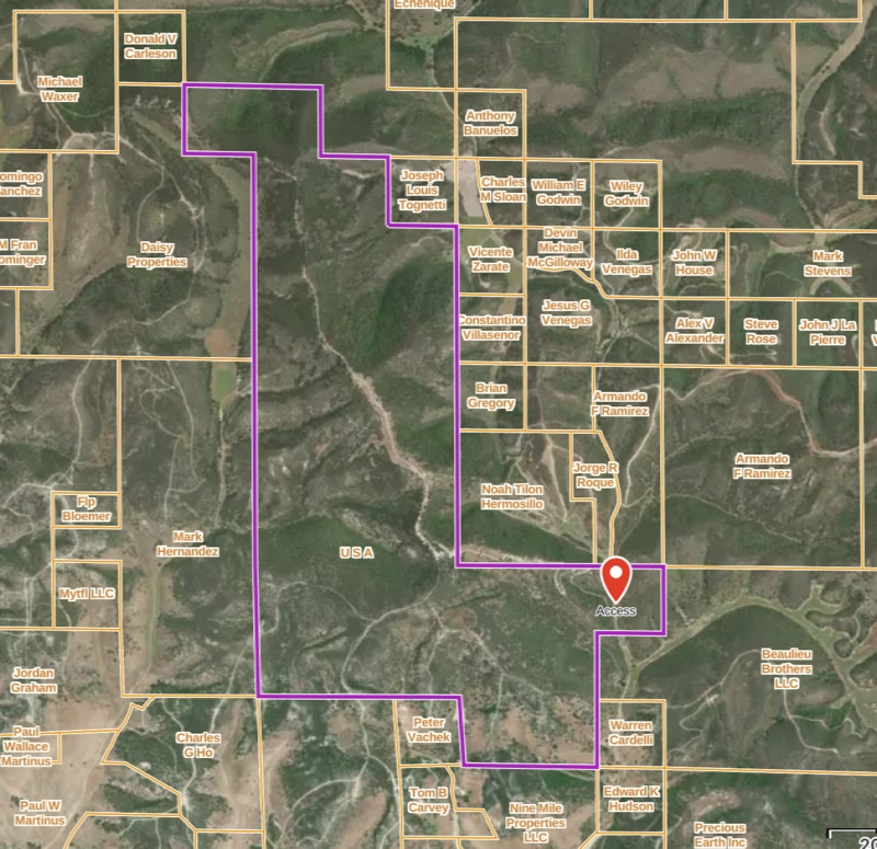
- LandAccess.jpg (458.1 KiB) Viewed 1379 times
onX's first product was a Hunt Chip (micro SD card) for most Garmin GPS handheld units. (Note: the chip is available for $120.)
onX Hunt was first available as an application in 2013, providing hunters with comprehensive digital maps.
onX Offroad followed in 2019 for offroad trails, onX Backcountry in 2021 for hiking, trail running, and skiing.
OnX Maps is headquartered in Missoula, Montana.
I'm familiar with and use onX Hunt and onX Offroad so will talk about those.
onX Hunt and Offroad (Common Features)
Where to get the App
The mobile apps are available from the Apple Store and Google Play. They are free but marginally useful without a subscription.
App cost
Once you have a subscription, the apps can be used on any platform (I believe any number). Data developed on one platform (e.g., a waypoint, route, or track) will automatically be synced to all other platforms.
Both apps are $30 per year for a "Premium" subscription and $100 per year for an "Elite" subscription.
App operating system
onX apps run on iOS, Android, and as a web-based app for desktops.
The web-based app is necessary for planning, and for importing (4MB limit) or exporting standard file formats (e.g., GPX, KML). In the field without online Internet access, you can only transfer data to other people who are also using the same app.
onx Offroad
Primary function of the App
onX Offroad is fine for navigating offroad trails. It has an extensive library of known offroad trails, which include clearly marked "routes", difficulty ratings, and elevation profiles (graph). "Routes" (in quotes) because they're just line. There is no direction information given, such as "turn right", "bear left".
Virtually all GPS navigation apps offer the same features as onX Offroad. I tend to like the satellite maps.
The Elite version gives you property boundaries and landowner names (like Hunt).
Examples of how you have used the App
onX Offroad is my preferred Offroad app. It allows both following routes and recording actual tracks while doing so.
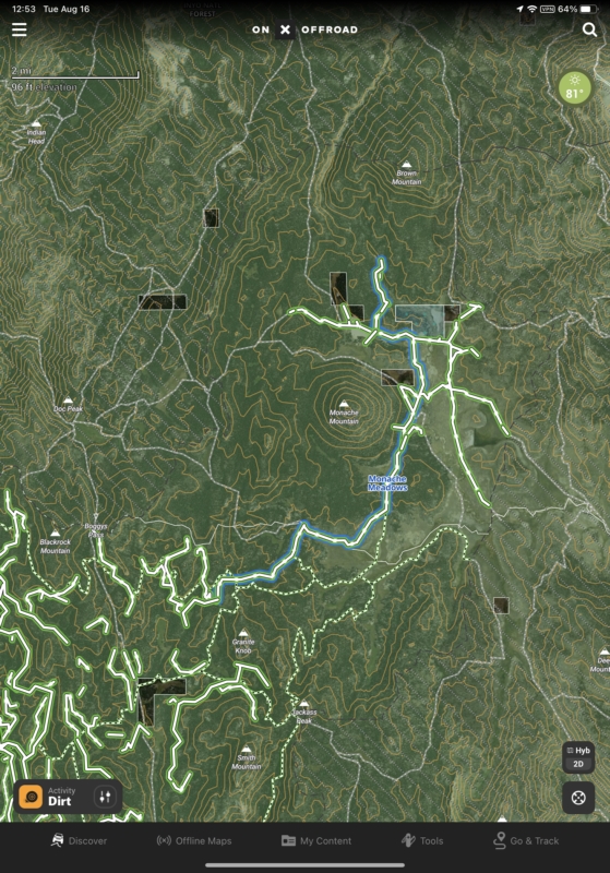
Sample screen shot of San Rafael Swell map with routes, tracks, and waypoints.
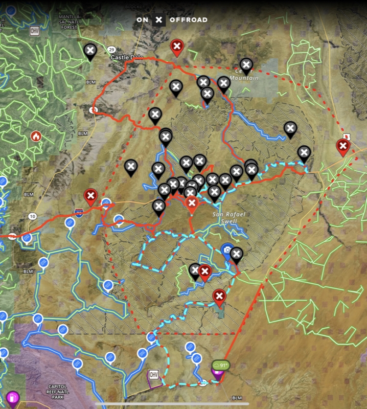
- SanRafaelSwellOffroad.jpg (556.14 KiB) Viewed 1378 times
Pros of the App
The price for the Premium subscription is reasonable. The app provides all of the basic features that are useful.
onx Hunt
The Premium subscription gives you one state only. Elite provides all 50 states.
onX Hunt Elite, possibly recognizing that hunting is seasonal, is available for $15 per month.
Primary function of the App
The original purpose of onX Hunt was to keep hunters from trespassing into private land while hunting.
Examples of how you have used the App
I have not used onX Hunt while hunting. Based on what I've seen in online hunting groups, it is the preferred app of many hunters.
Pros of the App
The price for the Premium subscription is reasonable. The app provides all of the basic features that are useful. Creating waypoints, recording tracks.
Many map layers are provided:
- Private Lands
- Government Lands
- Hunting Zones
- Possible Access Points
- State Game Refuges
- Active and Historical Wildfires
- Drought Data
- Air Quality
- Precipitation Radar
- CWD (CHronic Wasting Disease) Positive Counties
- CWD Zones and Locations
- Wildreness Areas
- US Fish and Wildlife Serice Hunt Areas
- Slope Angle (of terrain)
- Trails
- Trail Slope
- Trail Mileages
- Roadless Areas
- Motorized Roads and Trails
- Recreation Sites
- Forest Visitor Maps (somewhat low resolution)
- Timber Cuts
- Wetlands
- Acorn Producing Oaks
- Thermal Deer Cover
- Deciduous vs. Coniferous
- Elk Distribution
- Mule Deer Distribution'
- B&C Records for Elk, Mule Deer, and Pronghorn
onX Cons for both Offroad and Hunt
The onX apps provide only three kinds of 2D (looking straight down) maps: 1) fairly high-resolution satellite, 2) topographic, and 3) a hybrid that merges both. Most map features are available in a 3D viewing mode. Most other navigation apps provide a much wider variety of map types. Virtually all other apps include USGS topographic maps, which are somewhat of a gold standard. The information provided on onX topographic maps is limited. Following are sample maps:
Satellite Map for Offroad (Hunt is similar)
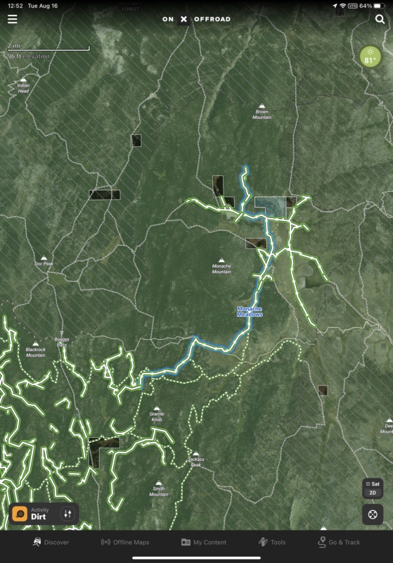
- OffroadSatellite.jpg (404.92 KiB) Viewed 1383 times
Topo Map for Offroad (Hunt is similar)
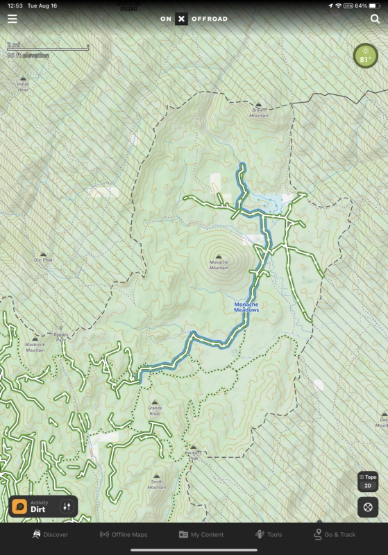
- OffroadTopo.jpg (460.08 KiB) Viewed 1377 times
Hybrid Map for Offroad (Hunt is similar)
- OffroadHybrid.jpg (483.82 KiB) Viewed 1376 times
Downloading offline maps is a real pain. Unlike some apps which permit large areas to be selected and downloaded, onX apps allow downloading in 5-mile by 5-mile high-resolution squares, 10-mile by 10-mile medium-resolution squares, or 150-mile by 150-mile low-resolution squares. If you want to download a large area in high resolution, you must successively position each 5x5 square individually and download, making sure they overlap just enough. While you can position the next while downloading the previous, it's very tedious.
There are many similarities between the apps. Hunt has everything that Offroad offers except additional trail information. It would be nice to pay just a few bucks more (not $100 instead of $30) to get an Offroad version with property and landowner information, or a Hunt version with trail information.
A zoomed in Offroad map.
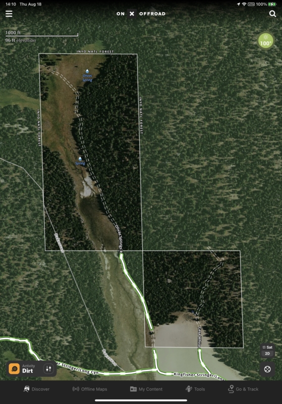
- OffroadDetail.jpg (383.98 KiB) Viewed 1375 times
A zoomed in Hunt map.
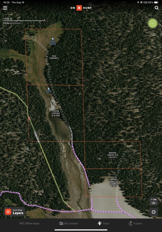
- HuntDetail.jpg (402.14 KiB) Viewed 1375 times
The onX planning tools are terrible, and I don't like to have to use a slow desktop web app. I use Gaia GPS on an iPad for all of my planning since it already know virtually all trails. (Just noticed that Gaia GPS's Premium subscription is now $20 for the first year only instead of $40.)
The apps limit most interactions to portrait mode which can be a nuisance if your device is mounted in landscape orientation.
An odd happening perhaps, but I imported a GPX file of the path of the 2024 eclipse across the United States. While cleaning up memory use on my phone and iPad, I noted that the onX Offroad app was using many gigabytes. Working with their tech support, the resolution was finally to delete the eclipse track, then delete and reinstall Offroad. Other apps had no problem reclaiming memory after large amount of GPX data were deleted.
Honestly, for all of the additional features (though adding a few bugs), Gaia GPS seems a good value at $40 per year compared to onX $100 per year for an Elite subscription.


